
Hiking to Chush Falls in the Three Sisters Wilderness
Chush Falls Trail No. 4080
Moderate
5 mi
Out-and-back
5 mi
8 km
Distance
624 ft
190 m
Gain
5,302 ft
1,616 m
Summit
2 hours
Est. time
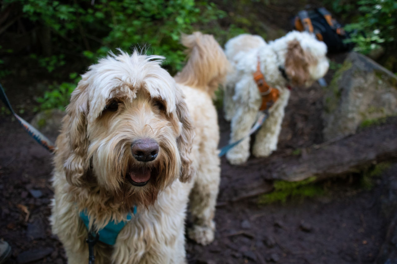
The first time we took this trail, we were looking for something easy for our two dogs, who were training for longer distances. We headed here on a Saturday morning, driving about 50 minutes from Bend to the trailhead. The photos I had seen of the waterfall were spectacular, but we weren’t sure about the steep scramble to the base of the falls. Would it be to tough for the dogs? Spoiler alert: It wasn’t.
Getting to the Trailhead
From Highway 242, in downtown Sisters, turn south on Forest Service Road 16, signed for Three Creek Lake (do not follow FR 15, signed for Squaw Creek, west of town). After 7 miles, turn right onto FR 1514, and proceed just under 5 miles to FR 1514-600. Immediately before crossing Whychus Creek on a large concrete bridge, and turn left. You’ve got five miles of gravel Forest Service road to reach the trailhead, but it’s well worth the car wash you’ll need later.
I was able to use Apple Maps and it got me there without issue.
Hiking the Chush Falls Trail
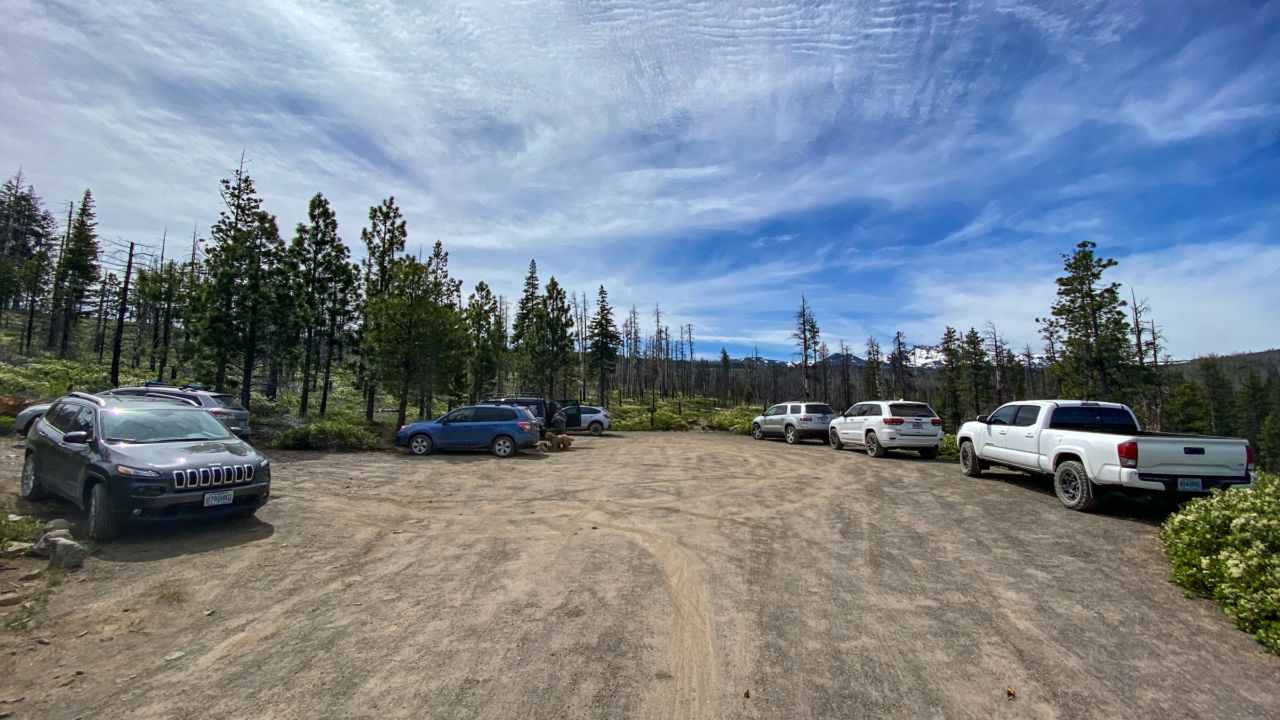
We reached the trailhead at 8:45am (a late start for us) and were just the third vehicle at the trailhead parking. The trailhead is clearly marked, and the sign suggests the distance to the overlook (end of trail) is two miles, though we clocked a bit more recording on GaiaGPS.
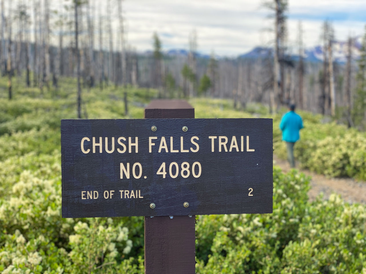
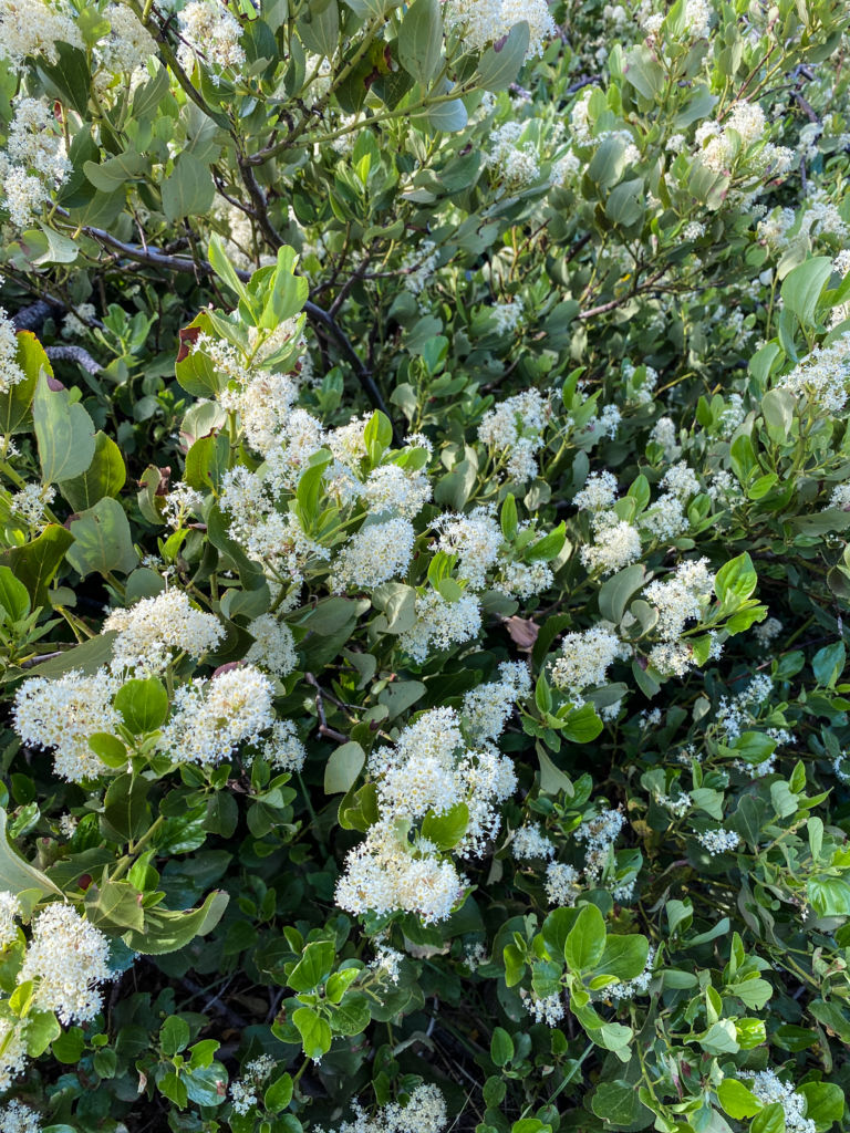
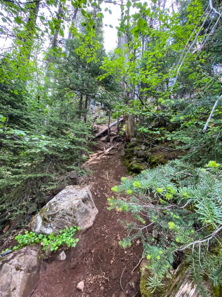
The initial trail is fairly flat, taking you the burned remains of a past forest fire, through manzanita and blossoming snowbrush. It may be bittersweet to see the charred trunks standing as a reminder of the wildfire, but it also opens up views of South Sister and Broken Top — both of which feed the Whychus Creek, making Chush Falls so spectacular.

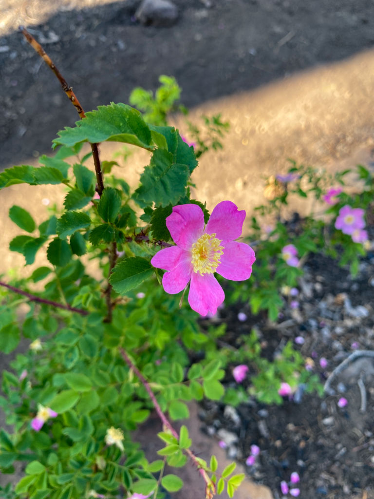
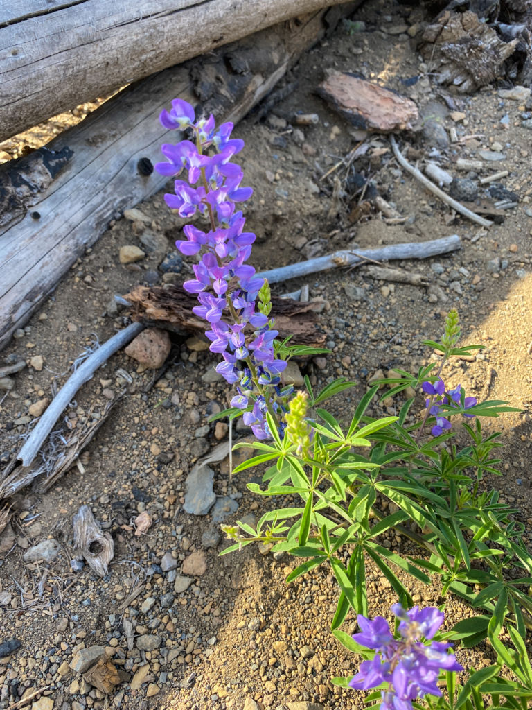
Wildflowers were blooming in late June. We saw lupine, skyrocket and wild roses. What we didn’t see were crowds. On our way to the falls, we saw one other person and her dog on their way back to the trailhead. Other than that, we had the trail to ourselves.
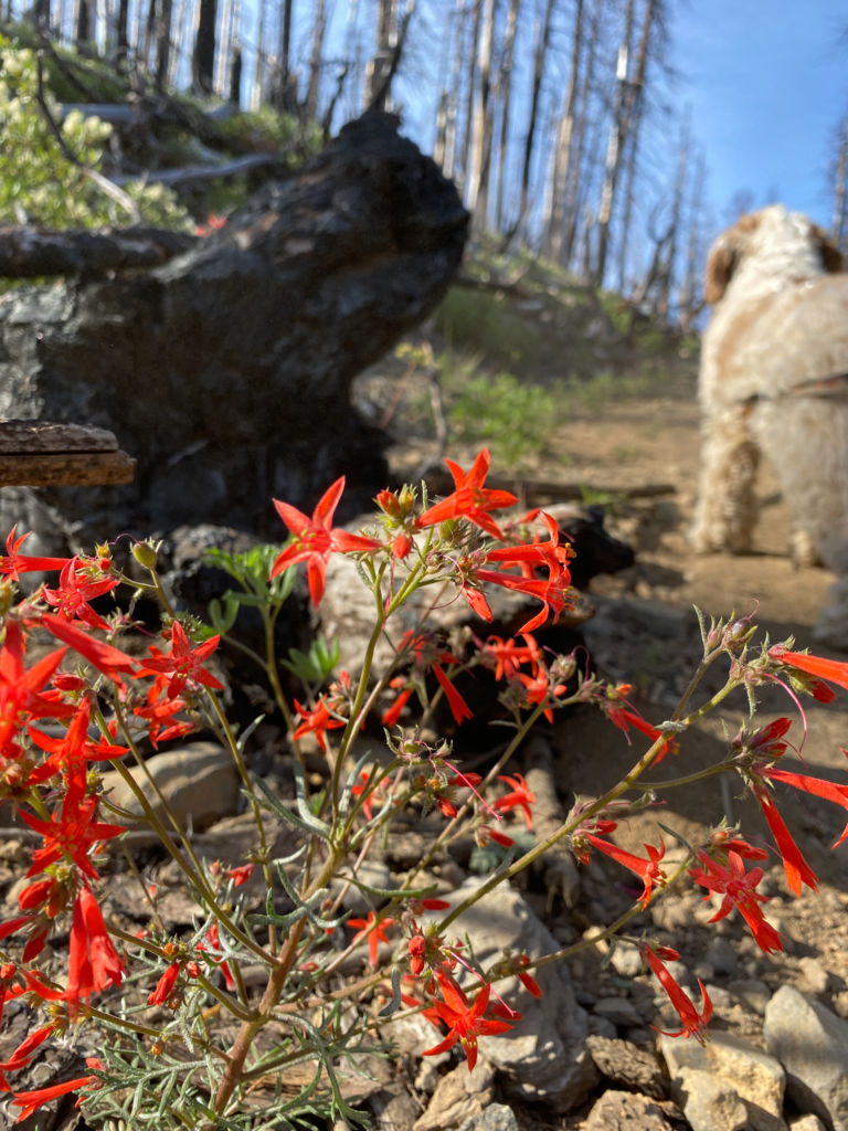
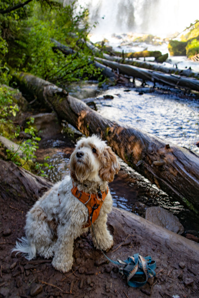
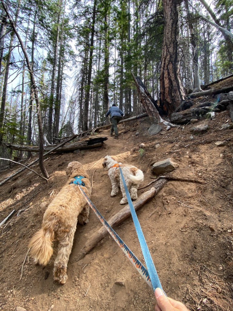
There were a lot of downed trees across the trail (we counted about 27), but the dogs made a game out of finding the best way to pass them. Bounding over most and ducking under some, they made it look easy and fun. After a little more than two miles, we could hear the roar of the falls. The end of the trail came into view.

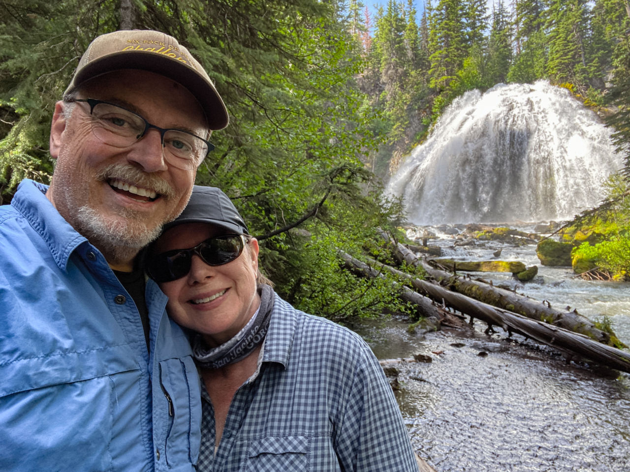
To the left of the sign is an overlook where you can see the falls through the trees, but you really need to do a little extra scramble to the base of the falls to get the best views.
Look for a social trail to the right of the TRAIL ENDS HERE sign. It descends fairly steeply through the tree-lined canyon. Taking our time, we were able to pick our route downhill using the trees as handholds at times. No butt-scooting required.
There’s not a lot of room at the base for many people, so were were grateful to be the only ones there. The dogs were more curious about the snacks they smelled in our backpack than the spectacular roaring falls.
When you’ve had a chance to take your photos and enjoy a moment of zen, it’s a scramble back to the top, then an easy hike back the way you came to the trailhead.
If you’re looking to extend the adventure, there is an upper cascade accessible via a social trail another half mile upstream.
On our return to the trailhead, we encountered numerous of groups making their way toward the falls. If you prefer solitude in the morning, start before 9am.
Chush Falls Trail Map & Elevation Profile
Chush Falls Tips & Resources
- A free wilderness permit is required, available for self-issue at the trailhead
- A valid recreation pass is required for parking.
- Official Deschutes National Forest overview of the Chush Falls Trail
- No water or toilets available at the trailhead.
- Get driving directions to the trailhead via Google Maps.
- Remember to follow the seven Leave No Trace principles.
- Dogs are allowed on leash.
- We had no cell service on this trail. I had downloaded the maps for the area into GaiaGPS for offline use, although the trail itself is easy to follow.
- After the hike, check out Three Creeks Brewing in Sisters. The back patio is dog-friendly.
Originally hiked on June 27, 2019 with Joan and our two labradoodles, Lucy and Farley.
You must be logged in to post a comment.