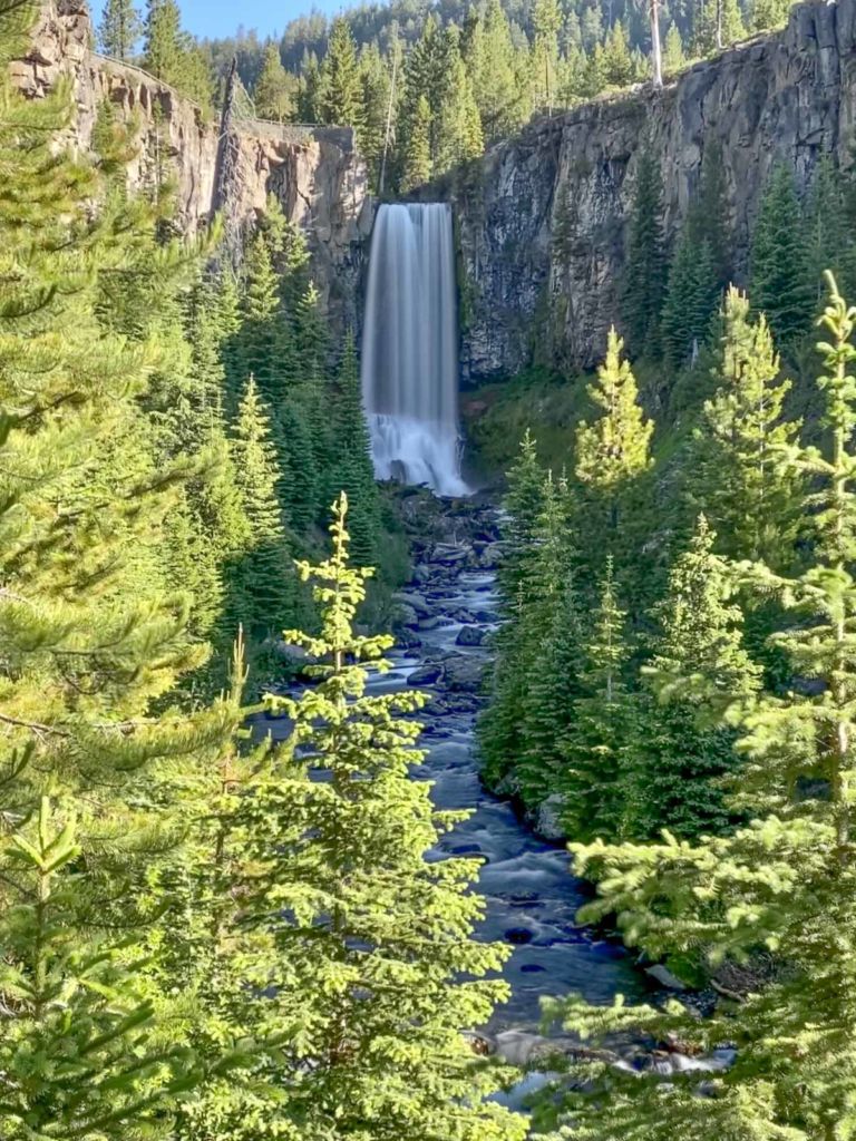
Hiking to Tumalo Falls is one of the “must-see” sights in the outdoor mecca that is Bend, Oregon. The namesake waterfall is a short walk from the trailhead parking, but most people don’t realize that there is so much more to see – if you’re willing to put in some miles.
Time: 3-4 hours
Difficulty: Moderate
Elevation gain: 1,625 ft
Dogs: Yes
When to go: June-October
One extra perk? After the first mile, you’ll leave the crowds behind.
Getting to Tumalo Falls
The trailhead parking area is 13.5 miles west of downtown Bend. Take Skyliners Road to Tumalo Falls Road, crossing Tumalo Creek on a one-lane bridge, and following a washboard gravel road another 2.5 miles to the parking area. There is a fee station that takes cash or cards for day use parking. If the parking area is full, you can also park on the side of the road (obey all signs). The fee still applies. Get turn-by-turn driving directions via Google Maps.
There is no water at the trailhead, but there are pit toilets.
Hiking the Tumalo Falls to Farewell Loop Trail
Start with a a look at the Tumalo Falls viewpoint, just steps from the trailhead.

Head back to the trail and start up hill. After a short climb, you’ll come to a overlook trail with a railing. There are several viewpoints along the way to the top of the falls.


This is where most people stop and turn around, missing out on the beauty of Tumalo Creek and it’s many falls and cascades. Head back to the main trail as it parallels the creek and heads upstream.
At one mile, you’ll see a signpost for a viewpoint on the cliff, overlooking the aptly named Double Falls.

At the two-mile mark, you reach Upper Tumalo Falls.

A quarter mile past Upper Tumalo Falls, you cross the Middle Fork of Tumalo Creek via a log bridge.

There are numerous cascades and falls, now on the south side of the trail.

At 3.5 miles, you join the Swampy Lakes Trail. Continue to the right towards Happy Valley. You get a break from the climbing as the trail continues. At 4 miles, you reach the junction with the Metolius-Windigo Trail. Here you turn north, crossing the creek on another log bridge and begin climbing towards the ridge.
Note that this is the last chance for water on the trail. The remainder of the trail is dry and has more sun exposure. If you do refill water bottles here, be sure to filter or treat it.


Near the ridgeline, the trail briefly joins Forest Service Road #4601. Turn right (east) and in about 20 yards, take the Mrazek Trail to the right.

The Mrazek trail parallels the Forest Service road, lower on the ridgeline. At ~6.25 miles you reach the junction with the Farewell Trail. Turn right and follow this trail back down to Tumalo Falls. The views begin to open up, give you a chance to see Tumalo Mountain (with Mount Bachelor peeking over it’s shoulder), Broken Top and South Sister.


This descent on the Farewell Trail has more exposure, and can get hot in the afternoon sun.
Tumalo Falls to Farewell Loop Trail Map & Elevation Profile
Tumalo Falls Tips & Resources
- Looking for something a little shorter? Hike up to the Swampy Lakes Trail, then turn around and turn it into an out-and-back. You could choose your own halfway point — Double Falls, Upper Tumalo Falls, or further.
- This route is also perfect for mountain biking. Note that while hikers can travel in either direction on the North Fork trail, bikes are only allowed uphill.
- Check the official Deschutes National Forest website for latest trail restrictions and conditions.
Originally hiked on July 4, 2020 with Joan and our two Austrailian Labradoodles, Lucy and Farley.

You must be logged in to post a comment.