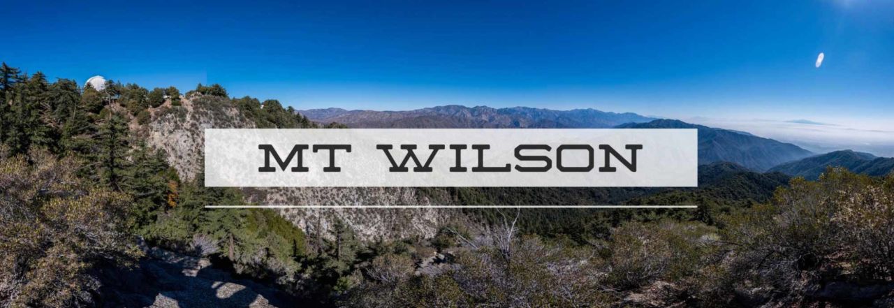
Mt. Wilson via Chantry Flats
Standing prominently above Pasadena, Mount Wilson is a Southern California landmark. The 5,713 foot summit is home for an observatory responsible for the most detailed photos of Mars as well a vast array of antennae for local LA radio and television stations. While the summit is steeped in astronomical wonder and tremendous views of Los Angeles, the trails are the real beauty of this hike.
Distance: 13.5 miles
Time: ~6 hours
Difficulty: Strenuous
Elevation gain: 4,200 ft
Dogs: OK
When to go: Fall through Spring
Note: this trail is quite popular and fills up early on the weekends. If you get there at 7am, you might find the lot already full. There is overflow parking at the Chantry Flats Pack Station, but they will charge you ($10 when I parked there in Nov. 2009). But don’t go too early — the gate to the trailhead parking doesn’t open until 6am. Also note that an Adventure Pass is required unless you park at the Pack Station.
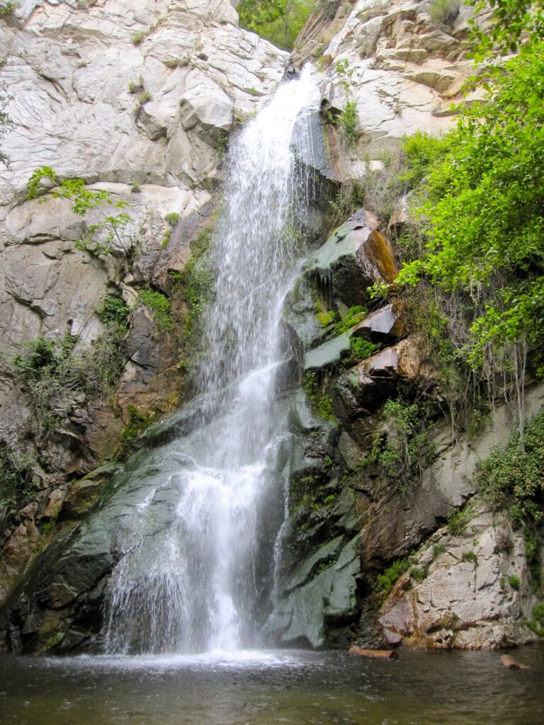
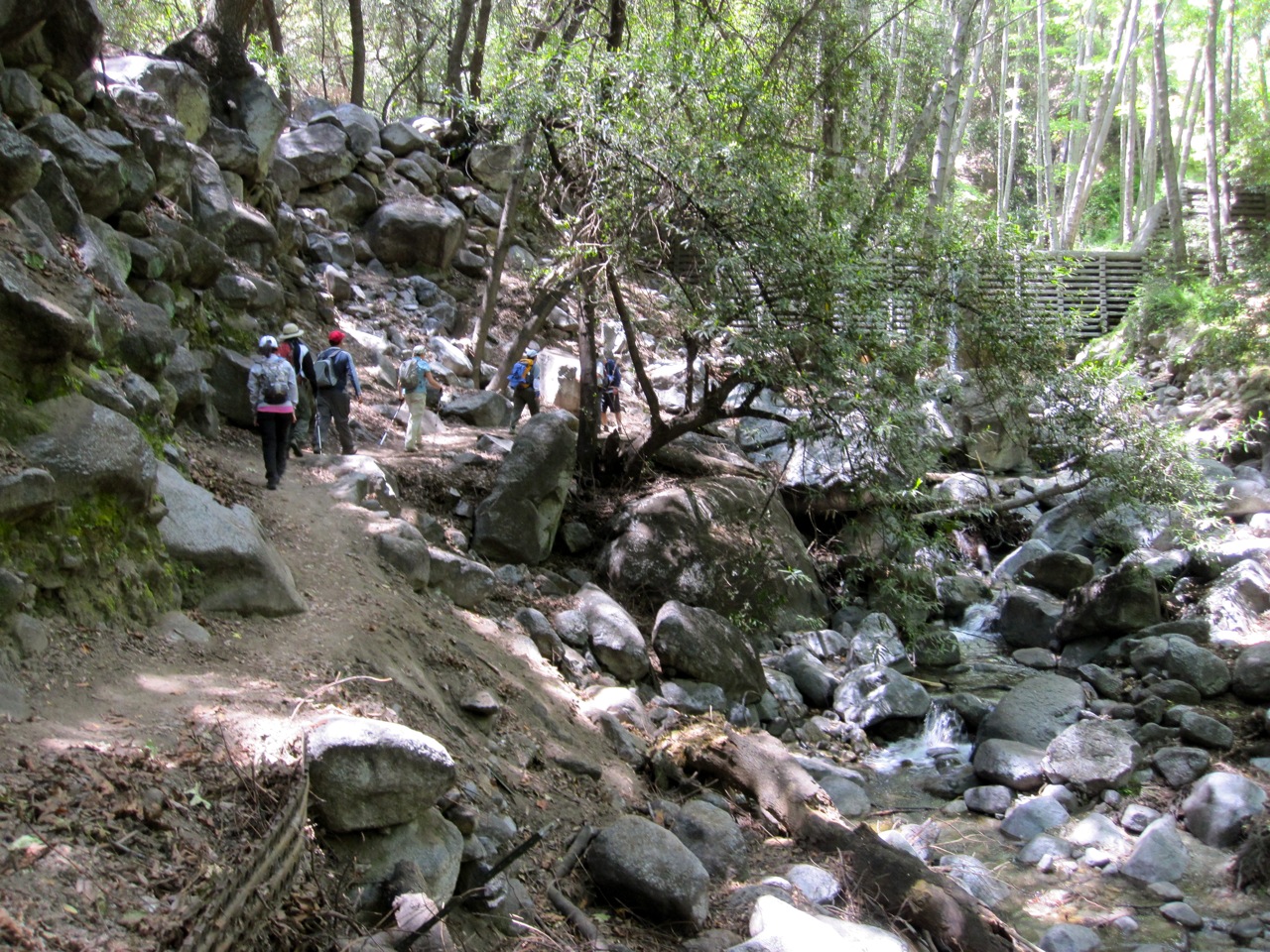
After a few photos, we retraced our steps from the falls to the junction with the Gabrielino Trail. There are two options, both about the same distance. The “high” trail is for horses and less scenic. Instead, take the trail to the right which parallels the babbling creek. You’ll follow this up to the Spruce Grove Campground — a good spot for a bio-break. These campsites are popular and would make a great introduction to backpacking, though you’ll get a lot of foot traffic (and mountain bikes) passing right by your campsite.
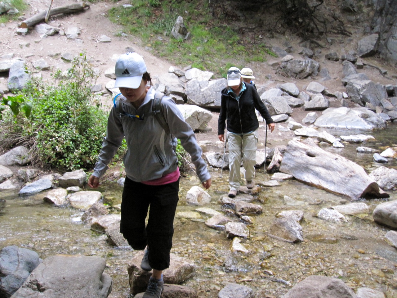
The Sturtesvant Trail to the summit follows the creek for a couple more miles, then begins a fairly steep switchback ascent up the side of the ridge for the last 1,000 of elevation gain.
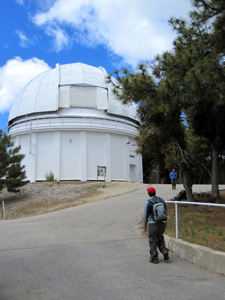
The top of Mt. Wilson is somewhat anticlimatic. There are buildings, observatories and paved roads. There is a water fountain where you can refill your water bottle near the bridge. The top of Mt Wilson is a jumble of buildings, paved roads and paths that can be confusing. It’s a little tricky to find your way across the top to the other trailhead to Winter Creek. I highly recommend printing out the visitor’s guide (PDF) for a detailed map. On this you’ll see a reference to of the “main parking lot.” It’s a gravel lot about the size of a football field. The marker for the trail down is near the 50 yard line on the opposite side. But before you head down, walk over to the boulders at the far end of the lot and soak in the views of Los Angeles. You’ll find a USGS benchmark at the southwest corner of the lot.

Heading back down Going back down the trail connects with a gravel road known as the old “Toll Road.” You’ll follow this for about 1/2 mile to the Winter Creek trail on the left. It comes at a right-hand bend in the road, and if you’re not watching for it, you could easily miss this trail. This downhill will seem like a cakewalk after the long uphill climb to Mt. Wilson. As you descend , you gain a real appreciation of just how much elevation you gained on the first half!
Eventually, you’ll reach Winter Creek and Hogee’s Camp. Here you’ll have a decision. You can take the mile-longer Upper Winter Creek trail for a 3-mile all downhill trek to Chantry Flat, or the shorter Lower Winter Creek Trail which follows the creek, but actually takes you below Chantry Flat, with an uphill climb for the last 1/2 mile. I’ve done both, and actually prefer the creekside trail.
Back at Chantry Flats
There are chemical toilets at the trailhead, but if you want real toilets with running water, walk up above the upper parking lot to the picnic area. It may be well worth it, and you can wash up a bit afterward. Also about 50 yards past the upper parking lot is the Chantry Flats pack station. They have a small store where you can buy drinks and food, and on weekend will often have a BBQ going. A great way to cap off your hike!
Mount Wilson Trail Map
PRO TIP: I track all my hikes using GaiaGPS. It’s the best solution for staying on the right trail, it works even when you don’t have cell service, and there are versions for iOS and Android. The app is free, and you can get a discounted membership for maps here.
Photo Gallery


")
Getting to Chantry Flats
Additional Mt. Wilson Resources
- Chantry Flat trail mileages
- Mt. Wilson webcam
- Mt. Wilson Observatory
- Current weather conditions on Mt. Wilson
- Big Santa Anita Canyon topo map
- Sturtevant Falls trail guide from Dan’s Hiking Pages
- GPS user? Download the GPX file
Special Thanks
I last hiked this trail on May 23, 2010 with friends from Hiking OC. We had beautiful weather, though it was quite chilly at the top (we even had a few little snowflakes!). Thanks to Joan, Uni, John, Daniel, Leslie, Lily, Tari and Adam for joining me.
Mt Wilson photo credit: Bryan Ungard. All other photos: Jeff Hester


I am mid 50’s and I just start to hike, your information is very helpful.
Thank you so much.
You’re welcome, Marie! I’m glad the website has been helpful. If you have any ideas on areas you would like to see more hiking guides for, please let me know.
Do you know if the Mt. Wilson water fountain is available during the winter?
(I’m planning a front range hike (backpack) for Dec 29-31, 2010) (yes I know it will be raining and/or snowing).
“The top of Mt. Wilson is somewhat anticlimatic. There are buildings, observatories and paved roads. There is a water fountain where you can refill your water bottle near the bridge.”
Elizabeth, I just returned from a holiday. I suspect that the water is still available in the winter as well (the buildings at the summit are in use year round), but I cannot guarantee that. To be safe, bring enough water for the entire hike.
I have hiked this in early December and the water was available. The smart thing to do is to bring enough water for the entire trip, and consider that source a backup.
Jeff,
Thanks for posting all this good info on these mountains. I’m assuming that its too late this year for a pleasant hike to the top of any of the higher mountains (San Jacinto, San Gorgonio, Mt. Baldy etc.) but was thinking of doing this one in the next two or three weeks before winter really sets in. But what king of temperatures could I expect at the 3000, 4000, 5000, and summit elevations? I want to day hike (fast) with a waistpack + water, not a back pack full of clothes. Could this be done in shorts or would long pants be necessary? I assume I would need a windbreaker type jacket anywhere near the summit for sure. Any advice would be much appreciated, thanks.
Russ, I’ve hiked Mt. Wilson on the first week of December in shorts, but there were wispy flakes of snow falling at the top, and it was chilly! Be prepared for the worst. You may carry a bit more weight, but you’ll be ready in case it’s really cold at the top.
I suggest convertible pants with zip-off legs for the best of both worlds, and then layers, including something to cut the wind (or rain, or snow). A knit cap will do a lot to keep you warm when it gets really cold.
Watch the forecasts. If there is rain down here, there may be snow up top!
And check with the ranger station for better estimates on temperatures.
Thanks Jeff – I got a pair of those convertible pants at A16, (didn’t know they existed till you mentioned them) and I plan on getting a suitable light weight jacket, gloves, cap, etc. and then keep checking for decent weather.
In training for Whitney I hiked this trail yesterday from Chantry to Mt Wilson and back. Great hike! The switch backs were a little tough as I had a 33lb pack on. it was doable and I learned a lot about myself. actually hiked it with one of the rangers, Dan. Awesome views of LA and the snow blowing off the top of Mt Baldy. Will try Baldy next weekend.
Forgot to mention in above post. Yesterday was Dan’s 501st hike up this trail. Thanks for the company and psychological push up and back.
Bruce, hiking with a 33-lb pack is definitely going to make a difference! That’s awesome training though, and something we learned when preparing for the JMT–don’t underestimate the value of training with a load.
Very cool about Ranger Dan. 501 trips up Mt. Wilson? I wonder if that’s some sort of record?
Jeff, we hiked this on 2/22/2014 using your trail guide. The detailed instructions were perfect and we had a great hike. Thanks for posting this. I agree that an early arrival on a weekend is key to parking anywhere near the trailhead.
Thanks, Paul! Glad you enjoyed the trail. See any signs of snow?
Jeff, my wife and I are planning on doing this hike in April, with an overnight stop at Spruce Grove, and taking Upper Winter Creek back to Chantry. Is the trail signed at the Toll Road? Or do we just have to keep our eyes open for it? Thanks!
@Rob, yes and yes. The trail IS signed on the Toll Road, but it’s easy to miss. Keep a close eye on the left side of the road for a post marking the trail down.
It’s not really hidden, because a lot of people travel on it, but you can get “comfortable” cruising down the wide, easy Toll Road and breeze right past it if you’re not looking for it.
Thanks Jeff! I didn’t want to end up in Altadena with my car at Chantry Flats! I noticed in some of you photos that there was quite a bit of poison oak. We hiked over Newcomb Pass last weekend and it’s starting to get thick on the Gabrielino Trail too.
Jeff, We just did this hike and a couple of things – The Mt. Wilson trail is washed out at the parking lot, but has a reroute so it’s no problem. And there are a couple of rock slides blocking the road down by Mt. Harvard, but you can get by them with little problem. And there is lots of poison oak along the trails!
Jeff,
What’s going on with your map and elevation profile for this hike? The map has this straight spur at the starting point, starting at a point along San Olene Rd, and going straight to Chantry Flat. What did you do, hang glide or zipline down to Chantry Flat? LOL. And the profile starts at sea level – huh?
Rich, I used my Garmin eTrex HC to track this, and it was probably having trouble acquiring satellites when I started out. I edited the GPX file to remove that little glitch.
Hi Jeff,
Did this hike the other day. It was amazing. On the way down, we missed the trail junction to winter creek trail, obviously we didn’t read this clearly enough before starting. Otherwise, it was really fun. What would you suggest one to use to track hikes with elevation and gps? So many different options out there, hard to decide what to go with.
Gayane, assuming you’re using a smartphone for your navigation, I recommend GaiaGPS or Ramblr. Either will allow you to track and record your route as well as download tracks and maps to follow.
In each of my guides, I provide a link to download the GPX file. You can load into whatever app you’re using and use that to make sure you’re on the right trail.
But even more importantly, I recommend carrying a paper map and knowing how to read it. It’s good to have a backup in case of technical problems or dead batteries, and a paper map can give you much more detail about the surrounding area, alternate trails, etc.
Definitely appreciate the advice, Jeff. Got myself a paper map of the San Gabriel mountains already and will download the apps for the iphone. As a matter of interest, what would you use in liue of a smartphone? Something that wont run out of battery power so quick. My phone doesn’t really last the whole day in the wild, especially if its constantly searching for a signal.
I have a Garmin handheld GPS which will last for about 22 hours of continuous use… plenty long for even the longest day hike. They have a variety of models at wide range of prices. You might check at REI, where they have a return policy as well as some folks who can help you learn how to use it.
Even though I have a Garmin, most of the time I use my iPhone. I bring along a spare external battery. I like the Jackery Mini, which will fully recharge an iPhone (or any other smartphone). It’s small, inexpensive and works well.
If you’re using a smartphone with one of those apps where you’ve already downloaded the maps, you can turn Airplane Mode on, then selectively turn GPS back on. This will keep your phone from looking for data and preserve the battery. I should note that with the external battery I bring, I’ve never had to do this. The combination of a fully charged phone and a full-charged spare battery gets me through the entire day.
Hi Jeff – 6 hours for a 14 miler with 4200ft of gain sounds quick. Are you just a fast hiker or should I plan on same? We hiked Baldy in ~7.5 hours to give you a sense. Also, is 10am too late to start this hike in June (from a heat perspective)? Thanks for any help!
ERH – I’m not particularly fast, but some people are faster — some are slower. As they say, HYOH (Hike Your Own Hike).
Personally, I’d shoot for an early start. The trailhead parking at Chantry Flats gets really crowded. If at all possible, get there by 7am. This will also help you as most of your climb will be in the morning — before the hottest part of the day.
And I’d also avoid this trail on a really hot days. It’s not high enough in altitude to give you enough of a break from the temperature.
It would be great if you could add coordinates to your descriptions for where tricky paths are or trails are not clear.. this way we easily preload the GPS 🙂
Soren – or you can just download my GPX file. You’ll find a link to it near the bottom of the post under “Additional Resources.” 😉
The poison oak is just unbelievably pervasive on this trail right now. Wear pants and you will likely be fine. We’ll see if we were successful in avoiding it.
Just finished this trail today. Good hike and surprisingly uncrowded with an early start. Definitely get to the trailhead early (before 7) on weekends; cars were parked at least 3-4 miles down the road when we were leaving in the afternoon.
Thanks for the report, Mark! I have never personally had a problem with the poison oak, but having trekking poles might help (you can gently “push” the encroaching branches out of the way). But then I also hate hiking in pants.
And I always tell people to get their early. 7am is not too early for this trailhead. It does get seriously crowded on the weekends. Fortunately, you’ll leave most of the crowds behind as soon as you pass Sturtevant Falls.
Hi Everybody, Im looking to bag my first peak on Monday, anybody been up after the rain?
Should be awesome! The waterfalls have been refreshed.
Hey, Jeff.
I did this hike today and had a great time, but didn’t finish up as well as I probably could have. I’m curious about your ~6 hour estimate for roundtrip travel time. Knowing you were probably more fit and fast than I was, I planned for 8 hours. It took me 10 and I spent the last several miles in the dark. (always carry a flashlight, luckily and I admittedly started a bit later than I would have liked) I love your site and the resources you create for everyone, but I’m wondering if it might be more user-friendly to list estimated times on hikes for those who are capable, but won’t necessarily excel. Just a thought. Keep up the good work!
I did this hike Monday. I must be a rookie. I am pretty sore, and it was too hot. I didn’t bring a map and worried I was lost a lot. I went up Winter Creek and down Sturtevant.
On the plus side, it was beautiful and I saw THREE bears during my descent, which was harrowing but mostly invigorating.
PS Thanks for your excellent site. I wish I’d discovered it before having such a needlessly painful first strenuous hike!
PPS Ian I did it in six on Monday and with the price I’m paying today I don’t think you could say I’m at all in shape. I would say I pushed myself, but not for speed (more like survival!). Numerous other sources say this hike takes 6-8 hours. Maybe hikers aren’t smelling the roses enough?
On the creekside trail for the way down… is it very steep? I am planning on doing this hike with a friend who is worried about the decent.
I wouldn’t consider it very steep, but that’s a difficult thing to quantify. Have you checked the elevation profile below the map?
I hadn’t! Thank you for the tip and quick reply!
Just did this hike yesterday and it was wonderful! A very good challenge.
We used GPS to record our hike and were caught off guard by how much longer it took us to do the trail than what was estimated here! GPS (and fitbit separately) placed us at having hiked almost 19 miles!!! That is significantly longer than the estimated 13.5! The total hike took about 10 hours…
The only thing we did differently was take the upper winter creek trail because it was easier to follow in the dark. Also be aware that the rangers are serious about closing the gates at 8pm in the evening. We got to the exist gate at about 9pm and were locked in! We had to call the police department (there is a number on the sign) to let us out, which they did… an hour and a half later.
The observatory at the top seems to be fully operational and there are two water fill up stations, one as listed by the foot bridge, and a second at the Cosmic Cafe. The Cafe is open until 5pm on the weekends until the beginning of October.
Did this hike yesterday. Not sure how far I went as I started the trail from a fire road that took me to San something road I eventually got back on track where the bench leading to the toll road is. But I made the whole loop and enjoyed it so much. But the gnats where ferocious and made it difficult to rest. I look forward to the next peak.
I completed the hike today by following your instructions. They were so helpful, thank you! I got to Chantry Flats by 6:30 am (on a Sunday) and got the last available parking spot inside Chantry Flats so come early, even this late in the season! The Cosmic Cafe really hit the spot at the top and I’m happy to report that poison oak was not an issue along the trail. However, as a previous poster noted, the gnats were insane. I highly recommend a buff or a head net to avoid breathing in the bugs as you hike in the cooler shaded areas (which is mercifully the majority of this hike). I know I looked silly with my head net over my big hat but I was so grateful I had it!
The last comment said that this is “late” in the season.
Isn’t it just the beginning?
I live a few hours away. Is there somewhere nearby to camp out for a day or two?
@ckc07 – There are hike-in campsites at Hoegee’s Campground (15 campsites) and the Spruce Grove Campground (7 campsites). Both are first-come, first-serve and can get busy on weekends and holidays. Both are on the route described in my guide to Mt Wilson via Chantry Flats.
I just signed up for the six pack peak challenge, and I’m ready to give this a go!! My biggest concern is just being able to find my way! Is the trail difficult to follow? I’m hoping to tag along with another group just so I feel a bit more comfortable. Thank you for all the info you post up, it truly makes thing much easier for a novice like me.
Jeff! I appreciate your trip reports! I am training for the JMT this June 23rd and posted a trip report of an extended version of this Mount Wilson hike (clocked at 18-20 miles). If you’re interested check the report out at https://hikesnhotsauce.wordpress.com/2016/01/27/a-long-trip-up-around-mt-wilson/ Thank you!
I’m planning this hike in late March. Are there gnats then, too?
Hey Jeff,
We want to backpack Mt Wilson just for fun. We would be starting midday around 3pm on a Saturday and hope to be back at the car before dark on Sunday. Do you have any suggestions on where to start the trail, where to stay the night, and how many miles between start and camp ground?
Thanks so much,
Zach
I am hiking Mt Wilson on Sunday. I plan to step off at about 0630 if anyone is looking to hike with someone. This will be my first peak for the Six Pack of Peaks Challenge. I took up hiking last September and have completed several local hikes in San Diego County. Some of them multiple times. Potato Chip Rock, Monserate Mountain Peak, Elfin Forrest Trail and El Cajon Mountain Trail. I also hiked the Marion Mtn Trail to San Jacinto Peak 3 times from Sept to Oct last year. I like to push myself, but I also like to enjoy the hike and the scenery.
Yeah, so I did this hike today. It was awesome, I referred to your hike. I think you’re a turd, but this was really useful. Thanks for it and for being awesome. Miss you, man. Have a beer with me, bring Joan.
No, you’re a turd. 😉
Glad you did the hike. You should do more. And I’m definitely down for a beer sometime.
This was the first of the 6 peaks I have completed. Having never hiked in that area, it would have been good to know about the Adventure Pass thing. We got there super early but couldn’t leave our car until we were able to part in the pack station lot that opens at 8AM. We were put 2 hours behind our intended schedule : (
Loved the hike though and had a great day despite the rough start!
Just did this hike as prescribed on Friday with an overnight at Hogees Camp. A beautiful trip although hauling a 32# pack up to the top was tough, especially on the section between Sturdavant Camp and the summit. There was water at both the bridge right where we came up, and again near the bathrooms and Cosmic Cafe.
Love the hike. Did it up sturtevant to the summit then looping down to the high winter creek trail. That plus parking a mile down the road which added 2 miles to the hike put us at 21 miles on Fitbit over 8 hours. I’d say be prepared for a longer hike the posted 6 hours/14 miles. But it’s doable and great. Just long….
Did this one today as the first of the 5 (can’t fit 6 into the schedule) in my planning for the JMT. Loved it, except for the last 1/2 mile from the creek bed back up to the parking lot. Plus parking is a blooming mess. Get there REALLY early to get parking. I got there at about 9:30 am and had to walk 1/2 a mile from my car to the trail head. Which added a mile to the total of 14.6, so 15.6 total, in 8 hours.
Did this hike today. We got to the parking lot at 6am and there were a few cars there already. When we got back to the parking lot, it was a total zoo – tons of people, no parking, people stalking you as you walk to your car to save the spot for their friend in the car, cars were parked WAY down the road and there LOTS of people milling about. Bathrooms were a mess, don’t know why folks can’t be more considerate. Anyway, I am new to longer hikes like this. Took us 4 hours up (+ 20mns of breaks), 3 hours 15 minutes down. Lots of campers enjoying Spruce Grove Camp. The way up gets a bit tough after Sturtevant Camp (where they offered free coffee, tea, and oatmeal to everyone!) with the steeper incline, switchbacks, and fatigue setting in, but doable at a slow pace. We spent an hour at the top, ate at the Cafe, refilled water, found the marker. Returned via the Upper Winter Creek Trail. Since we started early, there were no bugs in the AM but we did run into a few during the last 2 hours of the way up. Nothing bad but, as it gets warmer, consider a net. I have gone up the Mt Wilson trail to the Bench/Manzanita Ridge and would definitely recommend this route via Chantry Flat rather than the Mt Wilson trail from Sierra Madre, especially as the weather warms up. Very pretty hike! And excited to have done my 1st of the 6 Pack of Peaks!
I confirm the comments made by others that this route is considerably longer than the 13.5 miles you indicate – my iphone’s gps clocked it in at more like 19 miles. I took me 10 hours to complete this route. This is the first of the six hikes I’ve done, and if these hikes are supposed to be progressively more challenging as you claim I shutter to think how tough the other five get!
My friend’s GPS logged the distance as 14.37 miles. We wandered around a bit at the top so our actual mileage was probably really close to 13.5. We followed the route exactly as described on this page. Who knows. Technology! Can’t live with it, can’t live without it!
Gabriel, I’ve logged the distance with a Garmin HC GPS as well as my iPhone on multiple trips. It’s not 19 miles, unless you took the scenic route. 😉
I’m planning on hiking this trail alone and a bit nervous. Physically ill be fine, im more worried about getting lost, are the trails well marked? What gps do you recommend to keep me on the right route? Any help would be appreciated!
For hiking miles I have better luck with a site called gmap pedometer. It clocks this hike in at around 13 miles.
http://www.gmap-pedometer.com/
I actually used that site years back in a speeding ticket case in Nevada. It was a snowing blizzard outside so I was driving slow and my wife was taking photos of the town as we drove through. Highway patrol gave me a ticket for doing 40 in a 25 area during a snow blizzard. Im sure they gave me the ticket because I was from California and would not fight it. Thank God for that gmap website where I was able to correlate the time stamp on my photos with the buildings on the road and estimated my speed at 21 mph, not 40. No ticket 🙂
I did this hike today with 3 others, it was brutal! So hot, so many bugs, barely a dribble from the falls :(. We arrived at 7:15 and had to park at least 4 bends down the road, tucked into an alcove. Def start early if doing this in the summer, luckily the trail is mostly shaded. Went through about 3 liters of water and bought 2 Gatorades at the top of the mountain. They also sell nifty mosquito netting, although the lady said we we’re the first to purchase them. The trails we’re well marked, but we had the blog saved to walk us through the steps.Trails we’re pretty well marked, didn’t get lost and met the new owner of Strutevant camp. All and all it was a nice trail, just very challenging and hot.
Thank you! Just did this hike yesterday based on your write. Beautiful. Felt thoroughly lost in nature.
WOW!!! We were really surprised by what a beautiful fun (but tough) hike this was! Great way to start off the six pack, looking forward to the rest. We got the last parking spot in the main lot arriving at 6:55, the early start also let us hike the first six miles in foggy cloud cover which made for great temperatures and astonishing views. I was intrigued by all the concrete structures and cabins, the history of this trail is mind boggling! Links to some cool articles I found on it. Thanks again for the write up!
http://www.canyoncartography.com/chantry-flats-check-dams/
http://www.dankat.com/mstory/trail.htm
Hiked this today. Took a little over six hours to complete, including lunch at the observatory. Cafe up top was closed on Monday. The trail down from the west side of the big parking lot is marked as “closed due to bear attack” that occurred in October 2016. I hiked it down anyway and saw two hikers and one trail runner coming up…no bears. It is not marked “closed” at the bottom coming up. Trail was awesome and well maintained. Recommend a GPS coming down, as some of the trails, and trail changes, can get tricky to negotiate without one. Going up is a no brainer.
I’m planning to hike this one by myself on New Years Day this Sunday. Is there a lot of snow up top and are the trails open and cleared? I can always do it another day if it’s recommended but I wanted to start my year off right: with an awesome hike and knocking out the first peak in the six pack of peaks! Any advice helps, thank you!
Did this hike yesterday and used this site, along with my Gaia GPS app and a map purchased at the trailhead, as my guide. It was a great hike! A little chilly at the top but not unbearable by any means. Met a newborn fawn in the middle of the trail on my way back down, quickly put some distance between it and myself for fear that I had scared the mom away, but man, what an amazing experience.
Thanks for the helpful guide! Hoping to tackle Cucomonga Peak by Memorial Day.
Daniel Oliver and I had a great hike up to the top on 4/20. Bonus of seeing a momma bear and her baby on the drive up to Chantry at 630. I know practice makes perfect and I need a lot more practice with Gaia. FYI lots of poison oak between old toll road and Hoegee’s camp. Leaves of three, let it be.
I have tried this hike to Mt. Wilson from Sierra Madre. It was tough–I think the route from Chantry Flats might be a slightly longer route–but is it any easier or is it harder?? Any thoughts?
thanks!
Well, the Mt Wilson Trail has nearly 1000′ of additional climbing due to a lower starting elevation. Elevation gain trumps distance.
Just did this yesterday (5/11). Perfect day for a hike. Started at 8:30. One of the more amazing things on the way up was the 1/2 mile before Sturtevant Camp. One word: Ladybugs. There were ladybugs covering EVERYTHING for as far as you could see. Millions (if not hundreds of millions) of ladybugs. The trees, the fallen branches/trees and everything except the trail was covered with lady bugs. It was a sea of orange in the middle of all the green. This lasted until you got to Sturtevant Camp, then it ended.
I hiked this trail yesterday (Sunday 6/4/2017) and there were SO MANY FLIES!!! And they bite too!
We heard that June is fly season. I highly recommend waiting a bit or going earlier.
Other than that, it’s a great hike with fabulous views. The apple pie at the Cosmic Cafe is awesome and a great treat.
Did this hike June 1. Drove up the night before in a small RV and camped in the parking lot. This took us way longer than 6 hours, anyone else take awhile? We added the extra walk to see the waterfall. We did carry 20-25 lb packs to get in shape for a bigger trip so maybe that slowed us down. Or maybe we’re just not in the best condition yet lol. The bugs/flies started at Sturtevant camp and did not ease up until the top. It was so gross and they do bite, like horseflies. Beautiful hike though. A new area for us to explore.
On to the next one next week
There are 3 dangerous sections along this trail all heading up to Mt. Wilson. The first is a section that crosses an 8-10 foot long section of cliff side where the rocks are very narrow and jagged and you either have to have the balance of a mountain goat or hold onto the rock wall to traverse it. The second section is a large rock rising up from the trail so you either have to have very strong thighs to climb over it or grab onto natural grips on the rock and spider-climb over it. The third section is where the trail cross a landslide of scree and what remains is half the width of most of the trail. In each section there are large drops below. I implore the National Forest Service, the Sierra Club, or some other agency to repair these sections to make this a safe and non-stressful hike.
anyone willing to do it in the summer?
Did the trail from Chantry Flats on Sunday July 16. 6 hours round trip with another half hour up top. Nearly the entire hike is shaded which is great on such a hot day. I saw one hiker on the way up and passed another dozen coming up on my way down. That’s it. Lots and lots of poison oak. Be careful. The first 4+ miles parallels a stream whish is very pleasant. Saw a bear cub at Hoegees Camp. Never saw mom but didnt wait long. All in all a great hike and so close to the big city.
I just read all the comments in this string. I am planning to do the 6 Peaks Challenge next year. I did these peaks in 1989 in preparation for my first climb of Mt Whitney and a trip to climb Mt Blanc and the Matterhorn. Since then have not had the time, energy or motivation to do much hiking, as well as no kindred spirits to go along, although I did join a group of women who have hiked together over 20 years, my age, 60+, who hike Trabucal Canyon twice a week starting at 5:15 am. Had to quit because the early hour cut my sleep to such a minimum, up at 4 am for 45 min drive & wake up, that I started getting sick and ultimately came down with pneumonia. Usually never sick but this taught me a lesson for sure. I did do 4 long distance bicycle trips of 700-800 mi in a week for a while. Hoping to find some like minded people to have company on the hikes. Not really keen on hiking alone. Too much can happen. Looking forward to the cooler hikes starting perhaps, given weather in October or November.
I’m looking for partner this Sunday the 20th for mount Wilson 6am
Hi Simon! Please post requests for hiking partners in our forums: https://socal-hiker.mystagingwebsite.com//community/forum/campfire/
Just did this hike yesterday with a group of 10 people (late 20’s crowd, varying levels of fitness, but overall fairly active people). We only have limp noodles for legs today, but it was awesome! It’s rare to find a loop where the hardest part is the first half, and the second half is downhill (pretty steep, lots of acorns making it easy to slip). There were bugs throughout and face nets would have been nice, but no bites with enough DEET. Temps were in the 80’s, and we had a sprinkle of rain when we reached the top. The cafe on a Sunday serves a delicious veggie sandwhich and popsicles that made it all worth it! Probably one of my favorite hikes ever.
Outstanding trail, challenging but doable for fit seniors. The two mile section before the summit is the steepest section. Hiked it on gorgeous Saturday in December, no bugs! Be aware that the restrooms and snack bar at the summit are currently closed (December 2017).
Do you have recommendatins for the best time of year to go on each of the 6 pack peak hikes?
Thanks for the details about the hike. I did this yesterday and suggest hikers bring bug spray. I was surprised by how many mosquitoes were around even in early February. The trail is very well shaded. Also, I needed the help of my Gaia app to find the Mt. Wilson trail from the parking lot. Here’s a link to the route I took. https://www.gaiagps.com/public/zbDugLBDYpcLWpi60UQyoCMh
If this were to be done as a backpacking trip, where would you suggest to set up camp?
There are a few options. you could stay at Spruce Grove Campground, then up to Wilson and out. You could take the trail up to Wilson and then stay at Hoegee’s campground on the way out. But what I would do for a longer option is to take the Sturtevandt Trail past Spruce Grove. Take the trail up to Newcomb Pass and then down to Devore Campround. There are tables, but no toilets. Then the next morning take the trail back up to Newcomb Pass and take the Rim Trail to Wilson and then back to Chantry Flats.
If you have a garmin device the trail is in the course area of garmin and here is a quick link to it if you want to preload it onto your device ahead of time.
https://connect.garmin.com/modern/course/17309707
Jeff,
Thanks for a detailed description of the hike and the transition points. My wife and I hiked this on March 6, 2018 and it was a great hike. It was perfect hiking weather and maybe even on the chilly side as most of the hike to Mt. Wilson is in the shade. There were no bugs, gnats, or flies as I have seen others post. The hike took us 7.5 hours with the detour to First Water and Sturtevant Falls and then we spent about half an hour on top of Mt Wilson relaxing and enjoying the view. Once we left Sturtevant Falls, we only saw three other hikers on our way to Mt. Wilson and then saw one hiker coming down and three mountain bikers. We felt that we had the entire mountain to ourselves. It was awesome!!! When we arrived at the split off to go to Hogee camp and onto Chantry flat, we chose the longer 3 mile trek as my we did not want to hike 1/2 a mile back up to our car. However, when you first take the 3 mile route to Chantry flats, you have about 1/4 mile uphill hike until you start the trek downhill, so I’m not sure if I would take the longer trail the next time, but to be fair, you said that you prefer the shorter trail. I do like how you give different options and explain the benefits of each option. Thanks for providing such detailed hiking information!!!!
We just did the Mt. Wilson from Chantry Falls. I am so directionally challenged, the most difficult part was navigating the trail, and we did get lost twice, even with TheHikingGuy’s directions. The trail was pretty empty, and we discovered why. By the time you get to the last 3 miles or so, there is still snow and ice on the trail.. It was scary, but we made it! Do you know if the rest of the 6pack hikes are just as easy to get lost on? I love the challenge, but don’t want to die of exposure on the side of a mountain. Haha.
Completed this hike yesterday. Weather was perfect! Primarily training at the gym the last 10-12 months to start to get into trail shape. I wanted to gage my progress with this hike. It was challenging to say the least!
Learned that the best preparation for hiking is hiking. Planning to get out on the trail more as a result.
Beginners: This is not a 6-7 hour hike. I skipped the detour to Sturtevant Falls (you can see the falls from the trail above) and took countless stops for water and to catch my breath (mostly between Sturtevant Camp & the summit which was the most challenging part of the hike). At the top I had only a 15-20 minute water refill and bio break. I hiked with a pack ~15 pounds and two trekking poles. .. All that took about 9 hours.
Give yourself time, prepare for about 5 hours to the summit. You’ll make pretty good time up to Sturtevant Camp, but after that, it will be slow going.
On the way back down to Chantry Flats, I chose upper winter creek which is only moderately uphill for about a half mile then flat or downhill for the remaining 2.5 miles back to the parking lot. I did not want to climb back up the hill to the Sturtevant Trailhead at the end of a 9 hour hike. The loop has several fallen trees, but they are easy enough to get around.
Familiarize yourself with the map, keep a screenshot of it on your phone (no cell service) or even a paper map. The trail is fairly well beaten & there is frequent signage, but make sure you keep an eye out. Only 1 sign between Sturtevant and the summit which made me nervous at some points, but just keep following the trail.
As of yesterday 5/14/18 water fountain at Sturtevant Camp (across from the big swing) was operational & the three water stations at the top of the peak were available. There are big signs on Mt Wilson that tell you how to navigate to water, cosmic cafe, bathrooms, etc.
I drank about two liters of water in the hours leading up to the start of my hike, finished 2 liters while hiking up to the top, and had about 1 liter on the way down. The weather was cool for May ~55 degrees, but I was sweating profusely and removed all my layers.
Good luck & be safe. Don’t expect to have this done in 7 hours unless you are expierenced in hikes of this distance and elevation gain and/or are a trail runner.
Done this hike many times and never get tired of it with a reward of lunch and a beer at Lucky Baldwins in town afterwards.
GET THERE EARLY!!!
Had to come back and comment here because of all the help the previous commentors had given me. I was able to use the comments around the time I went (late Sept) from all the years prior to gain some advantages. It was my fourth backpacking night in total, my 4th adventure, on a Sunday-Monday trip. From the comments here, we knew to arrive early to get a spot. My friends arrived at 5:45 and got a front spot. I arrived at 6:15 and got the 3rd to last spot. My friends were holding the space next to them for me (which some people frowned/made a fuss at them for even though there was still spots open during that time — they would have let someone park if there were none left) but I made it by the skin of my teeth.
We hiked to Spruce Grove Campground, leaving the parking lot at around 6:30 and got there around 8:30 or 9am. We made camp and had some breakfast before we hiked to the top with some day packs. The hike to the top is much easier without a backpacking pack, but most people were doing full on day hikes it seemed. There were two campers there when we arrived on sunday morning, and we were the only ones camping on the sunday night.
We bought mosquito head nets from the reviews but thankfully didnt need them. It was wet but we still managed to make a fire to keep us warm that night. The trail kicked my butt, my two friends who are in much better shape than I crushed it. They were waiting for me the whole way up haha. Gotta hike your own hike and i am so glad I did it.
Thanks so much to this site for guiding me on my journey to seeing the peaks of So Cal!! (im a transplant from Boston!)
Hello All,
I have been wanting to start the 6 packs of peaks challenge for some time now and decided yesterday to day trip mount wilson (I am a resident of the SGV for many years). I did not hike the above mentioned trail map I instead started at Mt. Wilson trail park in Sierra Madre. I did the trail alone with my dog. Parking at this location was easy to find (started at 0900 on 3/18/2020) as opposed to starting at Chantry flats. Per google the gain was 4,600 at 7.3 miles in, 14.6 round trip with no detours. The trail is easily marked and can be done in regular tennis shoes, if there is no snow present near the peak. When you reach Orchid Campground (halfway) the trail becomes much more narrow with many tiny rocks. The last 1.7 miles is all access road to Mt Wilson unless you can locate the walk path detour on the right near the access road junction (coincidently I saw hikers descending off the trail). This trail leads you directly to the Mt Wilson observatory parking lot and is also quite challenging in the show, lots of overgrown foliage and trees. The Views of LA when you hit the access road off the trail are awesome. The hike is relatively shaded, still wear sunscreen. Can be a day hike, 6+ hours. Quite strenuous, hiking poles suggested. I think the the route above would be a much more scenic hike but agree with suggestions to arrive early as it does get crowded. Thank you all for your reviews/tips/suggestions. Happy hiking All! stay safe and socially distanced!
CHANTRY FLATS IS CLOSED due to COVID-19. Plan for an alternate!!
Zoe, Chantry Flats is currently closed on weekends only, as a safety precaution due to overcrowding.
Hi Jeff – thanks for the guide, do you know if Chantry Flats is still closed on weekends? If so i’ll start from the trailhead lower down. thanks!
As of 10/5/2022, road leading up to Chantry Flat is CLOSED.. We drove 1 mile west to Mt Wilson Trailhead for our hike.
(Another note) Google Map and Waze still gave driving direction to the Chantry Flat parking lot yesterday! Verify all sources before you go.
Chantry is closed due to the Bobcat Fire, no opening soon.