Cucamonga Peak via Icehouse Canyon
Icehouse Canyon
Challenging
11.6 mi
Out-and-back
11.6 mi
18.7 km
Distance
4,300 ft
1,311 m
Gain
8,859 ft
2,700 m
Summit
~7 hours
Est. time
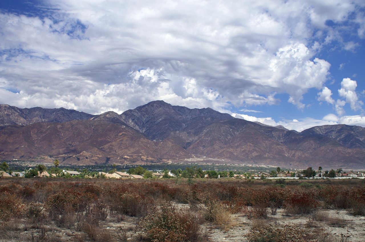
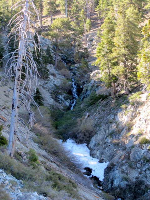
Cucamonga Peak offers amazing views over Southern California’s Inland Empire, east toward Apple Valley and beyond. This hike from Icehouse Canyon is a strenuous 11.6 mile out-and-back route with 4,300 feet of vertical gain and a top elevation of 8,859′. The north-facing slope holds snow much later in the season than other peaks. The first time I hiked Cucamonga Peak, there were several sections of the trail that were covered with large patches of snow even in June.
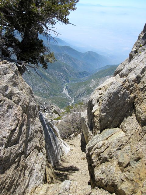
From atop Cucamonga Peak you can see most of the better-known peaks in Southern California, including the distinctive saddleback mountains (Santiago and Modjeska peaks) in Orange County; Mt. San Jacinto, San Gorgonio, and Mt. San Antonio (Mt. Baldy).
The trail begins at the popular Icehouse Canyon trailhead about a mile beyond Mt. Baldy Village. Permits are required, but are self-serve and available at the trailhead (bring a pen).
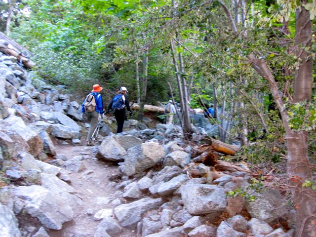
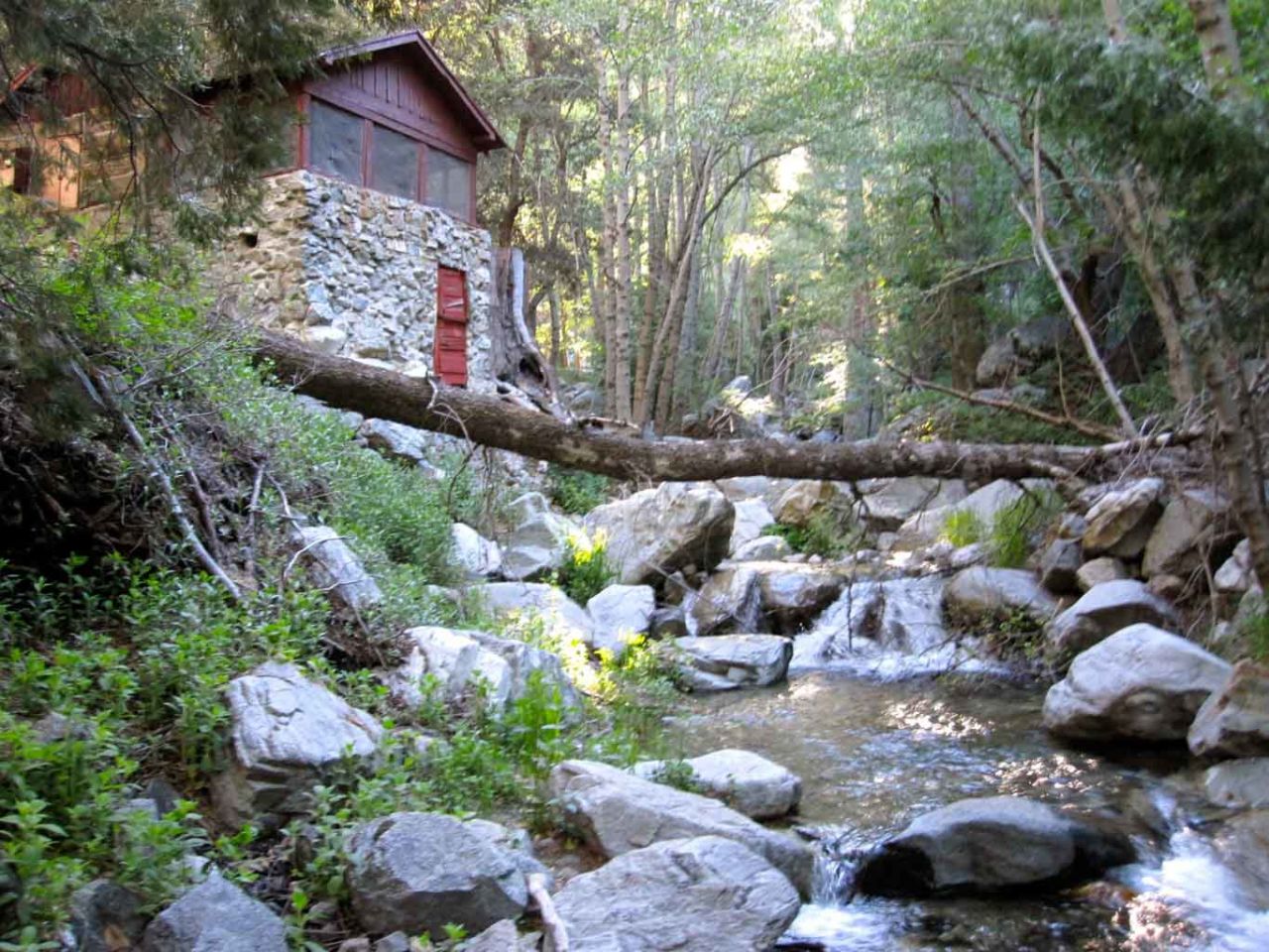
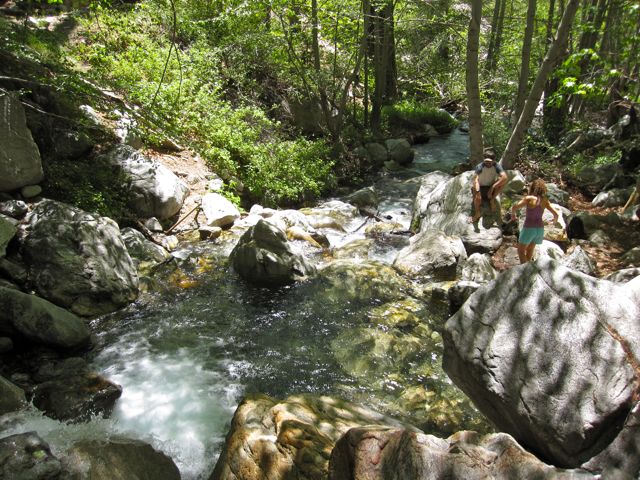
The Icehouse Canyon trail is a beautiful, well-forested trail that parallels babbling Icehouse Creek. There is lots of parking at the trailhead (Adventure Pass required) but due to the popularity, it fills up early. We started our hike at 7am and the parking lot still had a few spaces, but was quickly filling up.
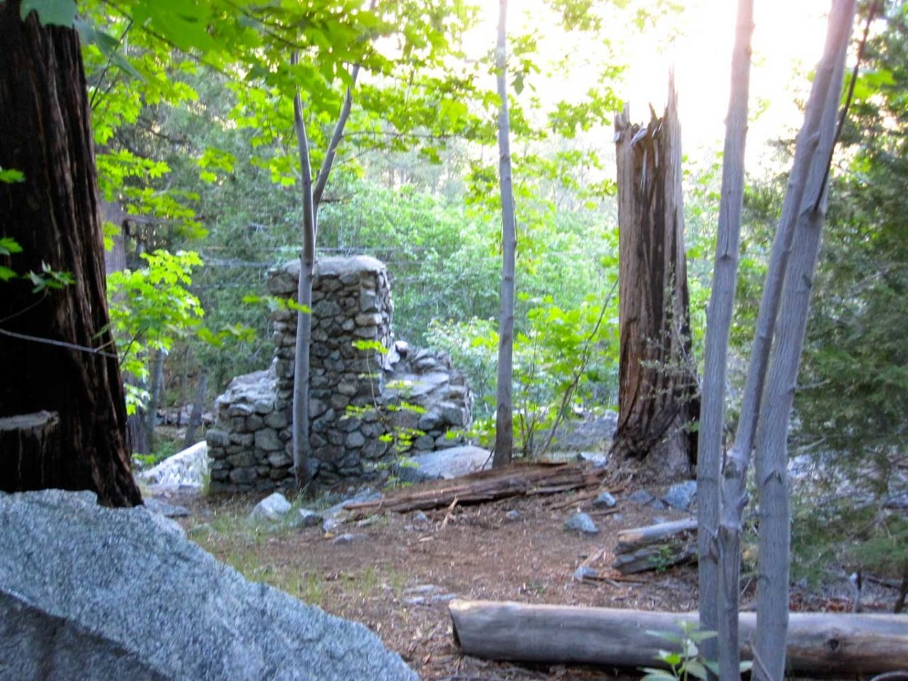
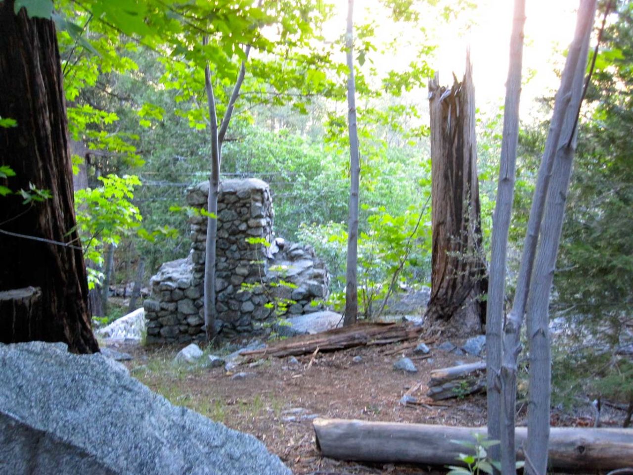
There are a number of cabins in the lower canyon that are still in use, as well as the remains of many more that have been destroyed by flood or fire over the years. It’s a beautiful trail but extremely popular. At times it felt like rush hour on the 5 with long lines of hikers and few places to pass.

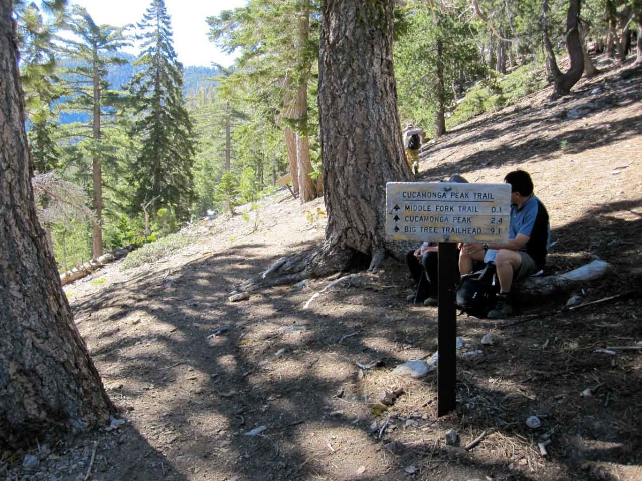
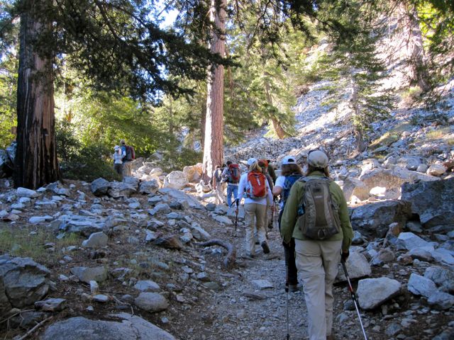
Icehouse Saddle makes a good place to break for a snack and regroup. There are five separate trails that come together at this junction. You want to look for the Cucamonga Peak trail sign. From here it’s only 2.4 miles to the summit, but they are steep and often hot miles.

The north face of Cucamonga holds snow much later in the season. Even in June, we hit many patches of snow that covered the trail, but nothing that required any technical equipment. Still, our trekking poles were much-appreciated.

Once you reach this marker to the summit, you’re almost there. And if it’s a clear day, you are rewarded with amazing views in every direction.
Retrace your steps for the return trip, which is nearly all downhill. One pleasant surprise. On our return trip down Icehouse Canyon, there were literally thousands of ladybugs flying about — a good omen for next week’s hike up Baldy!


Trail Advice
- Permits are required even for day hikes. Call ahead the day before and ask them to post it on the bulletin board.
- National Forest Adventure Pass is required for parking at the trailhead. Parking fills up quickly. Carpool and get there early.
- There is water available in Icehouse Canyon, but treat or filter before drinking. The second half of the trail is dry. I would recommend two liters for this dry and often hot section of the trail.
- The second half of the trail is steep, dry and exposed. On a hot summer day, I would opt to hike a different trail.
Note that this is a wilderness hike. Come prepared with the ten essentials, including a map that you’ve studied beforehand and the knowledge of how to navigate and find an alternate route in case of wildfire or other emergency.
There are many trails that lead from Icehouse Saddle and signage may be confusing or non-existent. I recommend carrying the Harrison Mt. Baldy and Cucamonga Wilderness Map, and backing that up with the GPX track loaded in GaiaGPS on my full-charged phone.
Cucamonga Peak Trail Map
PRO TIP: I track all my hikes using GaiaGPS. It’s the best solution for staying on the right trail, it works even when you don’t have cell service, and there are versions for iOS and Android. The app is free, and you can get a discounted membership for maps here.
Photo Gallery


I’ve posted even more photos on Flickr.
Bag the Six-Pack of Peaks

Additional Resources
- Call Mt. Baldy Ranger Station (sometimes called the Mt. Baldy Visitor’s Center) at (909) 982-2829 to get your permit
- Trailhead location on Google Maps
- Download the GPX file (right-click and Save Link As…)
- 3D trail view in Google Earth
Title photo credit: Erik Nielsen. All other photos: Jeff Hester
You must be logged in to post a comment.