• COVID-19 Park and Trail Closures
  • Learn about the Six-Pack of Peaks Challenge
  • Shop
  •  

SoCal Hiker

  • Find a Hiking Trail
    • All Areas
    • Arizona
    • Colorado
    • Los Angeles
    • Orange County
    • Oregon
    • San Francisco Bay
    • Washington
  • Trail Guides
  • Six-Pack of Peaks
    • Colorado Six-Pack of Peaks
      • Bergen Peak
      • Rocky Mountain
      • Birthday Peak
      • Horseshoe Mountain
      • Grays Peak
    • New England Six-Pack of Peaks
    • NorCal Six-Pack of Peaks
      • Mount Umunhum
      • Mount Saint Helena
      • Mount Tamalpais
      • Mount Diablo
      • Mount Sizer
      • Rose Peak
    • Oregon Six-Pack of Peaks
      • Tumalo Mountain
      • Black Butte
      • Black Crater
      • Maiden Peak
      • Mount Bachelor
      • South Sister
    • SoCal Six-Pack of Peaks
      • Mt. Wilson
      • Cucamonga Peak
      • Mt. San Antonio (Mt Baldy)
      • San Bernardino Peak
      • San Jacinto Peak
      • San Gorgonio
  • Backpacking
    • High Sierra Trail
    • John Muir Trail
      • Overview of the John Muir Trail
      • Training
      • Day-by-Day Itinerary
      • Resupply Addresses
      • JMT Discussion Forum
    • Lost Coast Trail
    • North/South Lake Loop
    • Rae Lakes Loop
    • Red Peak Pass Loop
    • Theodore Solomons Trail
    • Trans-Catalina Trail
    • Wonderland Trail
  • Gear
  • Forums
    • Latest Topics
    • Ask a Question
    • Campfire
    • Trails
    • Trail Reports
    • Gear Wisdom
    • Classifieds
  • Login

Hiking Stinson Beach to Mount Tamalpais

March 14, 2018 By Jeff H 3 Comments

Hike Stinson Beach to Mount Tam

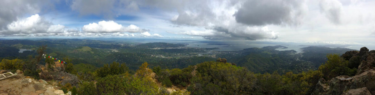
Mount Tamalpais stands guard over the bay, with views stretching from the Farallon Islands to the snow-capped peaks of the Sierra Nevada mountains. And while you can drive almost to the top, it’s nothing to brag about. Hiking to the top is better. Better still? Hiking to the summit, starting from Stinson Beach.

img
Trail Details
Summit: 2,571′ (784 m)
Distance: 15 miles
Time: 5-7 hours
Difficulty: Strenuous
Elevation gain: +/-2,771′ ft (844.6 m)
Dogs: No
When to go: Year-round
This hike totals about 15 miles, starting at Stinson Beach on the Dipsea Trail, then up the beautiful Steep Ravine Trail to Pantoll Campground, and following the Old Stage Road up to the summit and back, finally returning to Stinson Beach via the Matt Davis Trail.

Getting to the Trailhead

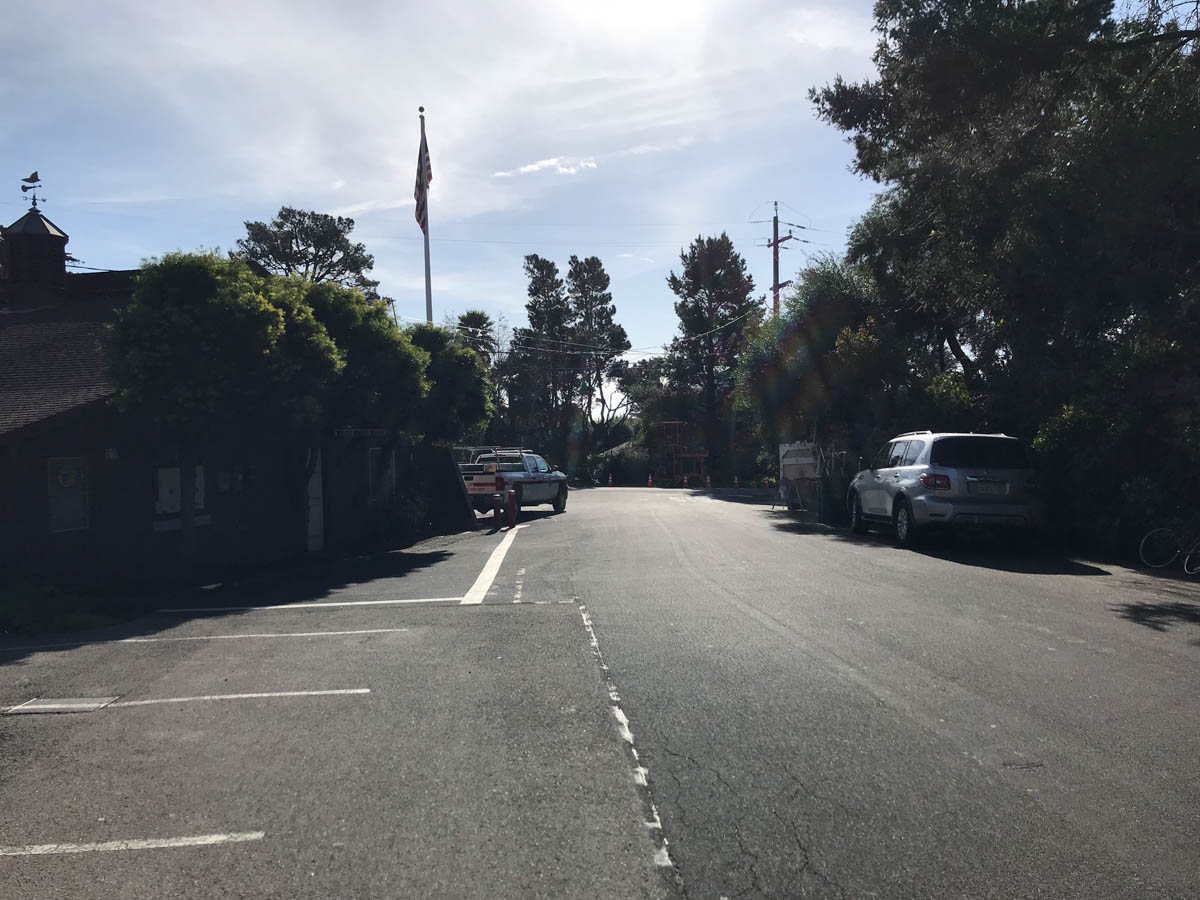
Getting here can be an adventure in itself. Stinson Beach is on the Pacific Coast side of Marin County, west of Mill Valley. When I hiked this, I left early to start hiking at sunrise. The normal route would be west on the Shoreline Highway, but there was a detour when I went, so instead I drove over the extremely windy Panoramic Highway. The benefit of this is that the parking area is right on Panoramic Highway, just before it connects with Shoreline. Here’s the exact location on Google Maps. I chose this parking area mainly because the beach parking lot wasn’t open yet, but because it’s on the east side of Shoreline, you aren’t vying for parking with beachgoers as well.

Hiking from Stinson Beach to Mount Tam

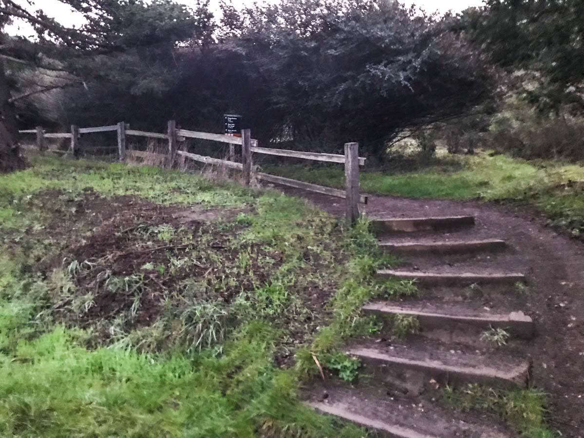
Start out by crossing to the south side of the Panoramic Highway and pick up the Dipsea Trail.

Head up this trail off Panoramic Highway
Dipsea Trail
Dipsea Trail marker

A bridge on the Dipsea Trail

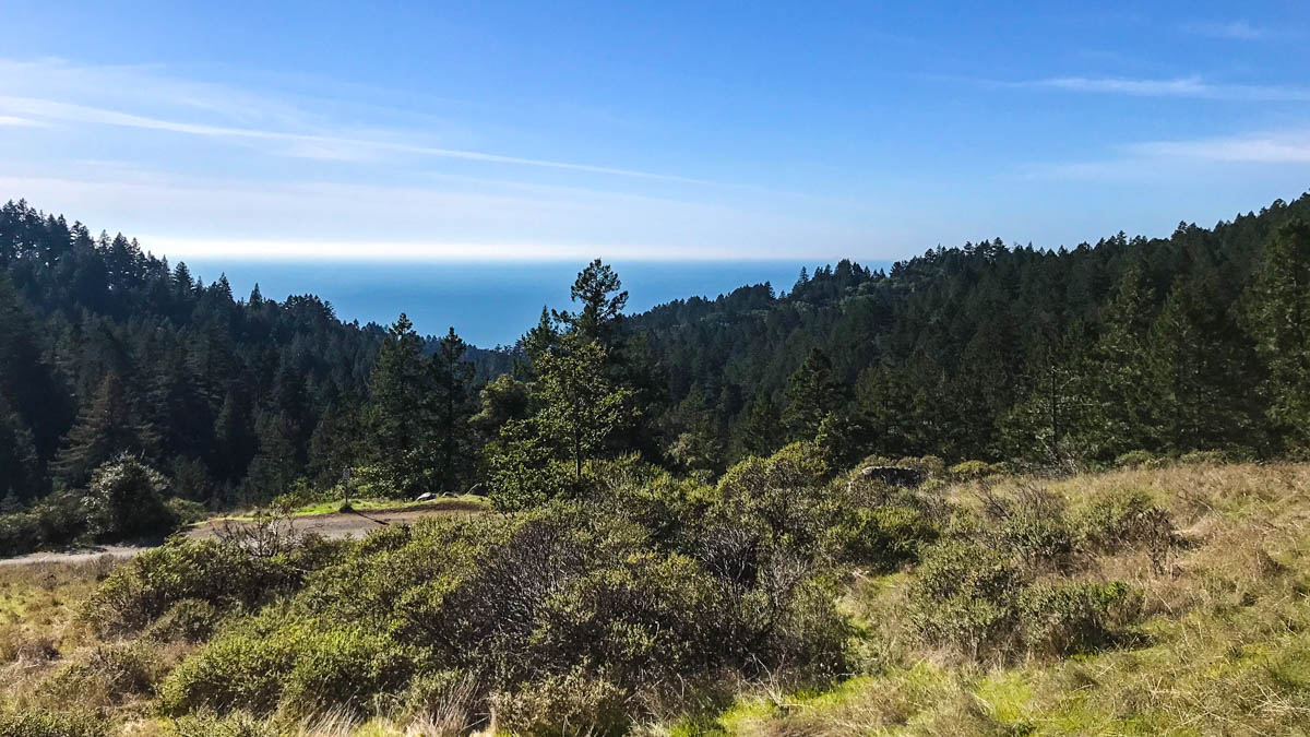
The trail begins climbing quickly across the grassy coastal headlands, providing sweeping views of the coastline, which looked especially sweet in the early morning light.

Sweeping views of Stinson Beach

Nearing the Steep Ravine Trail
The dark tunnel of trees leading into the ravine

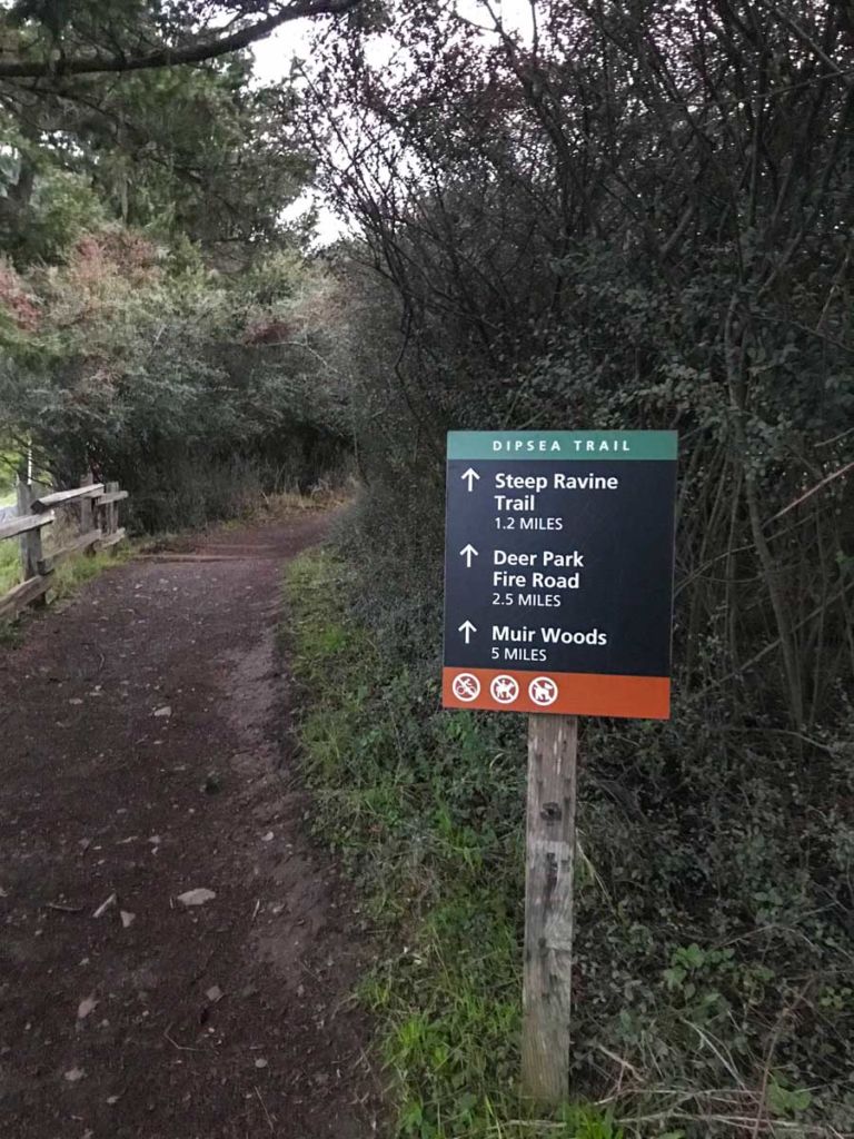
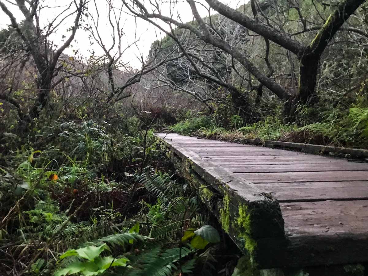
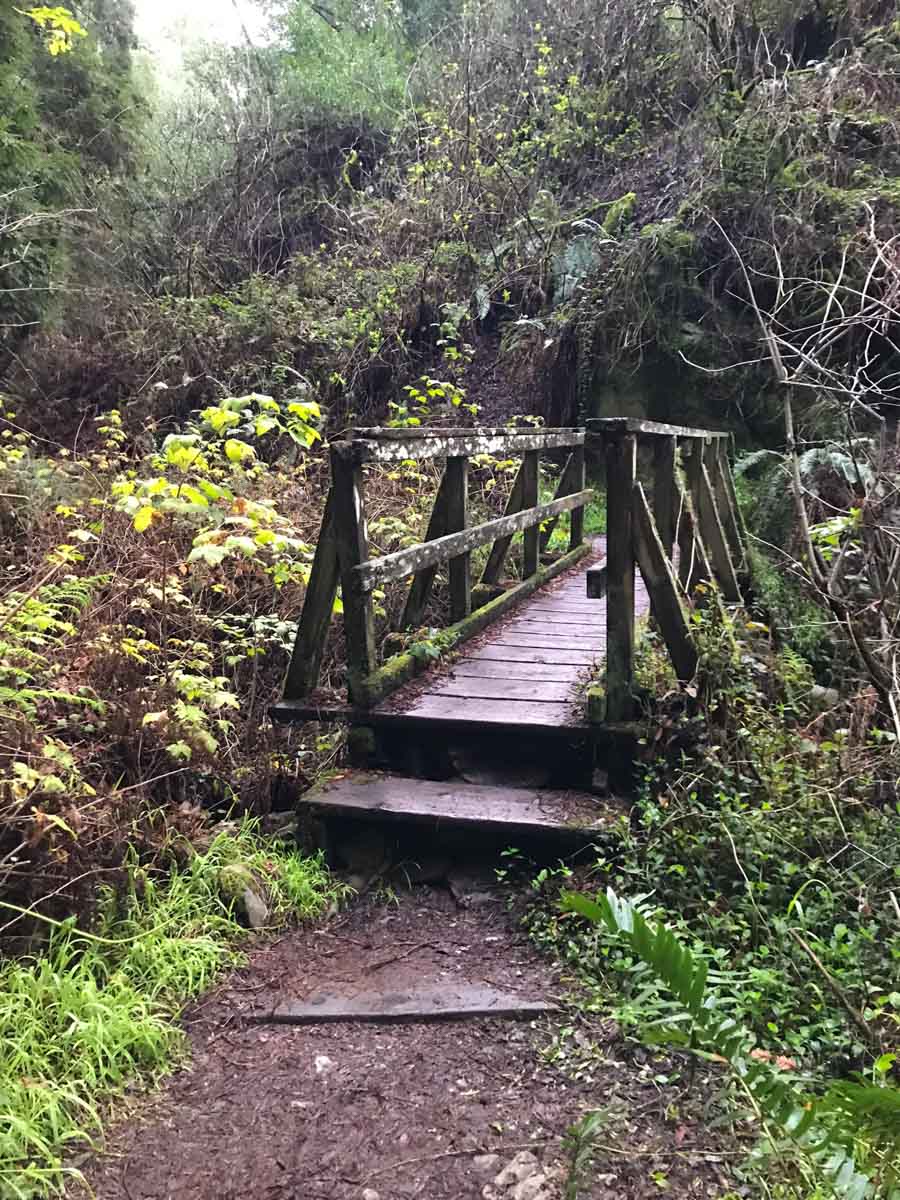
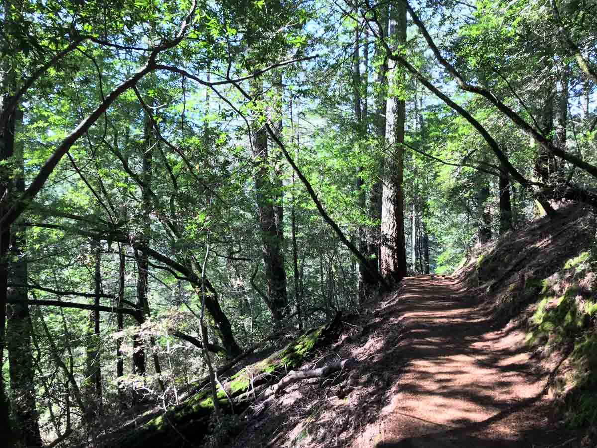
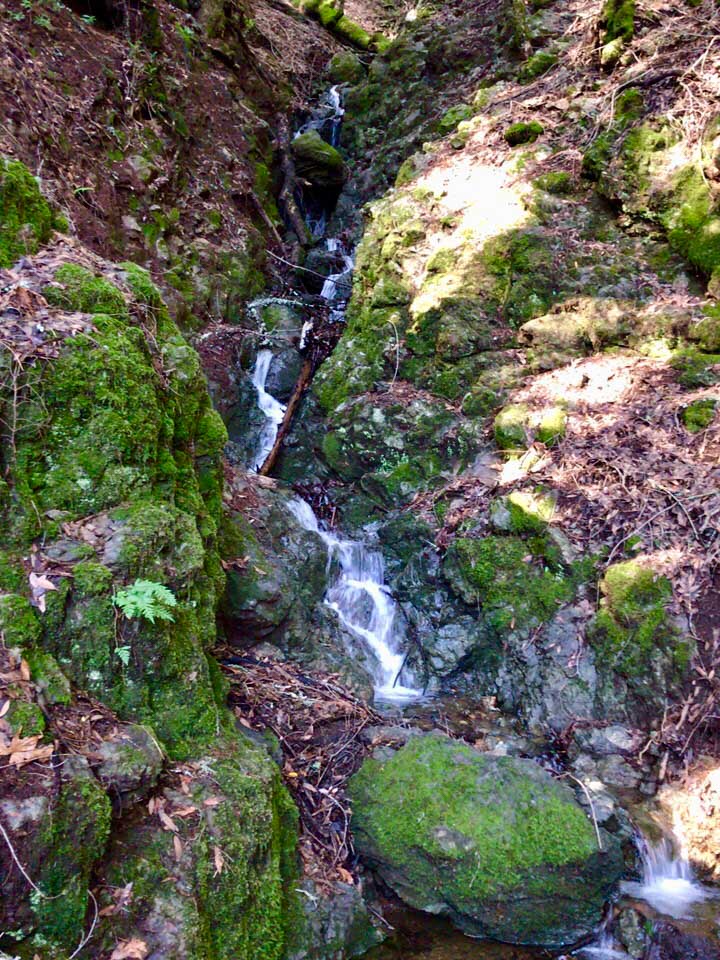
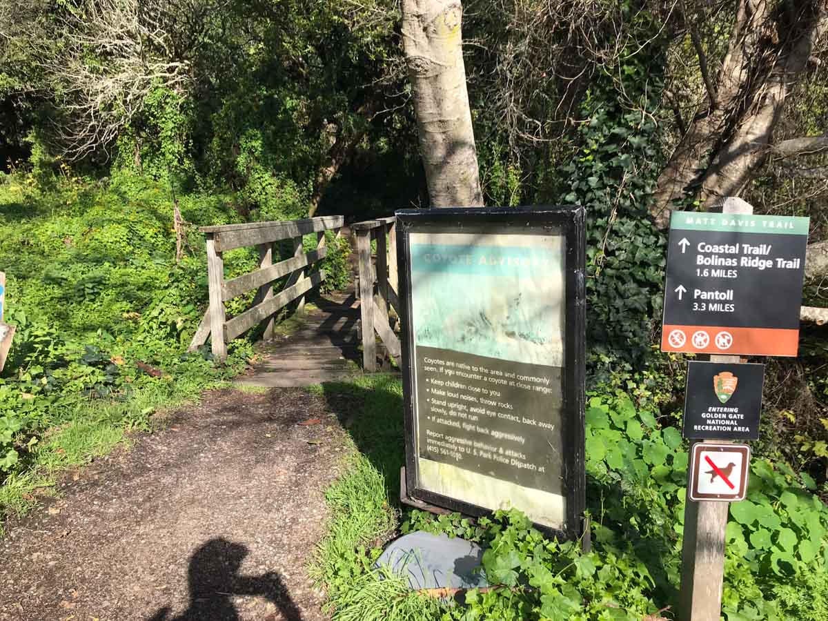
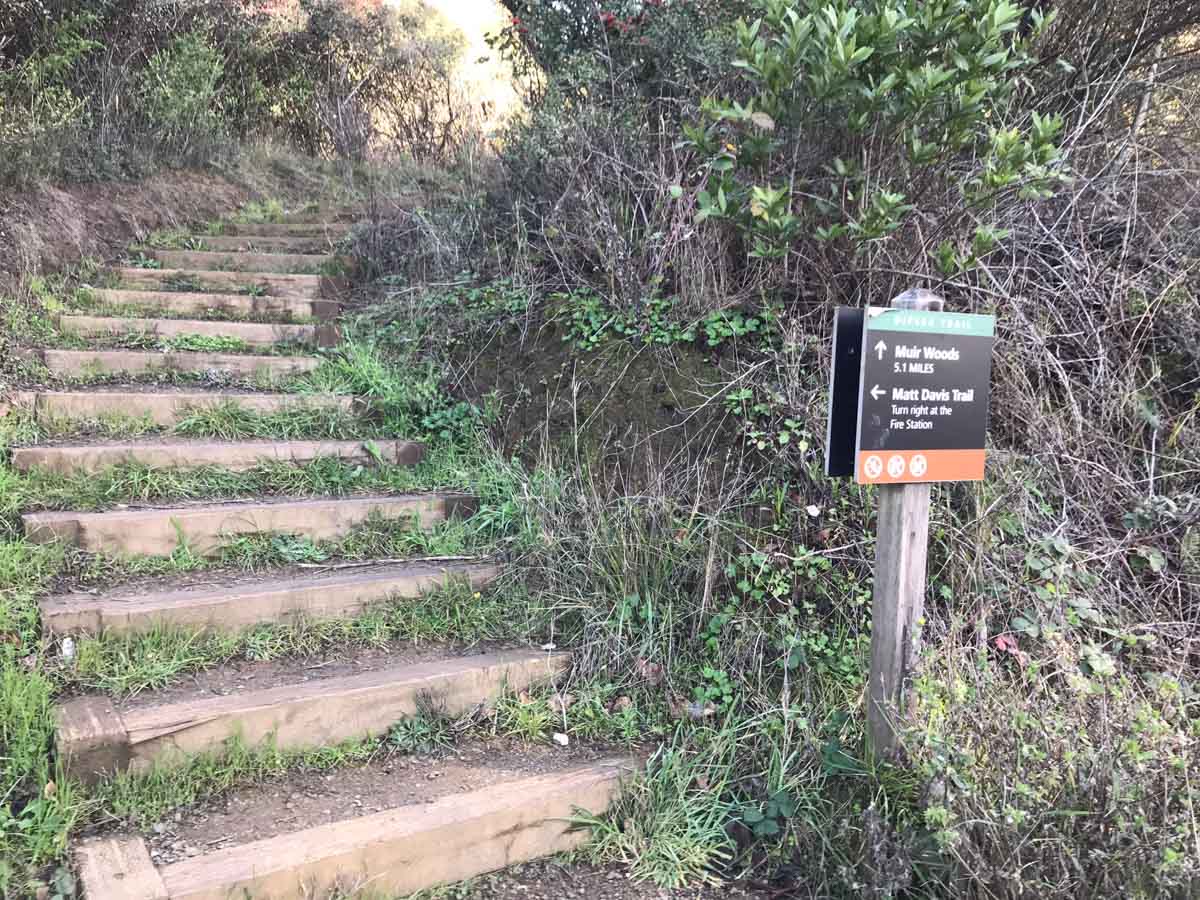
At 1.1 miles, you reach the Steep Ravine Trail. This trail climbs alongside Webb Creek, threading among towering redwood trees, criss-crossing moss-covered wooden footbridges, and climbing carefully hewn stone steps. About 1/10th of a mile up the Steep Ravine Trail, the Dipsea Trail peels off to the right. Keep to the left at this junction, and continue to follow the creek. This is one of the most beautiful sections of this hike, and worth a trip in itself.

Cascades alongside the Steep Ravine Trail
The cool, shady ravine
One of the wood bridges that criss-cross the ravine

Steep steps require careful footing

Note that there is a ladder you’ll have to climb. It was damp and slick this particular morning, but that’s not unusual back in this ravine. Take your time and use care going up. And don’t forget to pause beforehand to soak in the view of the cascading water.

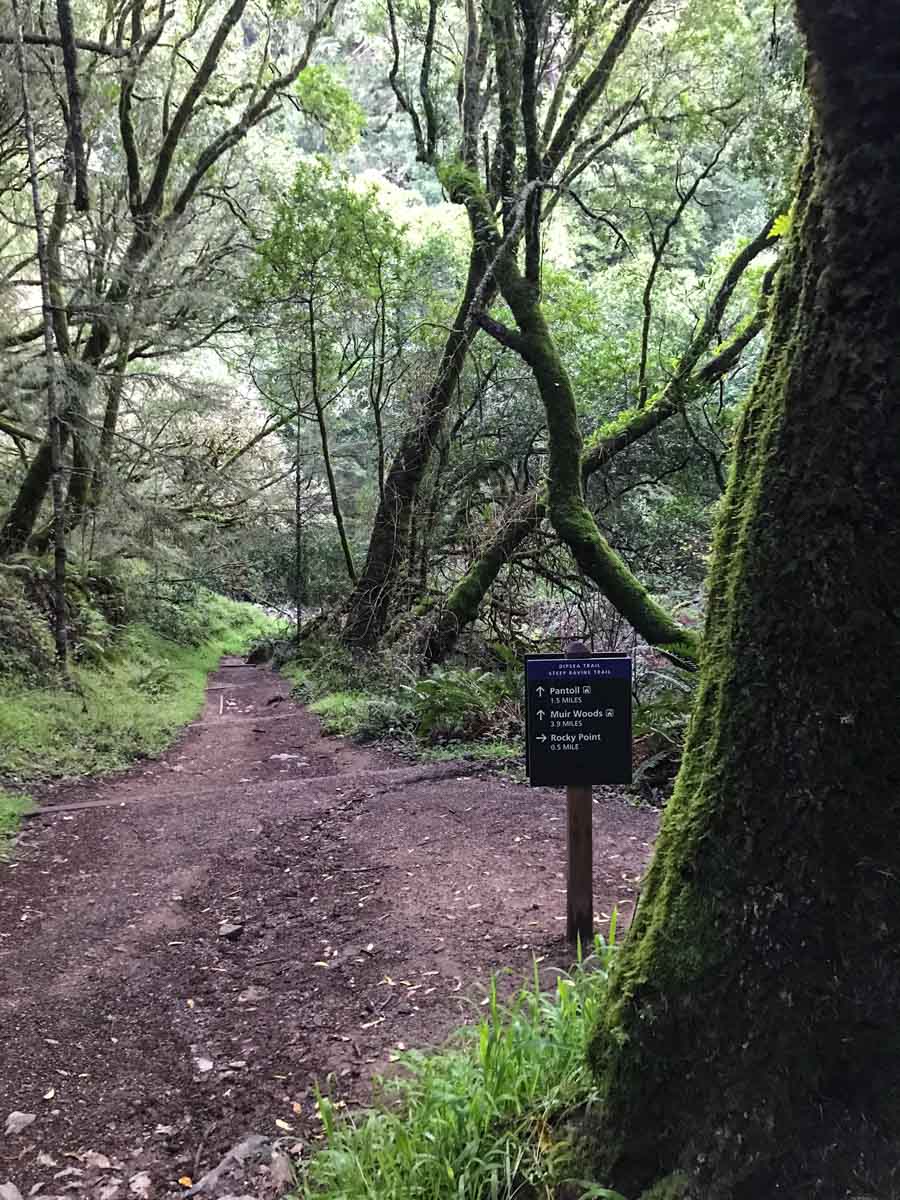
At the 3.4 mile mark, you see signs of Pantoll Campground through the trees. There are public restrooms here as well as a parking area.

Nearing Pantoll Campground

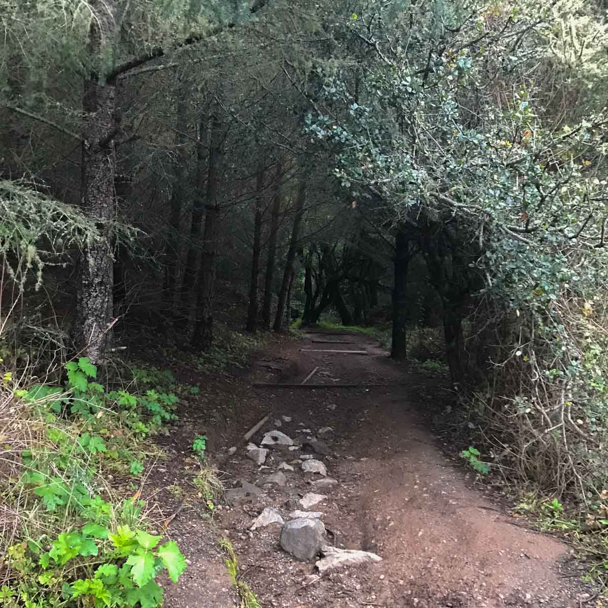
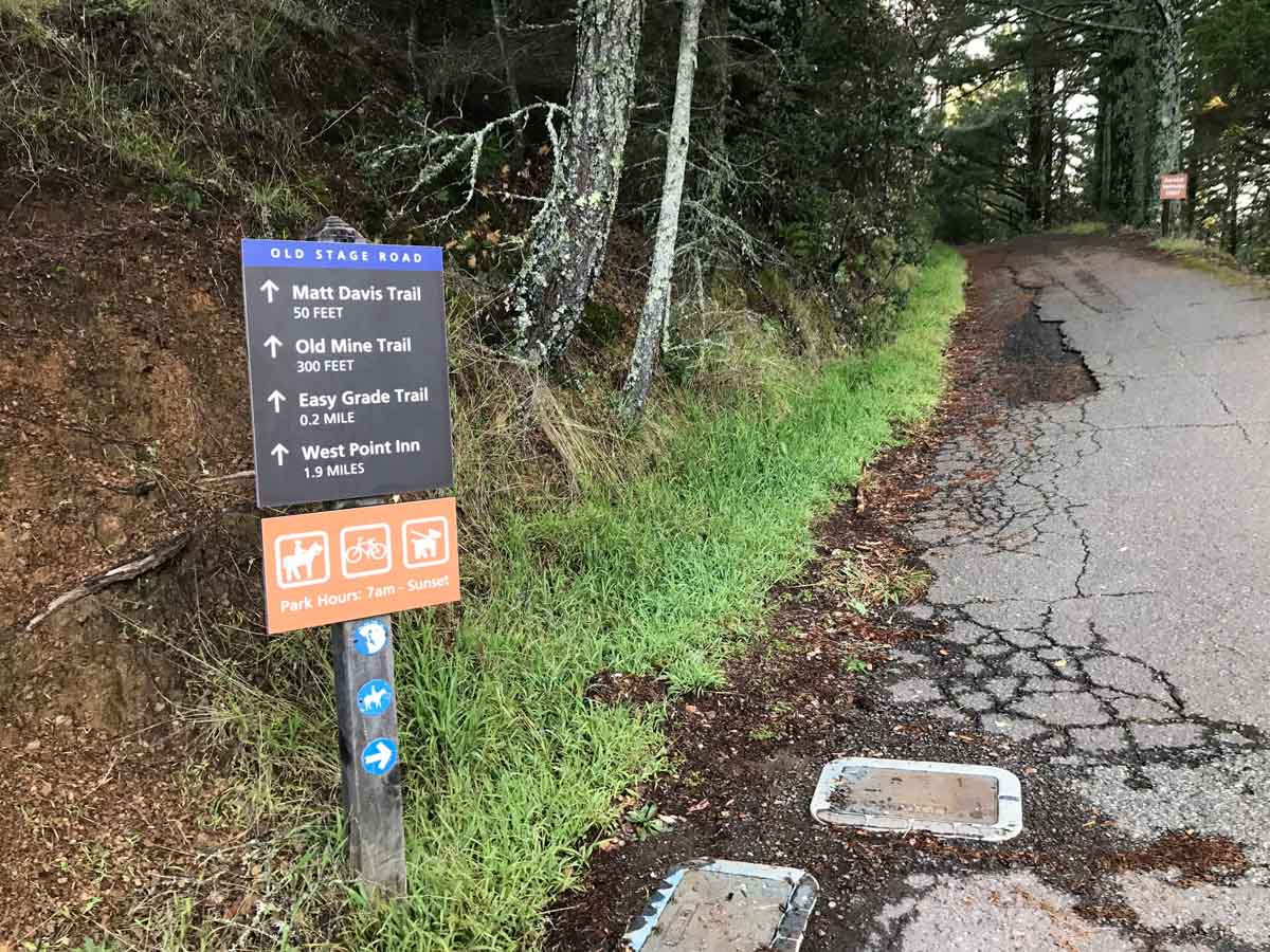
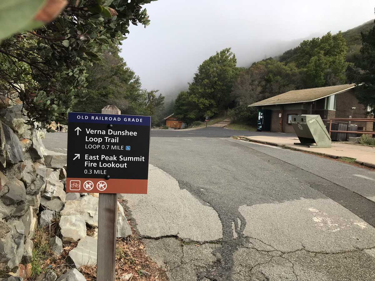
At the Pantoll Campground, you’ll cross the parking lot up to the driveway entrance, then (watching for cars) cross the Panoramic Highway. Look for the signs for the Old Stage Road, heading toward the West Point Inn.

Cross the Panoramic Highway from Pantoll Camp and take the Old Stage Road
Trail marker
West Point Inn

The Old Stage Road begins as paved for a short distance, quickly becoming a dirt road. My early morning start meant I had the trail to myself on my way up, though I met a number of hikers and mountain bikers climbing the road on my return trip.

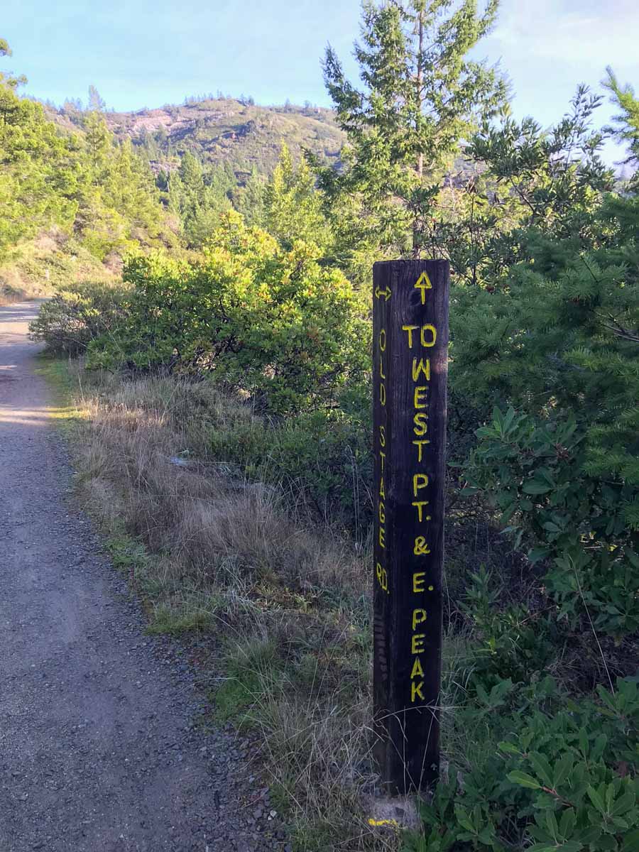
Two miles up this gentle grade brings you to the historic West Point Inn. This inn has been around for over 100 years, and has both rooms and cabins for rent. To reach the Inn, you’ll have to either hike or bike, which is part of the charm. Time your trip right and you can hike here for one of their famous pancake breakfasts!

Historic West Point Inn

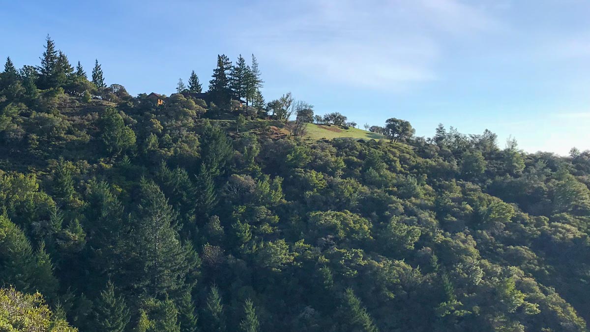
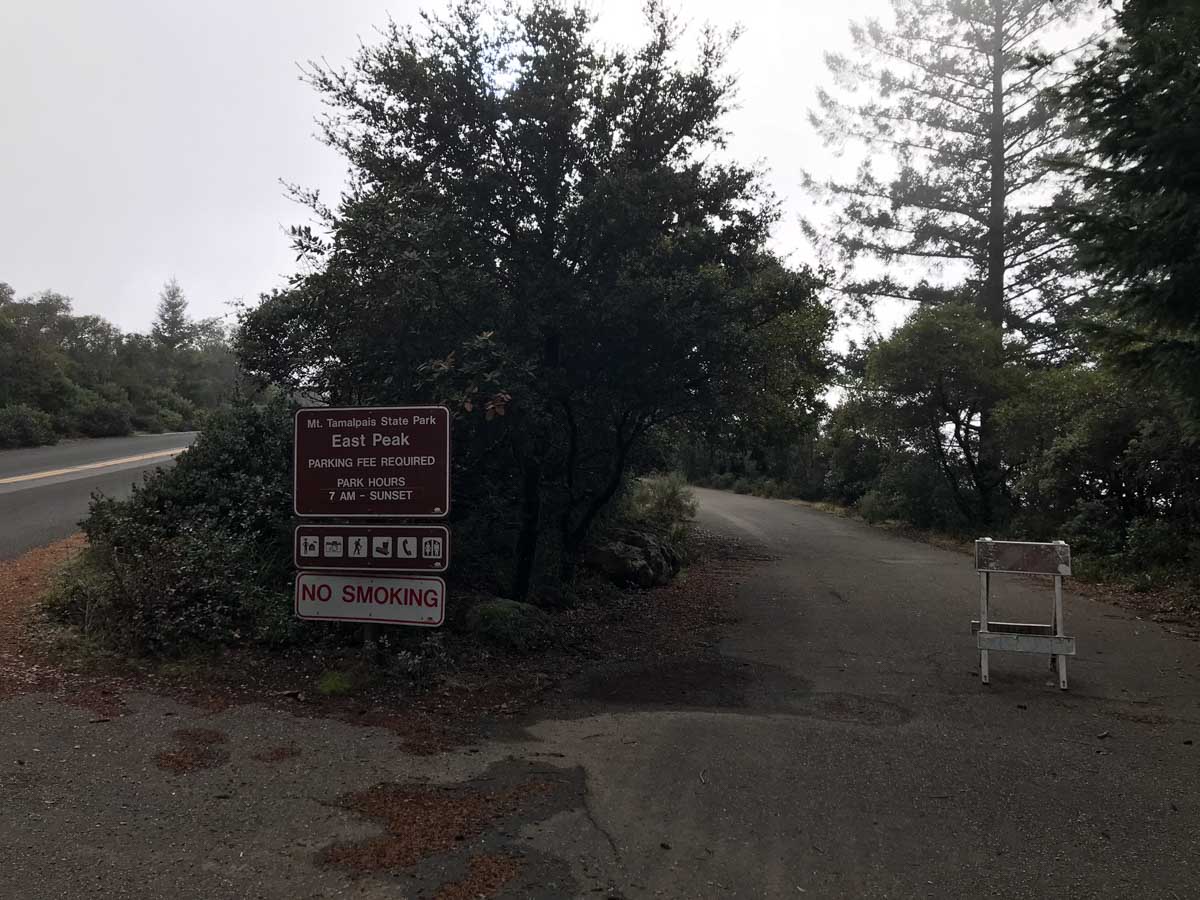
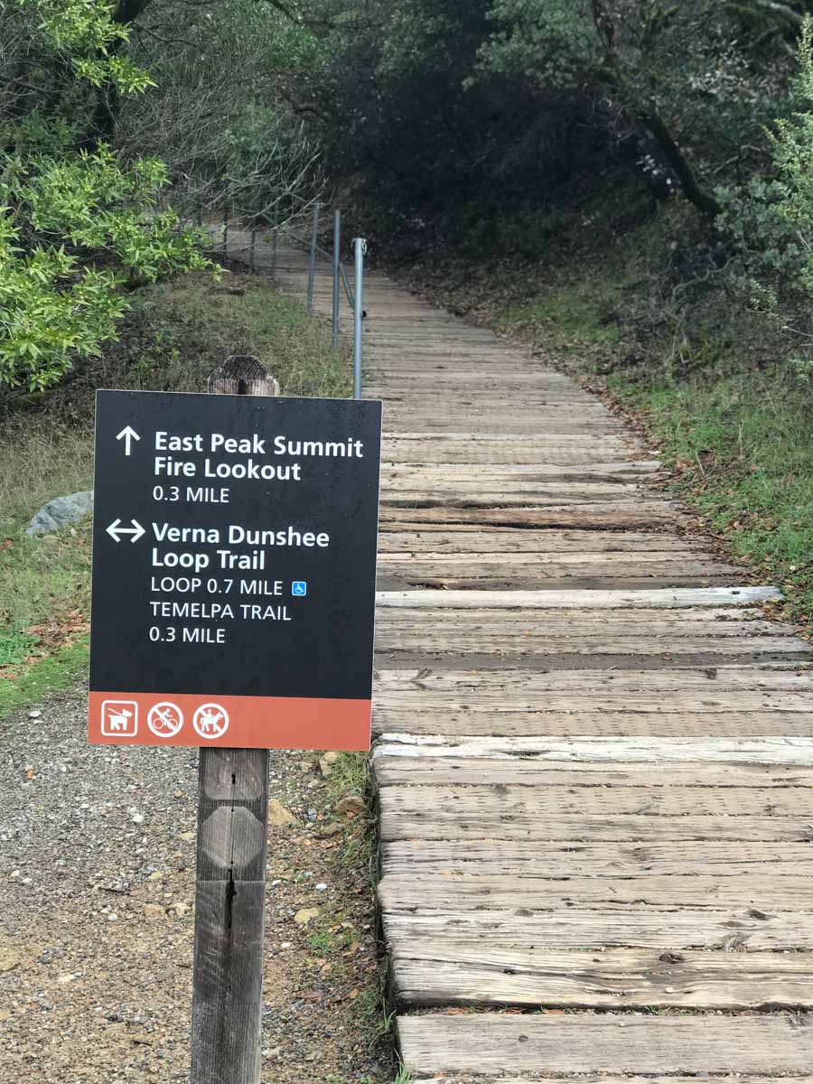
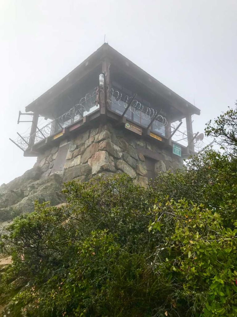
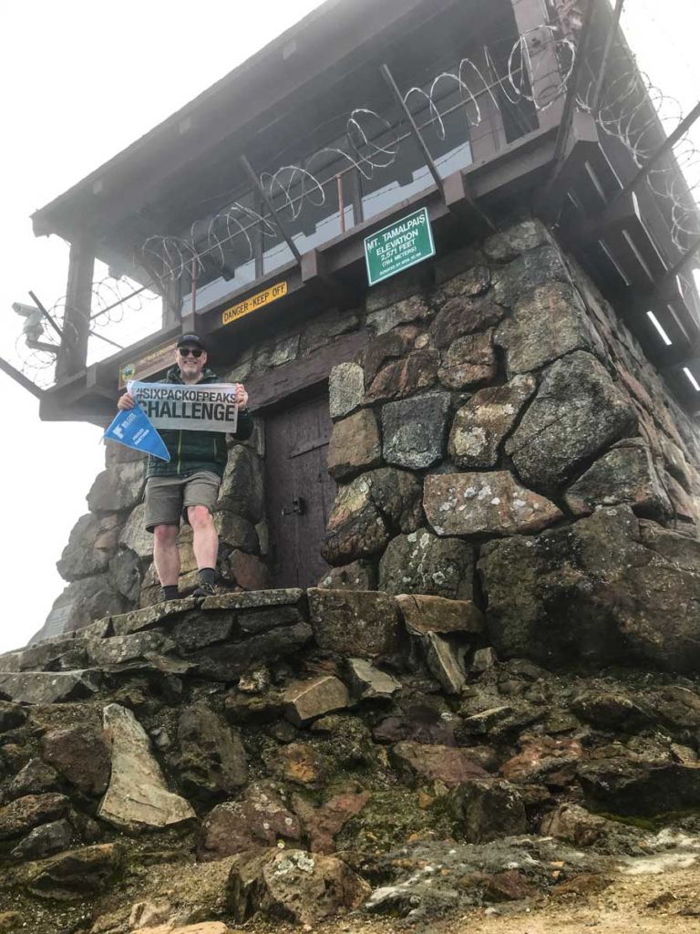
Follow the dirt road left around the front of the West Point Inn and around to the back where it continues the gradual climb up to Mount Tam. You’ll reach a gate and the road to the East Peak parking area. Bear right at the fork and follow to the Plank Walk Trail. This takes you the remainder of the way to the fire lookout tower on the summit of Mount Tamalpais.

Bear right at this fork
East Peak Parking Area
Plank Trail to the summit of Mt Tam

Mount Tam fire lookout tower
Mt Tam benchmark
Author at the Fire Lookout on Mt Tam

Plaque and NorCal Six-Pack of Peaks sticker

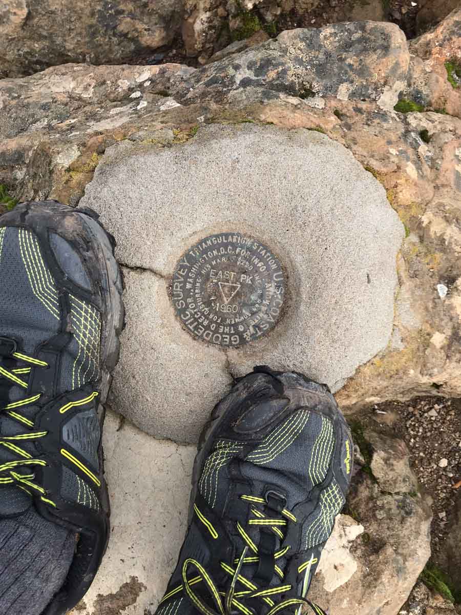
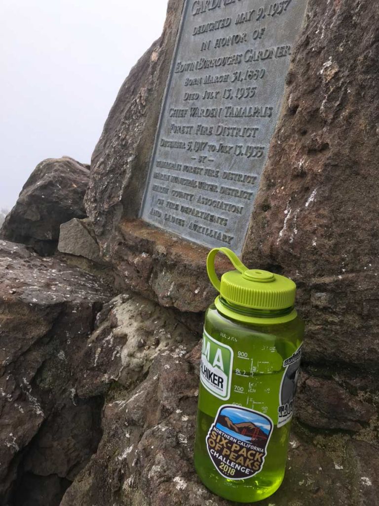
The summit makes a good spot for a snack or lunch break. On the weekends, you can stop at the Visitors Center in the East Peak parking area and purchase snacks or souvenirs with all the non-hikers. I was grateful to be here on a quiet weekday. Everything was closed and only a few other hikers here and there.

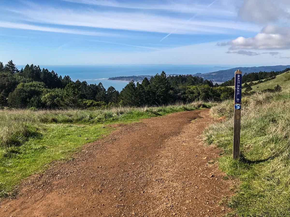
Heading back down to Stinson, follow the Old Stage Road again back to Pantoll Campground. From here, look for the signs for the Matt Davis Trail.

Matt Davis Trail

This trail is a little longer than the Steep Ravine Trail, but less slippery in wet conditions. I passed countless rivulets, even five days after the last rainfall, and the scenery varied from dark, lush forest to open, grassy hills with views out to the Pacific Ocean.

Easy hiking on the Matt Davis Trail
Countless rivulets and waterfalls
Views to the Pacific Ocean

Getting closer to Stinson Beach

Finally, the trail ends near the Stinson Beach fire station. From here, walk west and south to reach Shoreline, then south on Shoreline until you reach the Dipsea Trailhead. From here, just another 1/4 mile or so of trail takes you back to the parking area where you began the hike.

End of the Matt Davis Trail
Road walking to Shoreline
Dipsea Trailhead

After the hike, stop at the beach to dip your toes in the water. You’ve earned it!

Stinson Beach

Stinson Beach to Mount Tamalpais Trail Map & Elevation Profile

© OpenStreetMap contributors
Download file: stinson-beach-to-mt-tamalpais-2.gpx


NorCal Six-Pack of Peaks ChallengeStinson Beach/Mount Tamalpais Resources

  • Mt. Tamalpais State Park is open 7am to sundown daily
  • Visitor Center
  • Friends of Mt. Tam – great resource with a calendar of scheduled events including guided hikes in the park
  • History of the Gravity Cars
  • West Point Inn – Info on the history, accommodation, membership and their periodic pancake breakfasts!
  • This hike is part of the NorCal Six-Pack of Peaks Challenge. Take the challenge!

Mount Tamalpais Weather Forecast

The location could not be found.

Originally hiked on January 23, 2018.

Filed Under: Trail Guides Tagged With: 10+ miles, coastal, Marin County, Mt Tamalpais, NorCal, peakbagging, Six-Pack of Peaks, strenuous, waterfall

Like what you found here at SoCal Hiker? This site is a labor of love. Share your support for the site and help us development of new trail guides and expanded coverage -- make your next outdoor equipment purchase through our advertisers.

You can also subscribe to our weekly newsletter and follow us on Facebook or Twitter.

Jeff H

About Jeff H

I'm an avid hiker and backpacker. My wife Joan and I are on the trails every weekend. I started SoCal Hiker to share my passion for outdoor adventure.

Comments

  1. Lindsay Moran says

    August 14, 2018 at 1:54 pm

    Jeff thanks for this – I am about to head to the Bay Area with my kids – ages 13 and 11 – pretty hearty boys. Do you think they can hike this in sneakers? This was a great resource. Do you happen to have a PDF – would love to print it.

    Reply
    • Jeff HJeff Hester says

      August 14, 2018 at 4:06 pm

      Hi Lindsay,

      I hike it in Altra trail running shoes. You could hike it in sneakers, BUT… 14 miles is a long way to hike in sneakers IMO, and if the trail is damp or wet, all bets are off (mainly referring to the Steep Ravine Canyon section).

      I don’t have a PDF of the trail guide, but I can print to PDF from Safari, so I’ll send you what that captures.

      Finally, you should also consider the shorter Steep Ravine Loop, which you could follow up by driving almost to the top of Mt Tamalpais and then hiking the Plank Trail to the top.

      Reply
  2. RP says

    June 1, 2021 at 11:40 am

    Our family says it’s a “must do” when visiting the Bay Area. We hiked about half but was awesome

    Reply

Leave a Reply Cancel reply

Your email address will not be published. Required fields are marked *

This site uses Akismet to reduce spam. Learn how your comment data is processed.

About SoCal Hiker

Jeff on Mount Rainier

I created SoCal Hiker while preparing to thru-hike the John Muir Trail. My goal? Create guides for the best hiking and backpacking trails with enough detail to make it an enjoyable experience for you. And while I started with trails in Southern California, I’ve expanded across the west. We hike each trail to create these guides, sharing practical advice on gear and outdoor skills. Read more…

Connect with SoCal Hiker

  • 22,751 Fans
  • 11,947 Followers
  • Followers
  • 1,717 Followers
  • 5,281 Subscribers
  • 342 Subscribers
SoCalHiker was selected one of USA TODAY's 10 Best Hiking and Outdoor Blogs
Get our day-by-day guide to thru-hiking the John Muir Trail
Get up-to-day wildfire status throughout California

Products

  • Let your SoCalHiker flag fly! SoCalHiker Red, White & Blue Summit Flag
    Rated 5.00 out of 5
    $25.00
  • Mt San Jacinto Benchmark $39.95
  • Mount Baldy T-Shirt $23.00 – $27.00
  • Six-Pack of Peaks Patch for 2016 2016 Six-Pack of Peaks Patch $6.00

Sponsors

Sponsor SoCalHiker and see your banner here

Featured Posts

Hiking Belknap Crater in the Mountain Washington Wilderness

Hiking this out-and-back route up Belknap Crater you'll traverse an other-worldly … [Read More...]

Hiking to the Simpson Reef Overlook on the Oregon Coast Trail

The Oregon Coast is rugged, beautiful and often uncrowded. This bluff-top … [Read More...]

Join Team SoCalHiker at the Climb for Heroes

Team SoCalHiker is climbing Mount Baldy again as part of the annual Climb for Heroes … [Read More...]

Lastest Comments

  • Amy Courtney on Ridgeline Trail
  • Jay Eleanor on Hiking to the Simpson Reef Overlook on the Oregon Coast Trail
  • Charles Krim on Hiking to the Simpson Reef Overlook on the Oregon Coast Trail
  • 11 Best California Bikepacking Routes | Wild Lumens on Inside Crystal Cove State Park
  • Ted Thed on Burbank Peak, Cahuenga Peak, Mt. Lee and the Hollywood Sign
Get your SoCalHiker stickers now

Get your SoCalHiker stickers!

Latest Posts

  • Hiking Belknap Crater in the Mountain Washington Wilderness October 20, 2022
  • Hiking to the Simpson Reef Overlook on the Oregon Coast Trail August 25, 2022
  • Join Team SoCalHiker at the Climb for Heroes August 23, 2022
  • Hiking the Welch-Dickey Loop in the White Mountain National Forest August 18, 2022
  • Hiking Turtlehead Peak from Red Rock Canyon National Conservation Area July 15, 2022

Recent Forum Topics

  • How to deal with accidents while hiking in the winter?
  • Warm Tips for your hiking in winter
  • Some tips for hiking.
  • Keep your body warm in the winter hiking
  • The benefits of hiking, more than you can imagine!

The Six-Pack of Peaks Challenge Series

Six-Pack of Peaks Challenge SeriesThe Six-Pack of Peaks Challenge Series gives you an opportunity to explore your world while supporting a great cause. There are eleven challenges around the country. Hike or run them at your own schedule.

Flex your adventure muscles!

Learn more here.


Search

Tags

3-6 miles 6-8 miles 8-10 miles 11+ miles Arizona Backpacking coastal dog-friendly easy family-friendly High Sierra Trail hiking Hiking The John Muir Trail hipster inspiration JMT John Muir John Muir Trail Kings Canyon National Park LA County moderate Mount Rainier National Park Muir Monday National Park Orange County Oregon out of bounds Pacific Crest Trail peak peakbagging quote scenic Sequoia National Park Sierra Nevada Six-Pack of Peaks State Park strenuous Thru-hiking Utah vista Washington waterfall wilderness Wonderland Trail Yosemite

Copyright © 2023 SoCalHiker.net · Metro Theme on Genesis Framework with WPEngine Hosting · Contact SoCal Hiker · Sitemap · Privacy Policy


Loading Comments...