• COVID-19 Park and Trail Closures
  • Learn about the Six-Pack of Peaks Challenge
  • Shop
  •  

SoCal Hiker

  • Find a Hiking Trail
    • All Areas
    • Arizona
    • Colorado
    • Los Angeles
    • Orange County
    • Oregon
    • San Francisco Bay
    • Washington
  • Trail Guides
  • Six-Pack of Peaks
    • Colorado Six-Pack of Peaks
      • Bergen Peak
      • Rocky Mountain
      • Birthday Peak
      • Horseshoe Mountain
      • Grays Peak
    • New England Six-Pack of Peaks
    • NorCal Six-Pack of Peaks
      • Mount Umunhum
      • Mount Saint Helena
      • Mount Tamalpais
      • Mount Diablo
      • Mount Sizer
      • Rose Peak
    • Oregon Six-Pack of Peaks
      • Tumalo Mountain
      • Black Butte
      • Black Crater
      • Maiden Peak
      • Mount Bachelor
      • South Sister
    • SoCal Six-Pack of Peaks
      • Mt. Wilson
      • Cucamonga Peak
      • Mt. San Antonio (Mt Baldy)
      • San Bernardino Peak
      • San Jacinto Peak
      • San Gorgonio
  • Backpacking
    • High Sierra Trail
    • John Muir Trail
      • Overview of the John Muir Trail
      • Training
      • Day-by-Day Itinerary
      • Resupply Addresses
      • JMT Discussion Forum
    • Lost Coast Trail
    • North/South Lake Loop
    • Rae Lakes Loop
    • Red Peak Pass Loop
    • Theodore Solomons Trail
    • Trans-Catalina Trail
    • Wonderland Trail
  • Gear
  • Forums
    • Latest Topics
    • Ask a Question
    • Campfire
    • Trails
    • Trail Reports
    • Gear Wisdom
    • Classifieds
  • Login

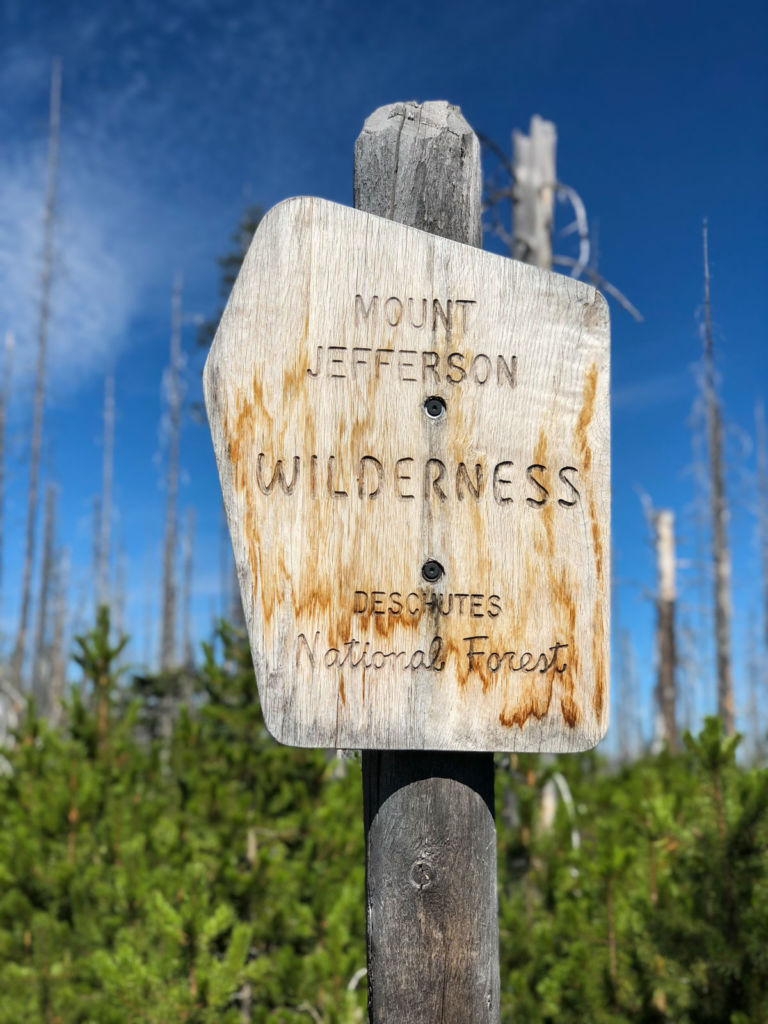
Hiking the Canyon Creek Meadows Loop in the Mount Jefferson Wilderness

June 3, 2020 By Jeff H 1 Comment

Canyon Creek Meadows

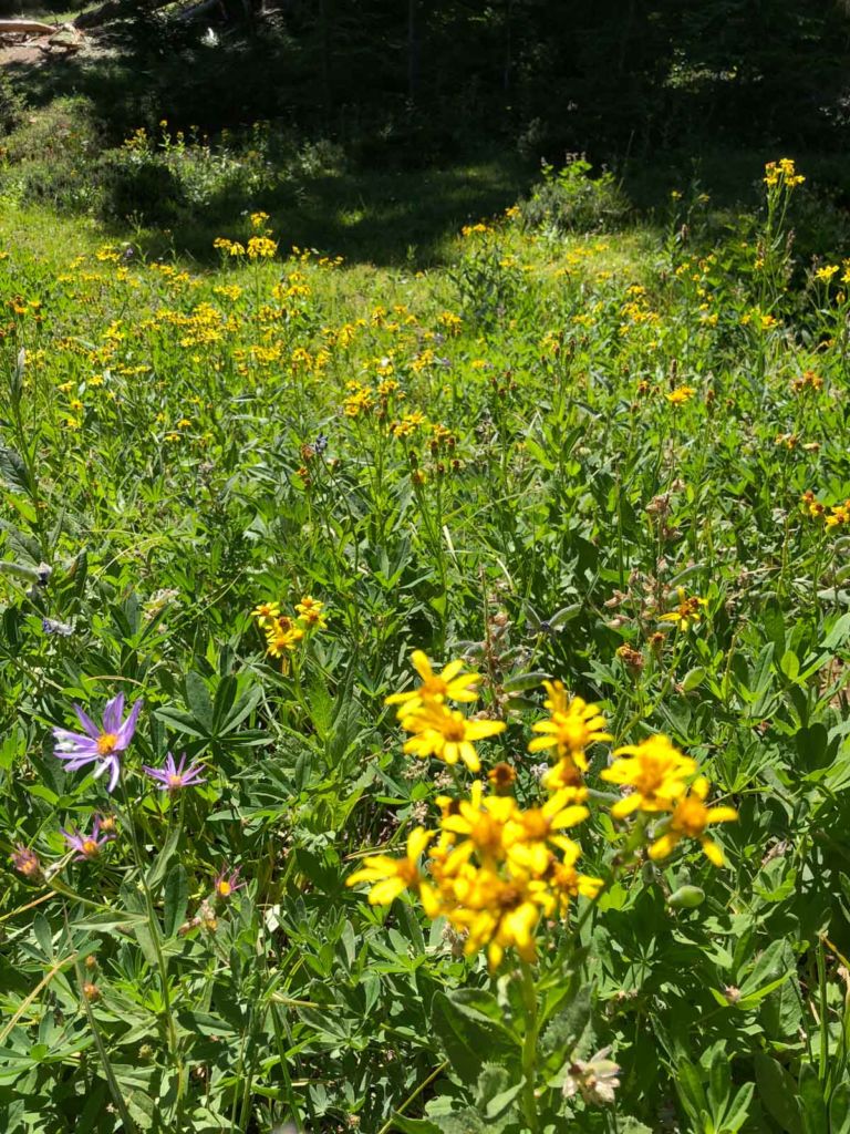
There is something about an alpine meadow filled with wildflowers with craggy mountain peaks as a backdrop that gives me a sense of peace. Beautiful cascading creek? Check. Craggy peaks? How about Three Fingered Jack? Alpine meadow? Hit it in late July and you’ll have abundant wildflowers. Optional scramble to a saddle with even bigger views? Yes, this hike to Canyon Creek Meadows in Central Oregon’s Mount Jefferson Wilderness fits the bill. And if you’re lucky, you might even spy mountain goats, like we did!

img
Trail Details
Distance: 5-7.3 miles
Time: 3-4 hours
Difficulty: Moderate-Strenuous
Elevation gain: 980-1,580 ft
Dogs: Yes
When to go: Summer
This trail can be moderate if you do just the five mile loop, or strenuous if you add in the optional scramble to Viewpoint Saddle below Three Fingered Jack. Our map and elevation profile shows the full enchilada, including a little rambling at a mini-plateau northeast from the saddle.

Getting to the Jack Lake Trailhead

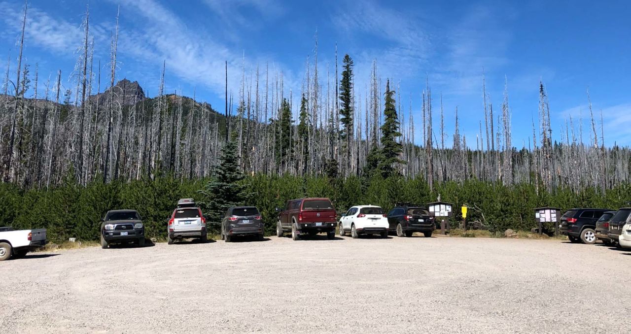
This hike begins at the Jack Lake Trailhead, and part of the adventure is getting there. The trailhead is about a 85 minute drive northwest of Bend, Oregon. From Bend, head west on Highway 20 33 miles, turning right on Suttle Sherman Road. In one mile, turn left onto paved Jack Lake Road (NF-12) for 4.4 miles, then turn left on one-lane Road 1230. At the end of the pavement, fork left onto NF 1234 , following it as it twists, turns and climbs over a washboard gravel surface for the next six miles. There were plenty of sedans at the trailhead, so high-clearance isn’t absolutely required, but expect to go slowly and carefully in some of the rutted areas. Get turn-by-turn directions via Google Maps.

Jack Lake Trailhead
Parking at the Jack Lake Trailhead
Canyon Creek Meadow Trail Number 4014
Starting the hike

Hiking to Canyon Creek Meadows

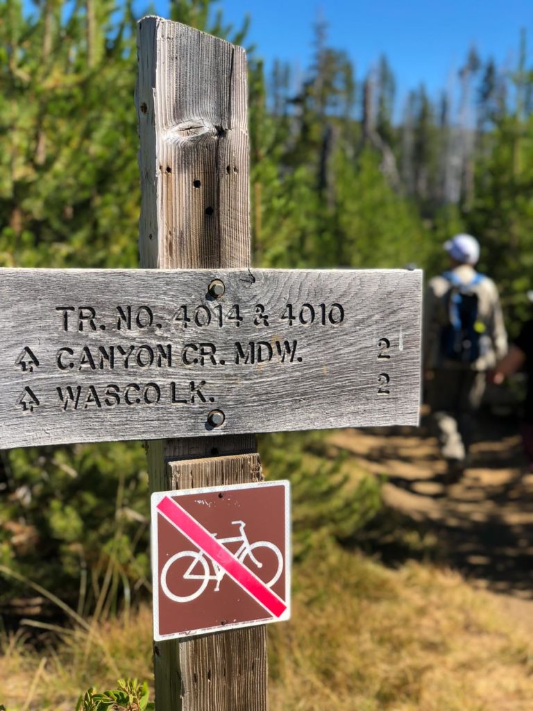
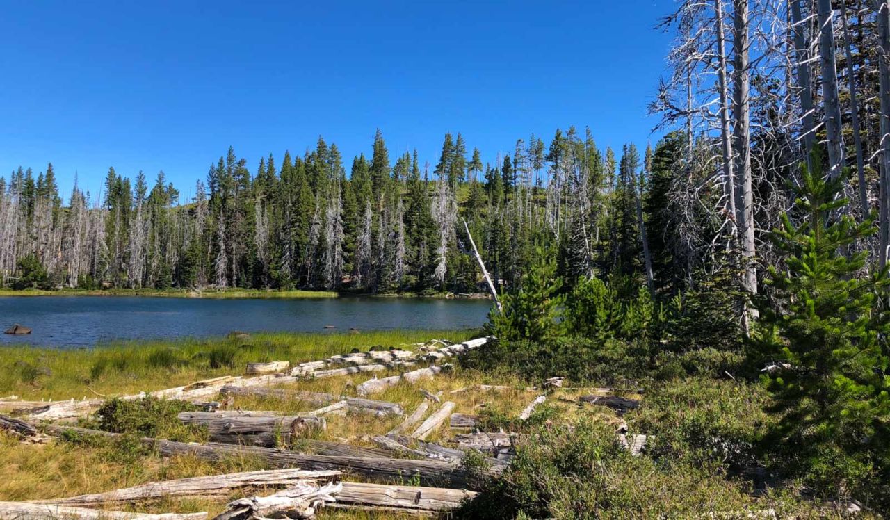
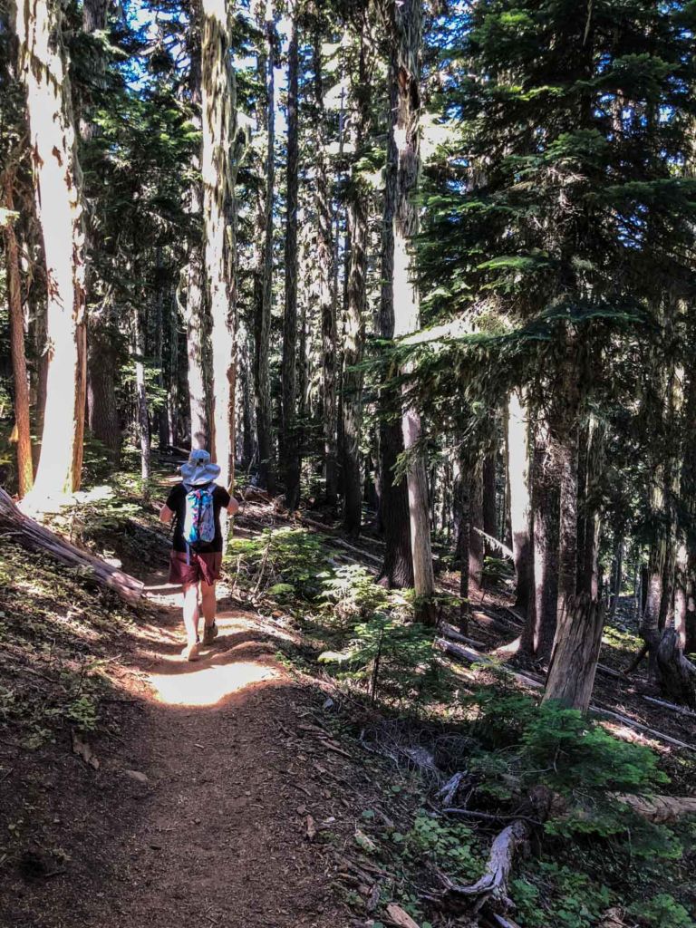
Find the trailhead for Canyon Creek Meadows and follow it around the east side of shallow Jack Lake. Shortly after you reach a junction with Trail 4014. For now, keep left (the Forest Service recommends this to reduce crowds) and continue up the ridge and in the shade.

Jack Lake
Jack Lake
Mount Jefferson Wilderness
Mt Jeff Wilderness
New Growth
New growth
Old moss-covered pine forest
Forested trail

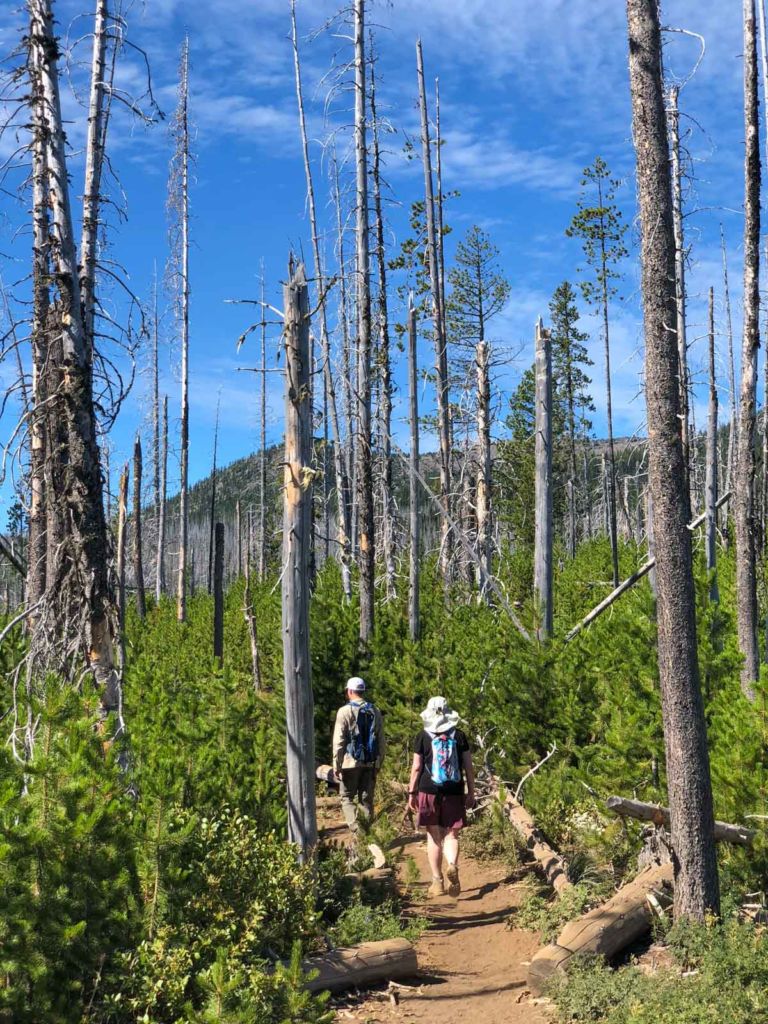
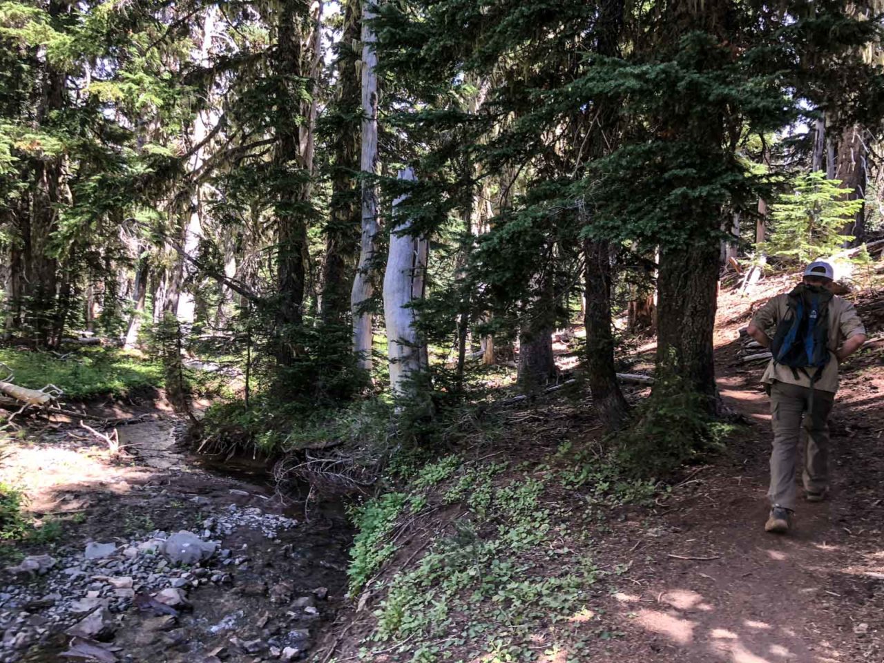
After a mile of climbing, the trail dips down  into Canyon Creek Meadows and begins to follow roughly parallel to Canyon Creek.

Canyon Creek Meadow and Three Finger Jack

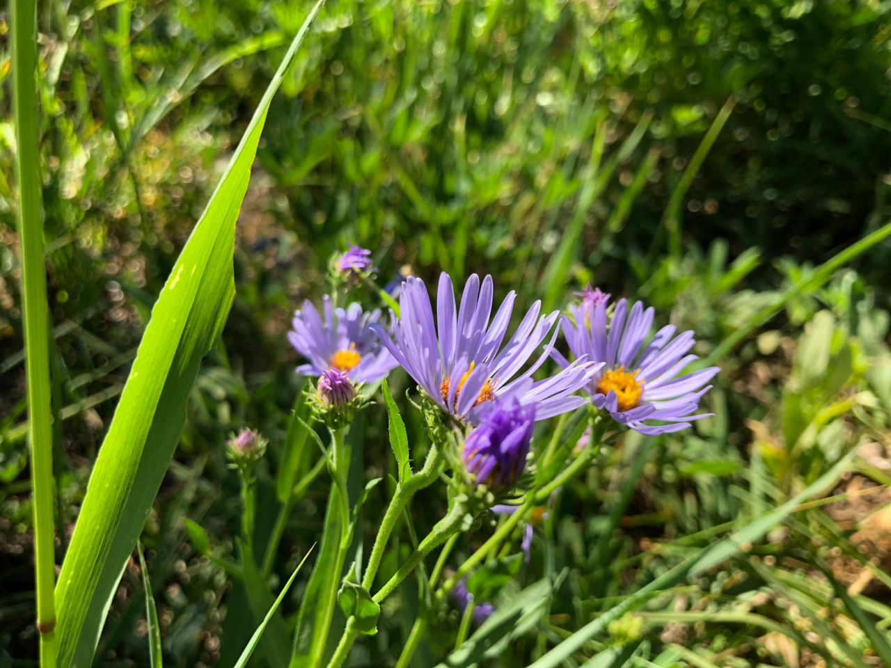
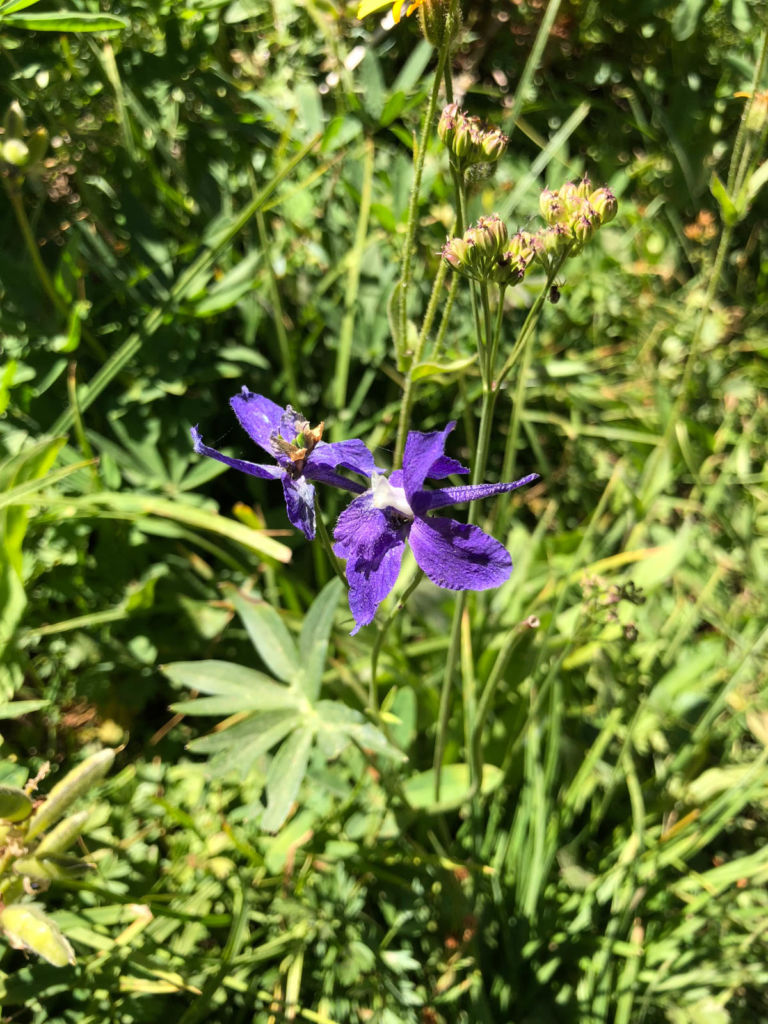
The trail continues climbing and passes through several meadows. Even in August there was still plenty of wildflower color to be found. You’ll find blue lupine, red paintbrush, and many other wildflowers.

Aster
Aster
Arroleaf Senecio
Arroleaf Senecio
Zigzag Larkspur
Zigzag Larkspur

Two miles in, the trail connects with another trail coming from the right. Stick left to follow the canyon uphill, but make a mental note of this junction. You’ll take this other trail on the way back for a change of scenery.

Along the way, there are a couple of wilderness campsites. While the trail is quite popular on weekends, you could come here on a weekday afternoon, and after a short hike have a beautiful spot for a quick getaway.

At roughly 2.5 miles, the maintained trail ends. This makes a fine spot to stop for a break, and if you’re hiking with kids, probably turn around for the return trip. In our case, we decided to continue to the junction, with a bit of exploring beyond.

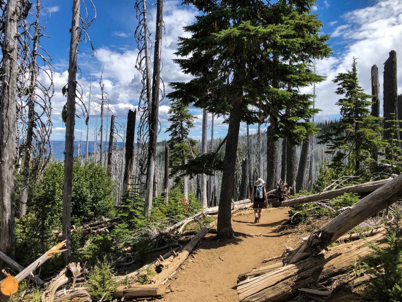
It’s readily apparent that the trail is not maintained. It’s loose with scree, and it climbs higher towards the saddle, becomes a spiderweb of trails criss-crossing the steep incline. Trekking poles are extremely helpful.

End of the maintained trail

Looking North toward Mt Jefferson

Looking back at the Cirque Lake with Mount Jefferson in the distance.

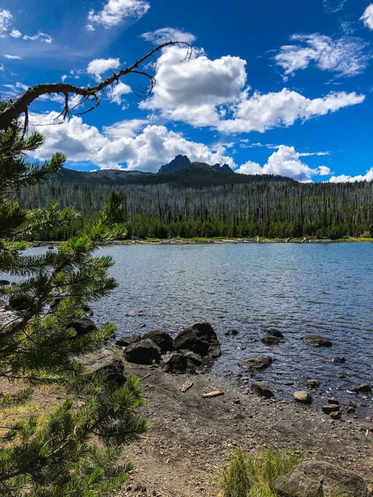
As you climb, stop to take in the views of what once was the Canyon Glacier (now just a snowfield) with craggy Three Fingered Jack looming above.

The Canyon Glacier and Three Finger Jack

From the saddle, there are views of the Three Sisters to the south, and Mount Jefferson to the north. Not pictured, but definitely felt were the strong winds. We were glad to have a shell to cut the brutal, chilling wind.

Pano from Saddle below Three Finger Jack

You might be able to spy someone climbing Three Fingered Jack (we did not). We opted to explore to the north east where social trails wandered to a little plateau, exploring a bit before heading back down. On our way down, we did see two mountain goats, and even caught one in the photo below.

Mountain Goat

Can you spot the mountain goat?

Heading down we turned left at the junction at the lower meadow to follow the creek and form the “loop” portion of this hike. At the junction with the trail from Wasco Lake, keep right. There are several beautiful cascades to enjoy before the trail head back toward Jack Lake through the new forest growth sprouting up from the 2003 fire that burned this area.

Taking the northern trail back to the car
Lots of dead trees
Back at Jack Lake
Back at Jack Lake

Canyon Creek Meadows Trail Map & Elevation Profile

© OpenStreetMap contributors
Download file: canyon-creek-meadows-8418-101258am.gpx


Canyon Creek Meadows Resources

  • Late July/Early August is the peak time for wildflowers. See what’s blooming there now.
  • Depending on the season’s snowfall, there can be snow on the trail to the upper meadow even in late July. Flexibility and preparedness is key.
  • Stay off the meadows (stay on the trails) and collect only photos of wildflowers, abiding by the seven Leave No Trace principles.
  • Backpackers must camp 100 feet away from trails and water, and only on durable surfaces (not on a meadow).

Hiking the Canyon Creek Meadows Loop

Originally hiked on August 4, 2018 with Joan and Daniel. 

Filed Under: Trail Guides Tagged With: 6-8 miles, Canyon Creek Meadow, Central Oregon, dog-friendly, moderate, Mount Jefferson Wilderness, Oregon, strenuous, Three Fingered Jack, wildflowers

Like what you found here at SoCal Hiker? This site is a labor of love. Share your support for the site and help us development of new trail guides and expanded coverage -- make your next outdoor equipment purchase through our advertisers.

You can also subscribe to our weekly newsletter and follow us on Facebook or Twitter.

Jeff H

About Jeff H

I'm an avid hiker and backpacker. My wife Joan and I are on the trails every weekend. I started SoCal Hiker to share my passion for outdoor adventure.

Comments

  1. mount damavand says

    July 30, 2020 at 6:17 am

    hey
    tnx for share your experiences

    Reply

Leave a Reply Cancel reply

Your email address will not be published. Required fields are marked *

This site uses Akismet to reduce spam. Learn how your comment data is processed.

About SoCal Hiker

Jeff on Mount Rainier

I created SoCal Hiker while preparing to thru-hike the John Muir Trail. My goal? Create guides for the best hiking and backpacking trails with enough detail to make it an enjoyable experience for you. And while I started with trails in Southern California, I’ve expanded across the west. We hike each trail to create these guides, sharing practical advice on gear and outdoor skills. Read more…

Connect with SoCal Hiker

  • 22,757 Fans
  • 11,938 Followers
  • Followers
  • 1,719 Followers
  • 5,281 Subscribers
  • 341 Subscribers
SoCalHiker was selected one of USA TODAY's 10 Best Hiking and Outdoor Blogs
Get our day-by-day guide to thru-hiking the John Muir Trail
Get up-to-day wildfire status throughout California

Products

  • Half Dome replica benchmark Half Dome Benchmark $39.95
  • Cucamonga Peak Benchmark Cucamonga Peak Benchmark $39.95
  • Mt San Antonio (Mt Baldy) Benchmark Mt Baldy (Mt San Antonio) Benchmark $39.95
  • Señor Muir Taco Hut T-Shirt $19.00 – $27.50

Sponsors

Sponsor SoCalHiker and see your banner here

Featured Posts

Backpacking the Grand Canyon of Tuolumne Loop in Yosemite National Park

Yosemite National P ark, and in particular Yosemite Valley, is home to some of the … [Read More...]

Hiking Belknap Crater in the Mountain Washington Wilderness

Hiking this out-and-back route up Belknap Crater you'll traverse an other-worldly … [Read More...]

Hiking to the Simpson Reef Overlook on the Oregon Coast Trail

The Oregon Coast is rugged, beautiful and often uncrowded. This bluff-top … [Read More...]

Lastest Comments

  • Amy Courtney on Ridgeline Trail
  • Jay Eleanor on Hiking to the Simpson Reef Overlook on the Oregon Coast Trail
  • Charles Krim on Hiking to the Simpson Reef Overlook on the Oregon Coast Trail
  • 11 Best California Bikepacking Routes | Wild Lumens on Inside Crystal Cove State Park
  • Ted Thed on Burbank Peak, Cahuenga Peak, Mt. Lee and the Hollywood Sign
Get your SoCalHiker stickers now

Get your SoCalHiker stickers!

Latest Posts

  • Backpacking the Grand Canyon of Tuolumne Loop in Yosemite National Park March 24, 2023
  • Hiking Belknap Crater in the Mountain Washington Wilderness October 20, 2022
  • Hiking to the Simpson Reef Overlook on the Oregon Coast Trail August 25, 2022
  • Join Team SoCalHiker at the Climb for Heroes August 23, 2022
  • Hiking the Welch-Dickey Loop in the White Mountain National Forest August 18, 2022

Recent Forum Topics

  • Lost Coast Trail
  • How to deal with accidents while hiking in the winter?
  • Warm Tips for your hiking in winter
  • Some tips for hiking.
  • Keep your body warm in the winter hiking

The Six-Pack of Peaks Challenge Series

Six-Pack of Peaks Challenge SeriesThe Six-Pack of Peaks Challenge Series gives you an opportunity to explore your world while supporting a great cause. There are eleven challenges around the country. Hike or run them at your own schedule.

Flex your adventure muscles!

Learn more here.


Search

Tags

3-6 miles 6-8 miles 8-10 miles 11+ miles Arizona Backpacking coastal dog-friendly easy family-friendly High Sierra Trail hiking Hiking The John Muir Trail hipster inspiration JMT John Muir John Muir Trail Kings Canyon National Park LA County moderate Mount Rainier National Park Muir Monday National Park Orange County Oregon out of bounds Pacific Crest Trail peak peakbagging quote scenic Sequoia National Park Sierra Nevada Six-Pack of Peaks State Park strenuous Thru-hiking Utah vista Washington waterfall wilderness Wonderland Trail Yosemite

Copyright © 2023 SoCalHiker.net · Metro Theme on Genesis Framework with WPEngine Hosting · Contact SoCal Hiker · Sitemap · Privacy Policy


Loading Comments...