• COVID-19 Park and Trail Closures
  • Learn about the Six-Pack of Peaks Challenge
  • Shop
  •  

SoCal Hiker

  • Find a Hiking Trail
    • All Areas
    • Arizona
    • Colorado
    • Los Angeles
    • Orange County
    • Oregon
    • San Francisco Bay
    • Washington
  • Trail Guides
  • Six-Pack of Peaks
    • Colorado Six-Pack of Peaks
      • Bergen Peak
      • Rocky Mountain
      • Birthday Peak
      • Horseshoe Mountain
      • Grays Peak
    • New England Six-Pack of Peaks
    • NorCal Six-Pack of Peaks
      • Mount Umunhum
      • Mount Saint Helena
      • Mount Tamalpais
      • Mount Diablo
      • Mount Sizer
      • Rose Peak
    • Oregon Six-Pack of Peaks
      • Tumalo Mountain
      • Black Butte
      • Black Crater
      • Maiden Peak
      • Mount Bachelor
      • South Sister
    • SoCal Six-Pack of Peaks
      • Mt. Wilson
      • Cucamonga Peak
      • Mt. San Antonio (Mt Baldy)
      • San Bernardino Peak
      • San Jacinto Peak
      • San Gorgonio
  • Backpacking
    • High Sierra Trail
    • John Muir Trail
      • Overview of the John Muir Trail
      • Training
      • Day-by-Day Itinerary
      • Resupply Addresses
      • JMT Discussion Forum
    • Lost Coast Trail
    • North/South Lake Loop
    • Rae Lakes Loop
    • Red Peak Pass Loop
    • Theodore Solomons Trail
    • Trans-Catalina Trail
    • Wonderland Trail
  • Gear
  • Forums
    • Latest Topics
    • Ask a Question
    • Campfire
    • Trails
    • Trail Reports
    • Gear Wisdom
    • Classifieds
  • Login

Mt. San Antonio (Mt Baldy) Loop

June 14, 2010 By Jeff H 71 Comments

Mt Baldy - 10,064 FT

Every Southern Californian can point out the white topped Mt. Baldy — actually it’s real name is Mt. San Antonio. Baldy is a SoCal icon that stands out boldly as a snow-covered backdrop for much of the year. At 10,064 feet above sea level, the snow often sticks around well into June. The higher altitude and easy access makes it a popular training hike for Whitney (or in my case, the John Muir Trail). And in fact, I included Baldy as peak #3 in my Six-Pack of Peaks progressive training series.

img
Trail Details
Distance: 10.2 miles
Time: ~7 hours
Difficulty: Strenuous
Elevation gain: 3,900 ft
Dogs: Yes
When to go: June-October

Find out more about the SoCalHiker Six-Pack of Peaks
This hike is the third in my Six-Pack of Peaks series of training hikes that I originally used to train for the hiking the John Muir Trail. 

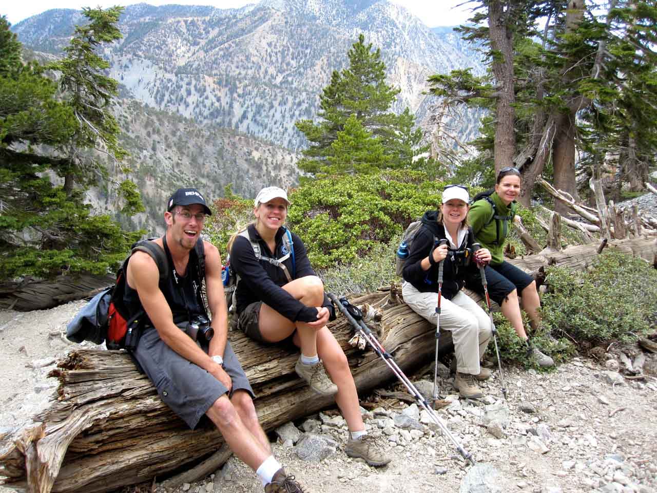
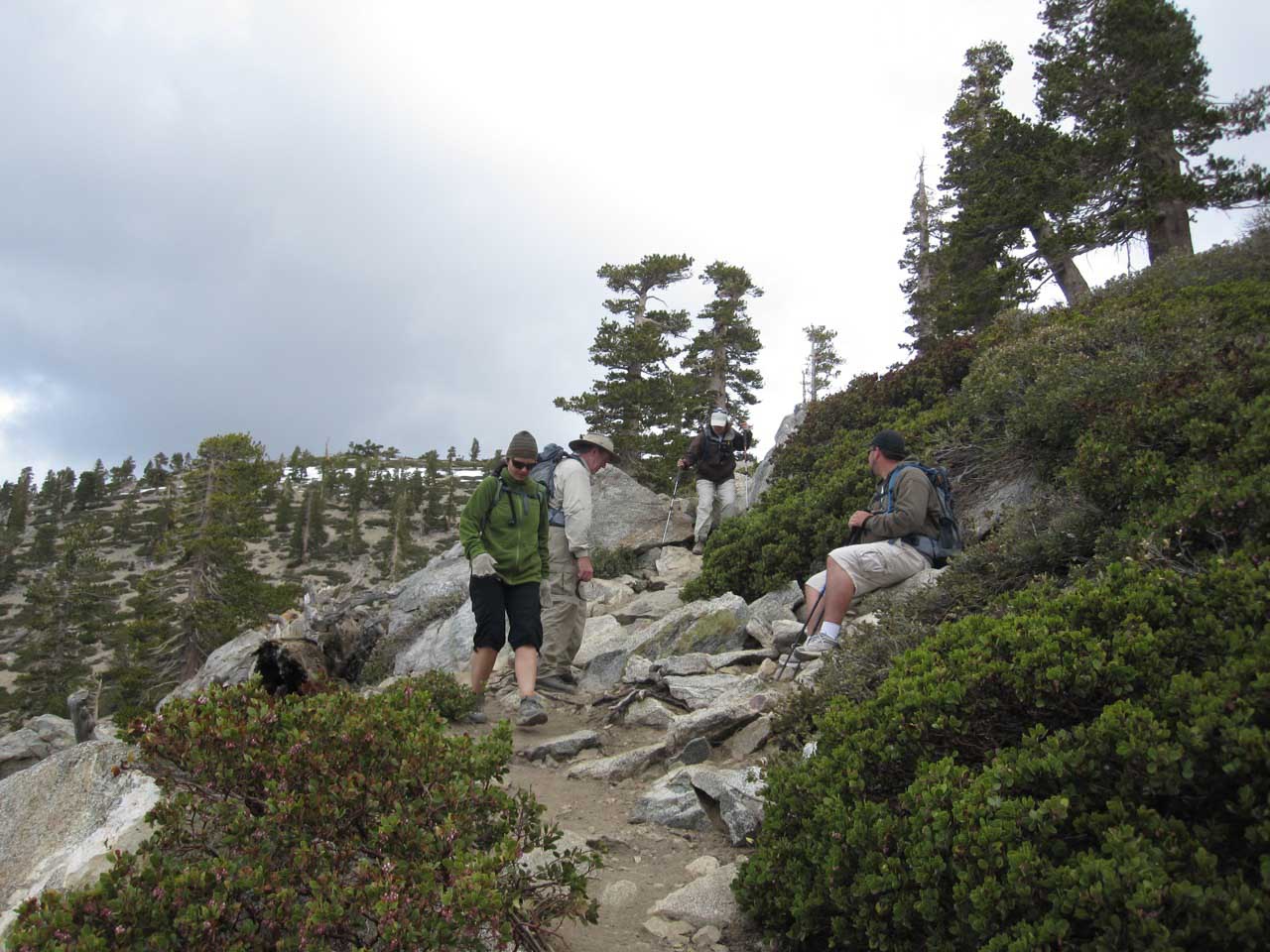
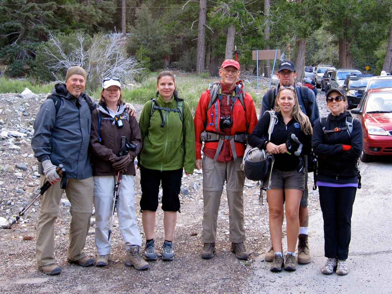
I hiked Mt. San Antonio as a loop route with some friends. We started at the Manker Flats trailhead (National Parks Adventure Pass required), taking the winding fire road up Baldy Notch, then hiking the Devil’s Backbone to the summit. Our return route took us down the steep Baldy Bowl trail, passing the Sierra Club Ski Hut and San Antonio Falls on the way back to Manker Flats.

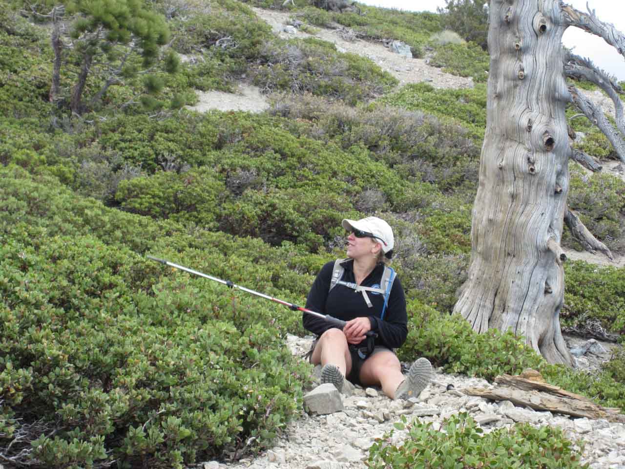
It should be noted that the previous weekend we hiked up Cucamonga Peak and it was almost too hot. A week later I found myself atop Baldy where it was 35 degrees with fierce winds. Thankfully, I was well-prepared with plenty of layers. Even so, we didn’t linger as long at the summit as we might have wanted.

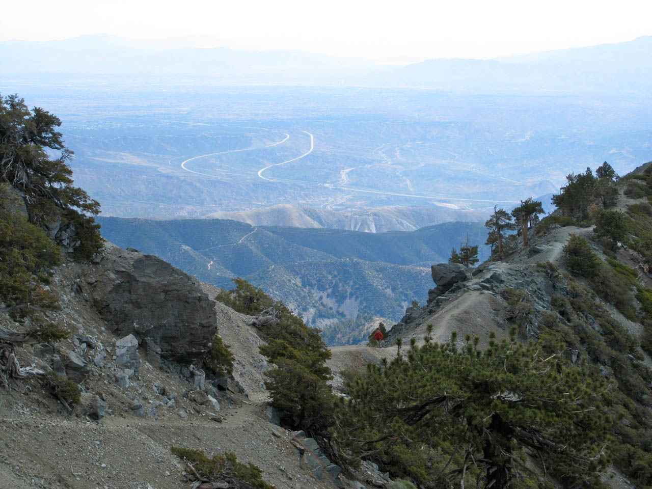
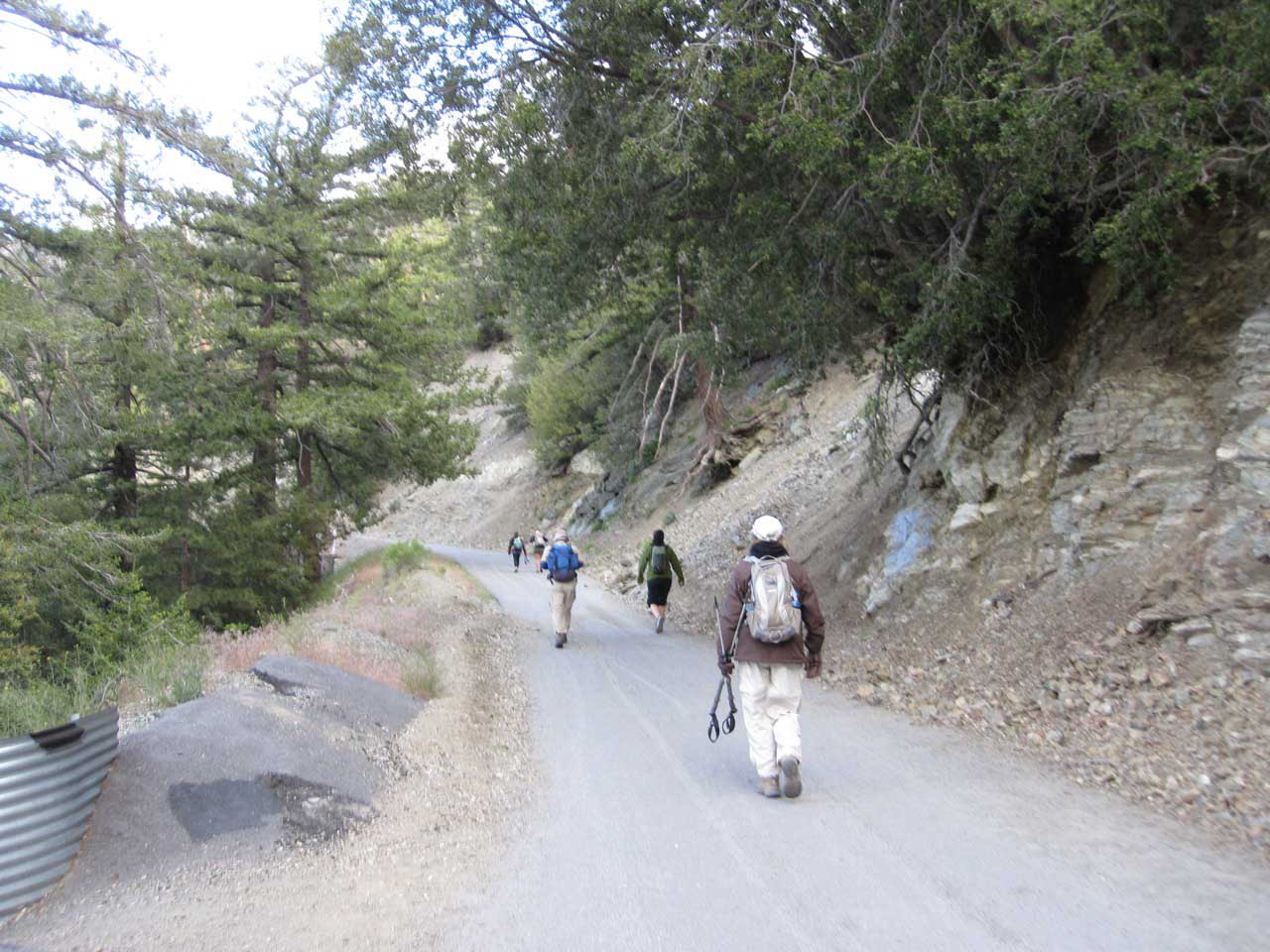
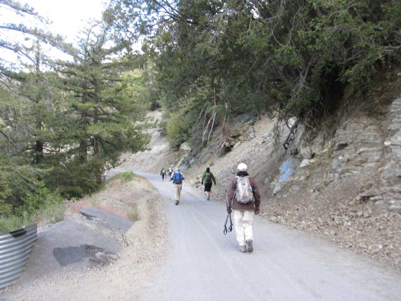
The trail begins up a paved road which quickly turns to gravel as it passes the San Antonio Falls overlook. This windy fire road eventually crosses the Mt. Baldy ski area, and meets up at Baldy Notch. The ski lift to the notch operates throughout the summer. It’s about $10 for a one-way ticket up (or $8 one way down) and some people use this as a short cut for what’s probably the least exciting portion of the hike. On the plus side, this route provided a nice easy grade to climb and made warming up much nicer.

Starting up the paved road toward Baldy Notch

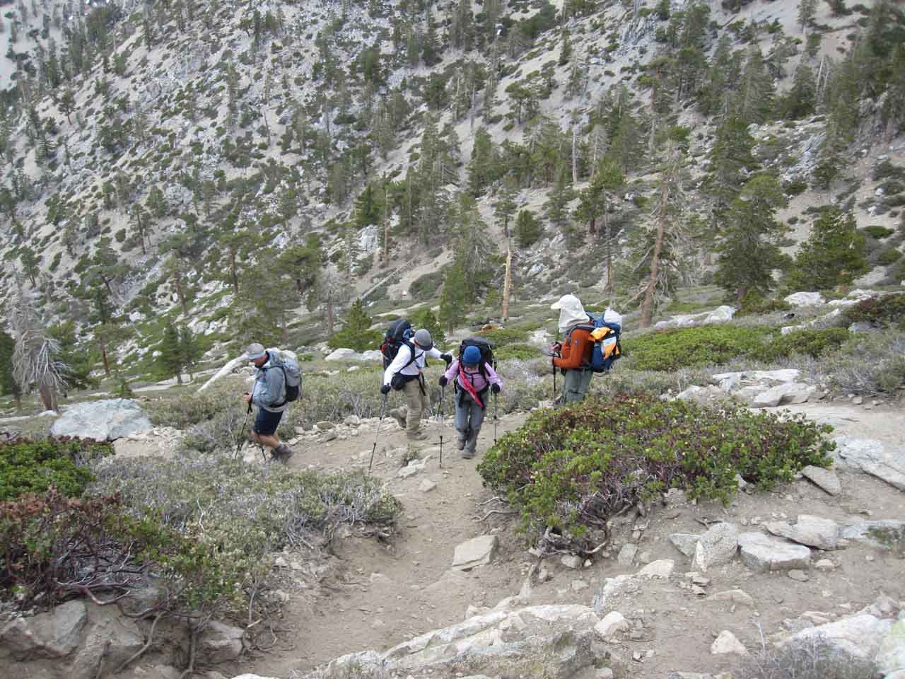
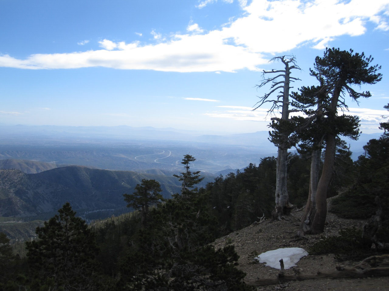
Once you reach the Baldy Notch, you can hike straight up the ski run to the east, or follow the trail that runs slightly south east. The ski run is a little steeper and more direct, and that’s the route we opted for. You are quickly rewarded with great views in every direction.

Looking down the valley from the Mt Baldy ski slopes

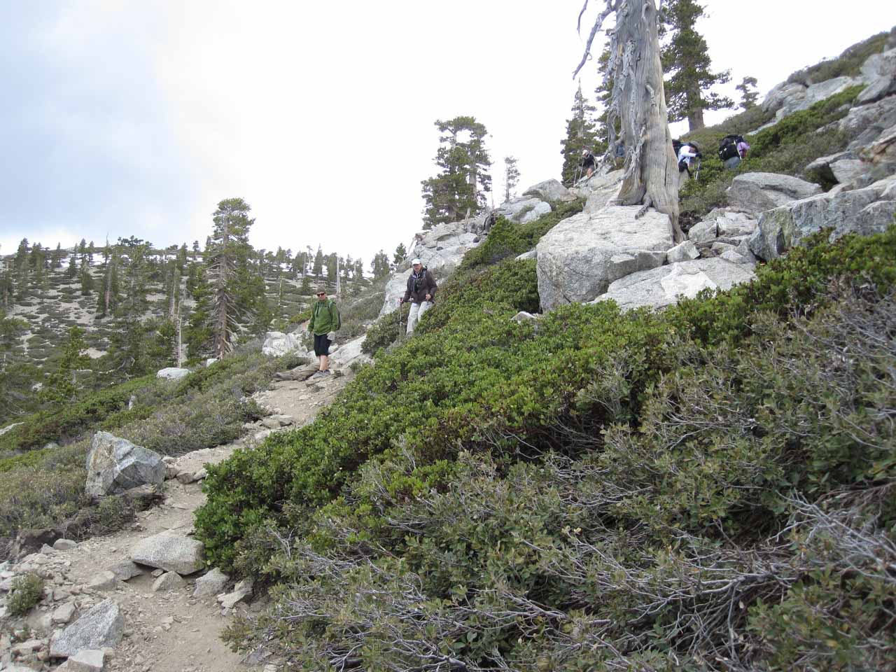
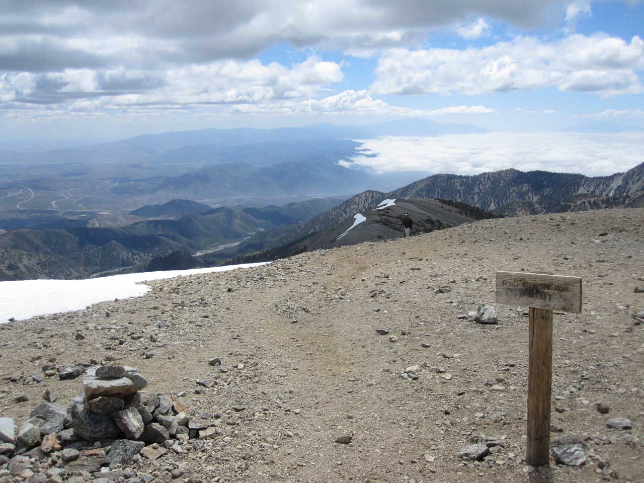
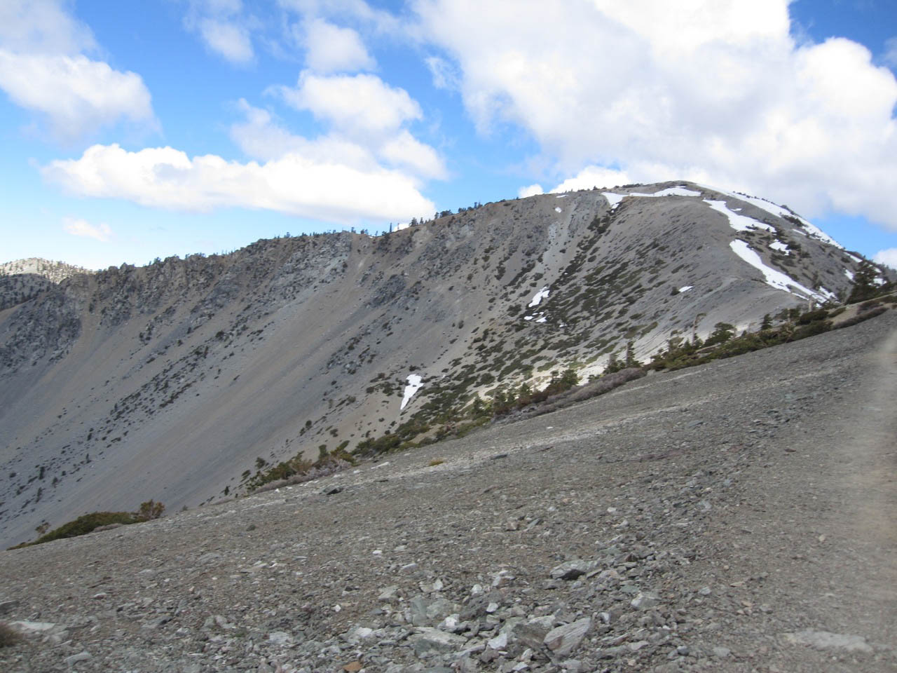
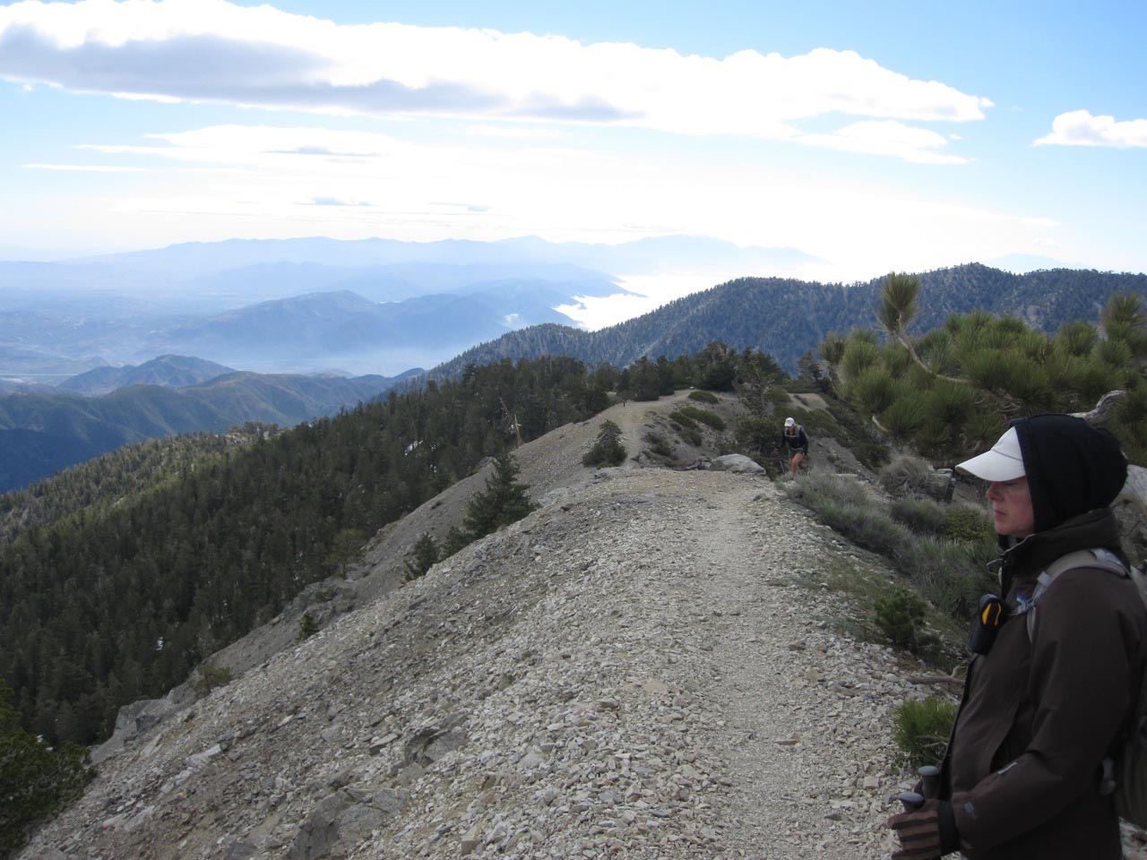
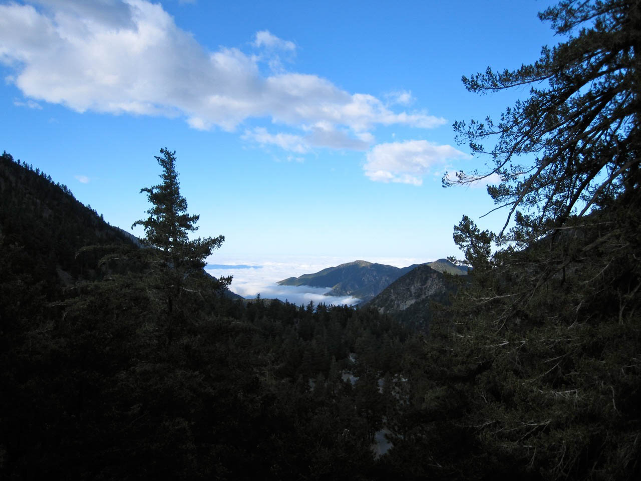
When you finally reach the boundary of the ski area, the infamous Devil’s Backbone trail begins. This trail sounds worse than it is. It runs along the top of a narrow ridge, but when it’s clear of snow and ice, it’s a pretty safe trail.

Devils Backbone Panorama

Those with a fear of heights might feel a touch of vertigo, but it doesn’t require any technical equipment (although trekking poles are nice). Check with the ranger station at Baldy Village to confirm trail conditions. On the darker side, there have been deaths on the trail. With snow and ice, it can be very treacherous.

The Devils Backbone trail can be treacherous when icy

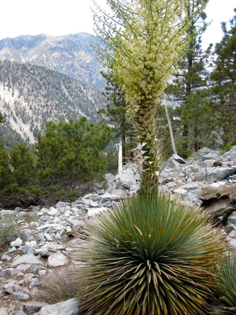
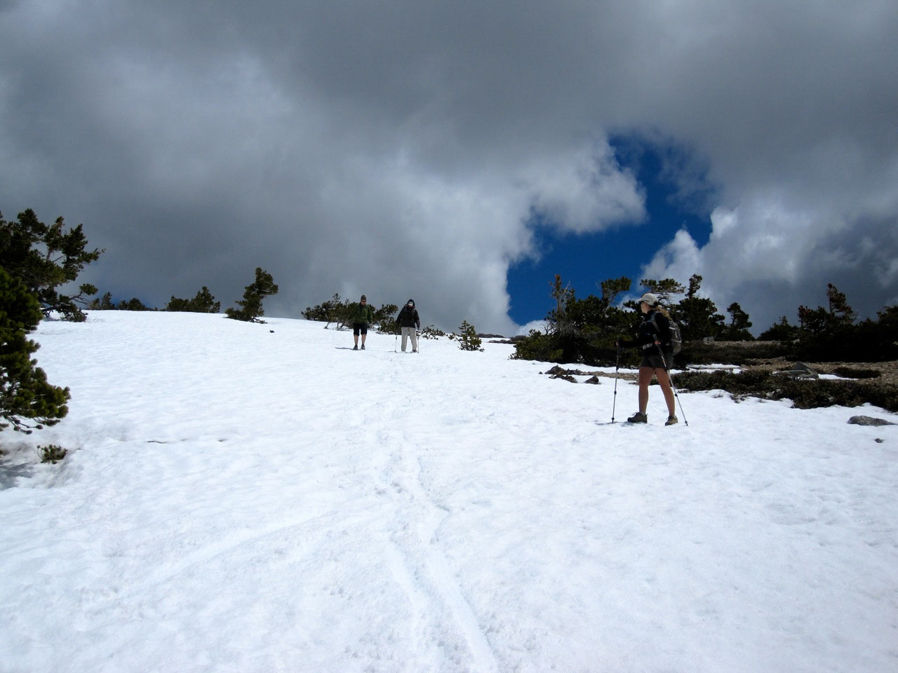
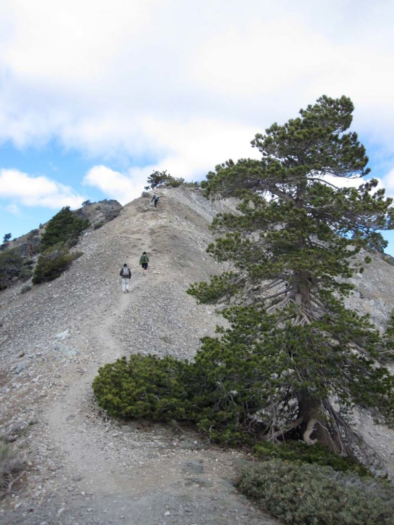
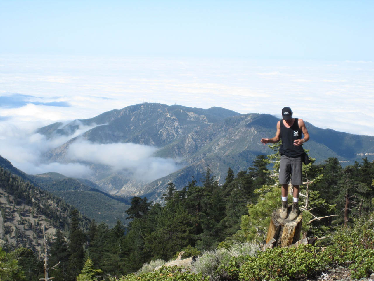
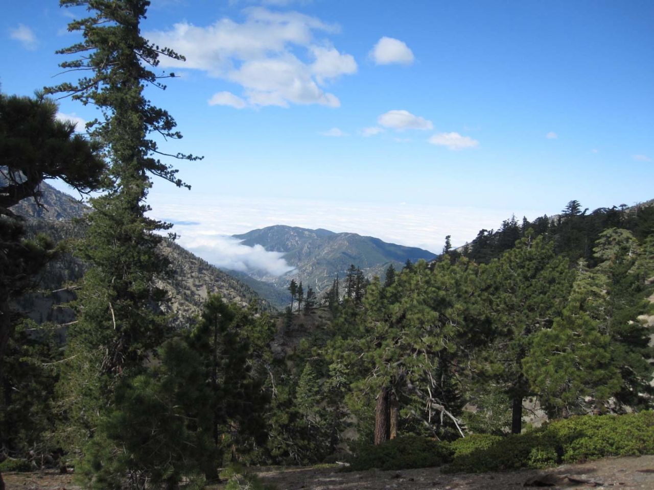
The trail skirts the side of Mt. Harwood, opening up to a sweeping view of Baldy Bowl. This bowl is pure scree and essentially unclimbable except when covered with snow, and then only with an ice ax and crampons. It’s great training for even higher mountaineering, and something I hope to do next winter. This time of year, the snow is gone from the bowl, and the trail clear of all but a few patches of snow.

Traversing a sketchy section of screen on the side of Mt Harwood

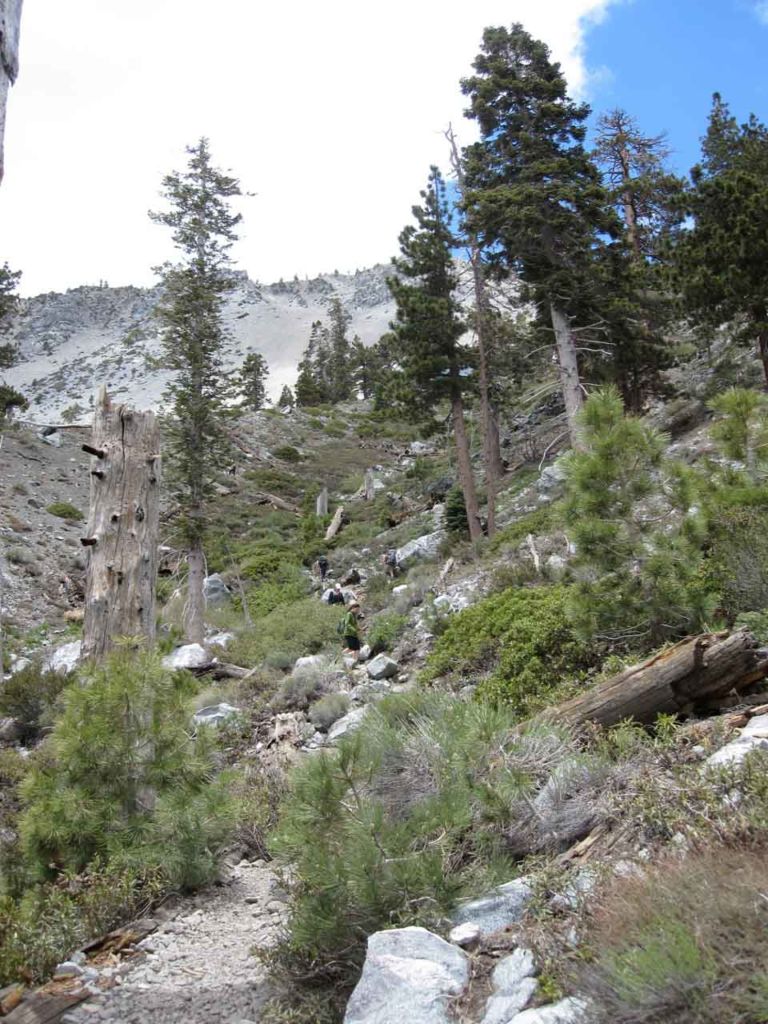
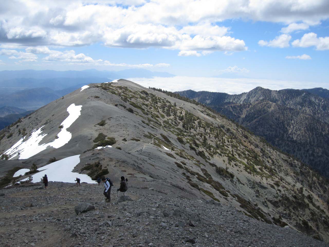
The last climb is a series of steep switchbacks up the side of Mt. San Antonio. It’s a busy trail, with all sorts of people going up and down. Pick your route and take your time. If you’re used to living at sea level like me, the high altitude begins to slow you down just a bit.

Looking down the final ascent up Baldy

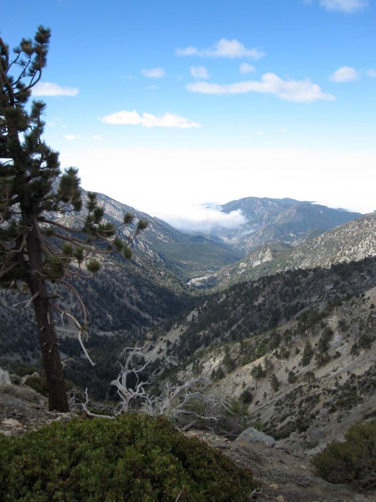
Looking back down the final ascent you’ve got a great view of Mt Harwood.

This make-shift rock wall atop Mt San Antonio protects against the oft-fierce winds

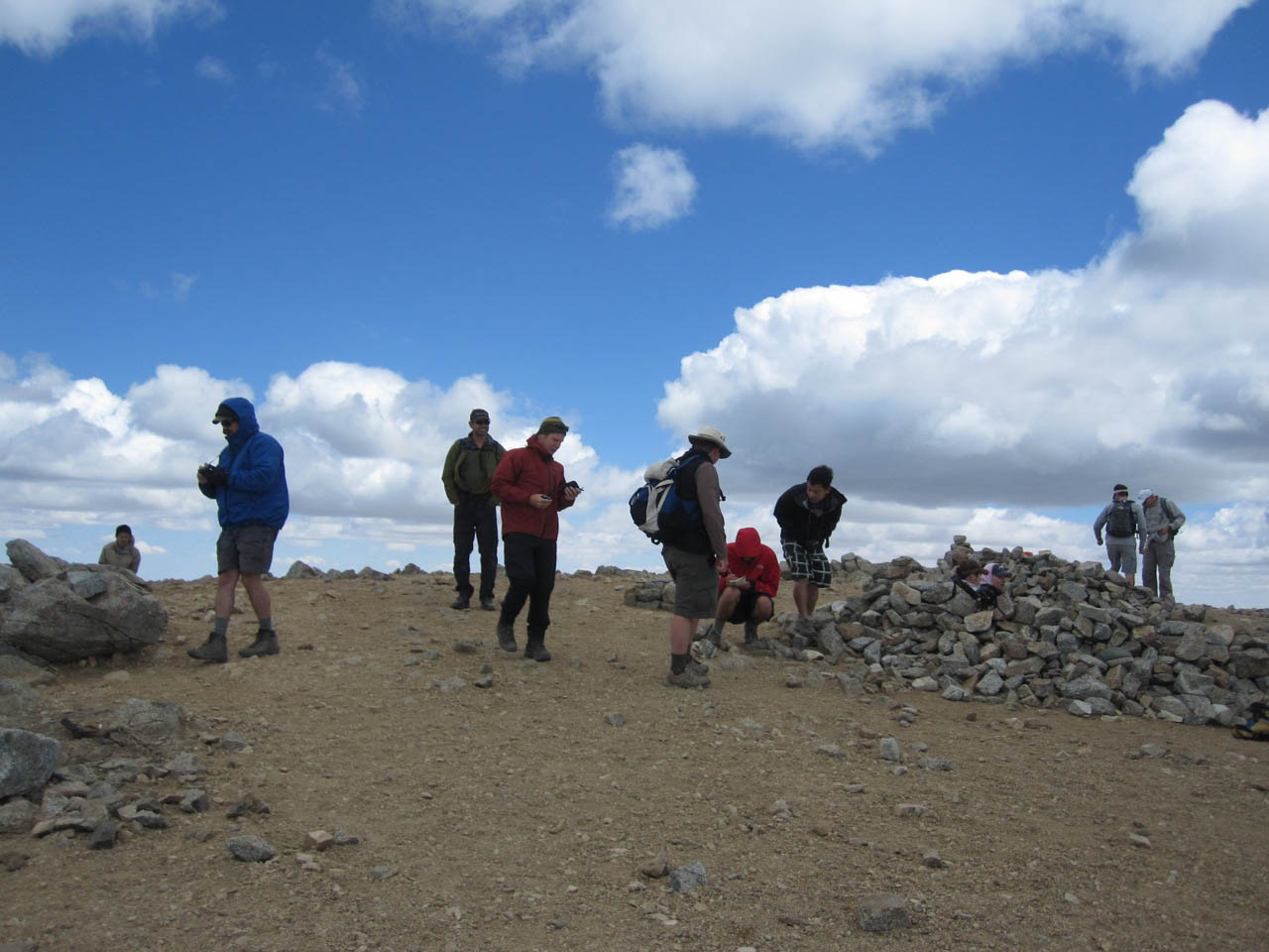
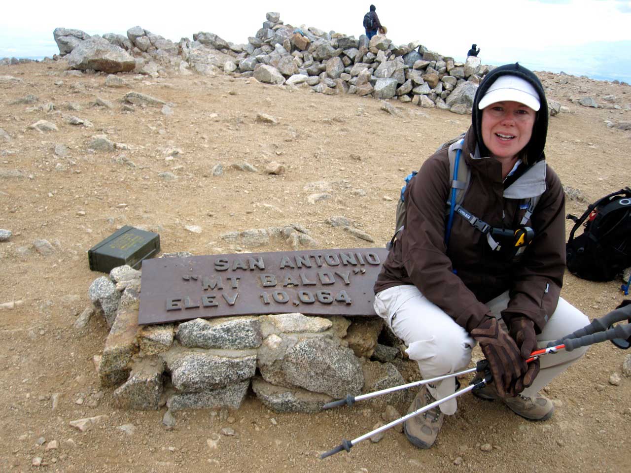
The summit of Mt. San Antonio is a broad knoll with a large iron plaque marking the spot. You’ll see several ad hoc stone shelters erected to provide some protection from the wind, which on this particular hike was fierce. Though it was comfortable down at sea level, it was 35 degrees at the summit, and much colder when you factor in the wind chill.

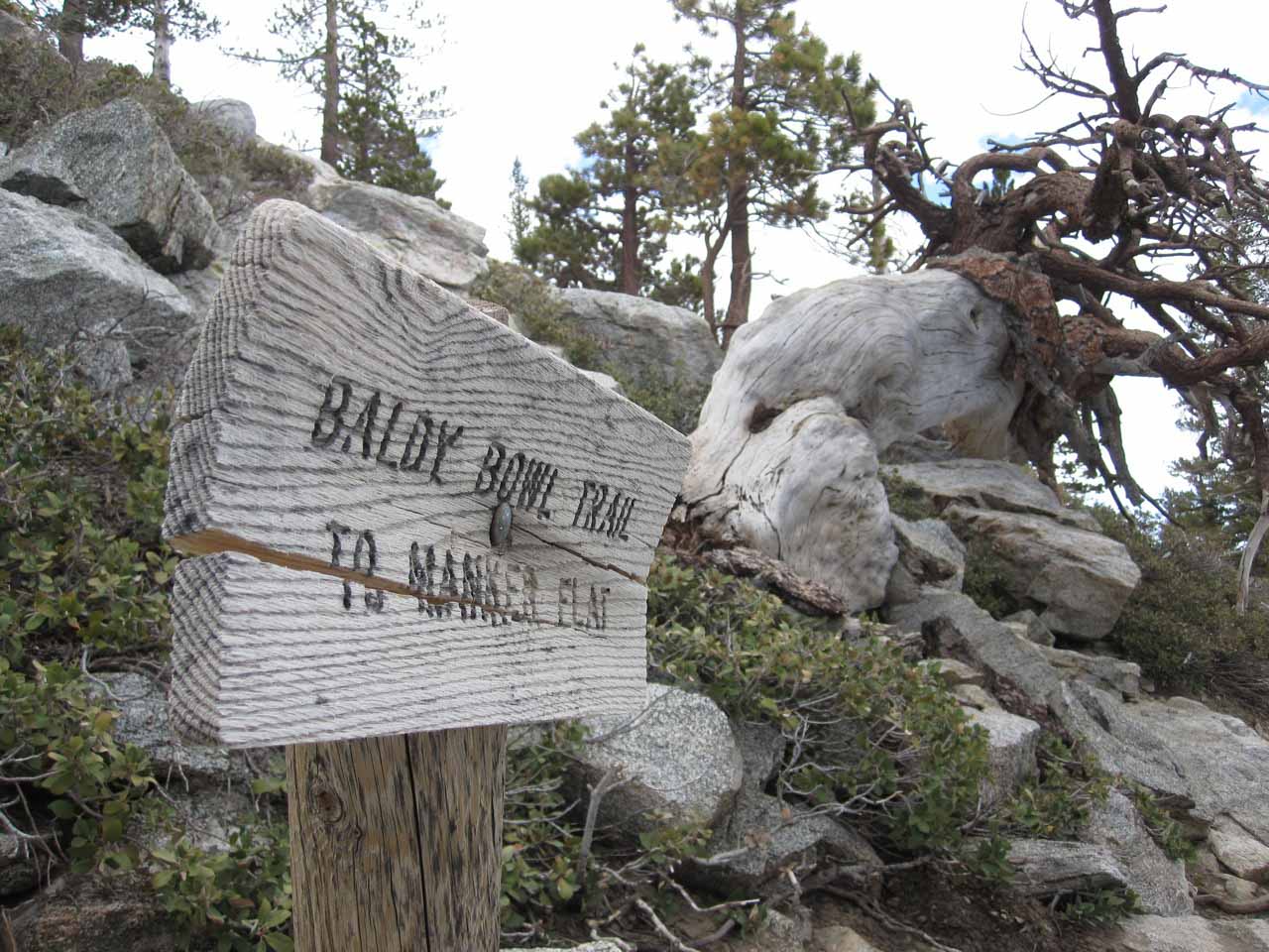
To return to Manker Flats we took the Baldy Bowl trail, which actually skirts the bowl on a ridgeline before steeply descending in a series of switchbacks to the base of the bowl and the Sierra Club ski hut. The log benches at the ski hut provide a great place to take a break and the sound of babbling San Antonio creek is refreshing.

Sierra Club ski hut at the base of Baldy Bowl

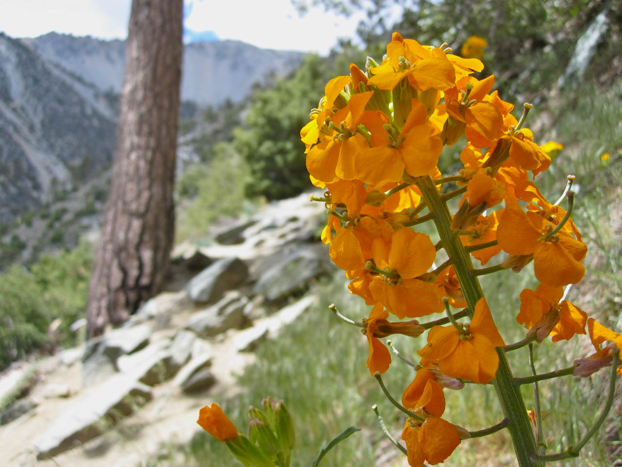
As we descended toward San Antonio Falls, the wildflowers became more plentiful. If you have time, you can stop for a closer look at the falls. This year’s heavy snowfall has made them spectacular.

San Antonio Falls

We reached our cars at the bottom and toasted our hike in true 6-pack style with a ice cold Stellas

Mount Baldy Trail Map

PRO TIP: I track all my hikes using GaiaGPS. It’s the best solution for staying on the right trail, it works even when you don’t have cell service, and there are versions for iOS and Android. The app is free, and you can get a discounted membership for maps here.

Trail Fly-by

Photo Gallery


img
Bag the Six-Pack of Peaks
Find out more about the SoCalHiker Six-Pack of Peaks

  1. Mt. Wilson 
  2. Cucamonga Peak
  3. Mt. San Antonio (Mt. Baldy) (you are here)
  4. San Bernardino Peak
  5. Mt. San Jacinto
  6. San Gorgonio

What is the SoCalHiker Six-Pack of Peaks?

Additional Mt. Baldy Resources

  • GPS user? Download the GPX file
  • View trail in Google Earth
  • Manker Flats trailhead parking on Google Map
  • Weather conditions at the summit
  • Mt. Baldy webcam
  • A couple more great trail guides on Dan’s Hiking Pages and Modern Hiker

Note that this is a wilderness hike. Come prepared with the ten essentials, including a map that you’ve studied beforehand and the knowledge of how to navigate and find an alternate route in case of wildfire or other emergency.

There is no clear signage to the Ski Hut Trail from the summit, and it’s easy to find yourself headed down the wrong route. I recommend carrying the Harrison Mt. Baldy and Cucamonga Wilderness Map, and backing that up with the GPX track loaded in GaiaGPS on my full-charged phone. If in doubt, you can (and should) hike this as an out-and-back, returning via the same route you took up to the summit.

Mt. Baldy Weather Forecast

The location could not be found.

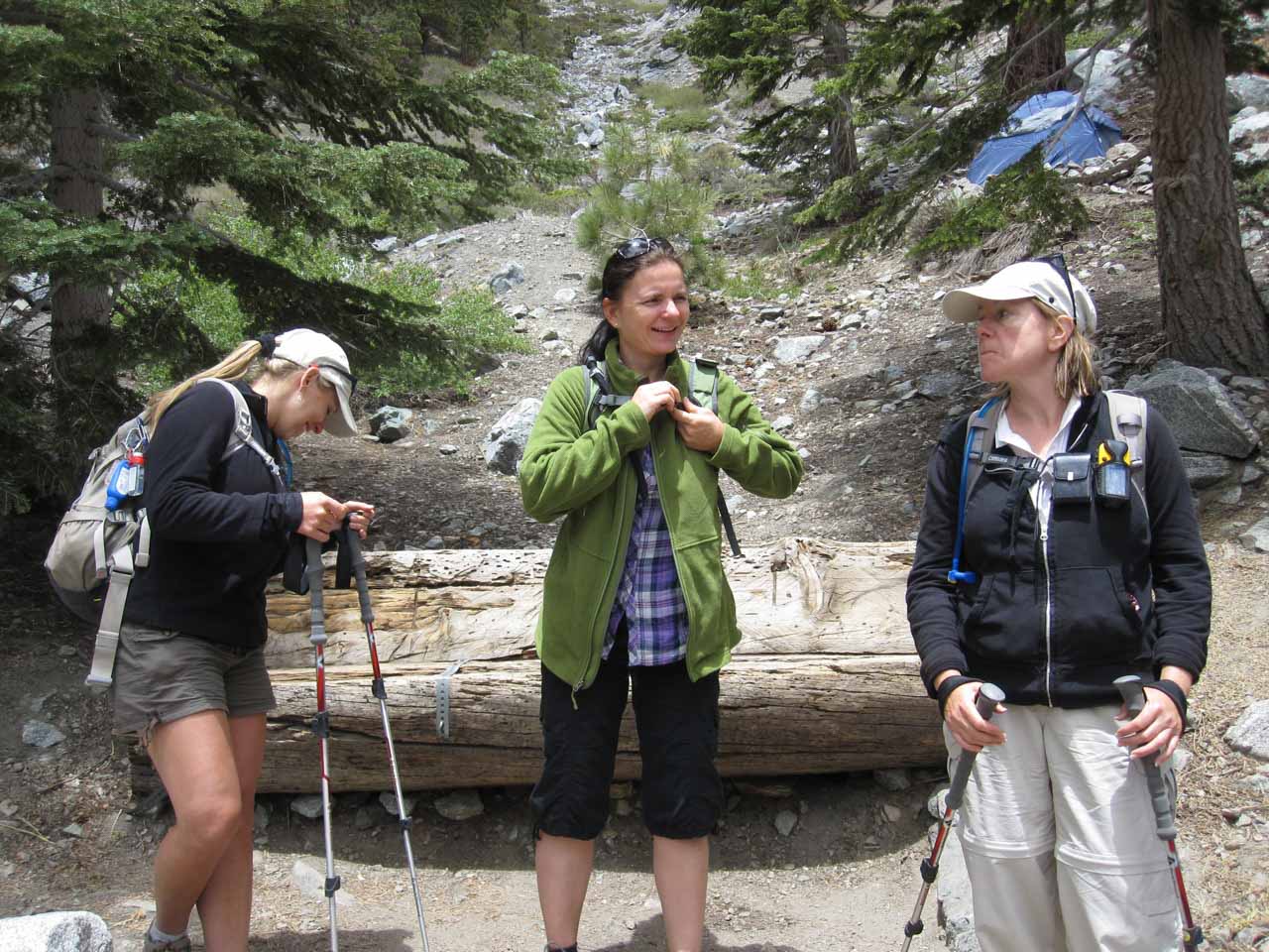
Special thanks to Bob from Pasadena, Tyler, Kelly, Ivana, Tari and of course Joan for joining me on this hike!

Title photo credit: Doc Searls

Filed Under: Trail Guides Tagged With: 6-pack, Backbone Trail, Baldy, Baldy Bowl Trail, Devil's Backbone, dog-friendly, hike, Mount Baldy, Mount San Antonio, mountain, Mt San Antonio, peak, peakbagging, Six-Pack of Peaks, strenuous, summit, The Devil's Backbone, The Trail, wilderness

Like what you found here at SoCal Hiker? This site is a labor of love. Share your support for the site and help us development of new trail guides and expanded coverage -- make your next outdoor equipment purchase through our advertisers.

You can also subscribe to our weekly newsletter and follow us on Facebook or Twitter.

Jeff H

About Jeff H

I'm an avid hiker and backpacker. My wife Joan and I are on the trails every weekend. I started SoCal Hiker to share my passion for outdoor adventure.

Comments

  1. Tim Miner says

    June 15, 2010 at 1:48 pm

    What a great set of pics! Looks like a great hike. Congrats on conquering #3. You are certainly on your way. I may have missed it in the report, but how long did the trip take?

    Reply
    • SoCal Hiker says

      June 15, 2010 at 1:59 pm

      Thanks, Tim. We did the loop in just over seven hours, starting at about 7:15am and returning to the car about 2:30pm. I’m going to post an update with a Google Earth fly-by of our GPS data. When you watch that, you can see relative speed (where we stopped for a few minutes or more, etc.). And the actual time is watermarked as the video advances.

      Reply
  2. Derek (100 Peaks) says

    June 17, 2010 at 12:54 pm

    Looks like a great day! I love the ridge line Devil’s Backbone pics. I almost forgot what it looked like up there.

    Reply
    • SoCal Hiker says

      June 17, 2010 at 1:12 pm

      Derek, it was bitter cold until we started heading down, but it was a great day. It was really fun to be up above the clouds — the “low-lands” were completely shrouded in clouds, even though there were still some clouds higher up.

      Devil’s Backbone is spectacular. I’m glad it was dry.

      Reply
  3. Chris says

    July 9, 2010 at 1:57 pm

    Hey I am hiking the same peaks a couple of week behind you it seems. Training for Mt Whitney in September. I just did Baldy 2 weeks ago but did the reverse of your route, up the Ski Hut trail and down the Devil 🙂

    Wonderful site and glad I found it. The descriptions are helpful and I am doing San Jacinto tomorrow along the same route you took.

    Again, great site

    Reply
    • SoCal Hiker says

      July 9, 2010 at 2:11 pm

      Thanks, Chris! Glad you found the trail descriptions helpful. I liked the variety of the “six-pack” of peaks, and I’ll probably do it again next year, though maybe not on consecutive weekends. You’ll enjoy San Jacinto. The Marion Mountain trail is beautiful.

      Good luck on Mt. Whitney in September!

      Reply
  4. Louie says

    April 19, 2011 at 10:05 am

    Great site you’ve got here! I am planning on visiting Baldy in the next few weeks and was wondering how it is around May. I am assuming there might be some ice left, but how much? Is it safe enough? If so, which trail is best?

    Thanks

    Reply
  5. Louie says

    April 25, 2011 at 12:50 pm

    Follow up…
    So my girlfriend and i hiked up the Devil’s Backbone this weekend (4/23/2011). Found ice and snow up at about 8500 Ft but made it all the way up. Top was covered in snow too. Was safe enough that no crampons needed, just be cautious and take a warm jacket if you go past 8500 ft, got pretty windy and cold. Happy hiking!

    Reply
  6. William says

    July 14, 2011 at 11:23 pm

    Great website and resources! Booked for Mt. Whitney in late September (hoping for no snow). Your summit six-pack series is very informative! Just did Mt. Baldy and had a great hike. Cloudy in OC with some drizzle, but started hiking at 8:00A under a sunny sky and very nice weather. A little snow on the last ascent to the peak. No/little wind.

    Looking forward to doing Gorgonio and Jacinto prior to Whitney as well…

    Reply
  7. Nathan says

    April 10, 2013 at 1:59 pm

    Great post! I’m itching to make this climb when I’m in town for a work trip the week of April 21st. Do you think that is too early? I’ve heard the Devil’s Backbone can be dangerous in snow. With how cold this winter has been, I’m sure there’s still snow up there. I have no problem making an attempt if there is a decent chance it will be accessible with clampons and trekking poles. My hiking/mountaineering experience is intermediate.
    -Nathan from Milwaukee

    Reply
    • Jeff Hester says

      April 10, 2013 at 3:24 pm

      @Nathan, you should be okay. There are still patches of snow up there (see the webcam: http://www.onthesnow.com/california/mt-baldy/webcams.html?t=cams&id=) but not much. Trekking poles are a great idea. Crampons are probably overkill. Microspikes would probably suffice. Today it’s over 80 degrees here in LA, and so there might not be ANY snow left by the time you hike this.

      Reply
  8. David says

    August 1, 2013 at 4:28 pm

    What do you think of doing this hike in reverse?

    Reply
    • Jeff HJeff Hester says

      August 1, 2013 at 10:27 pm

      It’s more commonly done in the reverse of what I show. The initial climb is much steeper, and then many people work in a stop at the ski lift bar before hiking the last couple miles down (or even take the ski lift down!).

      Reply
  9. David says

    August 3, 2013 at 10:03 pm

    Is the road to get to Manker Flat always open? What is the earliest you can get on the road, i want to start as early as possible when we go next Wednesday

    Reply
    • Jeff HJeff Hester says

      August 4, 2013 at 5:50 pm

      Yes, this is a public road and it’s always open (barring weather, fire, etc.). I like to get an early start — and that’s no problem for Mt. Baldy (especially since no permits are required).

      Reply
  10. Damian Murillo says

    September 25, 2014 at 11:00 am

    Hello Jeff.

    So tomorrow is going to be my first time attempting to summit Mt.Baldy. Very excited to say the least! I plan to use use the same loop route you have laid out here on your page. I checked the weather forecast for tomorrow and it’s looking like it’s going to be a windy day with wind gusts projected to be up to 19mph for the Mt.Baldy area. Would you advise going up The Devil’s Backbone under these kind of windy conditions or should I just do an out and back hike via The Ski Hut Trail?

    Reply
    • Jeff HJeff Hester says

      September 25, 2014 at 11:12 am

      Damian, I would recommend going up the Ski Hut Trail, then playing it by ear. Gusts up to 19mph isn’t bad, and going DOWN the Ski Hut Trail is a pain. In fact, my overall recommendation is to do this loop in the opposite direction that I did here. 🙂

      Reply
  11. Damian Murillo says

    September 25, 2014 at 12:28 pm

    Thanks for the reply and tip Jeff 🙂

    Reply
  12. Martin says

    November 4, 2014 at 4:57 pm

    Hi Jeff! Is the Devil Backbone ok to hike for someone who’s afraid of heights?

    Reply
    • Jeff HJeff Hester says

      November 5, 2014 at 12:22 pm

      Martin, when it’s dry, it’s not that bad. There is one section that crosses steep scree that I’m extra careful on. Bring trekking poles and a friend.

      In rain, ice or snow? That’s another story.

      Reply
  13. Eric says

    December 1, 2014 at 1:27 pm

    Hi Jeff–thanks for the super-helpful blog. I’ve got two to go on your six pack before I tackle Big Iron and possibly C2C.

    Just wanted to mention that I’ve done this Baldy route twice in the past month, first as described in your article, then the reverse, and I agree wholeheartedly with your recommendation to go up Baldy Bowl and down Backbone. I thought it’d be much harder that way (Baldy Bowl seemed like a beast even going DOWN) but I was wrong–I did it an hour faster than up Backbone/down Bowl, party because everything between the Notch and Manker–the “least exciting” portion of the hike–lends itself well to running/jogging down.

    The 2nd of these trips was yesterday–the clouds, wind, and snow made it interesting, to say the least. It’s a surreal experience to be alone on a mountaintop in those conditions. (Not recommending it…I just had to try it.)

    Reply
  14. martycogito says

    June 19, 2015 at 5:34 am

    Hi Jeff,

    I have a chance to hike Mt. Baldy in mid-July, 2015. Could you recommend the easiest way to summit? Would an ultra lightweight down ‘parka’ (8 oz.) and rain shell suffice for mid-July weather?

    Thanks,

    Marty

    Reply
    • Jeff HJeff Hester says

      June 19, 2015 at 7:07 am

      Marty, the shortest route is the reverse of this to the summit, and then down via the same Ski Hut trail. But that’s not the easiest. The route described is the easiest way up, though not the shortest. If you really want to make it easier, you can buy a lift ticket, ride up to The Notch and start hiking from there. That will shave a couple miles and quite a bit of the vertical climb off your hike.

      Reply
  15. Medicine Dog says

    June 19, 2015 at 12:49 pm

    Ok, how did you do the flyby? Coolest thing I’ve seen.

    Reply
    • Jeff HJeff Hester says

      June 19, 2015 at 4:27 pm

      Thanks, Medicine Dog! I did that in Google Earth. There’s a ton of power in Google Earth — and it’s free! It’s a great way to visualize a trail before you hike it.

      Reply
  16. SD says

    July 17, 2015 at 2:26 pm

    Thanks for all the information, great blog!! Is there a forum or something for Mt baldy hikers?
    any hikers for this Saturday (july 18th 2015)?
    I see the weather says a bit clody and possiblity of thunderstorms. Wondering if I should go for solo hike or wait until next weekend…

    Reply
  17. Rocko says

    September 14, 2015 at 9:09 am

    Hiked to the summit via Mt. Baldy Rd to the Notch then Devil’s backbone. Came back down on the Old Baldy Trail. I highly recommend you NOT go back this way unless you love punishment and have hiking poles. It’s a relentless downhill trail with many sections of loose rock. It starts off nice then picks up steepness and doesn’t quit until about 4.5 miles down when you reach Bear Flats Campground-which is relativity level. This way would really test out the fit of your boots/shoes and whether your toe box is of adequate size. Mine was not and about 25% of the way down I was in massive pain from toe slam after each step. It’s a real punisher. I should have taken the Sierra Ski Hut trail or gone back the same way. Lesson learned!

    Reply
  18. Stacy says

    September 28, 2015 at 3:13 pm

    We just hiked this past Saturday. We took the trail up Devil’s Backbone on the way there, and the Baldy Bowl trail on the way back. We regretted the Baldy Bowl trail… hikers should know it’s intensely steep, rocky, slippery, and unmarked. We almost lost the trail twice. We wished we took the Backbone on the way back instead of the bowl. Fun hike, but I’d skip the bowl all together.

    Reply
  19. Mark says

    November 4, 2015 at 2:27 pm

    I did Baldy a few months back and wanted to thank you for the turn-by-turn instructions. THANK YOU!!! That not only was a big help to me, but when going down on the return I came across two different hiking parties that were confused and I helped them get on the right track.
    Thanks again. Great site. I am doing Chiquito Falls this weekend.

    Reply
  20. sugetha says

    May 9, 2016 at 4:23 pm

    Hey.
    Thank you for this wonderful post.
    Would you recommend attempting to climb Mt.Baldy this labor day weekend?(may 31)
    Is it too early?

    Reply
  21. John Doe says

    May 19, 2016 at 9:41 pm

    Thanks for sharing the gpx file! You saved me a ton of marking on my map.

    Reply
  22. Timothy FTimothy F says

    June 5, 2016 at 5:42 pm

    Just did this hike today. I would agree with the comments on the Bowl trail. I did actually lose it, because I followed the people in front of me. From past experience, if you lose the trail, go back UP until you find it again, don’t try and cut across. #2 on the way to the JMT.

    Reply
  23. Jan says

    June 29, 2016 at 7:18 pm

    I accomplished this hike yesterday and what an experience. I can’t emphasize the importance of the .gpx file and the use of the GAIA app; it certainly got me back on the trail after getting slightly off track on the way down on the Baldy Bowl Trail. Halfway up to the Baldy Notch I encountered a black bear crossing the path, but fortunately he was more concerned minding his own business. It took me a little over 3 hours to get to the summit and the view both to the north and the south were spectacular. On the way down when I slightly veered off the trail I found a large airplane part which looked like it came from an old crash (maybe the F-6 crash from 1949). I agree with the previous comments about the steepness of the Baldy Bowl Trail, but I learned from previous hiking experiences to always wear 2 pairs of socks for stability in my boots (lesson learned on Mount Lady McDonald near the Banff National Park in Canada). Overall a great day with just a little rain; it took me about 6.5 hours and I am just an average hiker.

    Reply
  24. Cecilia says

    July 4, 2016 at 11:50 am

    Summitted Mt. Baldy on Friday, July 1. My hiking partner and I decided to do the loop in reverse: up the Baldy Bowl Trail and down the Devil’s Backbone trail. This was to give ourselves an easier descent, easier on our knees. For us, this was definitely the right decision. About 7 hours of hiking time plus about 1 hour of breaks. Although the forecast that day was clear and dry, stormclouds started to roll in while we were at the summit. Once back down in the Village, there were flash flood warnings. Always be prepared for changes in weather. Thank you for this website and for the inspiration to get out and do these awesome hikes!

    Reply
  25. Logan G says

    February 2, 2017 at 12:40 pm

    Great Write up!
    Trail update as of 1/31/17

    Summitted Via Ski Hut Trail on 1/31/17. Even with an alpine start, the layer of ice covering the snow had thawed tremendously by 12pm when we finished. If going up, be very cautious of the warm temperatures adding to already high avalanche danger. I would personally not recommend attempting the summit without crampons, ice ax, and helmet.

    Stay safe and happy hiking!

    Reply
  26. Scott says

    March 22, 2017 at 4:49 am

    Awesome write up, and it looks like a great group!

    I backpacked overnight on Mt. Baldy this past September, but used the old trail that starts in Baldy Village.

    Here is video if interested

    https://www.youtube.com/watch?v=mG2rNWo3EaE

    Reply
  27. Aaron S. says

    April 19, 2017 at 11:15 am

    I am trying to upload the GPX files to Garmin connect and Baldy, Gorgonio, Jacinto and Cucamonga are not loading. When I hit the upload button nothing happens. I was able to load them into Strava but that doesn’t help with getting on my Fenix.

    Any help would be much appreciated!

    Reply
    • Jeff HJeff H says

      April 20, 2017 at 12:28 am

      I haven’t used Garmin Connect. Are you uploading to a website or a device? Are you getting a particular error message?

      Reply
  28. Angela Beckett says

    August 7, 2017 at 1:14 pm

    I have explored a few options but am seeking recommendations before decision making. Looking for California based companies that offer 3 day hiking/camping lead trips/vacations? Or challenging day hikes. Looking for a quick getaway as a single person that capitalizes amenities that come with experienced guides in charge such as peace of mind and less map reschearch. Don’t mind hard work and getting immersed; just don’t want the homework.

    Reply
  29. Ramona VRamona V says

    November 27, 2017 at 8:02 pm

    Hiked to the summit on 11/25/17, it was a steep climb all the way to the top. Late start at 10 am prompt us to take the 1st lift, 10:15 to 1:00 pm hike to the summit. Well worth the climb. At 1:30 pm we left the summit, we completed the loop at 4:45 pm. It was just as steep going down the mountain as it was up. No snow, no wind and it was a beautiful day 70 degrees for the high with a light breeze at times. Devil’s backbone was not scary at all but would be in the snow or wind for sure. I had no effect from the elevation gain. A lot of loose rocks on the trail. I recommend if you have bad knees, back or ankles to wear the appropriate support. The difference between Mt Badin Powell and this hike is Badin Powell has switch backs and flat spots to catch your breath, Baldy is straight up. Baldy has great directional signs. There was no water so bring at the minimum 3L to 4L, no bugs, I recommend hiking shoes or boots. I would say this hike is strenuous for the experienced hiker. Ideally, I would have liked to start at 7am and end at around 2 or 3 pm. I loved this hike and would do it again, well worth the challenge.

    Reply
  30. John Wallace says

    October 7, 2019 at 10:32 pm

    Didn’t your guide for this hike used to be in reverse order of this loop? That is the way I did it a few years ago. Anyhow. Do you have a guide with details doing it in reverse?

    Also. I could not locate that parking lot on your link for parking on Google.

    Thx for all your resources and efforts.

    Reply
  31. David says

    March 30, 2020 at 1:06 pm

    10,000 feet looks and sounds like an awesome climb. Great looking pics from the top. Being from San Antonio, the first question which came to mind was, why is it called Mt San Antonio? Our hills here are only about 1,000 – 2,000 feet high, but fairly fun to hike with my dog.

    Reply
  32. Ryan T. says

    July 18, 2020 at 2:50 pm

    Toward the beginning of this guide, it says to take the trails to the east or southeast of The Notch Restaurant. It should says the trails to the west or southwest, right?

    Reply
  33. Desmond says

    October 23, 2020 at 8:44 pm

    It was 9.63 miles for me today, roundtrip and clear skies. Beautiful day. Had to hike without a shirt, because it was quite warm. Took a little over 4 hrs roundtrip at an easy pace and socializing with people along the way. If you are in good shape with a good CV conditioning, expect to complete in 4ish hrs. Otherwise 7-9 hrs.

    Reply

Leave a Reply Cancel reply

Your email address will not be published. Required fields are marked *

This site uses Akismet to reduce spam. Learn how your comment data is processed.

Mt Wilson
Cucamonga Peak
Mt San Antonio -- aka Mt Baldy
San Bernardino Peak
Mt San Jacinto
San Gorgonio

Connect with SoCal Hiker

  • 22,735 Fans
  • 11,941 Followers
  • 21,640 Followers
  • 1,717 Followers
  • 5,275 Subscribers
  • 338 Subscribers

Latest Posts

  • Hiking Belknap Crater in the Mountain Washington Wilderness October 20, 2022
  • Hiking to the Simpson Reef Overlook on the Oregon Coast Trail August 25, 2022
  • Join Team SoCalHiker at the Climb for Heroes August 23, 2022
  • Hiking the Welch-Dickey Loop in the White Mountain National Forest August 18, 2022
  • Hiking Turtlehead Peak from Red Rock Canyon National Conservation Area July 15, 2022

Recent Forum Topics

  • How to deal with accidents while hiking in the winter?
  • Warm Tips for your hiking in winter
  • Some tips for hiking.
  • Keep your body warm in the winter hiking
  • The benefits of hiking, more than you can imagine!

The Six-Pack of Peaks Challenge Series

Six-Pack of Peaks Challenge SeriesThe Six-Pack of Peaks Challenge Series gives you an opportunity to explore your world while supporting a great cause. There are eleven challenges around the country. Hike or run them at your own schedule.

Flex your adventure muscles!

Learn more here.


Search

Tags

3-6 miles 6-8 miles 8-10 miles 11+ miles Arizona Backpacking coastal dog-friendly easy family-friendly High Sierra Trail hiking Hiking The John Muir Trail hipster inspiration JMT John Muir John Muir Trail Kings Canyon National Park LA County moderate Mount Rainier National Park Muir Monday National Park Orange County Oregon out of bounds Pacific Crest Trail peak peakbagging quote scenic Sequoia National Park Sierra Nevada Six-Pack of Peaks State Park strenuous Thru-hiking Utah vista Washington waterfall wilderness Wonderland Trail Yosemite

Copyright © 2023 SoCalHiker.net · Metro Theme on Genesis Framework with WPEngine Hosting · Contact SoCal Hiker · Sitemap · Privacy Policy


Loading Comments...