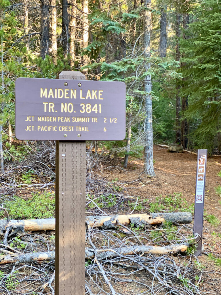
Maiden Peak sits on the Cascade crest, straddling the Willamette and Deschutes National Forests. Many people hike up Maiden Peak from the Gold Lake trailhead on the west side, but the Maiden Lake Trail offers an alternative that starts in the east, passing through a variety of forested habitats and meadows with an optional side trip to serene Maiden Lake.
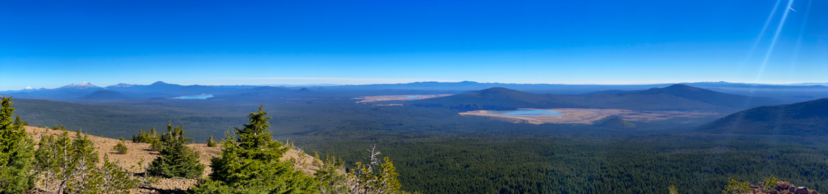
On clear days, the summit of Maiden Peak rewards hikers with views of much of the Cascade Mountains and many of the Cascade Lakes as well.
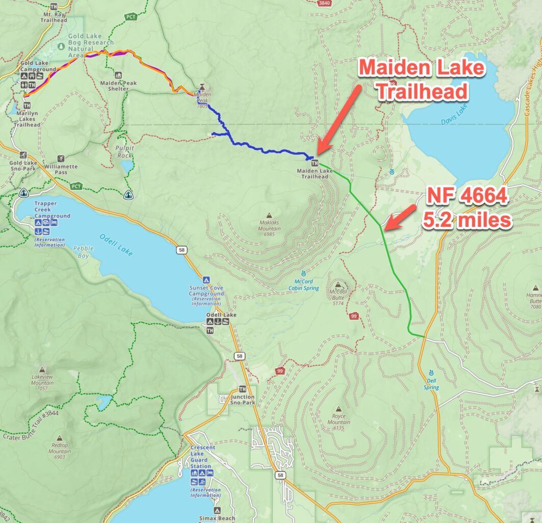
Getting to the Maiden Lake Trailhead
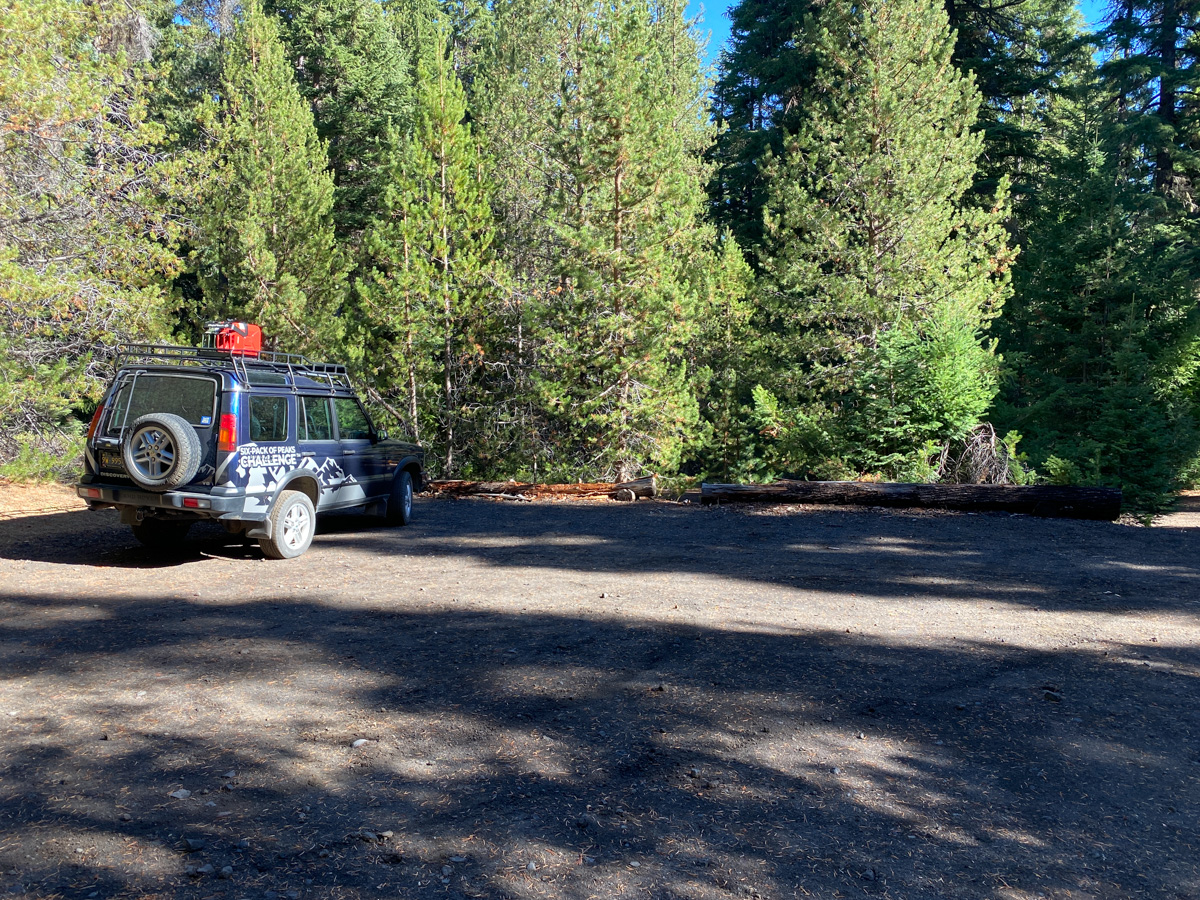
From the center of Bend, Oregon to the Maiden Lake trailhead it’s almost exactly 60 miles and 1 hour, 15 minutes driving time. From Bend, head south on Highway 97 for 17 miles, then exit right onto Vandevert Road (south of the main Sunriver exit). In about one mile, turn left on S Century Drive. Follow Century Drive south for 1.1 miles, then turn right to stay on S Century Drive. You’ll take this 22.8 miles to Cascade Lakes National Scenic Byway. Turn left on Cascade Lakes, following it south for 11.8 miles. Turn right on NF-4600 and follow that for 5 miles. This forest service road ends at the Maiden Lake Trailhead. There are no facilities at the trailhead. There is space to park about six vehicles. At the time of writing, no pass is required for parking. Get turn-by-turn directions via Google Maps.
Hiking to Maiden Peak via the Maiden Lake Trail
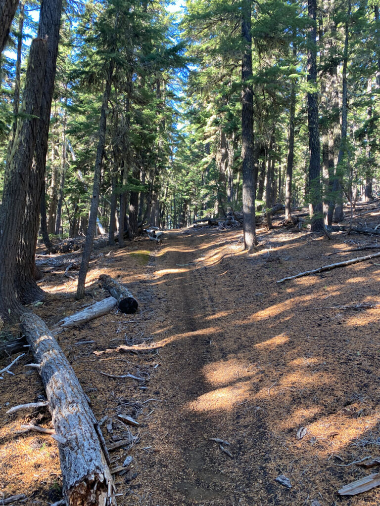
The trailhead begins at an elevation of 4,922′ and climb steadily but gradually.
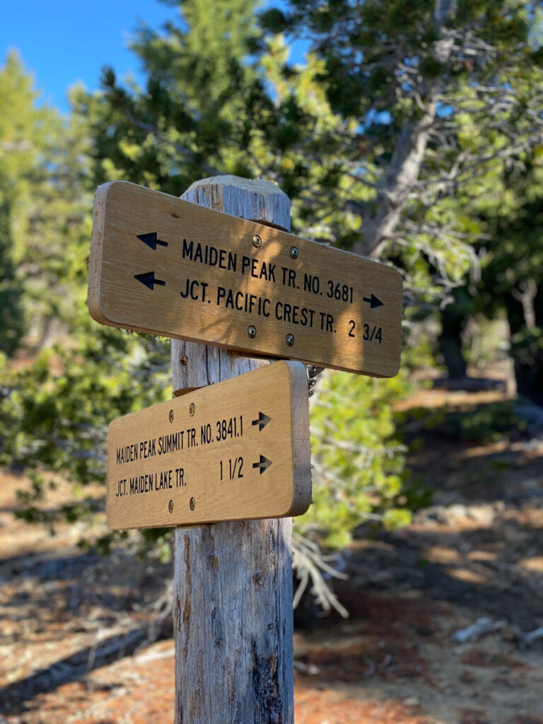
You’ll climb just half of the total vertical in the first three miles, where you reach the first trail junction. Maiden Lake heads to the left, but I recommend noting this for a potential side trip on your return down the mountain. For now, continue to the right.
Interesting to see the Pacific Crest Trail (PCT) listed here as the Pacific Crest National Scenic Trail (PCNST)
About a mile before the summit, the trail gets steeper, finally joining the Maiden Peak Trail for the remainder of the route to the summit.
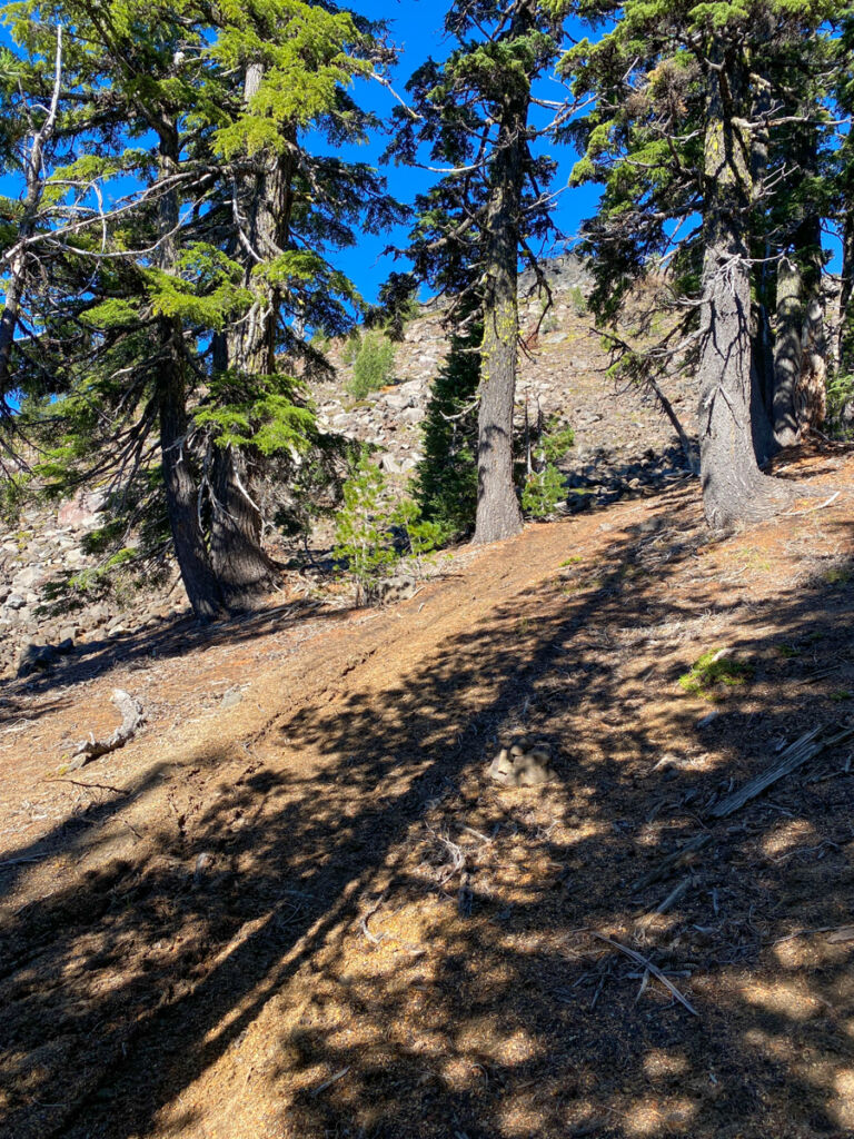
As you come around the west side of the peak, you finally get above the trees and the views really begin to open up.
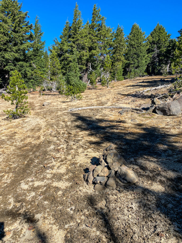
The summit of the peak is broad, and marked by a pile of rocks and rusty debris.
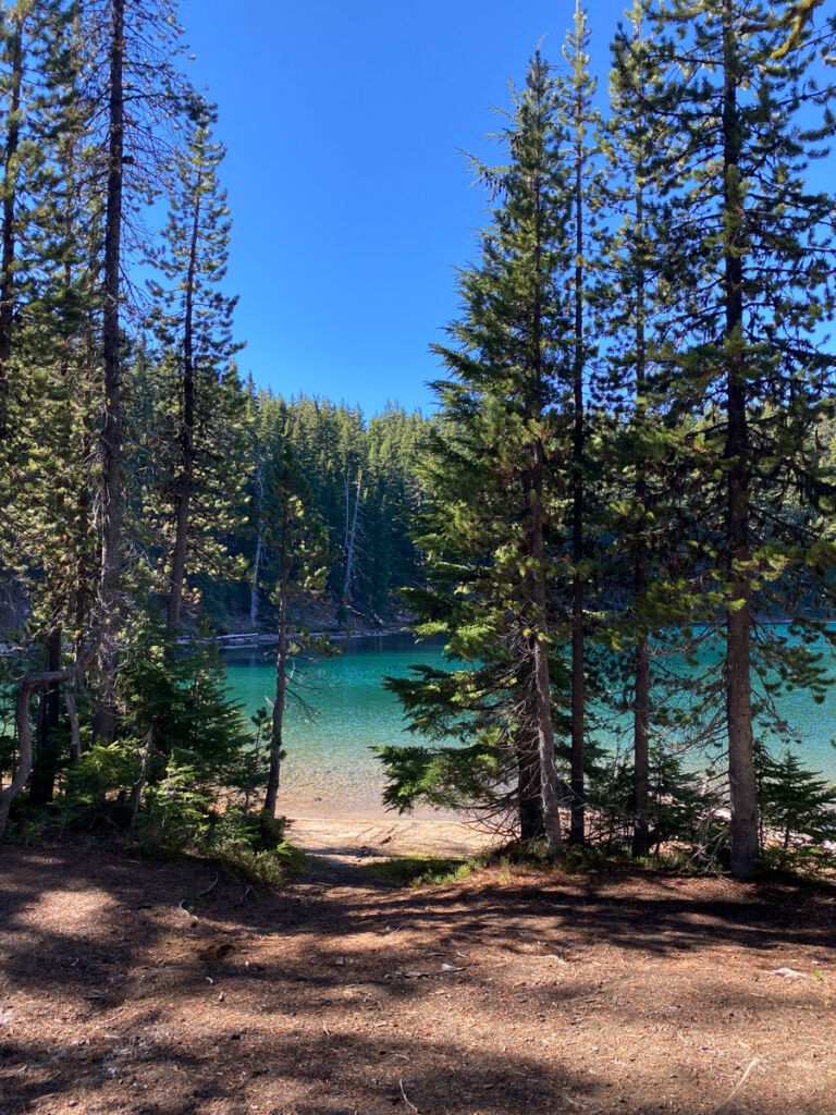
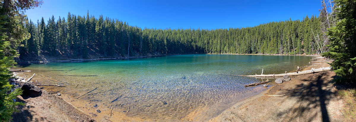
This is an out-and-back route, so return the way you came. If you have time and energy, take the side trail to Maiden Lake. It’s a hidden gem that is worth the short hike. There is no outlet for this lake, and it’s amazingly clear.
Maiden Peak via Maiden Lake Trail Map & Elevation Profile
Maiden Peak Tips and Resources
Bring plenty of water, sun protection, and the other ten essentials.
Maiden Peak is part of the Central Oregon Six-Pack of Peaks Challenge, a self-paced hiking challenge that takes you up six iconic mountains, each a bit higher and tougher.
It’s a challenge in itself, or great training for still bigger adventures. And your registration helps support some great outdoor-related non-profits. Learn more and sign up here.
Written by
Jeff Hester
Founder, SoCalHiker.net · Founder, Six-Pack of Peaks Challenge
Jeff has hiked and explored trails for over 50 years, covering everything from casual canyon walks to rugged multi-day Sierra routes. He started SoCalHiker.net in 2010 to document the trails he loves — and to make it easier for others to discover them.


You must be logged in to post a comment.