• COVID-19 Park and Trail Closures
  • Learn about the Six-Pack of Peaks Challenge
  • Shop
  •  

SoCal Hiker

  • Find a Hiking Trail
    • All Areas
    • Arizona
    • Colorado
    • Los Angeles
    • Orange County
    • Oregon
    • San Francisco Bay
    • Washington
  • Trail Guides
  • Six-Pack of Peaks
    • Colorado Six-Pack of Peaks
      • Bergen Peak
      • Rocky Mountain
      • Birthday Peak
      • Horseshoe Mountain
      • Grays Peak
    • New England Six-Pack of Peaks
    • NorCal Six-Pack of Peaks
      • Mount Umunhum
      • Mount Saint Helena
      • Mount Tamalpais
      • Mount Diablo
      • Mount Sizer
      • Rose Peak
    • Oregon Six-Pack of Peaks
      • Tumalo Mountain
      • Black Butte
      • Black Crater
      • Maiden Peak
      • Mount Bachelor
      • South Sister
    • SoCal Six-Pack of Peaks
      • Mt. Wilson
      • Cucamonga Peak
      • Mt. San Antonio (Mt Baldy)
      • San Bernardino Peak
      • San Jacinto Peak
      • San Gorgonio
  • Backpacking
    • High Sierra Trail
    • John Muir Trail
      • Overview of the John Muir Trail
      • Training
      • Day-by-Day Itinerary
      • Resupply Addresses
      • JMT Discussion Forum
    • Lost Coast Trail
    • North/South Lake Loop
    • Rae Lakes Loop
    • Red Peak Pass Loop
    • Theodore Solomons Trail
    • Trans-Catalina Trail
    • Wonderland Trail
  • Gear
  • Forums
    • Latest Topics
    • Ask a Question
    • Campfire
    • Trails
    • Trail Reports
    • Gear Wisdom
    • Classifieds
  • Login

Hiking Black Butte from the Lower Trailhead

May 24, 2022 By Jeff H Leave a Comment

Hiking Black Butte from the Lower Trailhead

Black Butte is an iconic mountain that stands alone, prominent and proud. The 6,436′ extinct start volcano lies 10 miles northwest of Sisters, Oregon along Highway 20. There are two ways to hike Black Butte. The shorter route from the Upper Trailhead is only four miles round trip, but requires a long drive up a washboard gravel forest service road. Starting from the Lower Trailhead is an easy drive, but a much longer hike. You begin at the base of the mountain and climb over three miles before joining the Upper Trailhead to continue your hike to the summit. The total roundtrip distance from the lower trailhead is 10.5 miles, with 3,400 feet of vertical gain.

img
Trail Details
Summit: 6,436′
Distance: 10.5 miles
Time: 5-6 hours
Difficulty: Strenuous
Elevation gain: 3,400 ft
Dogs: Yes
When to go: Spring-Fall
The combination of easy access, vertical gain and distance make this route a popular option for training, and the spring wildflowers and Cascade views from the summit keep hikers coming back for more.

The popular trail is well-maintained and can usually be hiked earlier in the season when the roads to other trailheads are still closed.

Getting to the Black Butte Lower Trailhead

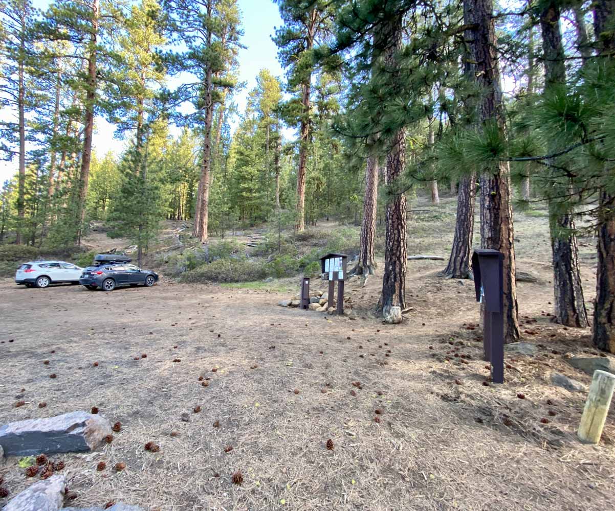
From Sisters, Oregon head west on US Highway 20 for ten miles. Turn right to head north on Camp Sherman Road. Follow Camp Sherman for 2.6 miles, then turn right onto SW Metolius River Road. Turn right at 0.2 miles (the first possible turn) onto the dirt and gravel Forest Service Road 1430 (there is no sign). A few hundred yards on your right is the parking area, with room for about 10 vehicles. There are no posted requirements for parking fees or passes, and there are no toilets or water at this trailhead. Get turn-by-turn directions via Google Maps.

Black Butte - Lower Trailhead

Hiking Black Butte from the Lower Trailhead

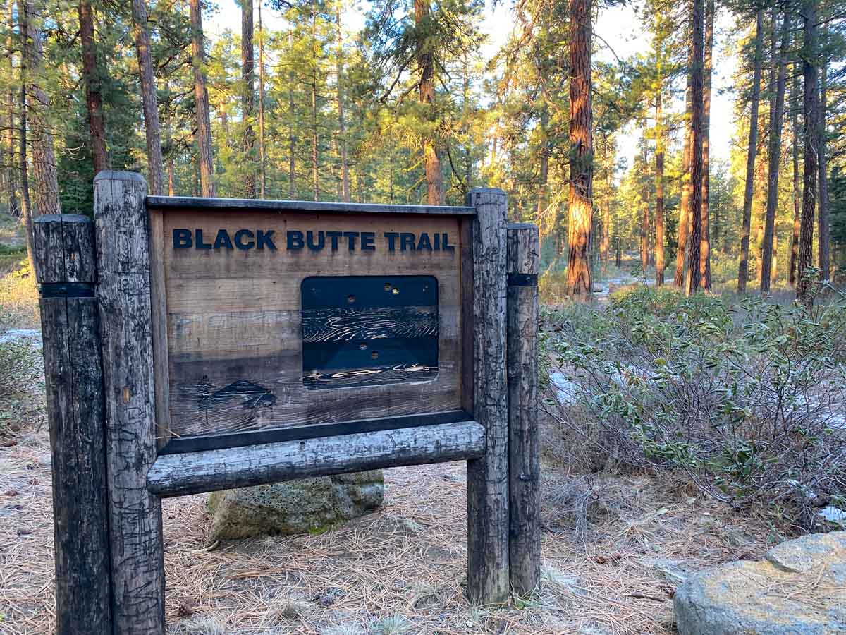
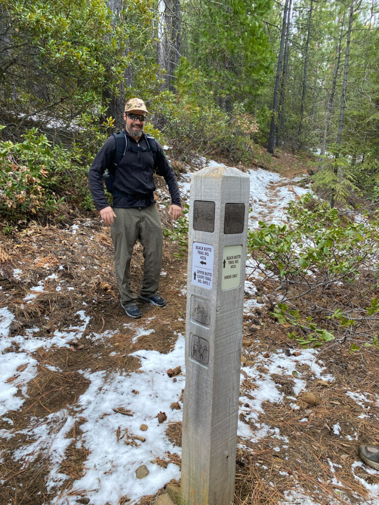
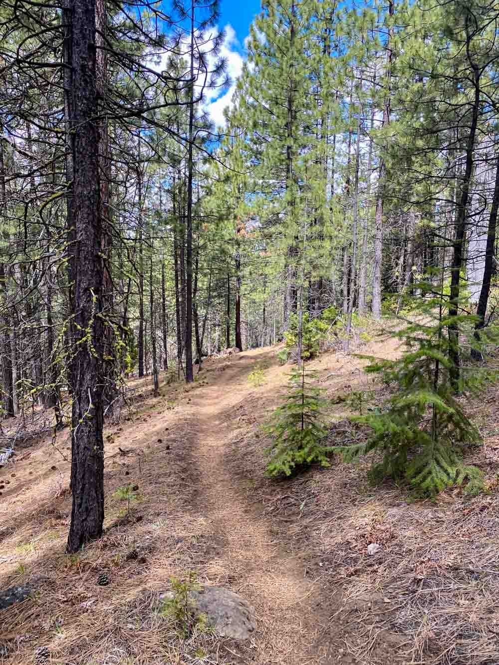
From the dirt parking area, look for the Black Butte Trail sign. You will see the mixed use trail heading due west, mostly flat for the first mile. This trail winds around the mountain at the base, so you’ll want to watch for the wood posts to turn on the hikers-only connector trails that head uphill. There are two options, and when you look at the map at the bottom of this trail guide, you’ll see we took the first option on the way up the mountain (~.75 miles from the trailhead), and the other on the way down (~1 mile from the trailhead). The second option is the more popular route.

Black Butte trail marker

From here, the trail begins a relentless but mostly gradual climb up and around the mountain. You will cross two forest service roads as you climb; watch for the hiker trail on the other side of the road and do a map check to make sure you’re on the correct route. At 3.2 miles you reach the Upper Trailhead. There is a picnic table and this is a great spot to take a break.  50 yards down the parking area here are pit toilets.

Black Butte Upper Trailhead parking

Note that the sign for the trail back down to the Lower Trailhead (from which you just hiked) is more prominent than any sign for the summit. On my most recent hike here, I helped two separate hikers parked at the upper trailhead who started hiking down the mountain until I asked them if they meant to hike to the summit.

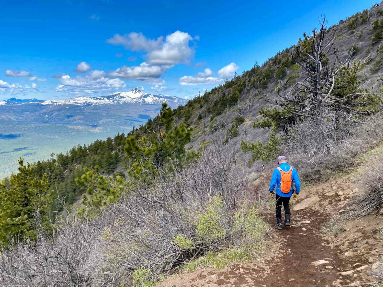
For a detailed guide from the Upper Trailhead to the summit, read Hiking Black Butte from the Upper Trailhead. The trail for the upper section is the same for both routes. From here, it’s a bit over two miles to the summit. The trail up has one switchback, then spirals upward toward the summit.

Forested trail on Black Butte

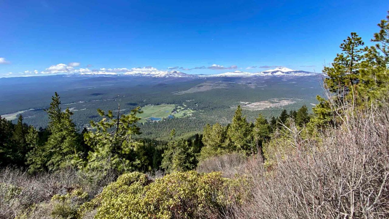
As you climb above the tree line, you are rewarded with sweeping views of the Cascade Mountains.

Cascades from Black Butte

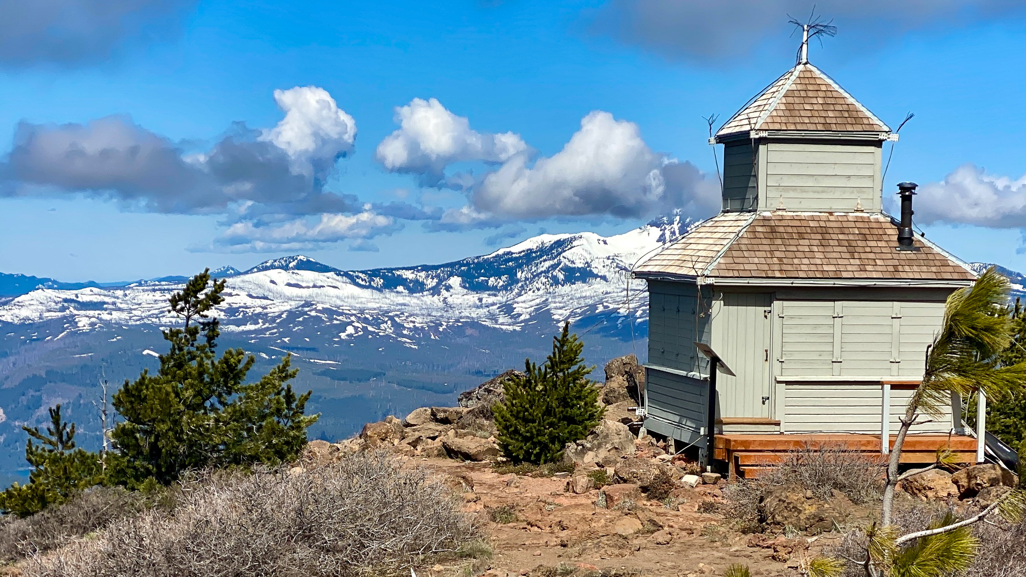
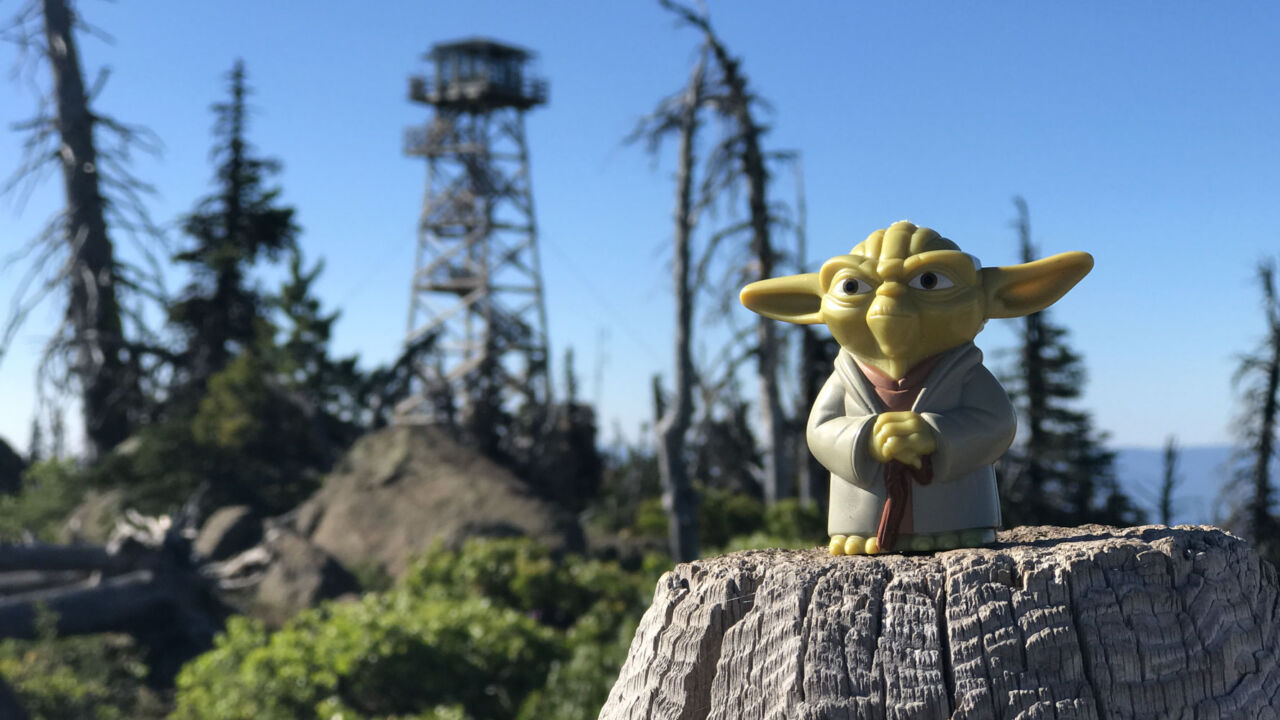
You’ll see the tall fire lookout tower that is actively manned during the summer months. As you round the east side of the mountain, you’ll hike through the scars of two modern wildfires before finally reaching the broad summit.

Black Butte Cupola

Once on the top of the butte, follow the trail to the northwest to visit the historic cupola (look for the rock carved by the “Bachelor of Black Butte” a century ago). Continue past the cupola to the new viewpoint deck. On a clear day, you can see Mount Hood and even Mount Adams.

Yoda atop Black Butte

Heading down Black Butte

When you’ve finished soaking in the views, retrace your route back down the mountain.

Black Butte Trail Map & Elevation Profile

© OpenStreetMap contributors
Download file: black-butte-from-the-lower-trailhead.gpx


Black Butte Hiking Tips

  • At the top, please stay on the marked trails to avoid damaging the fragile ecosystem.
  • Bring plenty of water, sun protection, and the other ten essentials.
  • Check out William Sullivan’s 100 Hikes / Travel Guide Central Oregon Cascades (affiliate link) for more on the history and flora on Black Butte.
  • For a shorter version of this hike that still goes to the summit, read our guide for Hiking Black Butte from the Upper Trailhead.
  • This mountain gets snow in the winter and becomes a more technical climb. Check the conditions before you go. I’ve used snowshoes on this trail during the month of January and microspikes and trekking poles can be helpful even into June depending on the snowfall.

Six-Pack of Peaks Challenge SeriesThe Central Oregon Six-Pack of Peaks Challenge

Black Butte is part of the Central Oregon Six-Pack of Peaks Challenge, a self-paced hiking challenge that takes you up six, iconic peaks–each one a bit higher and tougher.

It’s a challenge in itself, or great training for still bigger adventures. Learn more and sign-up here.

Originally hiked on February 17, 2022 with David and Ethan.
Latest hike on May 21, 2022 with Scott.

Filed Under: Trail Guides Tagged With: 8-10 miles, Black Butte, Deschutes National Forest, dog-friendly, Oregon, peakbagging, Six-Pack of Peaks

Like what you found here at SoCal Hiker? This site is a labor of love. Share your support for the site and help us development of new trail guides and expanded coverage -- make your next outdoor equipment purchase through our advertisers.

You can also subscribe to our weekly newsletter and follow us on Facebook or Twitter.

Jeff H

About Jeff H

I'm an avid hiker and backpacker. My wife Joan and I are on the trails every weekend. I started SoCal Hiker to share my passion for outdoor adventure.

Leave a Reply Cancel reply

Your email address will not be published. Required fields are marked *

This site uses Akismet to reduce spam. Learn how your comment data is processed.

About SoCal Hiker

Jeff on Mount Rainier

I created SoCal Hiker while preparing to thru-hike the John Muir Trail. My goal? Create guides for the best hiking and backpacking trails with enough detail to make it an enjoyable experience for you. And while I started with trails in Southern California, I’ve expanded across the west. We hike each trail to create these guides, sharing practical advice on gear and outdoor skills. Read more…

Connect with SoCal Hiker

  • 22,158 Fans
  • 12,066 Followers
  • 21,640 Followers
  • 1,714 Followers
  • 5,308 Subscribers
  • 338 Subscribers
SoCalHiker was selected one of USA TODAY's 10 Best Hiking and Outdoor Blogs
Get our day-by-day guide to thru-hiking the John Muir Trail
Get up-to-day wildfire status throughout California

Products

  • Mt Shasta Benchmark Mount Shasta Benchmark $39.95
  • Cucamonga Peak mug Cucamonga Peak Mug $15.95
  • Come to the woods, for here is rest. - John Muir Come to the Woods Poster $13.00 – $16.00
  • SoCal Six-Pack of Peaks Mug $15.95

Sponsors

Sponsor SoCalHiker and see your banner here

Featured Posts

Hiking Black Butte from the Lower Trailhead

Black Butte is an iconic mountain that stands alone, prominent and proud. The 6,436' … [Read More...]

Hiking Monserate Mountain

A popular hike in north-inland San Diego County, Monserate Mountain provides a good … [Read More...]

Hiking Sutton Mountain

Sutton Mountain gives you a sense of just how big Oregon is. Nestled between the … [Read More...]

Lastest Comments

  • jen on Hiking Quartz Peak in the Sierra Estrella Wilderness
  • Marlene on Ridgeline Loop to Barbara’s Lake
  • Jen Davies on Hiking Mitchell Canyon to Mount Diablo
  • Brandon on Muir Monday: One Touch of Nature Makes the Whole World Kin
  • Shannon on Hiking to Mount Saint Helena
Get your SoCalHiker stickers now

Get your SoCalHiker stickers!

Latest Posts

  • Hiking Black Butte from the Lower Trailhead May 24, 2022
  • Hiking Monserate Mountain May 6, 2022
  • Hiking Sutton Mountain April 25, 2022
  • Hiking Telescope Peak in Death Valley National Park December 21, 2021
  • Hiking Corte Madera in the Pine Creek Wilderness December 17, 2021

Recent Forum Topics

  • All about permits for newcomers
  • 1st overnight backpack trip with my son
  • JMT NOBO from Red Cones to Happy isles – how many days?
  • Early Spring SoCal Backpacking
  • Logistics for Kearsarge TH to Crescent Meadow TH

The Six-Pack of Peaks Challenge Series

Six-Pack of Peaks Challenge SeriesThe Six-Pack of Peaks Challenge Series gives you an opportunity to explore your world while supporting a great cause. There are eleven challenges around the country. Hike or run them at your own schedule.

Flex your adventure muscles!

Learn more here.


Search

Tags

3-6 miles 6-8 miles 8-10 miles 11+ miles Arizona Backpacking coastal dog-friendly easy family-friendly High Sierra Trail hiking Hiking The John Muir Trail hipster inspiration JMT John Muir John Muir Trail Kings Canyon National Park LA County moderate Mount Rainier National Park Muir Monday National Park Orange County Oregon out of bounds Pacific Crest Trail peak peakbagging quote scenic Sequoia National Park Sierra Nevada Six-Pack of Peaks State Park strenuous Thru-hiking Utah vista Washington waterfall wilderness Wonderland Trail Yosemite

Copyright © 2022 SoCalHiker.net · Metro Theme on Genesis Framework with WPEngine Hosting · Contact SoCal Hiker · Sitemap · Privacy Policy