• COVID-19 Park and Trail Closures
  • Learn about the Six-Pack of Peaks Challenge
  • Shop
  •  

SoCal Hiker

  • Find a Hiking Trail
    • All Areas
    • Arizona
    • Colorado
    • Los Angeles
    • Orange County
    • Oregon
    • San Francisco Bay
    • Washington
  • Trail Guides
  • Six-Pack of Peaks
    • Colorado Six-Pack of Peaks
      • Bergen Peak
      • Rocky Mountain
      • Birthday Peak
      • Horseshoe Mountain
      • Grays Peak
    • New England Six-Pack of Peaks
    • NorCal Six-Pack of Peaks
      • Mount Umunhum
      • Mount Saint Helena
      • Mount Tamalpais
      • Mount Diablo
      • Mount Sizer
      • Rose Peak
    • Oregon Six-Pack of Peaks
      • Tumalo Mountain
      • Black Butte
      • Black Crater
      • Maiden Peak
      • Mount Bachelor
      • South Sister
    • SoCal Six-Pack of Peaks
      • Mt. Wilson
      • Cucamonga Peak
      • Mt. San Antonio (Mt Baldy)
      • San Bernardino Peak
      • San Jacinto Peak
      • San Gorgonio
  • Backpacking
    • High Sierra Trail
    • John Muir Trail
      • Overview of the John Muir Trail
      • Training
      • Day-by-Day Itinerary
      • Resupply Addresses
      • JMT Discussion Forum
    • Lost Coast Trail
    • North/South Lake Loop
    • Rae Lakes Loop
    • Red Peak Pass Loop
    • Theodore Solomons Trail
    • Trans-Catalina Trail
    • Wonderland Trail
  • Gear
  • Forums
    • Latest Topics
    • Ask a Question
    • Campfire
    • Trails
    • Trail Reports
    • Gear Wisdom
    • Classifieds
  • Login

Trail Canyon Falls and Lazy Lucas Camp

March 23, 2014 By Jeff H 16 Comments

Trail Canyon Falls

The Trail Canyon Trail isn’t a product of the Office of Redundancy Department (or the Ministry of Silly Walks, for that matter). Trail Canyon refers to the trail of gold flakes seen swirling down the creek at the bottom of the canyon. At the turn of the 20th century, miners worked the creek, but the trail didn’t lead to any riches.

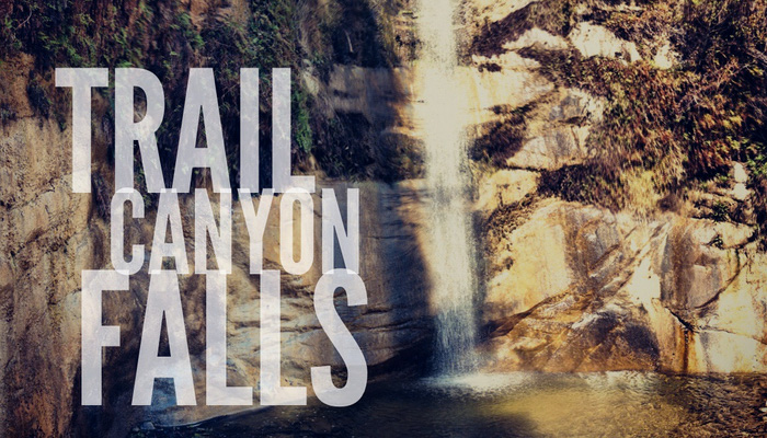
The real gold of Trail Canyon is the scenery: rugged and steep canyon walls containing a babbling creek and a beautiful waterfall.

img
Trail Details
Distance: 5.5 miles
Time: 3 hours
Difficulty: Moderate
Elevation gain: 1260 ft
Dogs: Yes
When to go: Spring
This area was ravaged by the Station Fire in 2009, but reopened last year. The trail is unmaintained, but a worthwhile adventure with 24 creek crossings.

We hiked to Lazy Lucas Camp — a single campsite named for Tom Lucas, a grizzly bear hunter and one of the first forest rangers in the San Gabriel Timberland Reserve — now known as the Angeles National Forest.

Getting to the Trailhead

The turnoff to Trail Canyon Road

The turnoff to Trail Canyon Road

There is a parking area about 0.4 miles off Big Tujunga Canyon Road at 19607 N. Trail Canyon Road. Click the pin on this map to calculate driving directions.

A couple notes about this dirt road. There is a gate that is sometimes closed. It only adds 0.4 miles each way (0.8 total) to hike in, so you can park and hike in if the gate is closed. Do not block the gate, as there are residents in the canyon who need to get in and out.

Also, the road narrows to one lane in a couple of sections. Proceed with caution. Finally, you’ll see a fork in the road at the crest of the first hill. Stay to the right to reach our trailhead.

There are conflicting reports about whether you need to display an Adventure Pass to park at this trailhead. I have an annual pass (highly recommended) and didn’t have to take any chances.

Hiking the Trail Canyon Trail

We parked amid a cluster of cabins dating back to the 1920’s. There is some shade here, and a marker pointing the direction toward the trailhead. There’s an information sign as well as a trail register.

Trail Canyon Trailhead

Just beyond the sign, you’ll see a gated dirt road that heads up the canyon. You immediately cross the creek — the first of 24 creek crossings  — and follow the dirt road as it clings to the canyon wall.

Soon you pass the last standing cabin, and the trail continues on a now abandoned jeep trail. You’ll pass a sign with an ominous warning: “TRAIL NOT MAINTAINED — HAZARDS MAY EXIST.” You’re on the right path.

Trail Not Maintained

0.8 Miles – The trail winds around a ridge and down toward the creek again. Reaching a hairpin turn, the old jeep trail beds downstream toward the ruins of an old cabin. You may see the rusty remains of it’s contents piled for pickup, like some sort of rusty yard sale. But here’s where the trail gets better. Bear right and head down towards the creek.

Down Toward the Creek

For the next 1/2 mile, you follow the creek, criss-crossing the water several times, climbing over and ducking under fallen tree trunks. It wasn’t especially difficult, but it was fun. You may have to pause a few times to find your way, but it was one of our favorite sections of the trail.

At 1.2 miles, the trail begins climbing up the west side of the canyon.

Hiking up the west side of Trail Canyon

This section of the trail is exposed, but soon we were rewarded with sweeping views back down the canyon.

Trail Canyon Panorama

At 1.8 miles, we caught our first glimpse of Trail Canyon Falls below.

IMG_3148

At about 2 miles, there is an unofficial spur trail that descends steeply with several treacherous spots. For many people, this is as far as they go. We opted to continue to Lazy Lucas Camp, and would visit the base of the falls on our way back.

The trail again criss-crosses the creek several times above the falls. We followed the trail up the canyon and at the 2.8 mile mark, we reached Lazy Lucas Camp. This is a single campsite with an iron fire ring. Note that the sign at the trailhead warned that this area was open for day use only and no campfires — so while backpacking to this spot may once again be an option in the future, it’s limited to a comfortable place to take a snack break for now.

Lazy Lucas Camp

We rested and munched on trail snacks — then started backtracking down the canyon. At the 4 mile mark, we again reached the spur that leads to the base of the falls. This “trail” requires some scrambling confidence to tackle, but yields a close-up view of a pretty spectacular waterfall.

Trail Canyon Falls

We followed the trail back to the trailhead, counting the creek crossings on our return. In total there were 24 creek crossings — 12 each way. Take care to look for the pink ribbons tied to tree branches to help you find the trail, and the occasional stone cairn.

I did a short exploratory hike to some of the ruins of the cabins that no longer stood. It’s amazing to think how these were built, and what this canyon must’ve looked like before the fire.

When we got back to our car, there were about ten other cars now parked in the lot. While the trail wasn’t crowded by any means, we did encounter several other groups of hikers. In contrast to the over-crowded Eaton Canyon Falls, this was a welcome change.

The Trail Canyon Falls hike was one of Joan’s favorites. It combines a lot of great features — interesting terrain, a cool creek and beautiful waterfall. This is a trail I’ll happily hike again.

Trail Canyon Trail Map

© OpenStreetMap contributors
Download file: Trail-Canyon-Trail.gpx

Trail Canyon Photo Gallery

Click on any photo to view a larger version. You can also leave comments on any photo.

Trail Canyon Falls
The turnoff to Trail Canyon Road
Benchmark at the Trailhead
Trail Canyon Trailhead
Trail Register
Trail Register
Gate at the Trailhead
Trail Not Maintained
Trail Canyon Trail
Down Toward the Creek
Log Crossing
Trail Canyon
Trail Canyon Panorama
IMG_3141
IMG_3142
IMG_3143
Hiking up the west side of Trail Canyon
IMG_3145
Trail Canyon Panorama
IMG_3148
Trail Canyon
Green on the Trail
Trail Canyon Trail
One of 12 Creek Crossings
Charred Survivor
Charred Survivor from the Station Fire
Lazy Lucas Camp
Lazy Lucas Camp
Yondering
Trail Markers
Trail Canyon Creek
Joan a Trail Canyon Creek
Trail Down to the Base of Trail Canyon Falls
Trail Canyon Falls
Trail Canyon Falls
Yoda at Trail Canyon Falls
Clambering Back up to the Trail
Another Creek Crossing
Poodle Dog Bush
Poison Oak
Old Flood Control
Ruins from the Station Fire
Rusty Chair

Trail Canyon Tips

  • This trail is unmaintained. There is poison oak and some of the dreaded Poodle Dog Bush, so long pants and long sleeves are highly recommended. Several of the hikers in our group hiked beyond to the remains of Big Cienega Camp, but reported that the trail was very difficult to locate and required a great deal of bushwhacking.
  • The many creek crossing require you pay close attention for trail markers to stay on the trail. Look for cairns (stacks of stones) or the occasional pink ribbon tied to branches to mark the trail.
  • The spur trail down to the base of the falls is treacherous and requires scrambling.
  • Joan and I agreed that we were glad we brought our trekking poles on this hike.

More Trail Canyon Resources

  • Looking for a challenge? You can extend this hike up to Condor Peak and you’ll log 16 miles and 4,000 feet of elevation gain. Casey over at Modern Hiker has a great write-up, as well as pre-Station Fire photos.
  • Dan Simpson shares his perspective on the trail from his June 2012 hike.
  • Love waterfalls? Check out these hikes.

Trail Canyon Weather Forecast

The location could not be found.

Filed Under: Trail Guides Tagged With: 3-6 miles, dog-friendly, LA County, moderate, National Forest, waterfall

Like what you found here at SoCal Hiker? This site is a labor of love. Share your support for the site and help us development of new trail guides and expanded coverage -- make your next outdoor equipment purchase through our advertisers.

You can also subscribe to our weekly newsletter and follow us on Facebook or Twitter.

Jeff H

About Jeff H

I'm an avid hiker and backpacker. My wife Joan and I are on the trails every weekend. I started SoCal Hiker to share my passion for outdoor adventure.

Comments

  1. GoldenPoppy says

    March 23, 2014 at 7:29 pm

    Thank you Jeff Hester. Ever since I discovered you, I keep up with your entries. You make living in Los Angeles much, much better.

    Reply
    • Jeff HJeff Hester says

      March 24, 2014 at 10:30 am

      Thanks GoldenPoppy! LA is a great place for outdoor adventure.

      Reply
  2. Josh says

    March 24, 2014 at 9:13 am

    Nice post and pictures! I can’t believe any waterfalls actually have water in the California drought! Beware the poodle brush as well! haha

    Reply
    • Jeff HJeff Hester says

      March 24, 2014 at 9:15 am

      Yes, the waterfall had pretty good flow and the creek was lively — which was nice because the trail darts across the creek 24 times! Made for a fun hike.

      It also made me wonder what this would be like after some real rainfall! Might be much trickier.

      Reply
  3. Miss Sherry says

    January 20, 2015 at 11:44 am

    Jeff, I just yesterday (1/19/2015) discovered Trail Canyon, although we did not hike since we were unprepared. Do you know if the cabins are ever rented out? That would be unbelievably awesome to stay there overnight. Thank you SO MUCH for putting together this site. I will definitely support your advertisers because I want to know more and go more on your recommendations!! You are hereby bookmarked!!

    Reply
  4. Gorgonio says

    March 20, 2015 at 10:42 am

    Jeff,
    I had not been up to Trail Canyon Falls since before the Station Fire of 2009. It’s sad to see the waterfall SO exposed to the sunlight as it is. Before, you literally had to rappel through thick brushes down into it, and even then, the waterfall was surrounded by trees and bushes. It’s good to see at least SOME of the foliage remains.

    Reply
  5. Ryan Delos Reyes says

    April 14, 2015 at 5:52 am

    Jeff,

    is this trail suitable for dogs? I see some log crossing on some of the pictures, my dog is not neccesarily
    the athletic type lol.

    Reply
  6. Jeff HJeff Hester says

    April 14, 2015 at 1:07 pm

    @Miss Sherry – The cabins all have full-time residents, as far as I can tell. Thanks for bookmarking us!

    @Gorgonio – Yes, the downed trees are sad. The canyon is pretty exposed now, but it’s still beautiful. And it will recover.

    @Ryan – Yes (it’s in the info box). The creek itself is not so deep. Your dog can probably cruise through it. Just be sure your dog can handle the distance. Remember that when your turn around, that’s your halfway point.

    Reply
  7. Albert Liao says

    May 17, 2015 at 7:40 pm

    I just did this hike today. It’s a little tough for dogs to travel down the path towards the waterfall as it’s pretty steep. We tried traveled past the waterfall in search of more interesting things, but turned back around 3 miles in. I believe the camp mentioned in this article is not the Tom Lucas camp. According to this other site, it’s actually located at the 4 mile mark. http://www.modernhiker.com/2007/02/06/hiking-condor-peak-via-trail-canyon/

    Reply
  8. Edmond says

    April 6, 2017 at 8:31 am

    Hi,
    Could you please share how you create/ add the route and the elevation profile to the hike which is on the map?
    Thanks

    Reply
  9. SD says

    February 14, 2018 at 6:20 am

    Great page. Thanks for creating it.

    One quick question on the creek crossings…can they be done in trail runners without getting wet feet? (I use hiking boots only when there’s snow.) Thanks.

    Reply
    • Jeff HJeff Hester says

      February 14, 2018 at 6:41 pm

      Depends on water level. When we hiked this, it was not an issue, and I suspect it would be same this year.

      Of course, the good thing about trail runners is that they dry pretty quickly! 😉

      Reply
  10. Amy says

    October 13, 2018 at 11:20 pm

    The cabin at the trail head has a vicious pit bull that is often chained up. Today it was out and bit my hiking companion. Be aware hikers

    Reply
    • Jeffrey HJeffrey Hester says

      October 14, 2018 at 4:27 am

      Amy, that’s awful! Is your friend going to be okay? Did you report the incident to animal control?

      Reply
  11. Bruce Brizzard says

    June 30, 2019 at 7:26 pm

    Sorry this is not Tom Lucas Trail Camp.The real camp is about four miles in and can take up to three hours on a hot day. I first hiked there in August of 1987 (way too hot!) and did it every few years for the next couple of decades, but discovered the route was completely overgrown after the 2009 fire. You made it to the first camp or “false camp” as I called it, with several fire pits. The actual camp is reached by going past this point, following the creek as it steadily climbs, until it crosses the creek then goes up and steeply to the left following the creek all the way to Tom Lucas. There was a sign at one time marking the area and was part of a boy scout camp with remains of several metal pit toilets. Straight along on the right there are, or were, two decent campsites with a picnic table on each (probably gone now) and two metal stoves. I camped there one time in 1989 by myself but found it a frightening experience with a lot of weird sounds and helicopters flying nearby all night. It’s sad that no one seems to have this info but me. I was 36 then and 66 now. Apparently, it’s almost impossible to get there now. I have pictures I can send if interested. Thanks!

    Reply
    • Kelly says

      January 21, 2022 at 4:19 pm

      I went today 1/21/2022 to look for the Tom Lucas Trail Camp. I was not successful. I went to 4.3 miles in and looked all around where it was supposed to be on my map, but never found it. It was very overgrown everywhere, and I went through overgrown brush all along last mile of trail. I was wearing long pants and jacket to get through. Water was flowing well along the creek, and the main waterfall was very beautiful. I hope the camp is restored one day, its a beautiful canyon.

      Reply

Leave a Reply Cancel reply

Your email address will not be published. Required fields are marked *

This site uses Akismet to reduce spam. Learn how your comment data is processed.

About SoCal Hiker

Jeff on Mount Rainier

I created SoCal Hiker while preparing to thru-hike the John Muir Trail. My goal? Create guides for the best hiking and backpacking trails with enough detail to make it an enjoyable experience for you. And while I started with trails in Southern California, I’ve expanded across the west. We hike each trail to create these guides, sharing practical advice on gear and outdoor skills. Read more…

Connect with SoCal Hiker

  • 22,751 Fans
  • 11,946 Followers
  • Followers
  • 1,717 Followers
  • 5,281 Subscribers
  • 342 Subscribers
SoCalHiker was selected one of USA TODAY's 10 Best Hiking and Outdoor Blogs
Get our day-by-day guide to thru-hiking the John Muir Trail
Get up-to-day wildfire status throughout California

Products

  • Mount Baldy T-Shirt $23.00 – $27.00
  • Mount Wilson Benchmark Mount Wilson Benchmark $39.95
  • SoCal Six-Pack of Peaks Mug $15.95
  • Gift Certificate Gift Certificate

Sponsors

Sponsor SoCalHiker and see your banner here

Featured Posts

Hiking Belknap Crater in the Mountain Washington Wilderness

Hiking this out-and-back route up Belknap Crater you'll traverse an other-worldly … [Read More...]

Hiking to the Simpson Reef Overlook on the Oregon Coast Trail

The Oregon Coast is rugged, beautiful and often uncrowded. This bluff-top … [Read More...]

Join Team SoCalHiker at the Climb for Heroes

Team SoCalHiker is climbing Mount Baldy again as part of the annual Climb for Heroes … [Read More...]

Lastest Comments

  • Amy Courtney on Ridgeline Trail
  • Jay Eleanor on Hiking to the Simpson Reef Overlook on the Oregon Coast Trail
  • Charles Krim on Hiking to the Simpson Reef Overlook on the Oregon Coast Trail
  • 11 Best California Bikepacking Routes | Wild Lumens on Inside Crystal Cove State Park
  • Ted Thed on Burbank Peak, Cahuenga Peak, Mt. Lee and the Hollywood Sign
Get your SoCalHiker stickers now

Get your SoCalHiker stickers!

Latest Posts

  • Hiking Belknap Crater in the Mountain Washington Wilderness October 20, 2022
  • Hiking to the Simpson Reef Overlook on the Oregon Coast Trail August 25, 2022
  • Join Team SoCalHiker at the Climb for Heroes August 23, 2022
  • Hiking the Welch-Dickey Loop in the White Mountain National Forest August 18, 2022
  • Hiking Turtlehead Peak from Red Rock Canyon National Conservation Area July 15, 2022

Recent Forum Topics

  • How to deal with accidents while hiking in the winter?
  • Warm Tips for your hiking in winter
  • Some tips for hiking.
  • Keep your body warm in the winter hiking
  • The benefits of hiking, more than you can imagine!

The Six-Pack of Peaks Challenge Series

Six-Pack of Peaks Challenge SeriesThe Six-Pack of Peaks Challenge Series gives you an opportunity to explore your world while supporting a great cause. There are eleven challenges around the country. Hike or run them at your own schedule.

Flex your adventure muscles!

Learn more here.


Search

Tags

3-6 miles 6-8 miles 8-10 miles 11+ miles Arizona Backpacking coastal dog-friendly easy family-friendly High Sierra Trail hiking Hiking The John Muir Trail hipster inspiration JMT John Muir John Muir Trail Kings Canyon National Park LA County moderate Mount Rainier National Park Muir Monday National Park Orange County Oregon out of bounds Pacific Crest Trail peak peakbagging quote scenic Sequoia National Park Sierra Nevada Six-Pack of Peaks State Park strenuous Thru-hiking Utah vista Washington waterfall wilderness Wonderland Trail Yosemite

Copyright © 2023 SoCalHiker.net · Metro Theme on Genesis Framework with WPEngine Hosting · Contact SoCal Hiker · Sitemap · Privacy Policy


Loading Comments...