Outdoor Mistakes: Navigation Overconfidence

It was our second day of a 22-day thru-hike on the epic John Muir Trail. I was the ring-leader — I had organized the trip, recruited three willing hikers, obtained the permit and got us to Yosemite Valley a couple days earlier. I had been to Yosemite many times. I had even hiked the JMT before — 30 years earlier.
The young guns — Jeffrey and Hari — got an early start. The plan was to meet at Sunrise Camp. If they got their early, they could snag the best campsite for our little group.
Joan and I took our time. As we were getting ready to break camp, we spied a bear ambling towards the campground, hoping to find an inattentive or lazy backpacker with their food improperly stored. We shot a few blurry photos from a safe distance, even as a family with children raced toward the bear to get a closer look. But that's an outdoor mistake for another story.

We checked our gear and headed up the trail.
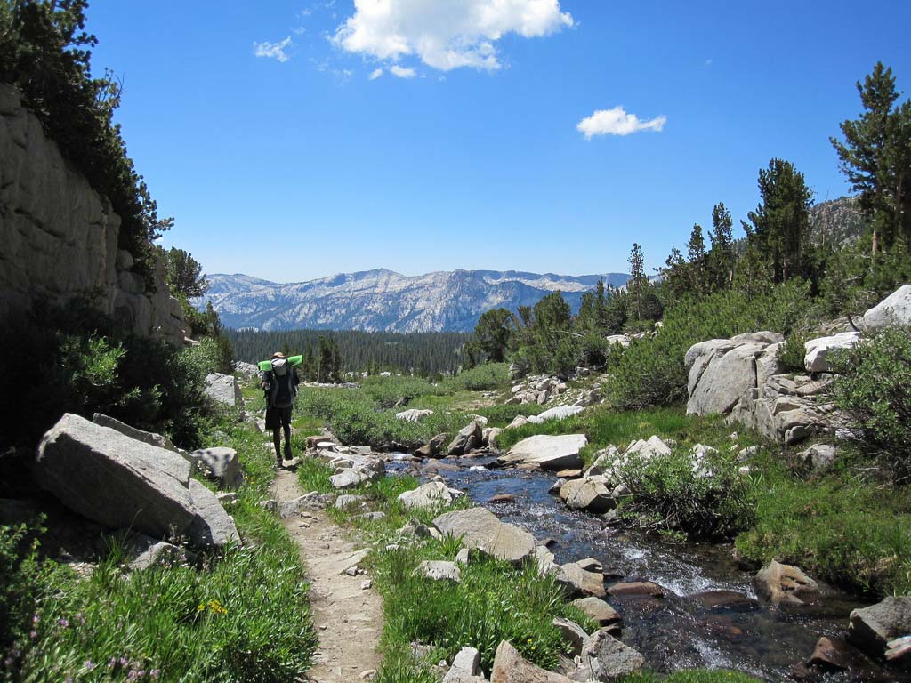
After 1.3 miles of climbing, we reached the junction to Half Dome. We had hiked here yesterday, so this part of the trail was still fresh in our memory. We took the right branch toward Sunrise, and hiked on.
Just 1/4 mile further we reached our next junction. Our map showed our trail continuing along the north side of Sunrise Creek, but the trail ahead looked to be heading toward a campsite. The trail to the left was much more travelled, and after a quick survey of the area, I headed up to the left.
We trudged along, climbing higher and higher. The sound of Sunrise Creek grew more and more faint. My girlfriend Joan began to question my navigation skills. “Didn't you say this trail ran near the creek?”
I brushed off her question and reassured her that this was the right trail. “Sometimes the scale of a map can be deceptive.” Hah. We continued to climb. I was beginning to question my decision as well, but at this point, the thought of backtracking was unappealing.
One of the great things about backpacking is the community of the trail. When encountering other hikers headed in the opposite direction, it's common to shout out a cordial “Hi! Where you headed? Where you coming from?” I used this to my advantage here. We encountered our first group…
“Hi! Where you coming from?” I asked hopefully. I wanted confirmation that we were on the right trail, and that we wouldn't have to backtrack, and that the miles of uphill hiking weren't in vain.
“Sunrise” came the answer. YES! I thought to myself. I turned to Joan and told her it was confirmed. I had basically doubled down on my commitment to this trail.
Still, we were climbing higher and higher. Soon we could see Half Dome. This didn't smell right.
Then next group of hikers came heading down the trail. “Where you coming from?” I asked again. “Sunrise Lakes.” Uh-oh. Sunrise LAKES?! Could that have been what the other group meant when they said “Sunrise”?
We stopped to check our map. Yes, it was certain we were on the wrong trail. We were en route to Clouds Rest and on to Sunrise Lakes beyond. I was eating my words.

It looked like we wouldn't meet up with Jeffrey and Hari tonight. We went with Plan B. We bagged Clouds Rest and what are probably the best views of Half Dome and the Yosemite Valley. We resolved to hike on until we could find a good campsite, then we would start early tomorrow and meet up with Jeffrey and Hari at Tuolumne Meadows.

Jeffrey and Hari were self-sufficient. We had planned to stick together in pairs, and had food, fuel and shelter to do just fine. And yes, on day three we did meet up again in Tuolumne Meadows.
So while it wasn't a disaster, it was a heaping serving of humble pie. And it was also the only wrong turn I took on the entire John Muir Trail.
What I Learned From My Mistake
I was over-confident — maybe even borderline cocky — about my choice at the junction. I should've taken time to check my maps and even break out my compass to make sure we were on the right trail. Being skilled and experienced doesn't help you if you get a little cocky.
On the bright side, while we ended up doing way more vertical gain than we had planned, we were equipped and prepared physically to deal with it. We had the supplies we needed and were in no real danger. And we had a plan to rejoin our friends at Tuolumne.
Although a popular trail like the JMT is well-marked, take time to use your map and navigation skills. And skip the humble pie.


That last photo is gorgeous! Looks like you got a wonderful view despite your wrong turn. If I were your friends, I would have been really worried that you didn’t show up to meet. They were probably glad to see you the next day?
Thanks Jessica. The view from Clouds Rest soothed the sting of getting “lost.” And from that point, I had cell phone reception (thanks to AT&T) and left a message for them. They were a little worried that night, but the next day in Tuolumne all was well.
Clouds rest was one of the most beautiful places I’ve been, though it’s a tough ascent with a heavy pack.