Hiking to Alamere Falls in Point Reyes National Seashore
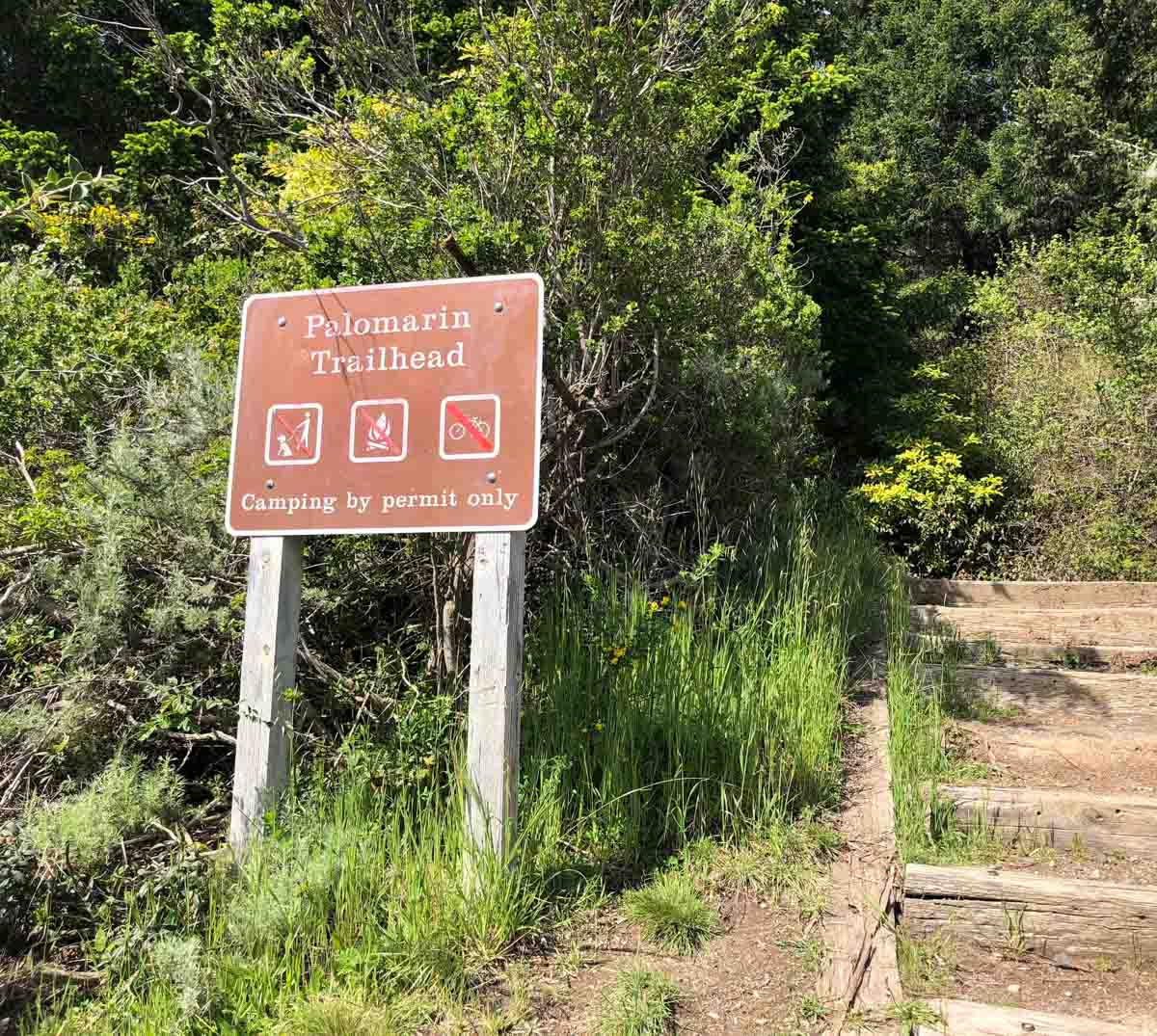
Palomarin Trailhead
Very Strenuous
14.2 mi
Out-and-back
14.2 mi
22.9 km
Distance
1,442 ft
440 m
Gain
586 ft
179 m
Summit
4-6 hours
Est. time
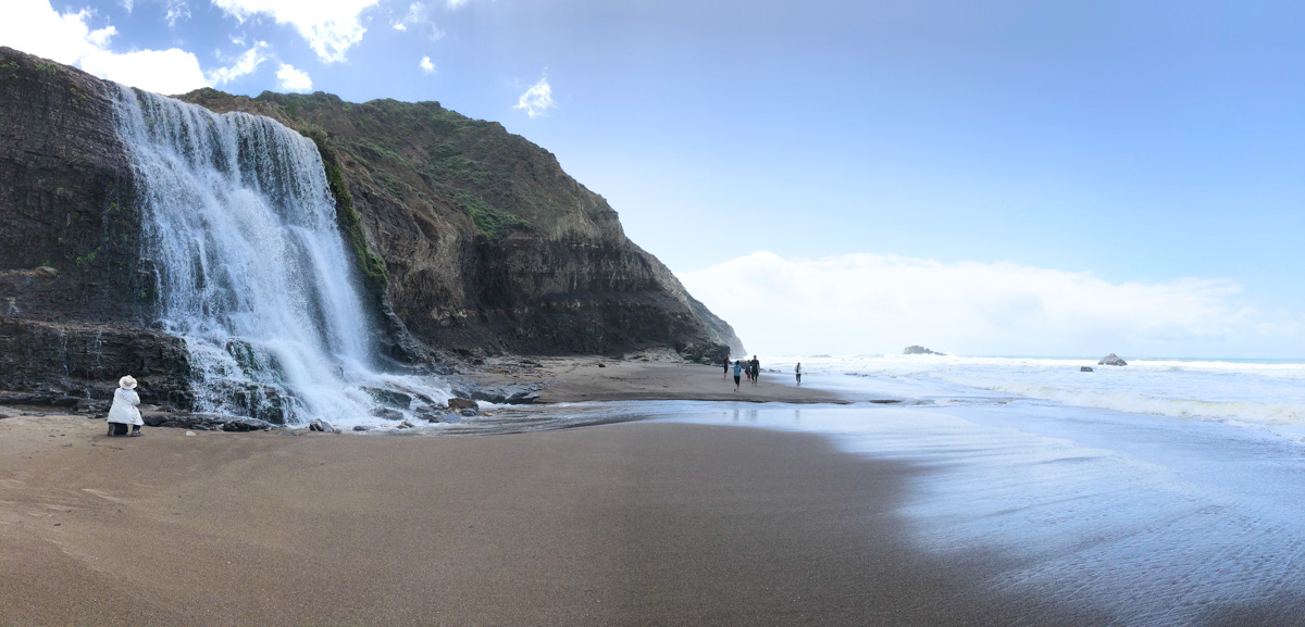
Alamere Falls is one of those rare and special places where a beautiful waterfall cascades directly onto the beach. This 14 mile hike is the easiest route to the falls, and makes a perfect long day hike. The Coast Trail from the Palomarin Trailhead near Bolinas offers pine forests, lakeside views, sweeping coastal panoramas, rushing creeks and ultimately, a safe route to Wildcat Beach and Alamere Falls.
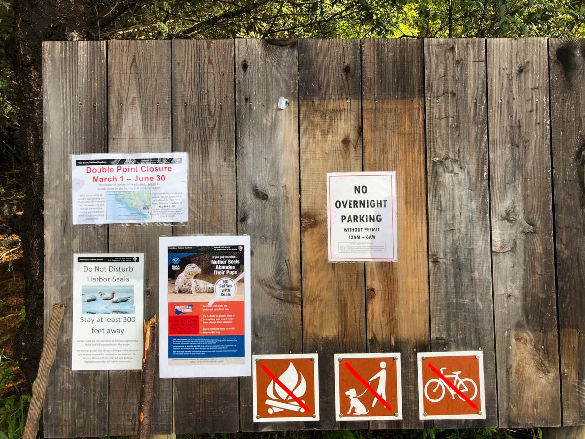
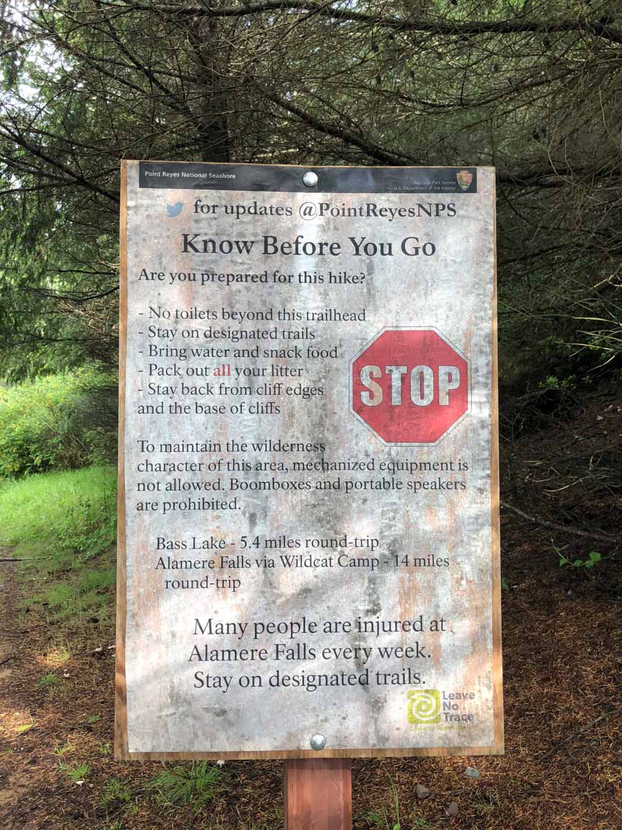
You may be tempted to take the unofficial trail that leads to the top of the falls and attempt to scramble down, but don’t. As the signs at the trailhead warn, people are injured attempting this every week. Be smart and stay safe by following the Coast Trail out to Wildcat Camp and down to the beach. It’s longer, but you’ll see much more of the coast, the lakes and the park. It’s well worth the extra miles.
Getting to the Palomarin Trailhead
From the small coastal town of Bolinas, follow Mesa Road north and drive all the way to the end, where you’ll find the parking lot for the Palomarin Trailhead. The last 1.2 miles to the trailhead is a rough, gravel road. A high clearance vehicle is ideal, but a sedan can make the trip with care and patience. At the trailhead, there are four pit toilets and an information board with rules and warnings. This is a popular trailhead on weekends. Best to arrive early to avoid a long “hike” to the trailhead. Get turn-by-turn directions to the trailhead via Google Maps.
Hiking the Coast Trail to Wildcat Camp and Alamere Falls
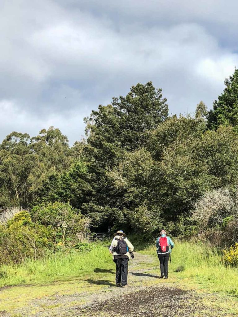
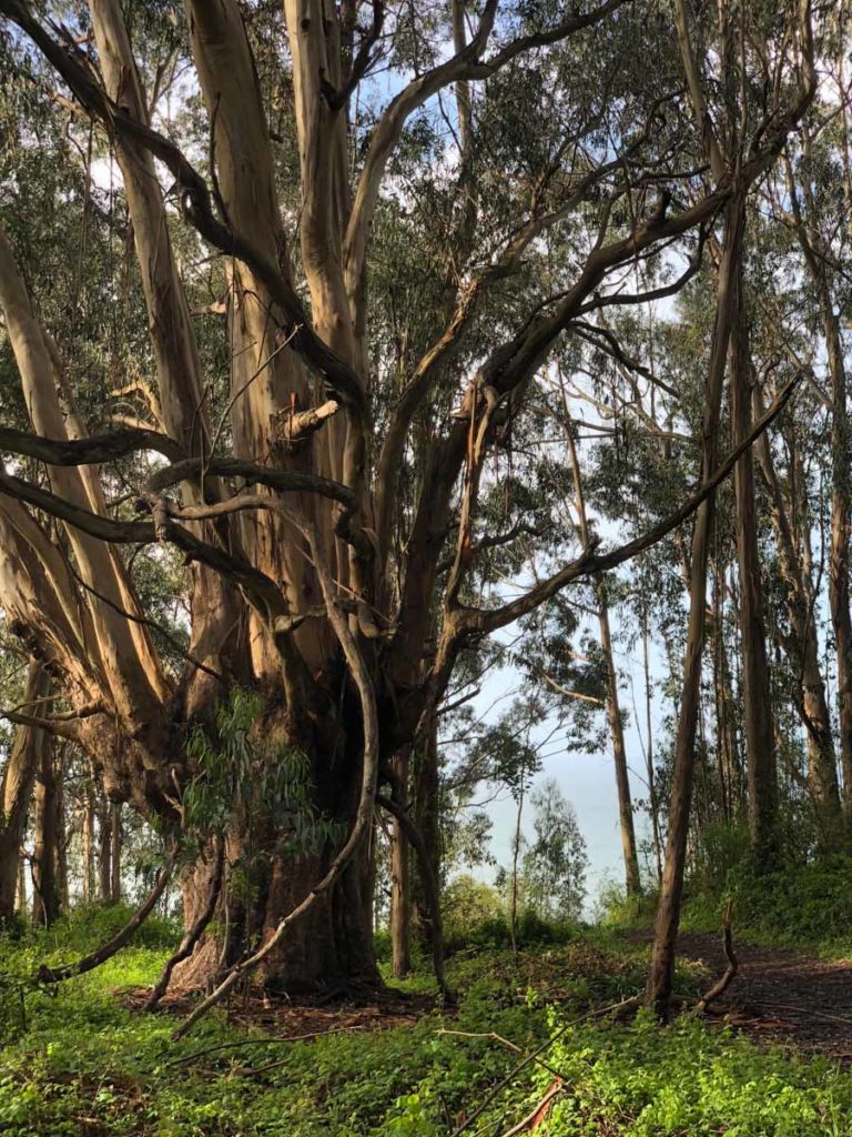
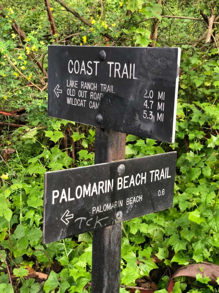
The trail begins at the northeast side of the parking lot. There’s only one trail from here, so it’s not difficult to find. You start through an old grove of towering eucalyptus trees with the sound of the surf crashing on the rocks below the bluff. At 0.2 miles, you reach a junction with the Palomarin Beach Trail. Bear right to stay on the Coast Trail toward Wildcat Camp.
The first 1.5 miles parallels the bluff, with some sweeping views of the coastline. After this, the trail veers inland, skirting some algae-covered ponds and reaching the north shore of Bass Lake at the 3.0 mile mark – the first of four named lakes you’ll pass on this hike.

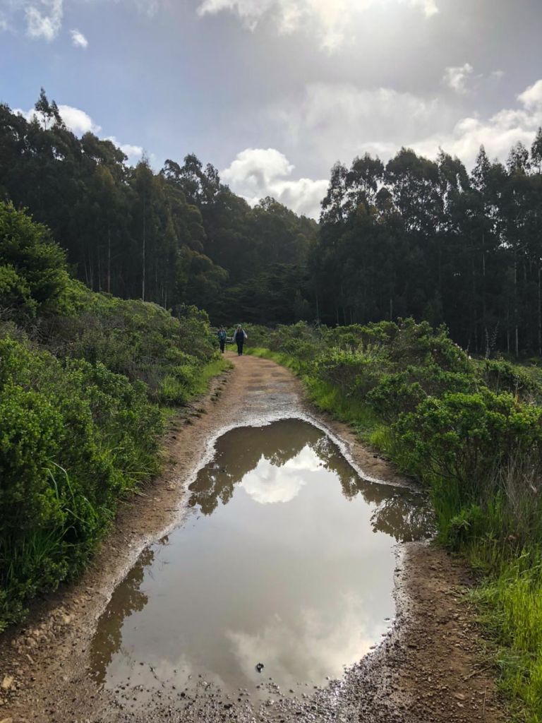
The vegetation is thick and green in the spring. The trail itself is in good condition, though it can get slick in the rain. There are three wooden foot bridges along the route crossing seasonal creeks.

At times, the coastal pines create a lush, dark tunnel over the trail.

At 4.7 miles, you reach a junction with the Ocean Lake Loop trail. Both trails reconnect just beyond Wildcat Lake, so we went right to stay on the slightly shorter Coast Trail going to Wildcat Camp, and would take the Ocean Lake Loop on our way back.
The trail narrows and the wet grasses and thistles made me thankful I kept the legs on my convertible hiking pants. Keep your eyes out for banana slugs and salamanders.

At 6.0 miles we reached Wildcat Camp. There are a number of backpacking campsites here, with picnic tables and secure food storage. There is also a pit toilet a short distance away.

From Wildcat Camp, the trail descends a gully to Wildcat Beach. We were able to cross the creek using old wood boards strewn on the sand.

Once on the beach, head south. In the distance, you can make out Alamere Falls just over a mile away.

Note that at high tide, the water can come up to the bluff and the beach can become impassable. Check the tide schedule before planning your hike, and make sure you have enough time to get to the falls and back before the tide comes in.
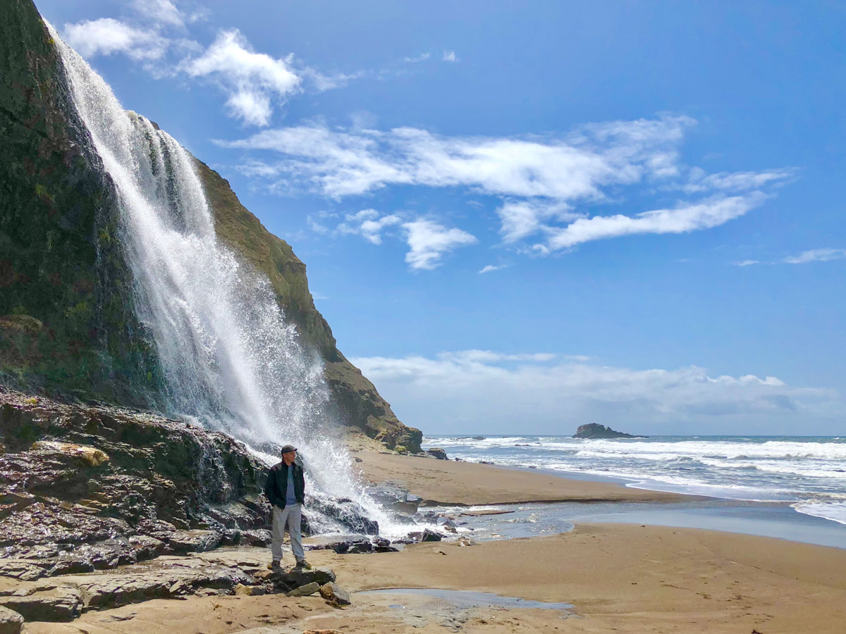
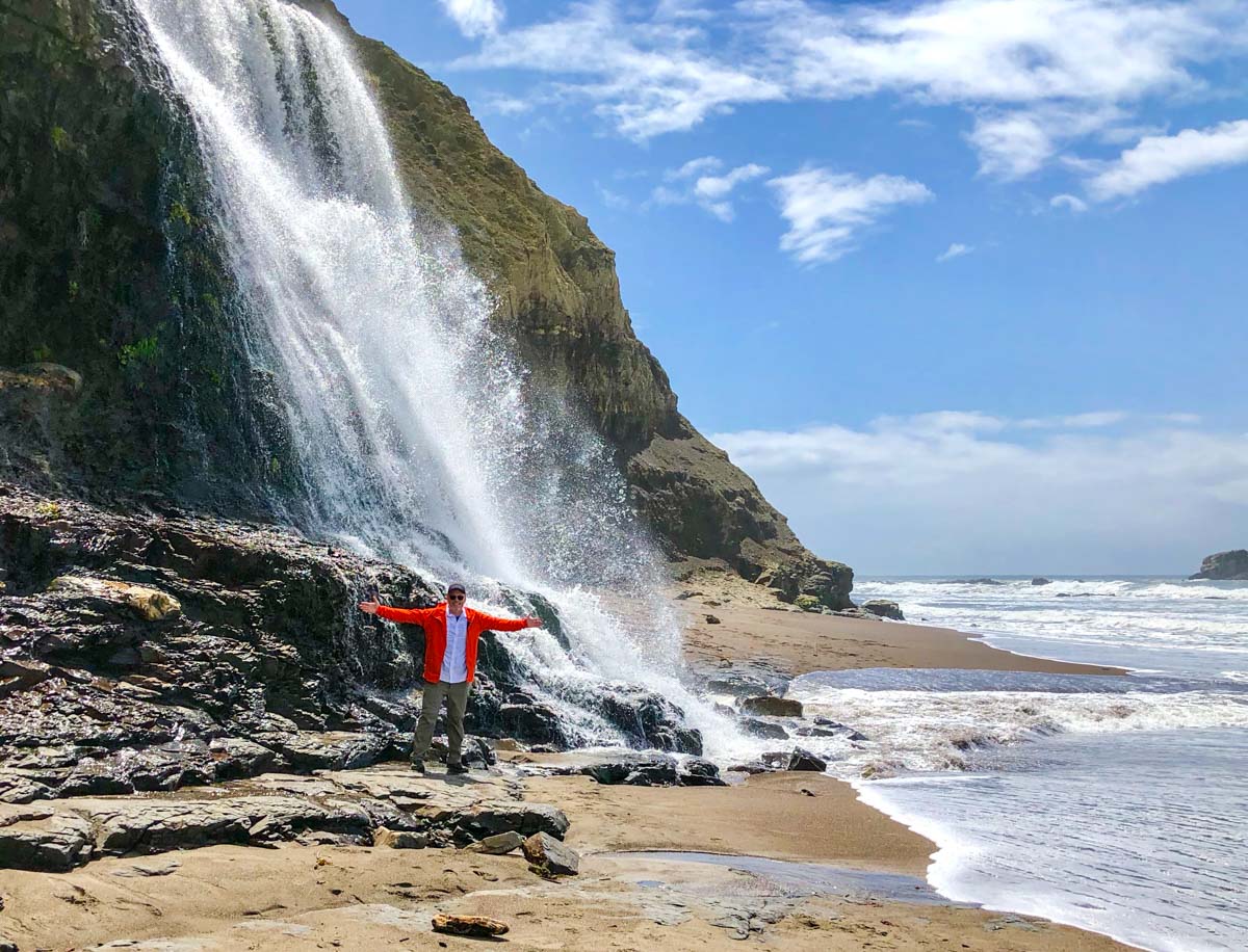
Alamere Falls cascade 30 feet from the bluff, falling onto rocks and spilling down the sandy beach right into the surf. It’s spectacular.
We took plenty of photos, fueled up with food and water, and headed back north on the beach, eventually reaching Wildcat Camp and heading back on the Coast Trail. When we reached the junction with the Ocean Lake Loop, this time we took it. The view was amazing. You can see Ocean Lake on the bluff, and Alamere Falls in the distance.

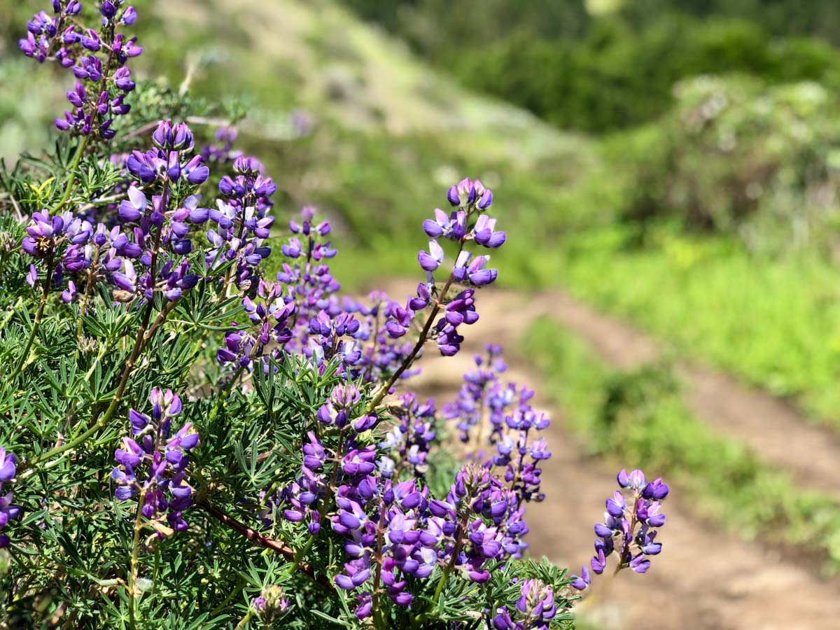
This out-and-back route to Alamere Falls is especially beautiful in the spring as the wildflowers come alive. We saw mariposa, lilys, poppies and lupine along the trail.


When you reach the bluff top and see the eucalyptus grove ahead, you’re nearly back to the trailhead.

This hike is beautiful, and while not technically challenging, it is long. We had periods of rain, cold wind, sun, and warmth. Bring plenty of food and water, and layers for the varied weather conditions.
Palomarin Trailhead to Alamere Falls Trail Map & Elevation Profile
Alamere Falls Tips and Resources
- Know the tide schedule beforehand. At high tide, the water can trap you against the bluff. Best to go when the tide is out and allow plenty of time for the beach hike to the falls and back.
- There was no AT&T cell coverage on most of this trail, and spotty coverage at the trailhead. Don’t count on being able to place a call or send messages on this trail.
- Devices such as radios, boomboxes, and portable speakers are prohibited. Enjoy the sounds of the birds, the wind through the trees, and the waves crashing on the beach.
- Print and carry this Alamere Falls trail map (PDF). The route described above is shown in purple on the map.
- There is no water available at the trailhead or on this trail. Bring and carry at least 2 liters of water per person.
- Bring the ten essentials, and follow the seven Leave No Trace principles.
- Visit the official Point Reyes National Seashore website for the latest information on Alamere Falls.
Finally, heed this warning from the National Park Service
Please take note! Many social media posts, websites, and older (and some newer) guide books reference an “Alamere Falls Trail.” The “Alamere Falls Trail” is NOT a maintained trail, and poses many hazards to off-trail hikers—crumbling and eroding cliffs, massive poison oak, ticks, and no cell phone service. Visitors who use this unmaintained trail may endanger themselves and rescuers, and inadvertently cause resource damage. On an almost weekly basis, visitors get hurt scrambling down the heavily rutted route leading to the top of the falls or sliding down the crumbly cliff-face to get to the beach, sometimes requiring search and rescue teams to be mobilized. The National Park Service strongly advises visitors against using this unmaintained route.

Jeff has hiked and explored trails for over 50 years, covering everything from casual canyon walks to rugged multi-day Sierra routes. He started SoCalHiker.net in 2010 to document the trails he loves — and to make it easier for others to discover them.
Originally hiked on April 12, 2018 with Kaete, Dan, Donna and Pat.
You must be logged in to post a comment.