• COVID-19 Park and Trail Closures
  • Learn about the Six-Pack of Peaks Challenge
  • Shop
  •  

SoCal Hiker

  • Find a Hiking Trail
    • All Areas
    • Arizona
    • Colorado
    • Los Angeles
    • Orange County
    • Oregon
    • San Francisco Bay
    • Washington
  • Trail Guides
  • Six-Pack of Peaks
    • Colorado Six-Pack of Peaks
      • Bergen Peak
      • Rocky Mountain
      • Birthday Peak
      • Horseshoe Mountain
      • Grays Peak
    • New England Six-Pack of Peaks
    • NorCal Six-Pack of Peaks
      • Mount Umunhum
      • Mount Saint Helena
      • Mount Tamalpais
      • Mount Diablo
      • Mount Sizer
      • Rose Peak
    • Oregon Six-Pack of Peaks
      • Tumalo Mountain
      • Black Butte
      • Black Crater
      • Maiden Peak
      • Mount Bachelor
      • South Sister
    • SoCal Six-Pack of Peaks
      • Mt. Wilson
      • Cucamonga Peak
      • Mt. San Antonio (Mt Baldy)
      • San Bernardino Peak
      • San Jacinto Peak
      • San Gorgonio
  • Backpacking
    • High Sierra Trail
    • John Muir Trail
      • Overview of the John Muir Trail
      • Training
      • Day-by-Day Itinerary
      • Resupply Addresses
      • JMT Discussion Forum
    • Lost Coast Trail
    • North/South Lake Loop
    • Rae Lakes Loop
    • Red Peak Pass Loop
    • Theodore Solomons Trail
    • Trans-Catalina Trail
    • Wonderland Trail
  • Gear
  • Forums
    • Latest Topics
    • Ask a Question
    • Campfire
    • Trails
    • Trail Reports
    • Gear Wisdom
    • Classifieds
  • Login

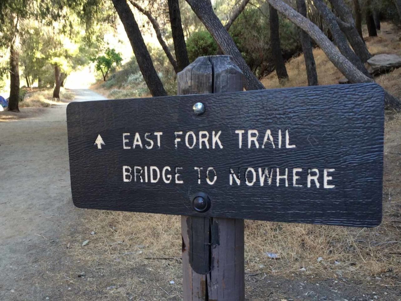
Hiking to the Bridge to Nowhere
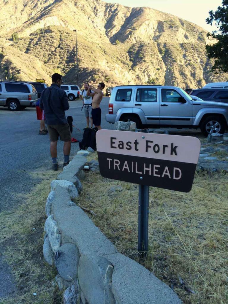
December 17, 2014 By Jeff H 25 Comments

Crossing the East Fork

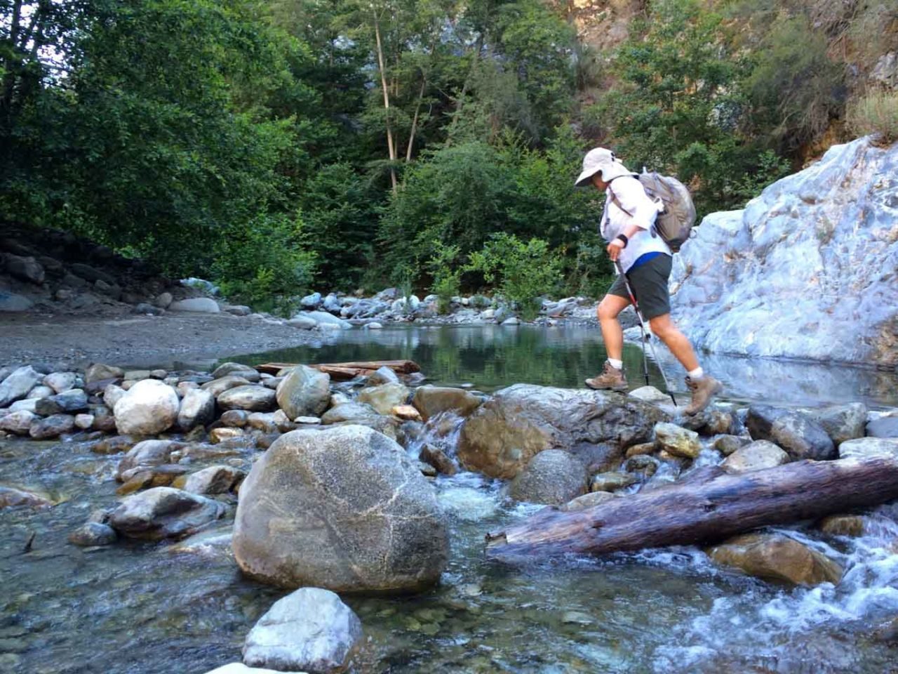
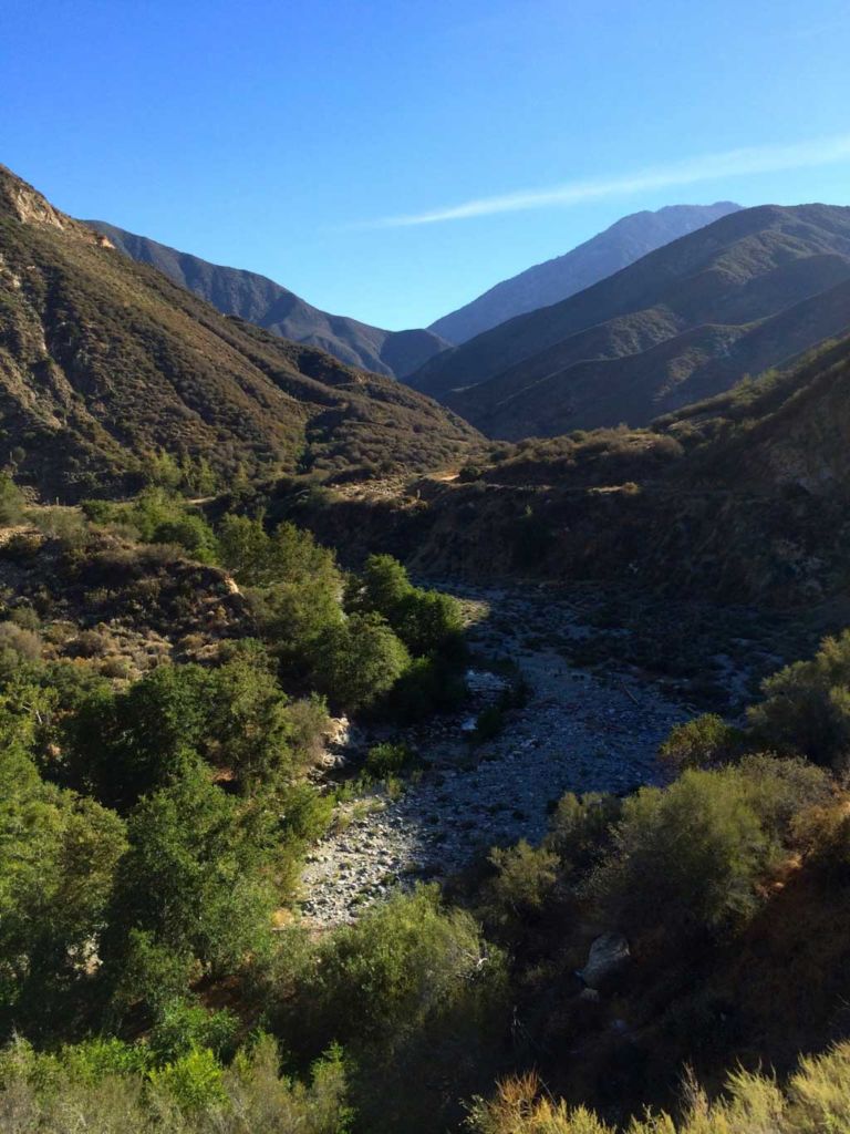
The Bridge to Nowhere hike is a quintessential SoCal trail. The trail criss-crosses the East Fork of the San Gabriel River many times. In the spring, the water can run fast and deep. Sometimes it’s waist high in places, making crossing a wet proposition. The river crossing make this trek more fun, and on a hot summer day, cooling off in one of the pools at the turnaround point is a perfect respite. But this hike has a bonus history lesson. It roughly follows the route of a road that attempted to provide a shortcut to Wrightwood. A flood in 1938 wiped out all but a few remnants of the road, but the “Bridge to Nowhere” remains.

img
Trail Details
Distance: 11 miles
Time: 4-5 hours
Difficulty: Moderate
Elevation gain: 1,140 ft
Dogs: Yes
When to go: Year-round
Download GPX
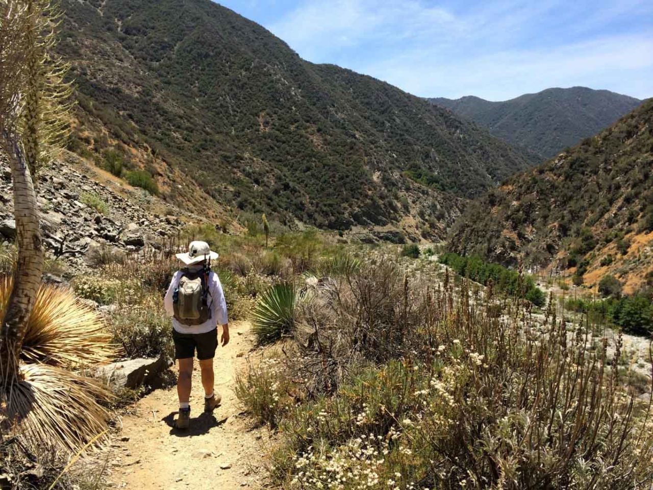
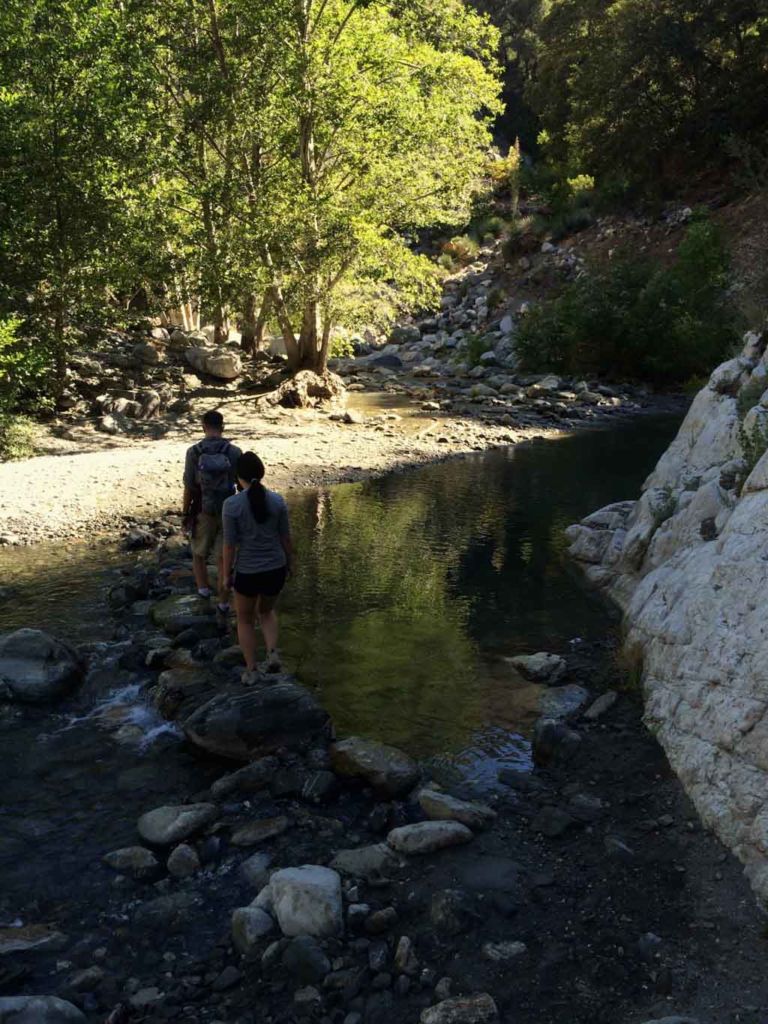
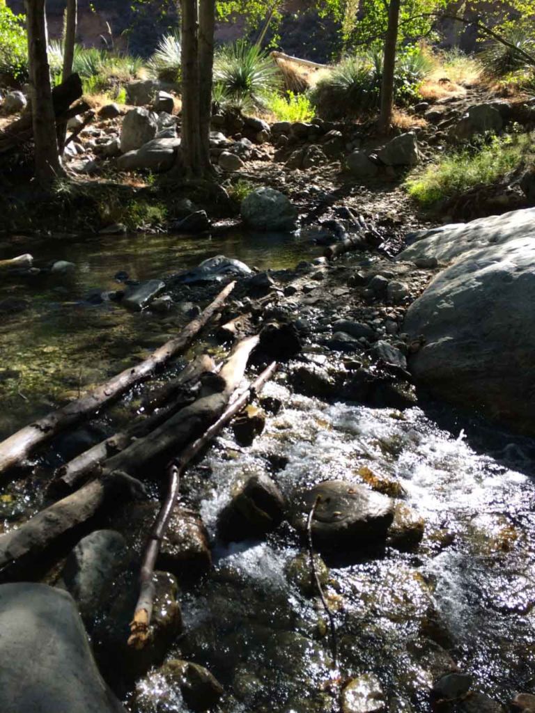
We hiked this trail in June on a warm but-not-too-hot day. Much of the trail is exposed and it gets too hot to be comfortable in the middle of summer. There was water running, but all of the crossing were easily managed by rock-hopping or log balancing. Only the soles of our shoes got wet — a relatively rare occurrence on this trek.

Getting to the Trailhead

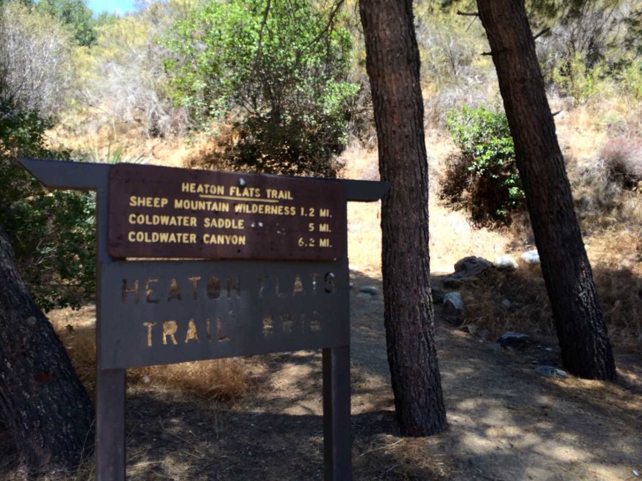
To get to the trailhead from Azusa, head north on San Gabriel Canyon Road for about 11 miles, then turn right at East Fork Road. Take this about 6 miles to the end and the parking lot. Note that the lot gets crowded, but you can park along the sides of the road. Pay attention to the signs. There are a few sections where parking is not allowed. Get detailed driving directions.

Hiking the Bridge to Nowhere Trail

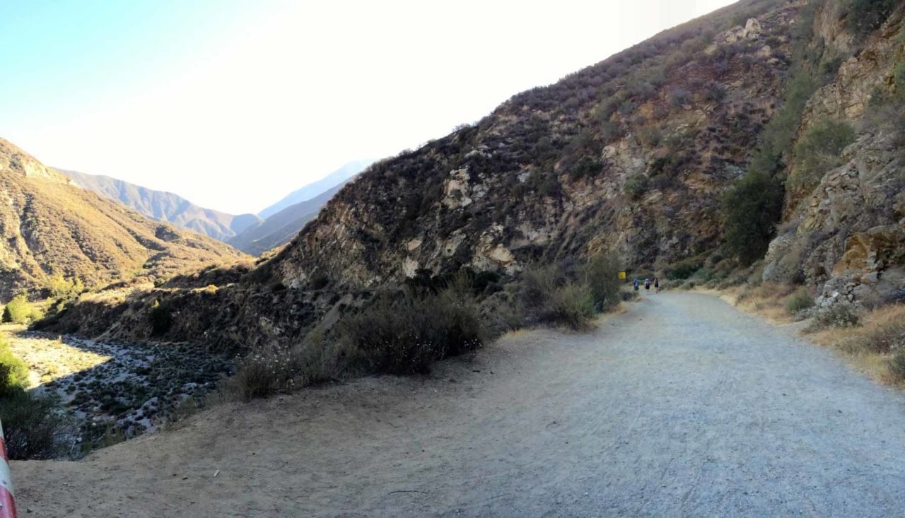
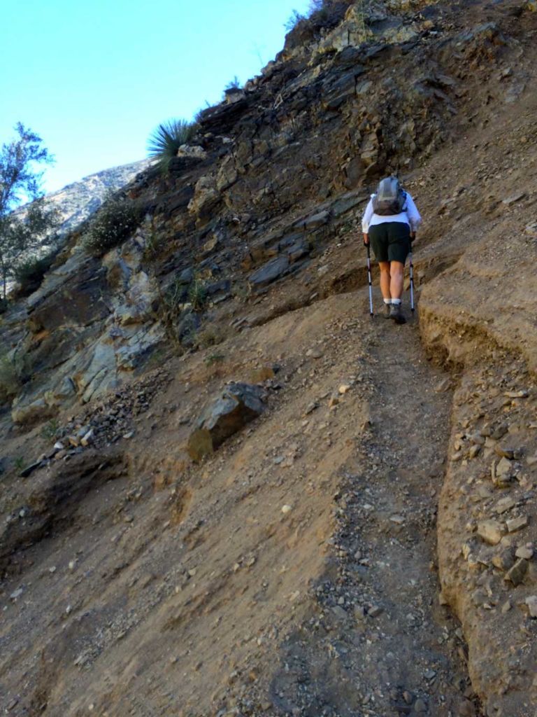
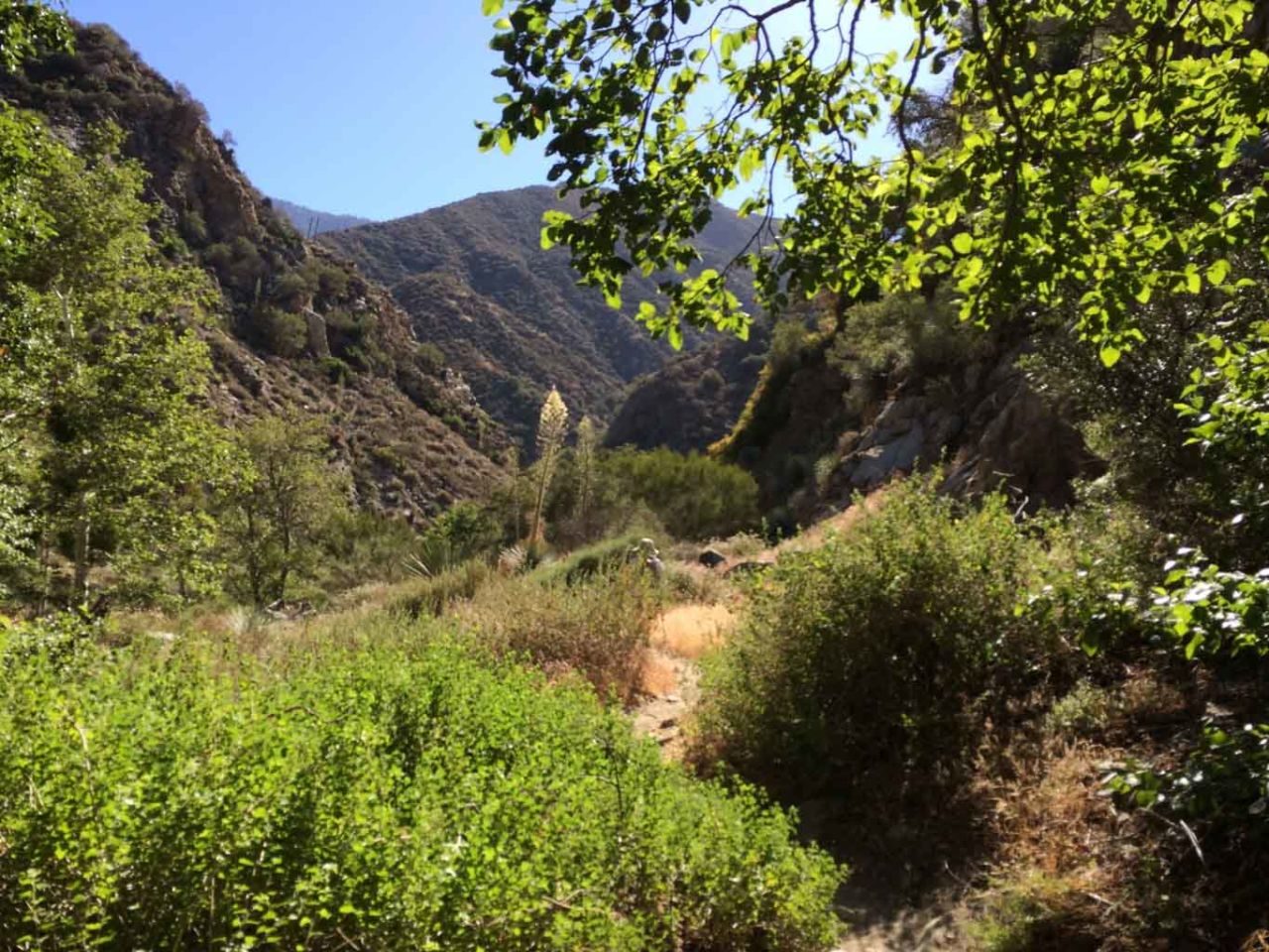
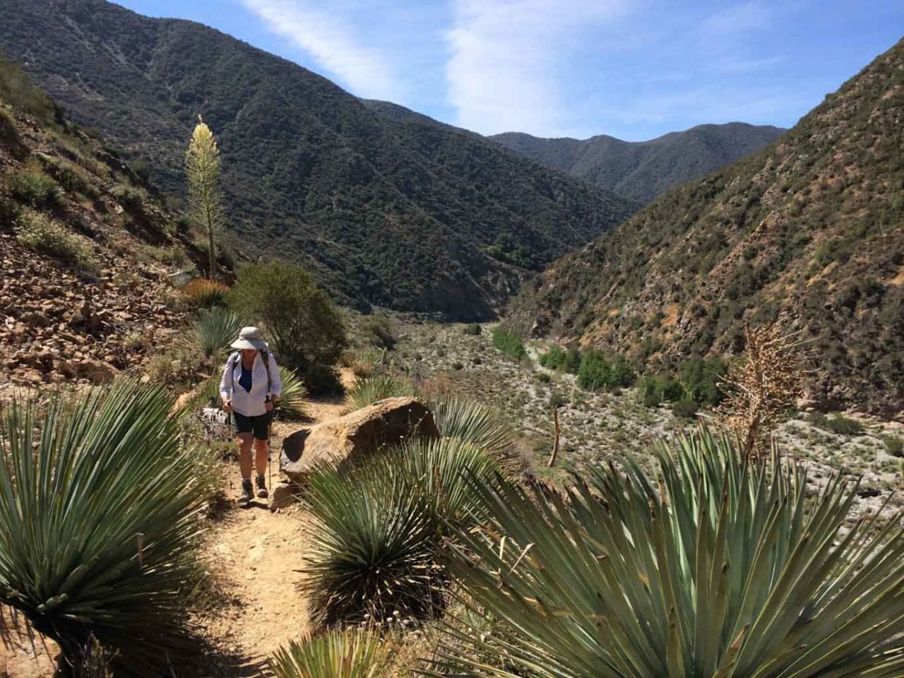
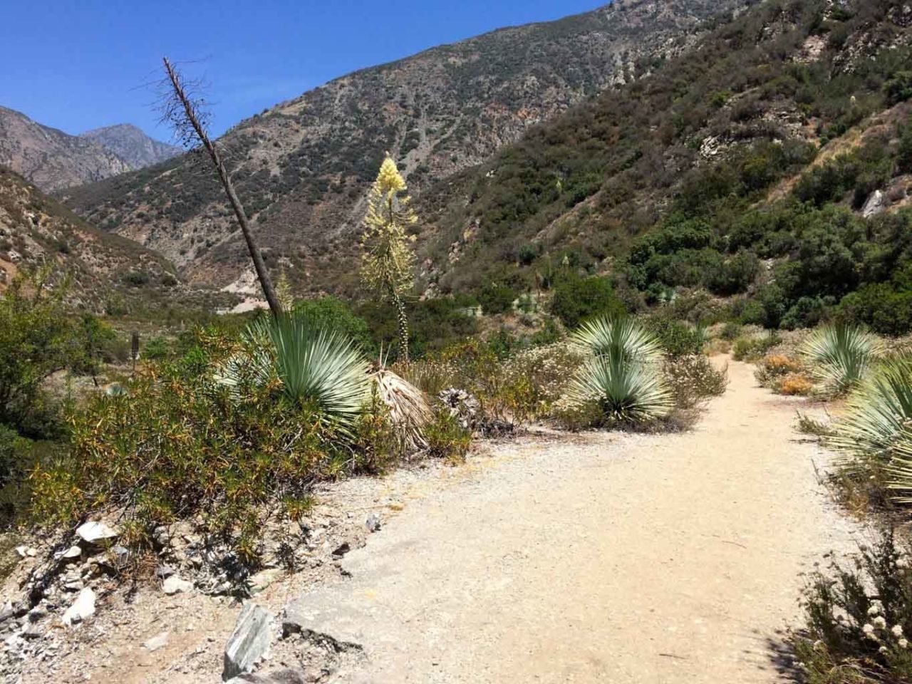
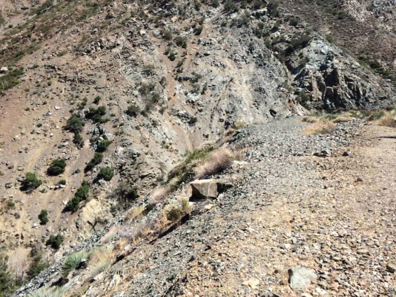
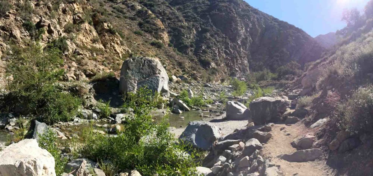
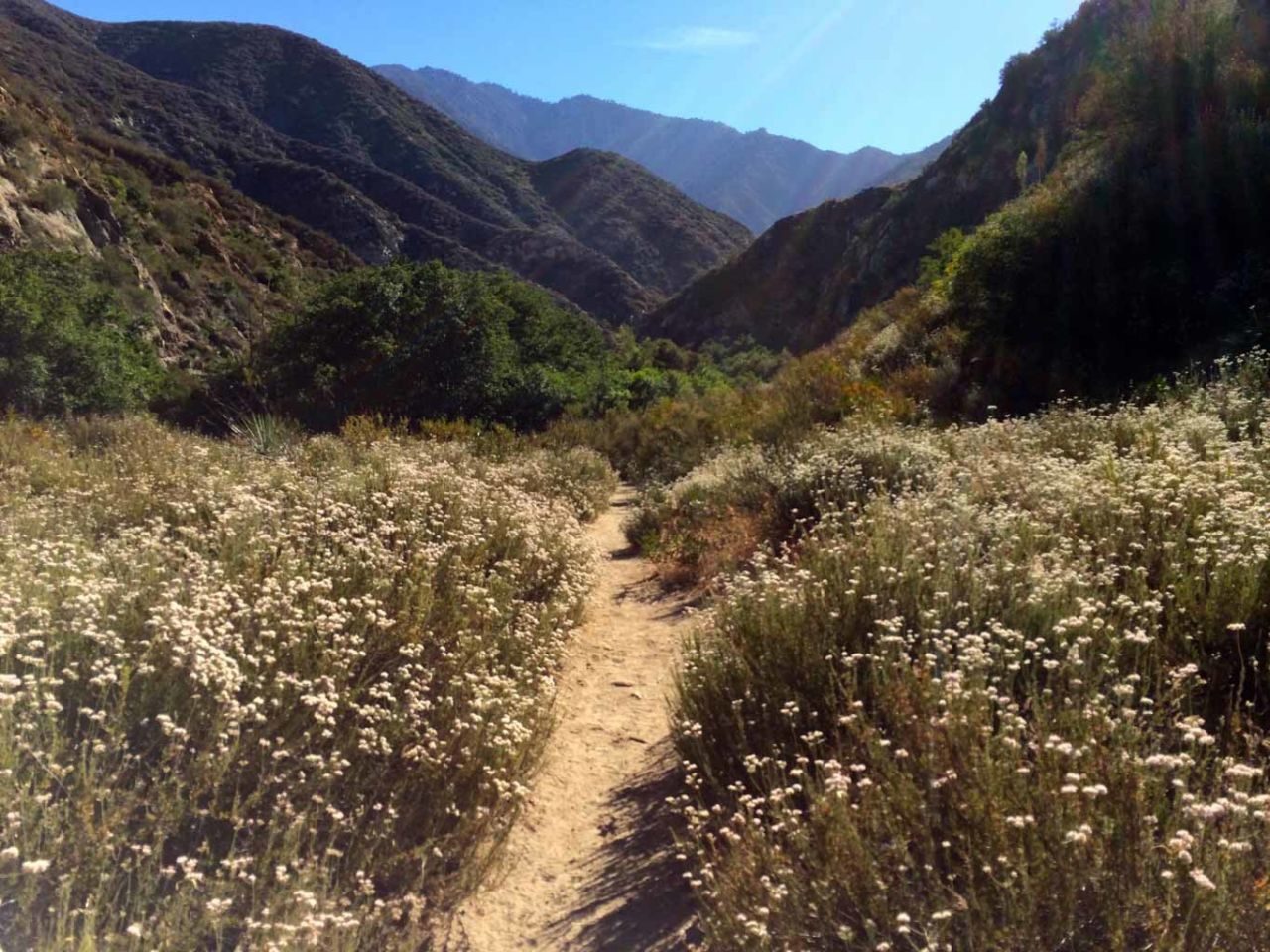
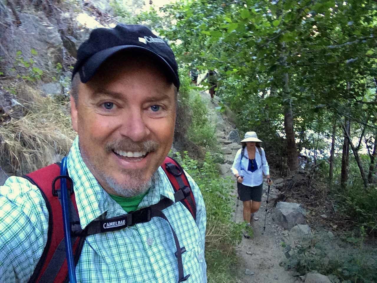
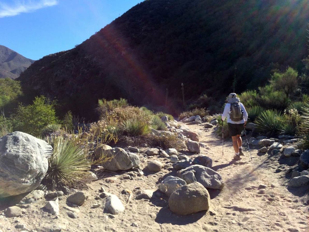
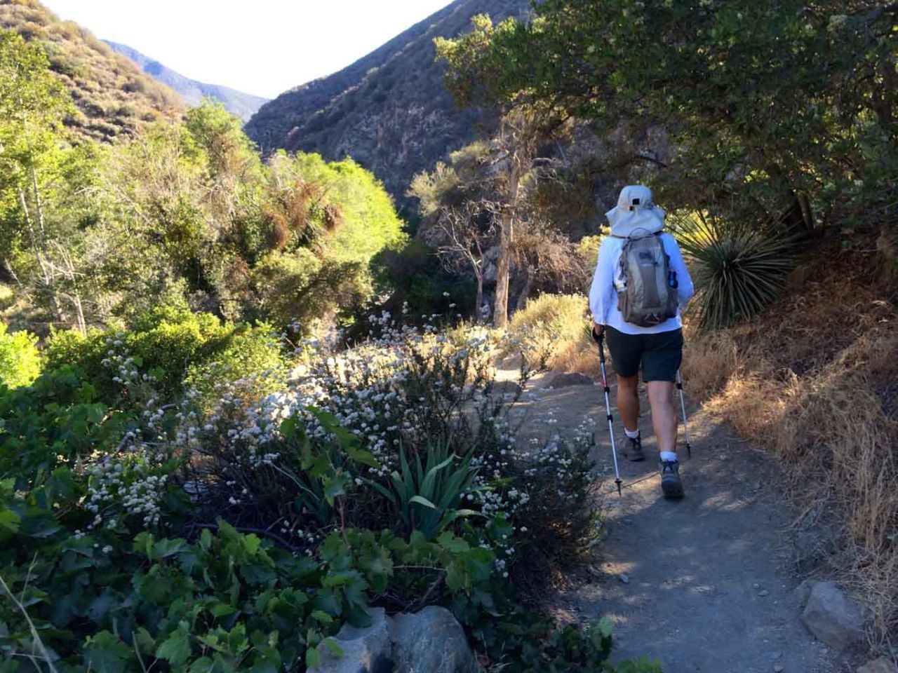
The trail is clearly marked. You start out heading north up the canyon on a gravel road that hugs the east side of the canyon, parallel to the river. In the early morning, the mountains provide shade from the sun — a welcome relief on hot days, as most of this trail has full exposure.


At 0.5 miles you’ll reach the Heaton Flat Campground. I would probably never camp here personally — too much of a zoo.

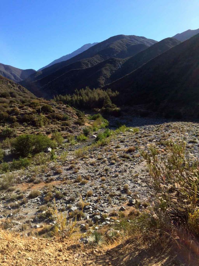
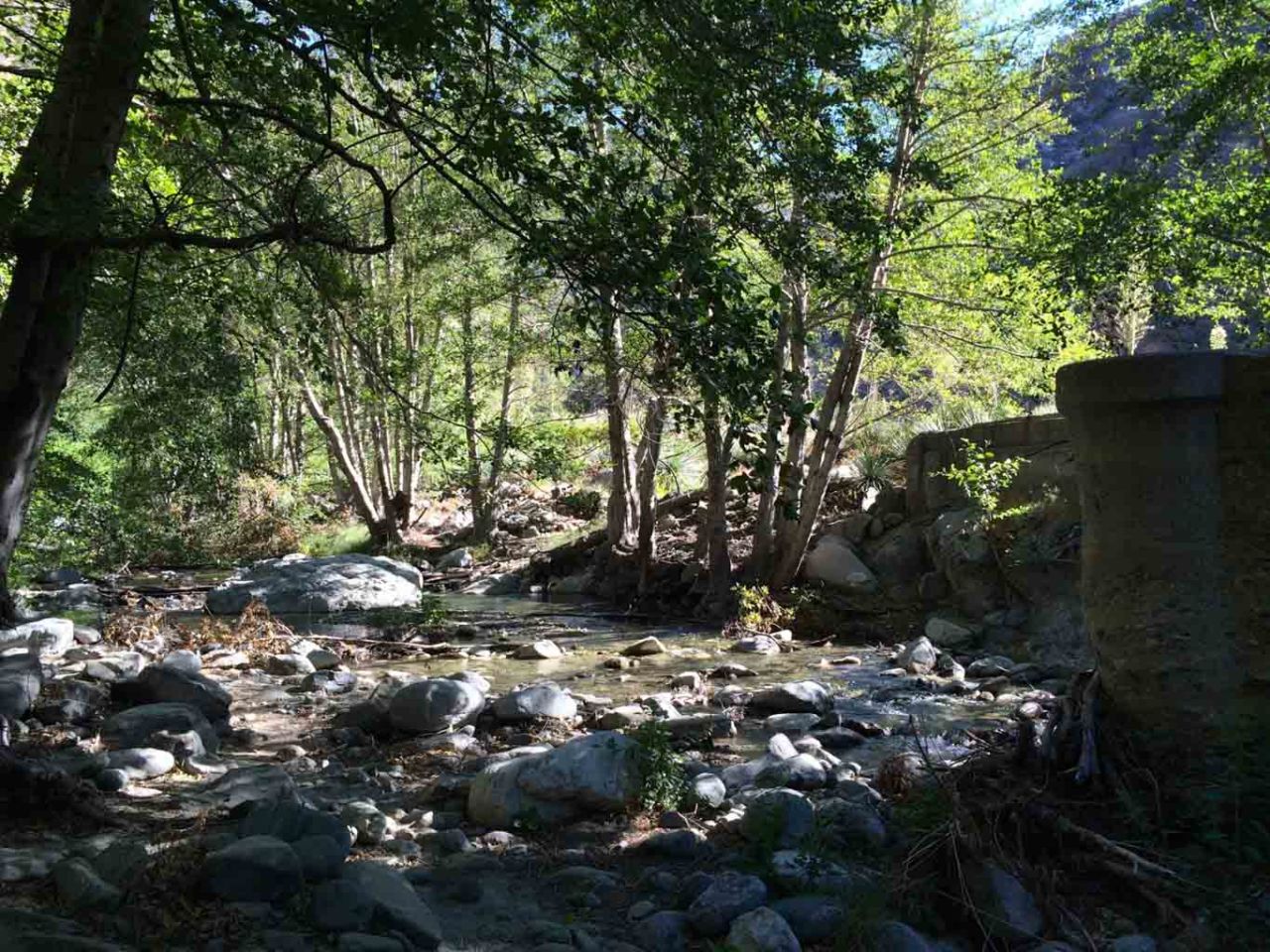
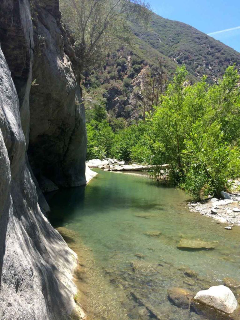
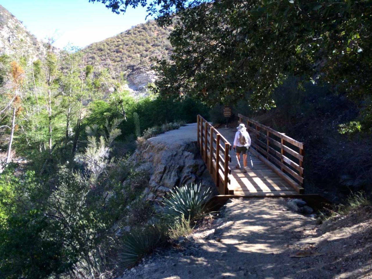
The trail crosses the river several times along the route, and each time you’ll be shaded by alder trees. It’s quite beautiful.

Shady Crossing

As you continue along the river trail, notice that at times there are traces of the road that once wound through the canyon. This is the very road that once cross the bridge. Mother Nature has done her darnedest to erase all evidence of the road, but look closely and you’ll see a patch of asphalt here and there.

Warming Up

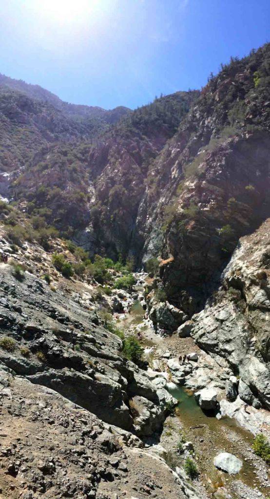
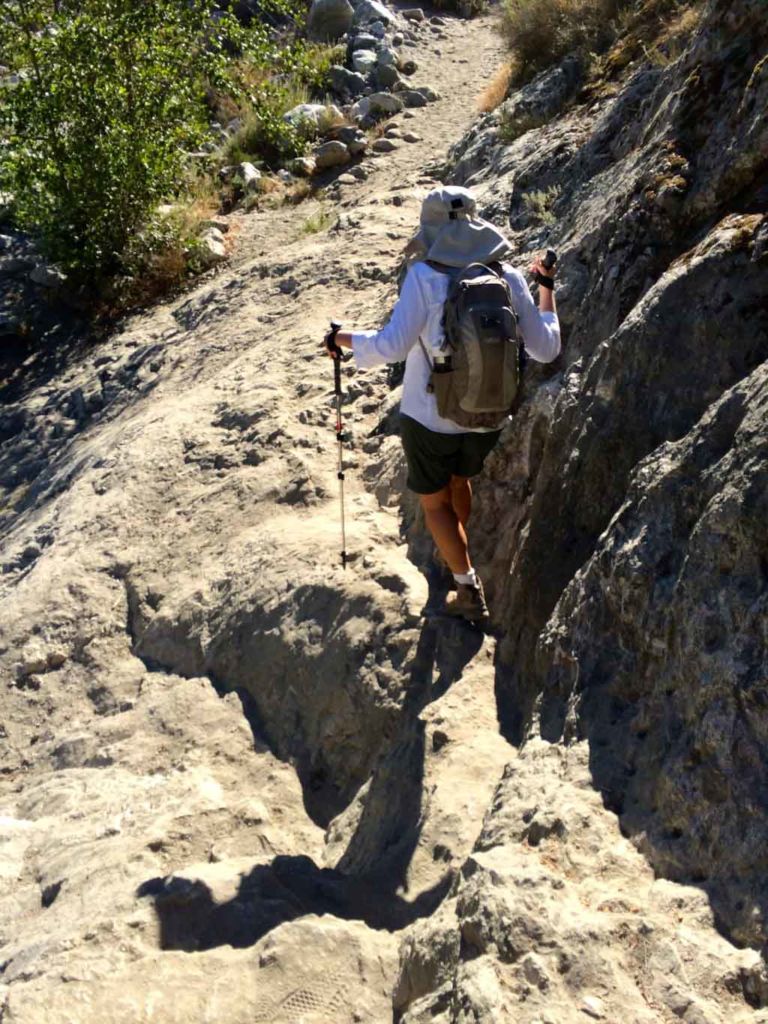
At about 3.5 miles, you scramble up the side of the canyon to a ledge with remnants of the old road. Watch closely to your right and you might see little spur creek feeding the river. If you’re feeling adventurous, you can scramble up this creek to a hidden waterfall that few ever see.

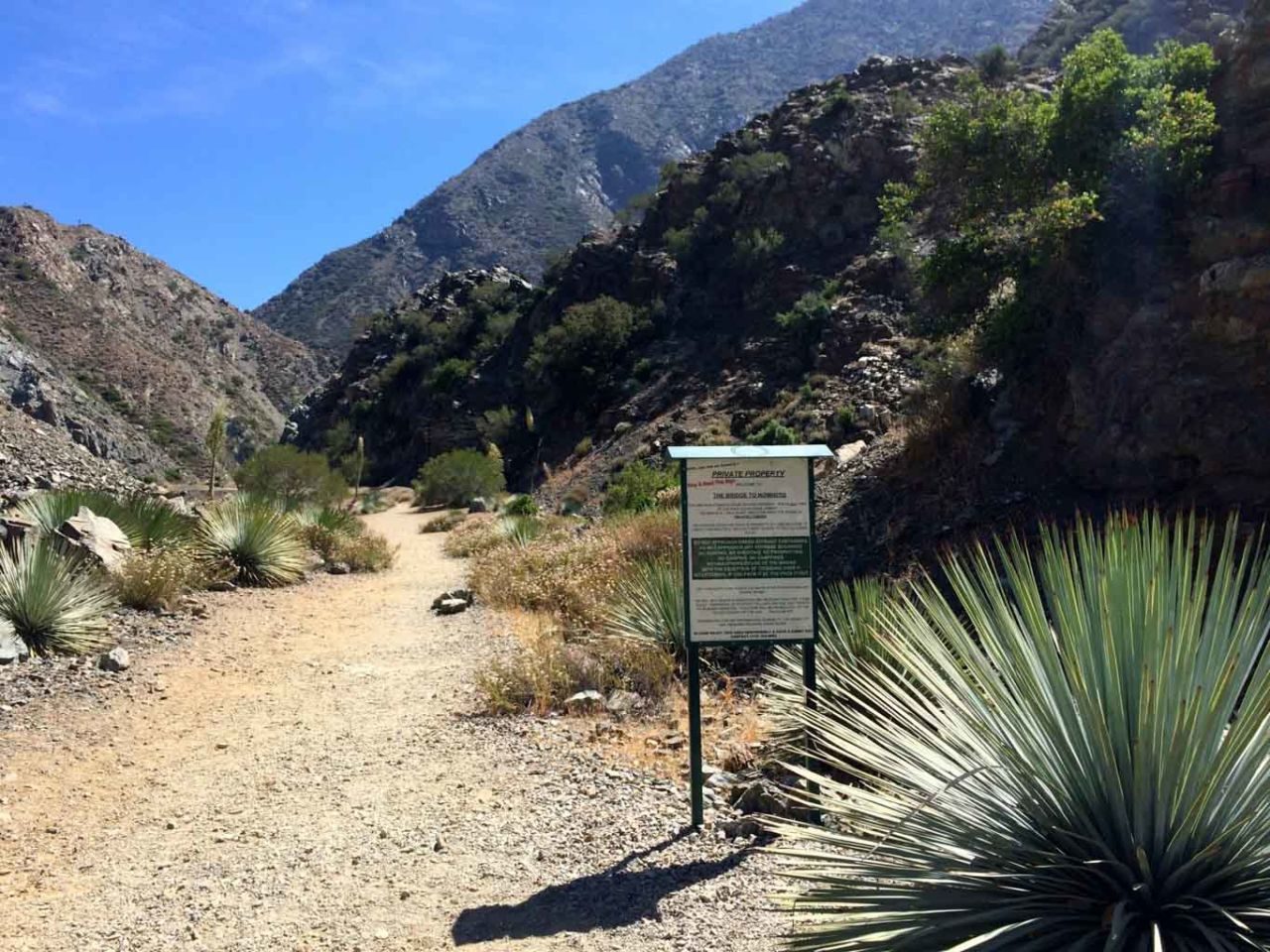
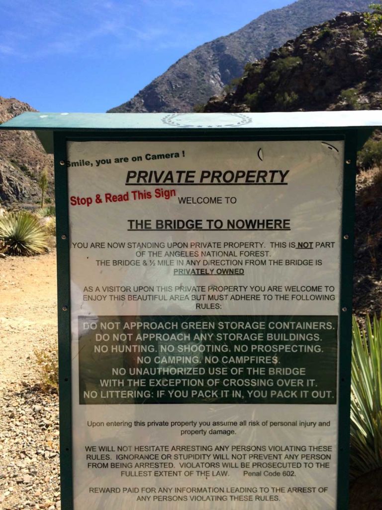
Soon you come to a sign with a long list of rules and a stern warning that you entering private property. Yes, the Bridge to Nowhere is on land leased to a company that runs bungee jumps off the bridge. For a fee, you too can wait in line and jump off a bridge.

Entering private property?

As we approached the bridge, we spied several big horn sheep making their way down the canyon wall on the opposite side of the river — quite appropriate sense we were in the Sheep Mountain Wilderness.

The Bridge to Nowhere

The Bridge to Nowhere is a beautiful structure oddly out-of-place. As it’s name suggests, it really is a bridge without a road, in the middle of nowhere. The bungee jumping crowds can be big on the weekends in warm weather. We threaded our way through the crowd to the opposite side of the bridge, then picked a route down to the river.

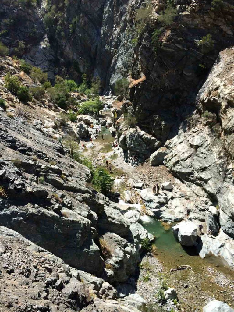
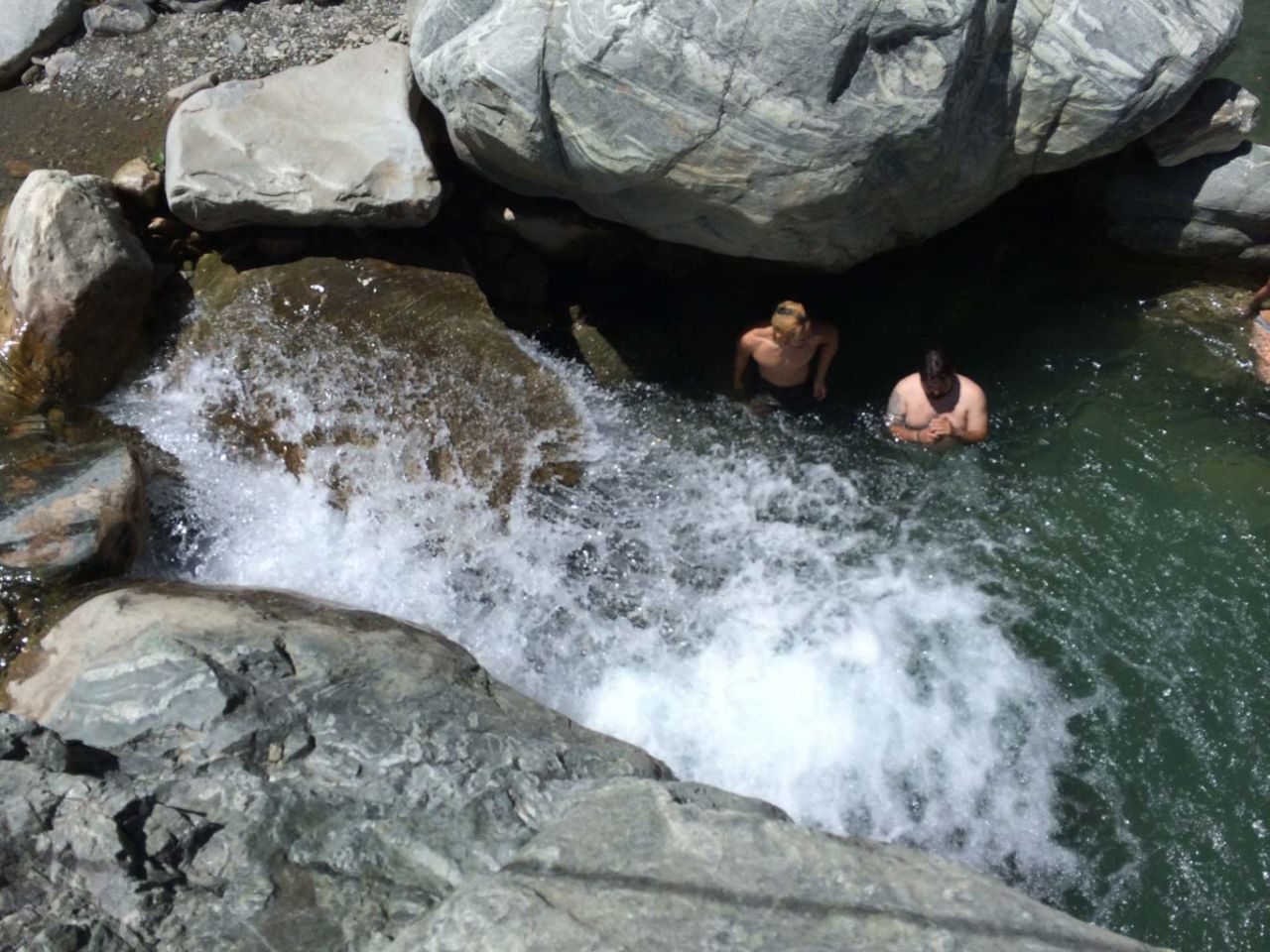
The area just beyond and below the ridge is the beginning of The Narrows. There are lots of pools, waterfalls, shady Alder trees and boulders to hop across or stretch out on. This is the perfect spot to kick off your boots, eat your lunch and take a refreshing dip in the surprisingly cool water.

IMG_4825


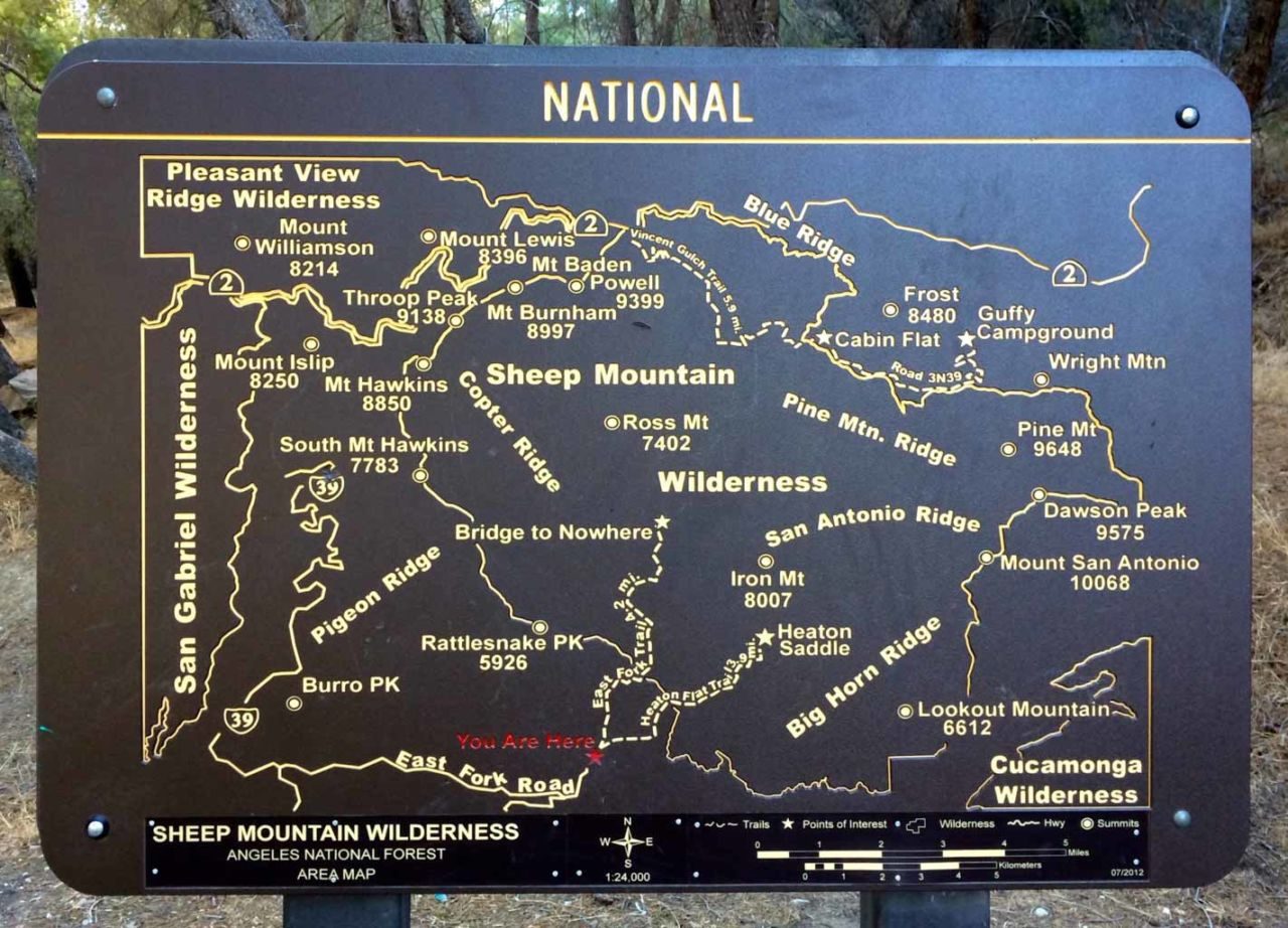
Bridge to Nowhere Trail Map

© OpenStreetMap contributors
Download file: bridge-to-nowhere.gpx

Photo Gallery

Click on any photo to view a larger version. You can also leave comments on any photo.


Entering private property?


Bridge To Nowhere Tips

  • An Adventure Pass used to be required here, but that has since been change. If in doubt, check with the Ranger Station.
  • Bring plenty of water, or a means of purifying or filtering water from the river.
  • When water is high, wear hiking shoes that are not waterproof, and just wear them through the water. The stones in the river are slippery. Going barefoot or even in sandals is not advised.
  • Trekking poles are very useful, particularly for the water crossings.

More Bridge to Nowhere Resources

  • Huell Howser’s video history on The Bridge to Nowhere
  • Afoot & Afield Los Angeles County – Wilderness Press

Originally hiked on June 21, 2014.

Filed Under: Trail Guides Tagged With: 11+ miles, dog-friendly, National Forest, strenuous, waterfall

Like what you found here at SoCal Hiker? This site is a labor of love. Share your support for the site and help us development of new trail guides and expanded coverage -- make your next outdoor equipment purchase through our advertisers.

You can also subscribe to our weekly newsletter and follow us on Facebook or Twitter.

Jeff H

About Jeff H

I'm an avid hiker and backpacker. My wife Joan and I are on the trails every weekend. I started SoCal Hiker to share my passion for outdoor adventure.

Comments

  1. Nick Baranov says

    January 5, 2015 at 2:34 pm

    excited to see this trail this weekend!

    Reply
  2. rudy says

    February 16, 2015 at 8:45 pm

    I really want to hike again I cannot alone this is a first for me looking on the internet

    Reply
  3. John says

    October 2, 2016 at 7:18 pm

    Is it runable?

    Reply
    • TRS says

      December 22, 2020 at 8:37 am

      I’s be curious to know this too.

      Reply
      • Jeff HJeff Hester says

        December 22, 2020 at 9:11 am

        Yes, most of it though there are rocky sections where you’ll need to tread carefully.

        Reply
  4. Bethany says

    April 10, 2017 at 12:10 pm

    We love the hike to the Bridge to Nowhere, when the weather is nice of course 🙂 And we love this website for all the amazing info! https://www.youtube.com/watch?v=zA1Bykadfug&t=1s

    Reply
  5. Derek says

    May 4, 2017 at 9:29 pm

    I went on the bridge to nowhere hike today but don’t know what you mean about the waterfall at 3.5 miles. I never saw a creek feeding the river from the left. I only saw creek from the right. How big is this waterfall your talking about?

    Reply
    • Jeff HJeff Hester says

      May 4, 2017 at 10:10 pm

      Depends on which direction you’re facing, Derek. 🙂

      Seriously though, you ARE correct… assuming you’re still headed toward the bridge, the creek is on your right. I’ve updated the post accordingly. I have purposely left details on finding the waterfall out of this guide because some places should remain hidden.

      Reply
  6. Courtney says

    May 20, 2017 at 11:00 am

    Is the water still abundant? Thinking if doing this hike next week.

    Reply
  7. Jason Robins says

    August 3, 2017 at 10:59 am

    Warning!! This Trail needs help! I have been hiking this trail for years but in several places it has become Dangerous. On Friday July 21st 2018, I was hit by rock fall out of nowhere at about 2 or 2,5 miles in. I was backpacking the main trail. My goal was a two night trip. One of the rocks hit me in the ankle, there was blood everywhere. The rock also broke my Tibia in my left leg. Thanks to the kindness of strangers and a really well stocked medical kit I did not bleed to death and was able to make it out. Maybe there is nothing that can be done and this was just a freak accident. But I believe it could happen again with no warning. I believe the trail needs some help in several places to make it safer.

    Reply
    • Jeff HJeff Hester says

      August 3, 2017 at 4:21 pm

      Jason, so sorry to hear about your accident!

      All trails carry with them risks; some more than others. Hiking in the wilderness there are many dangers, and rockfall is just one of many. It’s not possible to remove all risks. That said, it sounds like you were well prepared with first aid — one of the 10 essentials that everyone should carry!

      Reply
  8. Pure Nitro NO2 Review says

    August 4, 2017 at 12:44 pm

    Have you ever considered publishing an ebook or guest authoring on other blogs?
    I have a blog centered on the same ideas you discuss and
    would love to have you share some stories/information. I know my audience
    would value your work. If you’re even remotely interested,
    feel free to send me an e-mail.

    Reply
  9. SANDRO says

    January 2, 2018 at 9:11 am

    Elevation gain on this trail is under 800 feet, not over 2100 feet noted above…

    Reply
  10. Yo Romo says

    February 2, 2018 at 12:00 pm

    Is this hike 11 miles round trip?

    Reply
  11. LC says

    February 7, 2018 at 4:08 am

    How much hiking is actually happening here? I grew up in the Canadian wilderness and I’m dying for a dog-friendly difficult trail not crowded with tons of people. I keep finding cute little paved trails with tons of LA-ites in $100 yoga pants. I need a recommendation that’ll involve some rockclimbing, bouldering, and possibly use of tennis shoes for once!

    Reply
  12. Jesse St Louis says

    February 27, 2018 at 5:55 pm

    Did you know about the hidden waterfalls near The Bridge to Nowhere? Allison Gulch Falls and Devil Gulch Falls. I recently hiked out there to check them out.
    https://youtu.be/dLwlTbVCPUo

    Reply
  13. Craig Streiff says

    June 3, 2018 at 9:41 pm

    Anyone Hiked this recently, Just wondering what the water flow level is currently?

    Craig

    Reply
  14. Anthony S. says

    June 11, 2018 at 12:24 pm

    We hiked to the bridge yesterday. In my experience, the hike can range from 11 to 12.5 miles (5.5 in, 5.5 out) depending upon your exploration. The trail is busy, in a sense, but not as overwhelming as Echo Mountain or your favorite mall. The water levels were deep enough to jump into multiple pools from the surrounding boulders. We did not bungee like many other people did.

    It’s my opinion, the Bridge to Nowhere trail should be trekked with caution as the trail does not seem to be maintained with runners in mind.

    Water note: Take between 2-3 liters of water per person. The air to become very dry on the way out.

    Reply
  15. Momo says

    April 8, 2019 at 11:31 am

    Did this trail over the weekend and the water is 30″ at several crossing points. There are sometimes ropes strung across to help, but because the trail isn’t well defined at times, it’s easy to miss the ropes because you can make it without crossing the river as many times. We ending up taking a different way back and missed some of crossings we did on our way to the bridge.

    We also ending up rock climbing at one point up (“oh there’s a rope, guess we should follow it up”) and then went higher up to an old utility pole, before scrambling down a bit and across a precarious ledge to another rope (2 ropes tied together, so maybe 25ft? 30ft?) to take us down into the basin. If you don’t want to do that, I suggest crossing the river twice (there is a rope for the 2nd crossing).

    Lots of people. People were piggybacking their kids and carrying their dogs across the river. Last mile or so is in full sun so make sure you have water for that!

    Reply
  16. Valerie says

    November 18, 2019 at 9:51 am

    We are going this Saturday to do this hike…can I do it in a pair of Asics and waterproof socks? how high do you think the water is since its been dry for a really long time…And there must be a box to pay for parking…I didn’t see any info on where to buy a day pass 🙁 Appreciate your website!!

    Reply
    • Jeffrey HJeffrey Hester says

      November 23, 2019 at 10:50 am

      Valerie, I would totally do this in a pair of breathable trail runners. You can power right through the water if you need to, and they’ll dry pretty quickly.

      Reply
  17. Tessa Bollmann says

    July 1, 2020 at 4:05 pm

    I heard you need a permit to hike this. Is this true and if so, does everyone in your party need one and do you know where I can obtain one? I am not looking for a year pass. Just a day pass.

    Reply
    • Chip Terracina says

      July 14, 2020 at 10:30 am

      You’ll want to buy a 1-day Adventure Pass. It’s essentially a parking pass that you display in your car and not a hiking permit, so it’s good for whoever rides with you. The cost is $5 and you can buy them at Big 5. All the Big 5 stores near me were out of stock, so I went to REI to get mine. REI also sells them online for $5 plus shipping, which is a great option if you have the luxury of time to wait.

      Reply
    • Momo says

      July 19, 2020 at 1:11 pm

      You can also get the pass at some 7-11s. You can check the fs.usda.gov site for store locations. REI Arcadia has been out for a while.

      Reply
  18. satta matka says

    June 16, 2021 at 12:33 am

    Your blog website provided us with useful information to execute with. Each & every recommendations of your website are awesome. Thanks a lot for talking about.

    Reply

Leave a Reply Cancel reply

Your email address will not be published. Required fields are marked *

This site uses Akismet to reduce spam. Learn how your comment data is processed.

About SoCal Hiker

Jeff on Mount Rainier

I created SoCal Hiker while preparing to thru-hike the John Muir Trail. My goal? Create guides for the best hiking and backpacking trails with enough detail to make it an enjoyable experience for you. And while I started with trails in Southern California, I’ve expanded across the west. We hike each trail to create these guides, sharing practical advice on gear and outdoor skills. Read more…

Connect with SoCal Hiker

  • 22,754 Fans
  • 11,948 Followers
  • 21,640 Followers
  • 1,716 Followers
  • 5,279 Subscribers
  • 338 Subscribers
SoCalHiker was selected one of USA TODAY's 10 Best Hiking and Outdoor Blogs
Get our day-by-day guide to thru-hiking the John Muir Trail
Get up-to-day wildfire status throughout California

Products

  • Mount Wilson T-Shirt $23.00 – $27.00
  • Cucamonga Peak Benchmark Cucamonga Peak Benchmark $39.95
  • Mt Shasta Benchmark Mount Shasta Benchmark $39.95
  • San Gorgonio Benchmark San Gorgonio Benchmark $39.95

Sponsors

Sponsor SoCalHiker and see your banner here

Featured Posts

Hiking Belknap Crater in the Mountain Washington Wilderness

Hiking this out-and-back route up Belknap Crater you'll traverse an other-worldly … [Read More...]

Hiking to the Simpson Reef Overlook on the Oregon Coast Trail

The Oregon Coast is rugged, beautiful and often uncrowded. This bluff-top … [Read More...]

Join Team SoCalHiker at the Climb for Heroes

Team SoCalHiker is climbing Mount Baldy again as part of the annual Climb for Heroes … [Read More...]

Lastest Comments

  • Greg on Rae Lakes Loop via Kearsarge Pass
  • Tim Wilson on Rae Lakes Loop via Kearsarge Pass
  • Pam Selthun on Backpacking the Wonderland Trail
  • Calico Maps on Hiking Monserate Mountain
  • Deborah Aguanno on Mt. Wilson via Chantry Flats
Get your SoCalHiker stickers now

Get your SoCalHiker stickers!

Latest Posts

  • Hiking Belknap Crater in the Mountain Washington Wilderness October 20, 2022
  • Hiking to the Simpson Reef Overlook on the Oregon Coast Trail August 25, 2022
  • Join Team SoCalHiker at the Climb for Heroes August 23, 2022
  • Hiking the Welch-Dickey Loop in the White Mountain National Forest August 18, 2022
  • Hiking Turtlehead Peak from Red Rock Canyon National Conservation Area July 15, 2022

Recent Forum Topics

  • How to deal with accidents while hiking in the winter?
  • Warm Tips for your hiking in winter
  • Some tips for hiking.
  • Keep your body warm in the winter hiking
  • The benefits of hiking, more than you can imagine!

The Six-Pack of Peaks Challenge Series

Six-Pack of Peaks Challenge SeriesThe Six-Pack of Peaks Challenge Series gives you an opportunity to explore your world while supporting a great cause. There are eleven challenges around the country. Hike or run them at your own schedule.

Flex your adventure muscles!

Learn more here.


Search

Tags

3-6 miles 6-8 miles 8-10 miles 11+ miles Arizona Backpacking coastal dog-friendly easy family-friendly High Sierra Trail hiking Hiking The John Muir Trail hipster inspiration JMT John Muir John Muir Trail Kings Canyon National Park LA County moderate Mount Rainier National Park Muir Monday National Park Orange County Oregon out of bounds Pacific Crest Trail peak peakbagging quote scenic Sequoia National Park Sierra Nevada Six-Pack of Peaks State Park strenuous Thru-hiking Utah vista Washington waterfall wilderness Wonderland Trail Yosemite

Copyright © 2023 SoCalHiker.net · Metro Theme on Genesis Framework with WPEngine Hosting · Contact SoCal Hiker · Sitemap · Privacy Policy


Loading Comments...