• COVID-19 Park and Trail Closures
  • Learn about the Six-Pack of Peaks Challenge
  • Shop
  •  

SoCal Hiker

  • Find a Hiking Trail
    • All Areas
    • Arizona
    • Colorado
    • Los Angeles
    • Orange County
    • Oregon
    • San Francisco Bay
    • Washington
  • Trail Guides
  • Six-Pack of Peaks
    • Colorado Six-Pack of Peaks
      • Bergen Peak
      • Rocky Mountain
      • Birthday Peak
      • Horseshoe Mountain
      • Grays Peak
    • New England Six-Pack of Peaks
    • NorCal Six-Pack of Peaks
      • Mount Umunhum
      • Mount Saint Helena
      • Mount Tamalpais
      • Mount Diablo
      • Mount Sizer
      • Rose Peak
    • Oregon Six-Pack of Peaks
      • Tumalo Mountain
      • Black Butte
      • Black Crater
      • Maiden Peak
      • Mount Bachelor
      • South Sister
    • SoCal Six-Pack of Peaks
      • Mt. Wilson
      • Cucamonga Peak
      • Mt. San Antonio (Mt Baldy)
      • San Bernardino Peak
      • San Jacinto Peak
      • San Gorgonio
  • Backpacking
    • High Sierra Trail
    • John Muir Trail
      • Overview of the John Muir Trail
      • Training
      • Day-by-Day Itinerary
      • Resupply Addresses
      • JMT Discussion Forum
    • Lost Coast Trail
    • North/South Lake Loop
    • Rae Lakes Loop
    • Red Peak Pass Loop
    • Theodore Solomons Trail
    • Trans-Catalina Trail
    • Wonderland Trail
  • Gear
  • Forums
    • Latest Topics
    • Ask a Question
    • Campfire
    • Trails
    • Trail Reports
    • Gear Wisdom
    • Classifieds
  • Login

Hike Los Liones Canyon to Parker Mesa Overlook

August 12, 2016 By Jeff Hester 4 Comments

Hiking Los Leones Canyon Trail to Parker Mesa Overlook

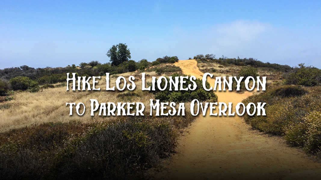
Los Liones Canyon winds it’s way through brush that at times spills over the trail, creating a tunnel. It climbs, and climbs… and climbs (you’ll really feel it on a hot sunny day), finally reaching the epic coastal views of Parker Mesa Overlook. This is a great seven mile out-and-back hike with decent vertical gain that makes a great training hike. It begins with winding single track but quickly joins wide, double-track fire roads with plenty of sunlight.

Trail Details
Distance: 7.3 miles
Time: 2-3 hours
Difficulty: Moderate
Elevation gain: 1,580 ft
Dogs: No
When to go: Year-round
GPX File
The trail is part of Topanga State Park and connects to a number of other trails. Signs clearly mark the junctions and the mileage, making it an easy path to follow. And being an out-and-back route, you can choose to shorten the hike, stopping whenever is best for you and retracing your steps. Benches at the Parker Mesa Overlook make the perfect place for a lunch or snack while you soak in the views of the California coastline and rest your legs for the mostly-downhill hike back.

Getting to the Trailhead

The trailhead begins at the end of Los Liones Drive in Pacific Palisades. Your best bet is to get driving directions via Google Maps. There are a couple of small parking lots, or you can park along the street. Be sure to check the signs so you don’t end up with a parking ticket. This trailhead can get quite busy, so you may need to park further down Los Liones. You can either walk along the side of the street or take the dirt trail that runs parallel on the east side of the street.

Starting the Los Leones Canyon Trail

Most signs even within Topanga State Park describe this as Los Liones Canyon, except for this sign at the trailhead.

The Trail

For the first mile, the trail winds back and forth through the canyon with dense brush on either side. In the spring, this trail can be lush with green and wildflowers, but much of the year it’s pretty dry.

Trail in Liones Canyon
Brush creating a tunnel over the Los Leones Trail

At about a mile in, you’ll reach a vista point and junction with the Paseo Miramar Trail. Take a hard left, following the wide fire road up the hill.

Heading up the fire road

The dirt road provides a broad and fairly consistent surface, but very little shade. At about 2.3 miles you reach a crest and descend slightly, following rolling hills dotted with a few old oak trees and a surprise meadow.

Distinctive spikes of agave blossoms
Some shade over the crest of Los Liones
Panorama from the Los Leones Trail

The trail rolls up and down, reaching the junction to Parker Mesa Overlook at the 3 mile mark.

Junction to Parker Mesa Overlook

Here you’ll turn toward the coast, and follow the ridge all the way out to the overlook half a mile away.

The Parker Mesa Overlook has several benches strategically placed to give you a chance to rest your feet, eat a snack and soak in the amazing views up and down the coast.

Benches at Parker Mesa Overlook

Time it right, and you can enjoy the sunset and watch the city light up as night falls.

Santa Monica lights up at night

Photo: Patrik Bangle

When you’re ready, turn around and retrace your steps three miles back to the trailhead.

Los Liones to Parker Mesa Trail Map

© OpenStreetMap contributors
Download

Photo Gallery

Click on any photo to view a larger version. You can also leave comments on any photo.

Trail in Liones Canyon
Brush creating a tunnel over the Los Leones Trail
Heading up the fire road
Panorama from the Los Leones Trail
Distinctive spikes of agave blossoms
Some shade over the crest of Los Liones
Junction to Parker Mesa Overlook
Trail to Parker Mesa Overlook
Benches at Parker Mesa Overlook
Yoda approves of the Pacfic Ocean views
Wildflowers at Parker Mesa Overlook

Tips for Hiking Los Liones Canyon

First of all, you should note that some of the signs spell the canyon Los Leones, though most of them use Los Liones. Don’t be confused. They are one and the same.

  • Even though this is a day hike, you should have the 10 essentials, especially sun protection and water. This trail has a lot of exposure and can get hot on a sunny day.
  • Sorry Fido. No dogs are allowed, even on leash.
  • Ticks are found in this area. Try to avoid brush, consider wearing long pants and check for ticks after your hike.
  • Mountain lions live in these mountains. Although encounters are rare, should you run across one, raise your hands over your head to appear bigger and make a lot of noise. It’s also a great idea to hike with friends that you can outrun.
  • As an out-and-back hike, you can modify this hike to make it shorter with less vertical gain.

More Los Liones Canyon Resources

  • Shoestring Adventures regularly schedules mid-week, after-work hikes on this trail. They don’t go all the way to Parker Mesa Overlook, but they often have tacos! Check out their calendar on Meetup.
  • You can also hike to Parker Mesa Overlook from Trippet Ranch.
  • GPS user? Download the GPX track for this hike.

Los Liones Canyon Weather Forecast

The location could not be found.

All photos Jeff Hester, June 2015 unless noted otherwise.

Related

Filed Under: Trail Guides Tagged With: 6-8 miles, coastal, LA County, moderate, State Park, sunset, Topanga State Park, vista

Like what you found here at SoCal Hiker? This site is a labor of love. Share your support for the site and help us development of new trail guides and expanded coverage -- make your next outdoor equipment purchase through our advertisers.

You can also subscribe to our weekly newsletter and follow us on Facebook or Twitter.

Jeff H

About Jeff Hester

I'm an avid hiker and backpacker. My wife Joan and I are on the trails every weekend. I started SoCal Hiker to share my passion for outdoor adventure.

Comments

  1. Nodogallows says

    September 18, 2016 at 4:50 am

    Trail Details above say
    Dogs: Yes

    Reply
    • Jeffrey HAdmin Istrator says

      September 18, 2016 at 2:07 pm

      Thanks for the catch! We’ve updated the details to correctly state that dogs are NOT allowed.

      Reply
  2. HS says

    January 14, 2020 at 5:57 pm

    This comment is not about the trail. The trail was beautiful and wonderful. However, I have reasons to believe someone went into my car and stole my credit and debit cards. My car has the capability to auto lock itself when I step away, but I found my car to be unlocked after hiking the trail and my cards were missing from my car. Please do not make the same mistake I did and do not leave valuables in the car. I do not know how they were able to unlock my car and I am in shock that it happened in broad daylight. Also, they tried using my card at Bloomingdales in Santa Monica which is about 5 miles from the trailhead parking lot. Please be careful out there!

    Reply
    • Jeffrey HJeffrey Hester says

      January 23, 2020 at 8:45 am

      It’s becoming a recurring problem at trailheads everywhere. Not sure what the solution is, except maybe cameras everywhere.

      Reply

Leave a Reply Cancel reply

Your email address will not be published. Required fields are marked *

This site uses Akismet to reduce spam. Learn how your comment data is processed.

About Jeff Hester

I created SoCal Hiker while preparing to thru-hike the John Muir Trail. My goal? Create guides for the best hiking trails throughout Southern California--and occasionally beyond. I personally hike each trail to create these guides, sharing practical advice on gear and outdoor skills. Read more...

Connect with SoCal Hiker

  • 22,238 Fans
  • 11,781 Followers
  • 21,640 Followers
  • 1,685 Followers
  • 5,467 Subscribers
  • 331 Subscribers

Get the SoCal Hiker Newsletter

Sign up to get your weekly trail recommendation and the latest updates from SoCal Hiker.

SoCalHiker was selected one of USA TODAY's 10 Best Hiking and Outdoor Blogs
Get our day-by-day guide to thru-hiking the John Muir Trail
Get up-to-day wildfire status throughout California

Products

  • Mount San Jacinto T-Shirt $23.00 – $25.00
  • Half Dome replica benchmark Half Dome Benchmark $39.95
  • Mt Wilson Mug Mt Wilson Mug $15.95
  • Poster - One touch of nature makes the whole world kin. - John Muir One Touch of Nature Poster $13.00 – $16.00

Sponsors

Sponsor SoCalHiker and see your banner here

Featured Posts

Hiking Black Mountain in Rancho San Antonio County Park

At 2,812 feet, Black Mountain looms large, way up, and behind, the smaller hills to … [Read More...]

Hiking Camelback Mountain via the Echo Canyon Trail

Camelback Mountain is the most popular mountain to hike in the Phoenix area for good … [Read More...]

Hiking to High Point on Palomar Mountain in the Cleveland National Forest

Appropriately named High Point is the highest peak in the Palomar Ranger District of … [Read More...]

Lastest Comments

  • Oliver John on 10 Overnight Backpack Trips in Southern California
  • Gustavo on Social Distancing on Public Trails
  • katrien on Gear Review: BioLite Stove
  • Jacob on Vital Link Trail to Verdugo Peak
  • Greg on San Gabriel Peak, Mt Disappointment, Mt Deception, Mt Markham and Mt Lowe
Get your SoCalHiker stickers now

Get your SoCalHiker stickers!

Latest Posts

  • Hiking Black Mountain in Rancho San Antonio County Park January 31, 2021
  • Hiking Camelback Mountain via the Echo Canyon Trail December 9, 2020
  • Hiking to High Point on Palomar Mountain in the Cleveland National Forest December 4, 2020
  • Hiking Hot Springs Mountain on the Los Coyotes Reservation November 19, 2020
  • New Day Hiking Permit Requirements for Wilderness Areas in the San Bernardino National Forest August 31, 2020

Recent Forum Topics

  • 1st overnight backing trip
  • Recommendations for trips for me and my dog
  • log hikes
  • My Baldy
  • Cactus to Clouds v. Iron Mountain

The Six-Pack of Peaks Challenge Series

Six-Pack of Peaks Challenge SeriesThe Six-Pack of Peaks Challenge gives you an opportunity to explore your world while supporting a great cause.

Flex your adventure muscles!

Learn more here.


Search

Tags

3-6 miles 6-8 miles 8-10 miles 11+ miles Arizona Backpacking coastal dog-friendly easy family-friendly High Sierra Trail hiking Hiking The John Muir Trail hipster inspiration JMT John Muir John Muir Trail Kings Canyon National Park LA County moderate Mount Rainier National Park Muir Monday National Forest National Park Orange County Oregon out of bounds Pacific Crest Trail peak peakbagging quote scenic Sierra Nevada Six-Pack of Peaks State Park strenuous Thru-hiking Utah vista Washington waterfall wilderness Wonderland Trail Yosemite

Copyright © 2021 SoCalHiker.net · Metro Theme on Genesis Framework with WPEngine Hosting · Contact SoCal Hiker · Sitemap · Privacy Policy

Copyright © 2021 · Metro Pro Theme on Genesis Framework · WordPress · Log in