• Learn about the Six-Pack of Peaks Challenge
  •  

SoCal Hiker

  • Find a Hiking Trail
    • All Areas
    • Arizona
    • Colorado
    • Los Angeles
    • Orange County
    • Oregon
    • San Francisco Bay
    • Washington
  • Trail Guides
  • Six-Pack of Peaks
    • Colorado Six-Pack of Peaks
      • Bergen Peak
      • Rocky Mountain
      • Birthday Peak
      • Horseshoe Mountain
      • Grays Peak
    • New England Six-Pack of Peaks
    • NorCal Six-Pack of Peaks
      • Mount Umunhum
      • Mount Saint Helena
      • Mount Tamalpais
      • Mount Diablo
      • Mount Sizer
      • Rose Peak
    • Oregon Six-Pack of Peaks
      • Tumalo Mountain
      • Black Butte
      • Black Crater
      • Maiden Peak
      • Mount Bachelor
      • South Sister
    • SoCal Six-Pack of Peaks
      • Mt. Wilson
      • Cucamonga Peak
      • Mt. San Antonio (Mt Baldy)
      • San Bernardino Peak
      • San Jacinto Peak
      • San Gorgonio
  • Backpacking
    • High Sierra Trail
    • John Muir Trail
      • Overview of the John Muir Trail
      • Training
      • Day-by-Day Itinerary
      • Resupply Addresses
      • JMT Discussion Forum
    • Lost Coast Trail
    • North/South Lake Loop
    • Rae Lakes Loop
    • Red Peak Pass Loop
    • Theodore Solomons Trail
    • Trans-Catalina Trail
    • Wonderland Trail
  • Gear

Inspiration Point and Muir Peak

November 17, 2013 By Jeff H 6 Comments

WP GPX Maps Error: GPX file not found! /home/runcloud/webapps/app-socalhiker/wp-content/uploads/Inspiration-Point-and-Muir-Peak.gpx

LA from Muir Peak

img
Trail Details
Distance: 11 miles
Time: ~6 hours
Difficulty: Strenuous
Elevation gain: 2864 ft
Dogs: Yes
When to go: Year-round
Hiking to Muir Peak and Inspiration Point from the Cobb Estate in Altadena is challenging. The 11 mile trail climbs over 2800 feet, gives you a taste of LA history and some really great views. Even with a coastal haze, we spied Catalina Island poking up in the distance.

I hiked this with the Sierra Club as part of their introduction to the Wilderness Travel Course they hold each year beginning in January. I have several friends who have taken the WTC class, and I don’t know a single one who didn’t enjoy it and learn a good deal. If you’re interested in learning more about backpacking in the wilderness, the WTC is a great starting point.

Old image of the Mt. Lowe Railway

From an old poster advertising the Mt. Lowe Railway

The first 2-1/2 miles we hiked up the Sam Merrill Trail to Echo Mountain. It’s a great hike in it’s own right, and one I’ve covered earlier. We stopped at the shade near the power-lines (the half-way point to Echo Mountain) to regroup, then stopped again to regroup at the ruins of the Echo Mountain house.

There are interesting things to see here, and some great (albiet weathered) information signs explaining the background and history of Echo Mountain and the Mt. Lowe Railway. Over 100 years ago, a funicular carried wealthy tourists up the mountain to the hotel at this site, complete with fine dining, tennis, and even a bowling alley. From this site, a light railway traveled further still up the mountain to one of our primary destinations — Inspiration Point.

Take time to explore this area, refuel, rehydrate, and catch your breath.  You’ll need it for the next leg up Castle Canyon.

Echo Mountain Ruins

Ready to continue on, we retraced our steps to the Castle Canyon Trail, turning towards the mountain and heading to Inspiration Point.

Castle Canyon Trail Marker

The Castle Canyon Trail is one of several leading up to Inspiration Point. It’s the shortest and steepest route, but also has a good deal of shade — a worthy consideration on a warm day. As we made our way up Castle Canyon, we passed a small creek that actually had a small amount of running water.

Fall color in Castle Canyon

There were numerous agave, and then deep in the canyon sycamore and oaks, giving us a bit of fall color.

At the 3.6 mile mark, the trail begins the steepest climb up a series of switchbacks. We climbed over 900 feet in 3/4 of a mile. The trail rounds a bend, providing the first good look at the shade structure atop Inspiration Point (4714′).

Inspiration Point

We stopped here for lunch and soaked in the views. There are picnic tables, and viewports that help direct you to notable LA landmarks. Note the one for Inspiration Point. It seems someone had a sense of humor.

Find your favorite LA landmark

It’s interesting to note that this Inspiration Point is not a point at all — but a saddle. It is also one of five officially-named Inspiration Points in Los Angeles County!

View from Inspiration Point

After lunch, the more energetic group headed to Muir Peak. At 4,688′ Muir Peak is the highest point on the southeast end of what some people refer to as Inspiration Ridge. And as a matter of historical record, John Muir himself climbed the peak in 1877. The side trip to Muir Peak is a 1.2 mile round-trip from Inspiration Point and makes a great option. Compared with the climb up Castle Canyon to Inspiration Point, this short side-hike is a breeze.

To get to Muir Peak, head southeast on the fire road from Inspiration Point. After about 0.3 miles you’ll take a single track trail on the right that heads more steeply uphill. There’s only one place this trail goes — Muir Peak.

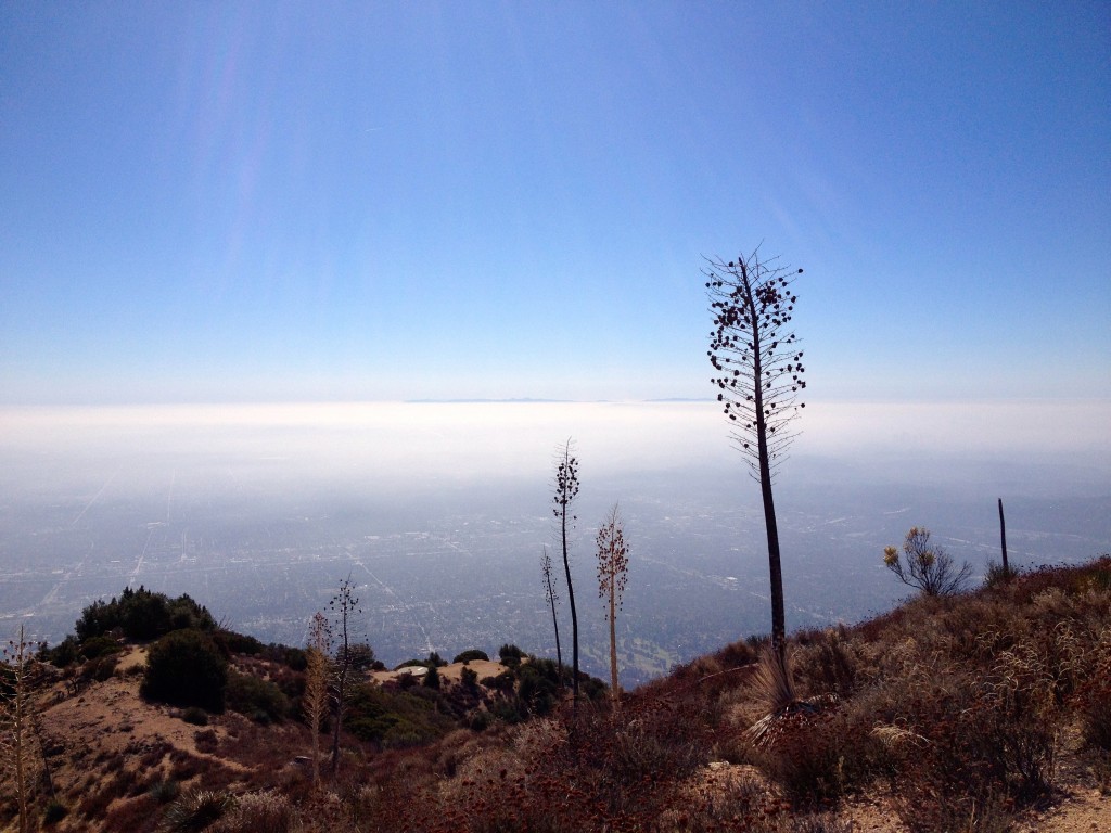
The summit is rounded, with a wooden marker and a small stone cairn but no summit register. But what views! Here’s the crew I hiked with at the summit. The opening image at the top of this post shows the view out to Catalina Island, but you also see Mt. Wilson, Mt. Lowe, Mt. San Gabriel and much of the San Gabriel Mountains.

Muir Peak

We soaked in the views and headed back to Inspiration Point.

From here, we headed back down to Echo Mountain, but this time taking the Upper Sam Merrill trail. From Inspiration Point, we took the fire road northwest to a wide open area with several trails converging.

You’ll see signs from the 2009 Station Fire. All the trails in the area of the fire have reopened, and new growth abounds. Unfortunately, with the fire damage comes an invasive plant known as the Poodle Dog Bush. This pungent plant is worse than poison oak, so avoid contact.

Upper Sam Merrill Trail sign

The Upper Sam Merrill Trail is easy to overlook. Watch for a single track trail on the left that heads down through shady trees.

Heading down the Sam Merrill Trail

The trail winds around the west end of Inspiration Ridge, then snakes down the ridge-line. At this point, you are high above the Castle Canyon trail that we took up to Inspiration Point.

There are a two notable stops on the way back to Echo Mountain. The first is Sunset Point, which is notable mainly as a great spot to catch the sunset (what else?).

IMG_1816

V3N4LOWEOBSERVATORYThe second stop is the ruins of the Echo Mountain Observatory. The observatory was constructed in 1893, and was used continuously until the building was torn apart in a wind storm in 1928.

The 16-inch refractor survived, and remains in use today at UC Santa Clara.

Today, all that remains on the site are the foundation, seen below.

Old Observatory

From the old observatory, we continued down until we intersected with the railway bed trail. This will look familiar, because this is the same trail that took us out to Echo Mountain on our way up.

Look for the lower Sam Merrill Trail on the downhill side (south). From here, head down the same trail we ascended a few hours earlier.

I’ve hiked Echo Mountain several times, but this was my first time up to Inspiration Point and Muir Peak. It was a challenging and rewarding hike, and whet my appetite for exploring more of San Gabriel Mountains.

Inspiration Point and Muir Peak Trail Map

© OpenStreetMap contributors
Download file: Inspiration-Point-and-Muir-Peak.gpx

Inspiration Point and Muir Peak Photo Gallery

Click on any photo to view a larger version. You can also leave comments on any photo.

Sign to the Sam Merrill Trail
Echo Mountain Ruins
Echo Mountain House, back in it's heyday
Echo Mountain House, back in it’s heyday
Can you find Downtown LA?
Castle Canyon Trail Marker
Heading up the Castle Canyon Trail
Fall color in Castle Canyon
LA Wilderness
Heading into the Trees
Changing climate zones
Inspiration Point
Top of the Castle Canyon Trail
Inspiration Point
Inspiration Point View
Find your favorite LA landmark
View from Inspiration Point
Muir Peak Spur
Muir Peak
LA from Muir Peak
Going down Muir Peak
Old Trail Sign
Castle Canyon Trail
IMG_1816
A glimpse of fall color in Castle Canyon, from the Sam Merrill Trail above
Heading down the Sam Merrill Trail
Old Observatory
IMG_1824


Tips for Hiking Inspiration Point

  • Bring the Ten Essentials. Although you are near a major metropolis, you are in the wilderness. Be prepared.
  • Bring plenty of water. As a rule of thumb, I recommend 1 liter of water for each 5 miles, but add water on this trail due to the elevation gain and weather.
  • Know how to navigate, and bring a map. There are a lot of trails in this area, and it helps to have a good map and the skills to use it. I recommend Tom Harrison’s Trail Map to the Angeles Front Country, which is plasticized and foldable.

Related Links

  • Hiking Echo Mountain
  • Hiking San Gabriel Peak, Mt. Disappointment, Mt. Deception, Mt. Markham and Mt. Lowe
  • BOOK: Trails of the Angeles: 100 Hikes in the San Gabriels

Altadena Weather Forecast

[forecast width=”100%” location=”90068″]

Filed Under: Trail Guides Tagged With: 11+ miles, Altadena, dog-friendly, Echo Mountain, Inspiration Point, LA County, Muir Peak, peakbagging, strenuous

Like what you found here at SoCal Hiker? This site is a labor of love. Share your support for the site and help us development of new trail guides and expanded coverage -- make your next outdoor equipment purchase through our advertisers.

You can also subscribe to our weekly newsletter and follow us on Facebook or Twitter.

About Jeff H

I'm an avid hiker and backpacker. My wife Joan and I are on the trails every weekend. I started SoCal Hiker to share my passion for outdoor adventure.

Comments

  1. Andy Ingersoll says

    April 1, 2015 at 8:50 pm

    Hi Jeff, I took my granddaughter and her friend on the Echo Mountain, Inspiration Point, Muir Peak loop, following the excellent directions on your So Cal Hiker web site. The photos, the map, and the trail description made it inviting and easy to follow. The girls are on the So Pasadena cross country track team, so I couldn’t keep up on the uphill, but it was a great trip. Thanks for creating this great web site.

    Andy Ingersoll

    Log in to Reply
  2. Michelle says

    January 29, 2016 at 10:46 pm

    They have recently updated some of those weathered signs on Echo Mountain.

    Log in to Reply
  3. Ruth Boyer says

    June 14, 2016 at 4:28 pm

    Wish I had found Muir Peak when I was 80 ! Ruth

    Log in to Reply
  4. Kaarel Hamersky says

    October 20, 2018 at 9:17 pm

    My wife, son and I did the Echo Mtn, Inspiration Point and Muir Peak loop today (10/20/18) and it was a wonderful hike. Thank you very much for your documentation; it was very helpful. I have used a number of your hike information in the past. I print them out and use them to mark our progress! Thank you for doing this.

    Just a clarification; you indicate that Inspiration point is 4,714′ elevation and Muir Peak is at 4,688′. Is that accurate? We had to climb to Muir Peak from Inspiration Point so I’m assuming it had to be higher than Inspiration Point. Could you clarify?

    Thanks again for your efforts.

    Log in to Reply
  5. Antonio Garcia Jr says

    April 1, 2019 at 6:43 pm

    I’m curious as to the parking regulations for this hike. I understand that parking is along a residential street so does anyone know how earl or how late you can park here.

    Log in to Reply
    • Benjamin Bachrach says

      July 13, 2020 at 12:17 am

      6am to 8pm on the street closest to the entrance, do not know about the other residential streets in the area

      Log in to Reply

Leave a Reply Cancel reply

You must be logged in to post a comment.

This site uses Akismet to reduce spam. Learn how your comment data is processed.

About SoCal Hiker

Jeff on Mount Rainier

I created SoCal Hiker while preparing to thru-hike the John Muir Trail. My goal? Create guides for the best hiking and backpacking trails with enough detail to make it an enjoyable experience for you. And while I started with trails in Southern California, I’ve expanded across the west. We hike each trail to create these guides, sharing practical advice on gear and outdoor skills. Read more…

Connect with SoCal Hiker

  • 22,727 Fans
  • 11,901 Followers
  • Followers
  • 1,716 Followers
  • 5,281 Subscribers
  • 339 Subscribers
SoCalHiker was selected one of USA TODAY's 10 Best Hiking and Outdoor Blogs
Get our day-by-day guide to thru-hiking the John Muir Trail
Get up-to-day wildfire status throughout California

Products

  • Mt Whitney Replica Benchmark Mt Whitney Benchmark $39.95
  • Six-Pack of Peaks Patch for 2016 2016 Six-Pack of Peaks Patch $6.00
  • Mt Baden-Powell Replica Benchmark Mt Baden-Powell Benchmark $39.95
  • Let your SoCalHiker flag fly! SoCalHiker Red, White & Blue Summit Flag
    Rated 5.00 out of 5
    $25.00

Sponsors

Sponsor SoCalHiker and see your banner here

Featured Posts

Backpacking the Grand Canyon of Tuolumne Loop in Yosemite National Park

Yosemite National P ark, and in particular Yosemite Valley, is home to some of the … [Read More...]

Hiking Belknap Crater in the Mountain Washington Wilderness

Hiking this out-and-back route up Belknap Crater you'll traverse an other-worldly … [Read More...]

Hiking to the Simpson Reef Overlook on the Oregon Coast Trail

The Oregon Coast is rugged, beautiful and often uncrowded. This bluff-top … [Read More...]

Lastest Comments

  • Sallie on Gear Review: BioLite Stove
  • Bluffs Beach Trail in San Onofre – Hike days with doug on San Onofre Loop to Cristianitos Fault
  • Sphynx on Murphy Ranch – The Nazi Compound in Rustic Canyon
  • Sphynx on Murphy Ranch – The Nazi Compound in Rustic Canyon
  • Sphynx on Murphy Ranch – The Nazi Compound in Rustic Canyon
Get your SoCalHiker stickers now

Get your SoCalHiker stickers!

Latest Posts

  • Backpacking the Grand Canyon of Tuolumne Loop in Yosemite National Park March 24, 2023
  • Hiking Belknap Crater in the Mountain Washington Wilderness October 20, 2022
  • Hiking to the Simpson Reef Overlook on the Oregon Coast Trail August 25, 2022
  • Join Team SoCalHiker at the Climb for Heroes August 23, 2022
  • Hiking the Welch-Dickey Loop in the White Mountain National Forest August 18, 2022

The Six-Pack of Peaks Challenge Series

The Six-Pack of Peaks Challenge Series gives you an opportunity to explore your world while supporting a great cause. There are eleven challenges around the country. Hike or run them at your own schedule.

Flex your adventure muscles!

Learn more here.


Search

Tags

3-6 miles 6-8 miles 8-10 miles 11+ miles Arizona Backpacking coastal dog-friendly easy family-friendly High Sierra Trail hiking Hiking The John Muir Trail inspiration JMT John Muir John Muir Trail Kings Canyon National Park LA County moderate Mount Rainier National Park Muir Monday National Forest National Park Orange County Oregon out of bounds Pacific Crest Trail peak peakbagging quote scenic Sequoia National Park Sierra Nevada Six-Pack of Peaks State Park strenuous Thru-hiking Utah vista Washington waterfall wilderness Wonderland Trail Yosemite

Copyright © 2023 SoCalHiker.net · Metro Theme on Genesis Framework with WPEngine Hosting · Contact SoCal Hiker · Sitemap · Privacy Policy


Loading Comments...
 

You must be logged in to post a comment.