• COVID-19 Park and Trail Closures
  • Learn about the Six-Pack of Peaks Challenge
  • Shop
  •  

SoCal Hiker

  • Find a Hiking Trail
    • All Areas
    • Arizona
    • Colorado
    • Los Angeles
    • Orange County
    • Oregon
    • San Francisco Bay
    • Washington
  • Trail Guides
  • Six-Pack of Peaks
    • Colorado Six-Pack of Peaks
      • Bergen Peak
      • Rocky Mountain
      • Birthday Peak
      • Horseshoe Mountain
      • Grays Peak
    • New England Six-Pack of Peaks
    • NorCal Six-Pack of Peaks
      • Mount Umunhum
      • Mount Saint Helena
      • Mount Tamalpais
      • Mount Diablo
      • Mount Sizer
      • Rose Peak
    • Oregon Six-Pack of Peaks
      • Tumalo Mountain
      • Black Butte
      • Black Crater
      • Maiden Peak
      • Mount Bachelor
      • South Sister
    • SoCal Six-Pack of Peaks
      • Mt. Wilson
      • Cucamonga Peak
      • Mt. San Antonio (Mt Baldy)
      • San Bernardino Peak
      • San Jacinto Peak
      • San Gorgonio
  • Backpacking
    • High Sierra Trail
    • John Muir Trail
      • Overview of the John Muir Trail
      • Training
      • Day-by-Day Itinerary
      • Resupply Addresses
      • JMT Discussion Forum
    • Lost Coast Trail
    • North/South Lake Loop
    • Rae Lakes Loop
    • Red Peak Pass Loop
    • Theodore Solomons Trail
    • Trans-Catalina Trail
    • Wonderland Trail
  • Gear
  • Forums
    • Latest Topics
    • Ask a Question
    • Campfire
    • Trails
    • Trail Reports
    • Gear Wisdom
    • Classifieds
  • Login

Hiking Runyon Canyon Park

May 15, 2013 By Jeff H 8 Comments

Views of LA

Runyon Canyon Park gets a bad rap. The park lies just beyond Hollywood Boulevard, and attracts a steady stream of dog walkers, hikers and trail runners. It’s not unusual to overhear a conversation about script development or a new pilot. It’s not a wilderness trail. You won’t find solitude here. But if you live in the area, Runyon Canyon is a great place for a mid-week hike, with a lung-busting climb, good views over LA and convenience. There are several trails through Runyon Canyon, but this moderately challenging 3.2 mile loop will appeal most to hikers.

Trail Details
Distance: 3.2 miles
Time: 90 min.
Difficulty: Moderate
Elevation gain: 1,030 ft
Dogs: Yes
When to go: Year-round

Getting to Runyon Canyon

Without mincing words, parking in LA is a bitch, and this is no exception. There is no public parking lot for Runyon Canyon Park, and the street parking is limited. Read the signs carefully. As of the time of writing, you can park for two hours during weekdays until 7pm, and then it’s permit parking only evenings and weekends. Factor in a short street walk just to get to the park. We lucked out and found a curbside spot on Vista, near the intersection with Franklin.

Walk uphill on Vista Street, following the street as it bends to the right and through the gate at the entrance to Runyon Canyon. From here, you might be tempted to follow the paved road right up the canyon. Don’t do it. Instead, look for the dirt trail that splits to the left and sharply uphill. This is the strenuous Hero Trail — much more fun, and you’ll lose a lot of the riff-raff in the process.

Hero Trail in Runyon Canyon

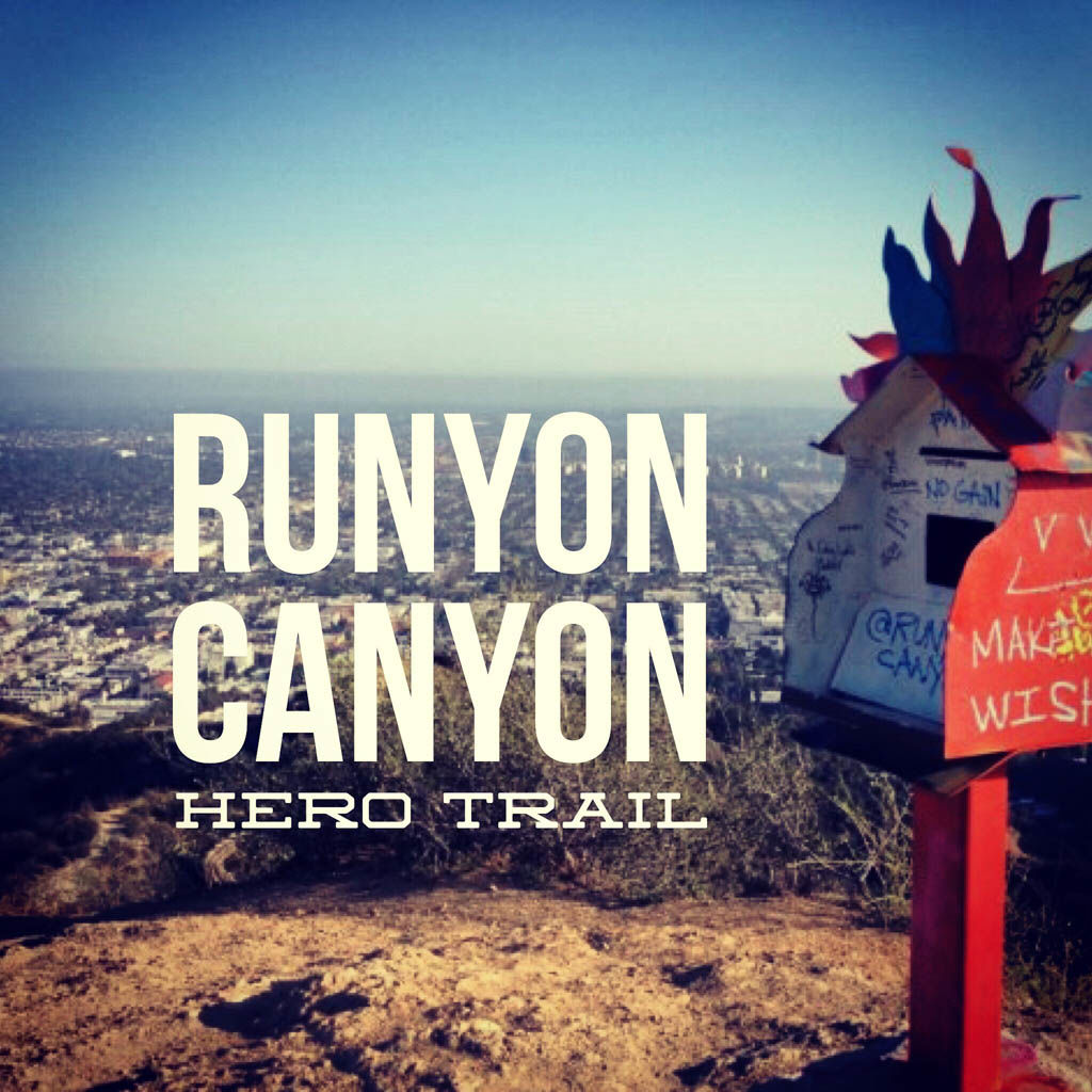
The trail uphill is quite steep in sections — almost to the point where your hands become helpful. But you’re rewarded with lighter crowds, a great workout, and an awesome view over the rest of the park. At the summit, you’ll find the Prayer Box.

The Runyon Canyon Prayer Box

Look around and you’ll also find the USGS benchmark.

USGS benchmark

Follow the trail around the mansions near the top of the hills until you reach the paved Runyon Canyon Road. Turn right and head downhill. At about the 1.5 mile mark, you’ll see a broad dirt trail bearing left and splitting away from the paved road. Take it. This is the Star Trail, and leads down the eastern ridge above Runyon Canyon.

There are several vistas with a benches where you can soak in the view. Some of the steeper sections of the trail have been improved with steps to make the going easier.

Views on the Runyon Canyon Star Trail

At the 2.25 mile point, take a sharp right and follow the paved road back into the canyon. You’ll pass the tennis courts, eventually reaching a bend as the road turns to head back down the canyon toward the trailhead, but don’t go there just yet. Pick your way through a little-travelled single track trail back up the canyon. About 300 yards back — hidden from view — is the Peace Spiral.

Runyon Canyon Peace Spiral

From here, turn around and follow the trail back to the paved road, and then down the canyon toward the Fuller Avenue entrance. You’ll see a trail to your right that climbs up and over a short hill and back to the Vista Street entrance.

Runyon Canyon Trail Map

© OpenStreetMap contributors
Download file: runyon-canyon-loop.gpx

Photo Gallery

Click on any photo to view a larger version. You can also leave comments on any photo.

Plan to walk the street to reach Runyon
Entrance to Runyon Canyon
The Hero Trail
The Hero Trail
Views of LA
Views of LA
The Hero Trail
Looking down on Hollywood
IMG_9440
Trees on the trail
Typical Los Angeles panorama
The Runyon Canyon Prayer Box
You did it!
USGS benchmark
Runyon Canyon views
IMG_9454
A steep downhill
Wildflowers in Runyon Canyon
Hollywood McMansion
Trailer on Runyon Canyon Drive
Vandalized Cactus
Runyon Canyon panorama
Views on the Runyon Canyon Star Trail
Runyon Canyon views
Looking down the ridge over Runyon Canyon
Heading down the Star Trail
Steps on the Star Trail
The Star Trail in Runyon Canyon
A bench with a view
LA panorama from the Star Trail
The path to the Peace Spiral
Runyon Canyon Peace Spiral
Ruins from the past
Street art
Heading down the canyon
The Hero Trail
Views down the Hero Trail and over Los Angeles
West Ridge in Runyon Canyon
A steep section on the Hero Trail
Heading down the Star Trail
LA panorama
The Star Trail
Trail back to Vista Street Entrance

Runyon Canyon Tips

  • Runyon Canyon Park is maintained as an urban wilderness. There are lots of people, but also snakes, coyotes and deer.
  • Dogs are allowed off-leash in much of this park. Read the signs for details.
  • Best time to go is week nights, Monday through Thursday. Even so, don’t expect solitude.

Runyon Canyon Weather Forecast

The location could not be found.

Related

Filed Under: Trail Guides Tagged With: 3-6 miles, dog-friendly, hills, Hollywood, LA County, moderate, Runyun Canyon, vista

Like what you found here at SoCal Hiker? This site is a labor of love. Share your support for the site and help us development of new trail guides and expanded coverage -- make your next outdoor equipment purchase through our advertisers.

You can also subscribe to our weekly newsletter and follow us on Facebook or Twitter.

Jeff H

About Jeff H

I'm an avid hiker and backpacker. My wife Joan and I are on the trails every weekend. I started SoCal Hiker to share my passion for outdoor adventure.

Comments

  1. realarmyofmoms says

    May 15, 2013 at 11:07 am

    I love your trails. You make me want to jump in the car and drive up there…then I remember traffic. I need to check out Orange county trails.

    Reply
    • Jeff HJeff Hester says

      May 15, 2013 at 11:33 am

      We’ve got lots of Orange County trails on the site. Check out our interactive trail list (with a zoomable map) for details: https://socalhiker.net/trails/

      Reply
  2. David says

    May 17, 2013 at 11:31 am

    I imagine it gets pretty crowded there on weekends – but still looks like a great hike. The peace spiral is pretty cool.

    Reply
  3. Asher Waxman says

    January 27, 2015 at 12:17 pm

    The “Prayer Box” on the West Ridge has been gone for a few months.

    Reply
  4. Rebecca says

    June 16, 2015 at 12:36 pm

    Thanks so much for this post. My husband and I have done this hike many times, but not in the way you mentioned and it was much better! As mentioned above, the “Prayer Box” is gone, but we did find the peace spiral and that was pretty awesome!!!! Thanks again!!! We look forward to doing more of your hikes!

    Reply
    • Jeff HJeff Hester says

      June 16, 2015 at 1:24 pm

      That is such a bummer about the prayer box. It was a nice little surprise after that seriously steep climb. Glad you enjoyed the rest of the hike. There are some nice parts to Runyon, and it can definitely make a great workout. Be sure to check out the trails in neighboring Griffith Park, too!

      Reply
    • asher waxman says

      February 19, 2020 at 7:17 pm

      The Spiral was bulldozed away, with no public hearing, a few months ago. Currently there is a Smiley Face Circle and graffiti on the concrete slab. A charming, peaceful spot was brutally spoiled.

      Reply
  5. Muy says

    November 18, 2015 at 10:26 pm

    Aw… I was so exciting to go just for the prayer box. 🙁 Oh well, go there anyway. Your resource is very helpful, thank you for creating this website Jeff. 😀

    Reply

Leave a Reply Cancel reply

Your email address will not be published. Required fields are marked *

This site uses Akismet to reduce spam. Learn how your comment data is processed.

About SoCal Hiker

Jeff on Mount Rainier

I created SoCal Hiker while preparing to thru-hike the John Muir Trail. My goal? Create guides for the best hiking and backpacking trails with enough detail to make it an enjoyable experience for you. And while I started with trails in Southern California, I’ve expanded across the west. We hike each trail to create these guides, sharing practical advice on gear and outdoor skills. Read more…

Connect with SoCal Hiker

  • 22,158 Fans
  • 12,064 Followers
  • 21,640 Followers
  • 1,711 Followers
  • 5,303 Subscribers
  • 340 Subscribers
SoCalHiker was selected one of USA TODAY's 10 Best Hiking and Outdoor Blogs
Get our day-by-day guide to thru-hiking the John Muir Trail
Get up-to-day wildfire status throughout California

Products

  • Quality, weather resistant and dishwasher safe SoCalHiker stickers. SoCal Hiker Stickers (2-pack) $3.50
  • 2017 Six-Pack of Peaks Patch 2017 Six-Pack of Peaks Patch
    Rated 5.00 out of 5
    $6.00
  • SoCal Six-Pack of Peaks Mug $15.95
  • Mount Wilson T-Shirt $23.00 – $27.00

Sponsors

Sponsor SoCalHiker and see your banner here

Featured Posts

Hiking Monserate Mountain

A popular hike in north-inland San Diego County, Monserate Mountain provides a good … [Read More...]

Hiking Sutton Mountain

Sutton Mountain gives you a sense of just how big Oregon is. Nestled between the … [Read More...]

Hiking Telescope Peak in Death Valley National Park

Standing over 11,000 feet above the lowest spot in North America is Telescope Peak. … [Read More...]

Lastest Comments

  • How to Safely Hike Half Dome - sarahherron.com on A Six-Pack of Peaks
  • Rachel on Gnats!!
  • Haunting last texts missing hiker sent mom before being found dead at base of notorious waterfall after 80ft plunge - Celeb 99 on San Gorgonio via Vivian Creek
  • Wiliamson on Hiking Corte Madera in the Pine Creek Wilderness
  • alexer on Hiking Corte Madera in the Pine Creek Wilderness
Get your SoCalHiker stickers now

Get your SoCalHiker stickers!

Latest Posts

  • Hiking Monserate Mountain May 6, 2022
  • Hiking Sutton Mountain April 25, 2022
  • Hiking Telescope Peak in Death Valley National Park December 21, 2021
  • Hiking Corte Madera in the Pine Creek Wilderness December 17, 2021
  • Hiking Quartz Peak in the Sierra Estrella Wilderness September 28, 2021

Recent Forum Topics

  • Early Spring SoCal Backpacking
  • Logistics for Kearsarge TH to Crescent Meadow TH
  • First time in California, looking for ideas and hiking buddies
  • 1st overnight backing trip
  • Recommendations for trips for me and my dog

The Six-Pack of Peaks Challenge Series

Six-Pack of Peaks Challenge SeriesThe Six-Pack of Peaks Challenge Series gives you an opportunity to explore your world while supporting a great cause. There are eleven challenges around the country. Hike or run them at your own schedule.

Flex your adventure muscles!

Learn more here.


Search

Tags

3-6 miles 6-8 miles 8-10 miles 11+ miles Arizona Backpacking coastal dog-friendly easy family-friendly High Sierra Trail hiking Hiking The John Muir Trail hipster inspiration JMT John Muir John Muir Trail Kings Canyon National Park LA County moderate Mount Rainier National Park Muir Monday National Forest National Park Orange County Oregon out of bounds Pacific Crest Trail peak peakbagging quote scenic Sierra Nevada Six-Pack of Peaks State Park strenuous Thru-hiking Utah vista Washington waterfall wilderness Wonderland Trail Yosemite

Copyright © 2022 SoCalHiker.net · Metro Theme on Genesis Framework with WPEngine Hosting · Contact SoCal Hiker · Sitemap · Privacy Policy


Loading Comments...