• COVID-19 Park and Trail Closures
  • Learn about the Six-Pack of Peaks Challenge
  • Shop
  •  

SoCal Hiker

  • Find a Hiking Trail
    • All Areas
    • Arizona
    • Colorado
    • Los Angeles
    • Orange County
    • Oregon
    • San Francisco Bay
    • Washington
  • Trail Guides
  • Six-Pack of Peaks
    • Colorado Six-Pack of Peaks
      • Bergen Peak
      • Rocky Mountain
      • Birthday Peak
      • Horseshoe Mountain
      • Grays Peak
    • New England Six-Pack of Peaks
    • NorCal Six-Pack of Peaks
      • Mount Umunhum
      • Mount Saint Helena
      • Mount Tamalpais
      • Mount Diablo
      • Mount Sizer
      • Rose Peak
    • Oregon Six-Pack of Peaks
      • Tumalo Mountain
      • Black Butte
      • Black Crater
      • Maiden Peak
      • Mount Bachelor
      • South Sister
    • SoCal Six-Pack of Peaks
      • Mt. Wilson
      • Cucamonga Peak
      • Mt. San Antonio (Mt Baldy)
      • San Bernardino Peak
      • San Jacinto Peak
      • San Gorgonio
  • Backpacking
    • High Sierra Trail
    • John Muir Trail
      • Overview of the John Muir Trail
      • Training
      • Day-by-Day Itinerary
      • Resupply Addresses
      • JMT Discussion Forum
    • Lost Coast Trail
    • North/South Lake Loop
    • Rae Lakes Loop
    • Red Peak Pass Loop
    • Theodore Solomons Trail
    • Trans-Catalina Trail
    • Wonderland Trail
  • Gear
  • Forums
    • Latest Topics
    • Ask a Question
    • Campfire
    • Trails
    • Trail Reports
    • Gear Wisdom
    • Classifieds
  • Login

Hiking Mt San Jacinto via Humber Park in Idyllwild

May 4, 2018 By Jeff H 9 Comments

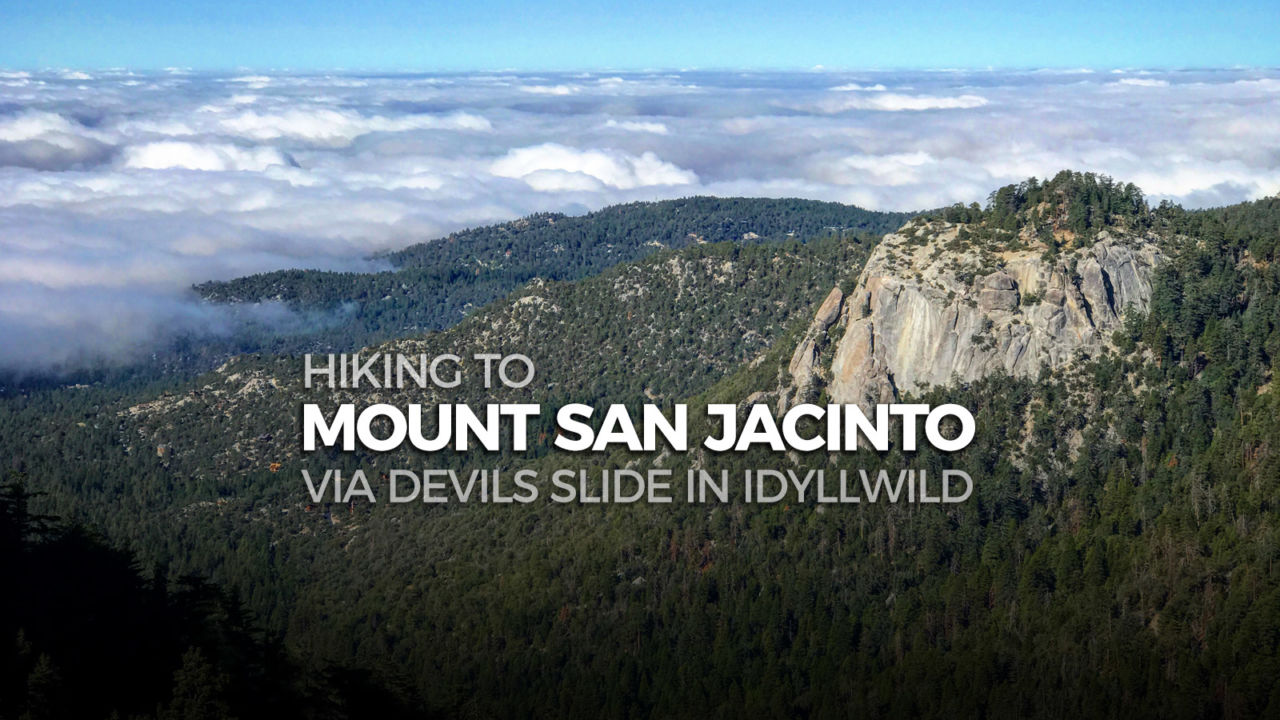
Hiking to Mount San Jacinto via Devils Slide Trail in Idyllwild

If you’ve hiked up a peak many times before, taking a new route to the top keeps the adventure fresh. That was my goal as I hiked Mount San Jacinto via the Devil’s Slide Trail from Humber Park in Idyllwild.

I’ve been up Mount San Jacinto more times than I can remember, and I’ve hiked from Humber Park, but I hadn’t combined the two. For my fourth time taking the SoCal Six-Pack of Peaks Challenge, this provided the fresh scenery I was looking for.

img
Trail Details
Summit: 10,834′
Distance: 15.5 miles
Time: 7-9 hours
Difficulty: Strenuous
Elevation gain: 4,125 ft
Dogs: No
When to go: May-October
This 15.5 mile out-and-back route climbs from Humber Park to the Saddle Junction, where it joins the Pacific Crest Trail for a few miles en route to Wellman’s Divide. From the divide to the summit, the route is the shared by those taking the Palm Springs Tram, but in the end, this hike is longer and has much more total vertical gain. And it has great views of both Suicide Rock and Taquitz Rock – popular rock climbing  destinations.

Getting to the Trailhead

The hike begins in Idyllwild’s Humber Park. An Adventure Pass is required to park, and a wilderness permit for hiking to the summit can be picked up from the ranger station in Idyllwild. There’s quite a bit of parking here, but it is a popular trailhead for hikers, climbers and backpackers that fills up on the weekends, so get there early.

Hiking Mount San Jacinto via Devils Slide

The trail begins at the southeast corner of the Humber Park parking area. As always, check the information board for any notices and warnings about the trail conditions before heading out.

The Devils Slide Trail climbs about 2,000 vertical feet over 2.5 miles. The trail itself is well-engineered, with a steady climb that is best enjoyed before the sunlight hits it later in the day. As you climb, pause to take in the views of Suicide and Taquitz Rock on opposite sides of the valley.

Devils Slide Trailhead Information
Suicide Rock from Devils Slide
Taquitz Rock from Devils Slide

Taquitz Rock from Devils Slide

The trail levels off at Saddle Junction, and this is a good place to regroup and take a break. There are several trails that converge at this junction, so look carefully for the PCT trail and signs for Wellmans Divide and Mount San Jacinto before taking off.

Sign to Mount San Jacinto at Saddle Junction

Over the next 2+ miles you will be on a section of the famed 2600 mile Pacific Crest Trail. If you hike this in May, there’s a good chance you’ll encounter thru-hikers making their way from the Mexican border to Canada.

Pacific Crest Trail marker
Climbing toward Wellmans Divide
Junction where you leave the PCT

At 5.45 miles you reach Wellman’s Divide, just 2.3 miles from the summit. This is where you meet up with the trail from Long Valley. If you’ve hiked from the tram, this spot is one of the first with a sweeping view.

Junction at Wellmans Divide

The trail climbs the eastern slope of Mt San Jacinto, switching back to a saddle where the Marion Mountain Trail joins before heading past the stone shelter and the final boulder scramble to the summit.

Mountain Station and Palm Springs from the side of Mt San Jacinto

Even on a weekday, it’s not uncommon to run into other hikers, even other Six-Pack of Peaks Challengers. And as John Muir said, “The view from San Jacinto is the most sublime spectacle to be found anywhere on this earth!”

Panoramic view from the summit of Mount San Jacinto
Always fun to meet fellow Six-Pack of Peaks challengers at the summit

The peak is a great place to rest and refuel. Remember that this is the halfway point of your hike, so be sure you’ve saved enough energy for the hike back down.

Mt San Jacinto via Humber Park Trail Map & Elevation Profile

© OpenStreetMap contributors
Download file: mt-san-jacinto-via-humber-park-91517-81743am.gpx

Mount San Jacinto Resources

  • As with any trip in the wilderness, carry the ten essentials and follow the Leave No Trace principles.
  • There is a seasonal spring below Wellman’s Divide, but I recommend that you don’t rely on that. Bring enough water for the full hike.
  • The Devils Slide trailhead can be reached at Humber Park, at 24559 Fern Valley Road, Idyllwild, CA 92549.
  • You must display an Adventure Pass in your car.
  • Free, self-service permits are required for day hikes, obtainable at the Ranger Station in Idyllwild at 25905 State Highway 243

Idyllwild Weather Forecast

The location could not be found.

Originally solo hiked on September 15, 2017. All photos by Jeff Hester. 

Filed Under: Trail Guides Tagged With: 11+ miles, Cranston Fire, Mount San Jacinto, PCT, peak, peakbagging, scenic, Six-Pack of Peaks, State Park, strenuous

Like what you found here at SoCal Hiker? This site is a labor of love. Share your support for the site and help us development of new trail guides and expanded coverage -- make your next outdoor equipment purchase through our advertisers.

You can also subscribe to our weekly newsletter and follow us on Facebook or Twitter.

Jeff H

About Jeff H

I'm an avid hiker and backpacker. My wife Joan and I are on the trails every weekend. I started SoCal Hiker to share my passion for outdoor adventure.

Comments

  1. Robert Dryden says

    May 4, 2018 at 6:43 pm

    I love going this way. Then returning down Deer Springs through Little Round Valley, Strawberry Jct and returning to Humber Park! The views from the Strawberry section back towards Tahquitz Peak are amazing!!!

    Reply
  2. James says

    May 5, 2018 at 1:21 pm

    Nice write-up, Jeff. This was the route we took, my first time up San Jacinto. Your advice about paying attention to the trails leading from Saddle Junction is well taken. We had gotten a late start, got to the summit late afternoon and hiked back down mostly in darkness. Really had to pay attention at Saddle Junction to get back on the Devil’s Slide Trail. All the best!

    Reply
  3. TheJerr says

    May 7, 2018 at 7:47 am

    Thanks Jeff – it is cool way to get there.. I found this way few years back when I was resting at the Divide and saw a hiker coming up on a trail from this direction and told myself – when I get back I’m going to find out where this trail starts and do it. It is a fun trail getting up to the saddle and then the long stretch getting to the Divide. I have also used this trail to form a horse shoe. Go up The Marion Mountain trail and summit San Jacinto and then down to Humber park on this trail.

    Reply
  4. Lauren says

    May 8, 2018 at 8:34 am

    That looks like a great hike. I’m not a Californian, but have used your trail guides in the past when visiting.

    Reply
  5. WanderingPIne says

    May 12, 2018 at 5:40 am

    Nice review and photos, I miss the mountains. I grew up in SoCal and this makes me want to come back for a visit. 🙂

    Reply
  6. Shannon says

    May 17, 2018 at 6:20 am

    Those are some gorgeous views and I love how it includes a short piece of the PCT. Although, it looks like today is great day to do this one super early with a weather forecast in the 90s!

    Reply
  7. Charlie says

    June 20, 2018 at 5:58 pm

    My son and I did this today. Left the trail at 530am and got to the peak at 10. Trip down got real,hot.

    Reply
  8. Keith LKeith L says

    January 21, 2019 at 6:22 am

    Soon to be a resident of this area and visiting for the holidays I selected this ascent from the West side based on ease of parking, ranger station for registration and few trail intersections for easy navigation. This is a beautifully maintained trail that has an nice grade and wonderful views right away. I hiked this trail on 12-18-18 starting at 6:30AM with summit by 10:45AM. This left plenty of time for lunch and pictures to be back to car with lots of light left. Most of the hike was on packed snow. I could have used my crampons & poles for the trip down as the sun warmed the trail and it was slipping and sliding most of the way down. I am really looking forward to my permanent move to the area and many more hikes and backpacks of this region. Keith

    Reply
  9. Lily Rose says

    December 22, 2020 at 7:49 pm

    Really, I love going this way. Then returning down Deer Springs through Little Round Valley, Strawberry Jct, and returning to Humber Park! The views from the Strawberry section back towards Tahquitz Peak are amazing!!!

    Reply

Leave a Reply Cancel reply

Your email address will not be published. Required fields are marked *

This site uses Akismet to reduce spam. Learn how your comment data is processed.

About SoCal Hiker

Jeff on Mount Rainier

I created SoCal Hiker while preparing to thru-hike the John Muir Trail. My goal? Create guides for the best hiking and backpacking trails with enough detail to make it an enjoyable experience for you. And while I started with trails in Southern California, I’ve expanded across the west. We hike each trail to create these guides, sharing practical advice on gear and outdoor skills. Read more…

Connect with SoCal Hiker

  • 22,751 Fans
  • 11,946 Followers
  • 21,640 Followers
  • 1,717 Followers
  • 5,281 Subscribers
  • 342 Subscribers
SoCalHiker was selected one of USA TODAY's 10 Best Hiking and Outdoor Blogs
Get our day-by-day guide to thru-hiking the John Muir Trail
Get up-to-day wildfire status throughout California

Products

  • Mt Baden-Powell Replica Benchmark Mt Baden-Powell Benchmark $39.95
  • Muir Taco T-shirt Señor Muir Taco Hut Tech-Tee $19.95 – $22.95
  • Come to the woods, for here is rest. - John Muir Come to the Woods Poster $13.00 – $16.00
  • Mt Baldy Mug Mt San Antonio (Mt Baldy) Mug $15.95

Sponsors

Sponsor SoCalHiker and see your banner here

Featured Posts

Hiking Belknap Crater in the Mountain Washington Wilderness

Hiking this out-and-back route up Belknap Crater you'll traverse an other-worldly … [Read More...]

Hiking to the Simpson Reef Overlook on the Oregon Coast Trail

The Oregon Coast is rugged, beautiful and often uncrowded. This bluff-top … [Read More...]

Join Team SoCalHiker at the Climb for Heroes

Team SoCalHiker is climbing Mount Baldy again as part of the annual Climb for Heroes … [Read More...]

Lastest Comments

  • Amy Courtney on Ridgeline Trail
  • Jay Eleanor on Hiking to the Simpson Reef Overlook on the Oregon Coast Trail
  • Charles Krim on Hiking to the Simpson Reef Overlook on the Oregon Coast Trail
  • 11 Best California Bikepacking Routes | Wild Lumens on Inside Crystal Cove State Park
  • Ted Thed on Burbank Peak, Cahuenga Peak, Mt. Lee and the Hollywood Sign
Get your SoCalHiker stickers now

Get your SoCalHiker stickers!

Latest Posts

  • Hiking Belknap Crater in the Mountain Washington Wilderness October 20, 2022
  • Hiking to the Simpson Reef Overlook on the Oregon Coast Trail August 25, 2022
  • Join Team SoCalHiker at the Climb for Heroes August 23, 2022
  • Hiking the Welch-Dickey Loop in the White Mountain National Forest August 18, 2022
  • Hiking Turtlehead Peak from Red Rock Canyon National Conservation Area July 15, 2022

Recent Forum Topics

  • How to deal with accidents while hiking in the winter?
  • Warm Tips for your hiking in winter
  • Some tips for hiking.
  • Keep your body warm in the winter hiking
  • The benefits of hiking, more than you can imagine!

The Six-Pack of Peaks Challenge Series

Six-Pack of Peaks Challenge SeriesThe Six-Pack of Peaks Challenge Series gives you an opportunity to explore your world while supporting a great cause. There are eleven challenges around the country. Hike or run them at your own schedule.

Flex your adventure muscles!

Learn more here.


Search

Tags

3-6 miles 6-8 miles 8-10 miles 11+ miles Arizona Backpacking coastal dog-friendly easy family-friendly High Sierra Trail hiking Hiking The John Muir Trail hipster inspiration JMT John Muir John Muir Trail Kings Canyon National Park LA County moderate Mount Rainier National Park Muir Monday National Park Orange County Oregon out of bounds Pacific Crest Trail peak peakbagging quote scenic Sequoia National Park Sierra Nevada Six-Pack of Peaks State Park strenuous Thru-hiking Utah vista Washington waterfall wilderness Wonderland Trail Yosemite

Copyright © 2023 SoCalHiker.net · Metro Theme on Genesis Framework with WPEngine Hosting · Contact SoCal Hiker · Sitemap · Privacy Policy


Loading Comments...