
DAY FOUR on the High Sierra Trail we hiked straight north up the Kern River – a gorgeous 10 mile, 2,000 vertical foot, gentle-but-steady ascent from 6,000 feet to 8,000 feet.
Time: 4-6 hours
Difficulty: Strenuous
Elevation gain: 2,169 ft
Dogs: No
When to go: July-Sept.
Heading up the east side about two miles up the trail you arrive at Kern Hot Springs – an actual hot spring with a concrete tub that allows for 110-120 degree bathing! When we arrived early morning, the campground was pretty full with a big group of fly fishermen. The tub was occupied and there was a waiting list – so no hot bath today. Kevin and his gang stopped there later and said it was marvelous!

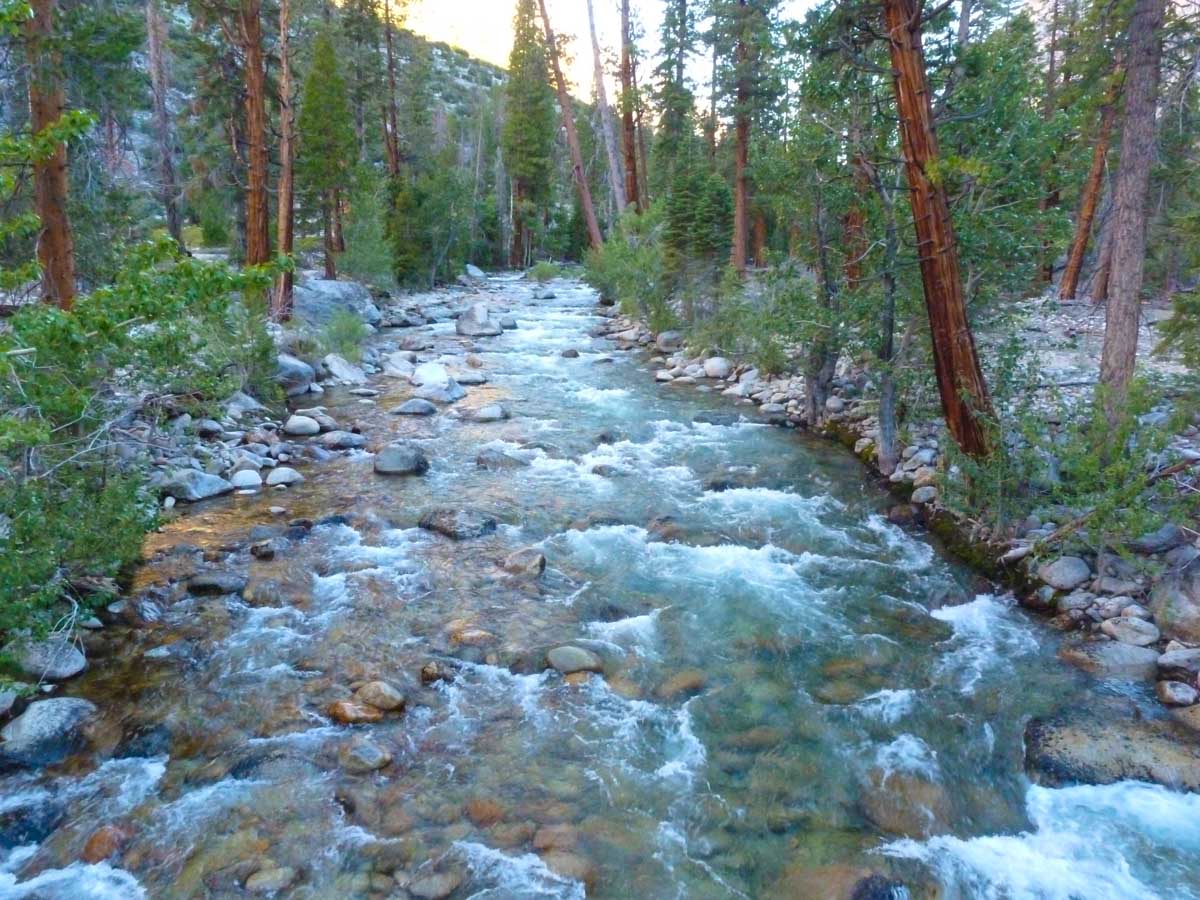
The hike up the Kern valley was gorgeous, varying from rocks and sand to heavy ferns and big trees. As we got higher and closer to Junction Meadow, there were a number of challenging stream crossings. I slipped and got a shoe wet on one, and then we both had to cross with shoes on during another deep and fast one. Good thing it was a warm day, where we could dry the shoes out later at Junction Meadow. We always took the ‘better safe than sorry’ approach with stream crossings. If it looks hairy, plow straight through!


We arrived at Junction Meadow about 1:30 p.m., and the campground sits right on the junction of the Kern River and another stream (Wright Creek I think). Anyway, gorgeous spot – we even had a solo hiker come in and do some fly fishing there. The early arrival gave us a chance to do some clothes washing (4-day stink was getting noticeable) and dry out our shoes.

Kevin, Amber and Bart arrived around 4:30. We made a fire, ate dinner together and entertained visiting deer. The sound of the Kern was a great way to doze off later that night.

Spending the day hiking up the Kern River valley was a great reminder of how big and important that river is – and how much water it pushes through the park to eventually become Lake Isabella and hydrate a big chunk of California.
Back at 8,000 feet, we prepared to do another almost 3,000 feet of climbing and join the John Muir Trail and the Pacific Crest Trail the next day.
High Sierra Trail: Upper Funston Meadow to Junction Meadow
Trail Map & Elevation Profile
Next up?
- Continue to Day 5 on the High Sierra Trail, hiking from Junction Meadow to Crabtree Meadow.
- Go back to Day 3 on the High Sierra Trail.
- New to the High Sierra Trail? Get the big picture with our HST overview.
- Got questions about the High Sierra Trail? Join our HST discussion forum.

You must be logged in to post a comment.