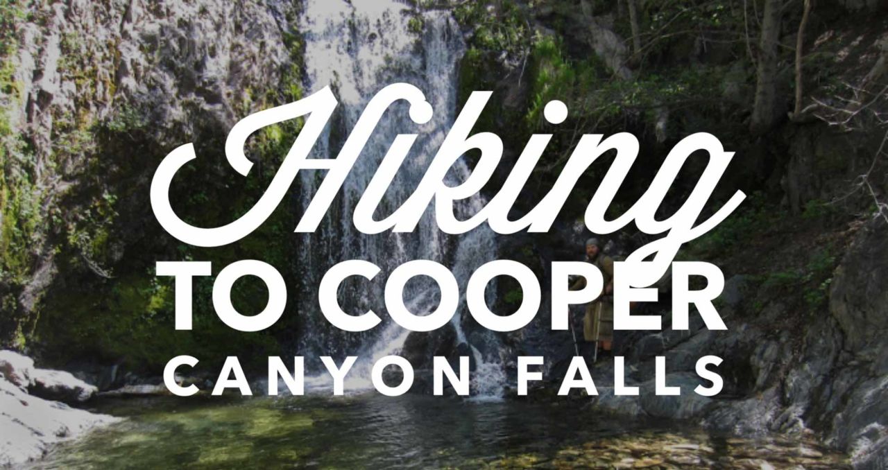
• COVID-19 Park and Trail Closures
  • Learn about the Six-Pack of Peaks Challenge
  • Shop
  •  

SoCal Hiker

  • Find a Hiking Trail
    • All Areas
    • Arizona
    • Colorado
    • Los Angeles
    • Orange County
    • Oregon
    • San Francisco Bay
    • Washington
  • Trail Guides
  • Six-Pack of Peaks
    • Colorado Six-Pack of Peaks
      • Bergen Peak
      • Rocky Mountain
      • Birthday Peak
      • Horseshoe Mountain
      • Grays Peak
    • New England Six-Pack of Peaks
    • NorCal Six-Pack of Peaks
      • Mount Umunhum
      • Mount Saint Helena
      • Mount Tamalpais
      • Mount Diablo
      • Mount Sizer
      • Rose Peak
    • Oregon Six-Pack of Peaks
      • Tumalo Mountain
      • Black Butte
      • Black Crater
      • Maiden Peak
      • Mount Bachelor
      • South Sister
    • SoCal Six-Pack of Peaks
      • Mt. Wilson
      • Cucamonga Peak
      • Mt. San Antonio (Mt Baldy)
      • San Bernardino Peak
      • San Jacinto Peak
      • San Gorgonio
  • Backpacking
    • High Sierra Trail
    • John Muir Trail
      • Overview of the John Muir Trail
      • Training
      • Day-by-Day Itinerary
      • Resupply Addresses
      • JMT Discussion Forum
    • Lost Coast Trail
    • North/South Lake Loop
    • Rae Lakes Loop
    • Red Peak Pass Loop
    • Theodore Solomons Trail
    • Trans-Catalina Trail
    • Wonderland Trail
  • Gear
  • Forums
    • Latest Topics
    • Ask a Question
    • Campfire
    • Trails
    • Trail Reports
    • Gear Wisdom
    • Classifieds
  • Login

Cooper Canyon Falls

August 27, 2014 By Jeff H 21 Comments

Backpacking to Cooper Canyon

Cooper Canyon Falls is a beautiful waterfall that flows almost year round, but roars in April-May as the spring snow melts. The falls can be spectacular when you time your hike right, and I’m surprise more people don’t talk about this trail.

This hike includes a side trip to Cooper Canyon Campground — a wilderness campsite right on the Pacific Crest Trail — making this an easy hike to modify for an overnight backpacking trip. It’s not long, but it it has some great features and makes a great shake-down trip for testing your gear and getting comfortable with your pack weight before a longer trip.

img
Trail Details
Distance: 6 miles
Time: 2-3 hours
Difficulty: Moderate
Elevation gain: 907 ft
Dogs: Yes
When to go: Spring to Fall
Although we hiked this as a day hike, you could shorten the journey by heading straight Cooper Canyon Falls and back, skipping the side trip to the campground and cutting the total distance in half. We wanted to check out the campground first hand.

Getting to the Trailhead

The trailhead is found at the very back of the Buckhorn Campground, about 33 miles back from La Cañada-Flintridge off Highway 2 in the Angeles National Forest (Google map).

Trail Description

Start at the Burkhart Trail and head down. Yes, this is one of those trails where the elevation gain is all on the way out. Some people prefer to get the vertical out of the way first, but that’s not really an option for this trip. But it’s worth it. 

Heading down the Burkhart Trail

The trail descends down a mostly shady canyon with a babbling creek at the bottom. The Buckhorn Campground provides car camping, and a lot of people were exploring and playing in the creek not far from the trailhead. We soon left them behind as we traveled further down.

Redwoods

I was surprised to see a number of redwood trees — an unusual site in southern California.

Trail Markers

At the 1.2 mile mark, the trail reaches a junction with the Pacific Crest Trail. The falls are to the right only  a few hundred yards down the trail. You’ll have to scramble down the embankment to reach them, and there was a handy rope to make getting down (and back up) a bit easier.

Detour to Cooper Canyon Falls

Look for the steep scramble down to the base of the falls.

I was surprised to see fairly decent-sized fish swimming in the pool below the falls! The waterfall and creek were beautiful in spite of the drought. In wetter years as the snow melts, Cooper Canyon Falls are spectacular.

Here’s a shot from Kolby “The Hike Guy” Kirk taken during his 2011 hike on the PCT:

Kolby Kirk at Cooper Canyon Falls

Doubling back to the junction, we took the PCT toward the Cooper Canyon Campground. This was about 1.5 miles up another canyon, and we ran into a group of PCT thru-hikers headed the same way. The campground itself feels quite developed, even though you have to hike back there. There are two pit toilets, picnic tables and plenty of area for tents — making it suitable for groups. And the creek runs just behind the camp area, providing a water source.

Cooper Canyon Camp

Personally I wouldn’t choose this camp for a quiet getaway, but for a group looking for an easy way to test the waters and give backpacking a try, this could be ideal. And it gives you a chance to actually backpack a section of the epic Pacific Crest Trail.

Cooper Canyon Falls Trail Map

© OpenStreetMap contributors
Download file: Cooper Canyon Falls.gpx

Cooper Canyon Photo Gallery

Click on any photo to view a larger version. You can also leave comments on any photo.

Burkhart Trail
Burkhart Trailhead Day Use Parking
Burkhart Trailhead
Heading down the Burkhart Trail
IMG_4217
IMG_4250
IMG_4260
Redwoods
Juntion to Cooper Canyon Campground
Heading to Cooper Canyon Camp
Trail Markers
Cooper Canyon
IMG_1077
IMG_4230
Cooper Canyon Camp
Back down Cooper Canyon
Detour to Cooper Canyon Falls
Cooper Canyon Waterfall
Kolby Kirk at Cooper Canyon Falls
SoCalHiker at Cooper Canyon Falls
Climbing up the Burkhart Trail
Towering Pines
IMG_1069
IMG_4261
Back at the Trailhead
Happy Hikers
Post-Hike Libations


Cooper Canyon Tips

  • No permits are required for the Cooper Canyon Camp. There are six, first-come, first-serve hike-in sites.
  • Water is typically available from the stream at Cooper Canyon Camp, but should be treated. Flow may be low or non-existent in dry years during the height of summer.
  • An Adventure Pass is required to park at the Burkhart Trailhead.
  • After the hike, grab a burger and a beer at a favorite biker destination — Newcomb’s Ranch on your way back.

Cooper Canyon Weather Forecast

The location could not be found.

Filed Under: Backpacking, Trail Guides Tagged With: 3-6 miles, Angeles National Forest, Backpacking, dog-friendly, LA County, moderate, Pacific Crest Trail, PCT, waterfall, wilderness

Like what you found here at SoCal Hiker? This site is a labor of love. Share your support for the site and help us development of new trail guides and expanded coverage -- make your next outdoor equipment purchase through our advertisers.

You can also subscribe to our weekly newsletter and follow us on Facebook or Twitter.

Jeff H

About Jeff H

I'm an avid hiker and backpacker. My wife Joan and I are on the trails every weekend. I started SoCal Hiker to share my passion for outdoor adventure.

Comments

  1. Greg S (SocalAdventures) says

    August 27, 2014 at 5:58 pm

    I love that hike. I’m surprised there is any water at all in the creek.

    Reply
  2. Jessica C says

    May 31, 2016 at 4:31 pm

    FYI: the falls are on the LEFT after you pass by the Pacific Crest Trail marker. Great hike!

    Reply
  3. Jeff HJeff Hester says

    June 1, 2016 at 10:32 am

    @Jessica — Yes, they are on the left from the trail, but I was pointing out that when you get to the PCT junction, you take the fork to the right to reach the falls (not the trail to the left, which takes you away from the falls).

    Reply
  4. Anne says

    June 8, 2016 at 9:58 pm

    Do you know if the waterfall is still flowing now?

    Reply
  5. Jeff HJeff Hester says

    June 9, 2016 at 8:37 am

    I haven’t been there recently. The Forest Service website has this generic message: “Seasonal stream water (treat before using). However, water flow may be low or non-existent due to reduced rainfall/snowfall.”

    It is seasonal, but there should be some water still flowing at this time.

    Reply
  6. Layla Sefried says

    July 10, 2016 at 7:58 pm

    What mappears would you reccomend having/ printing for this hike?

    Reply
  7. Mai Thao says

    April 6, 2017 at 2:41 pm

    I am interested in visiting this falls. Do you know if this is high enough for snow falls at this time of year? I’m planning on going this weekend.

    Reply
    • Jeffrey HSoCal Hiker says

      April 6, 2017 at 7:11 pm

      The water will be running well. There will likely be patches of snow on the route.

      Reply
  8. Meg says

    April 9, 2017 at 9:23 am

    I was interested in going this week- wondering if I will be too cold at night though ????

    Reply
  9. Meg says

    April 9, 2017 at 9:24 am

    I was interested in going this week backpacking- wondering if I will be too cold at night though ????

    Reply
  10. Fred M. Cain says

    January 30, 2018 at 5:31 am

    You mentioned that you “were surprised to see a number of redwood trees”. Are these trees truly giant Sequoias or actually incense cedars? Incense cedar can look somewhat like a Sequoia and on one website someone opined that they are actually incense cedars. *BUT* it is a fact that the U.S. Forest Service also planted a number of Sequoia seedlings back in the 1970s in the San Gabriel, San Bernardino and San Jacinto ranges because they thought they might be more smog tolerant. A few of those seedlings have not only survived but have become quite large so you might have actually seen Sequoias.

    I would be most interested to find out.
    Regards,
    Fred M. Cain

    Reply
    • Fred M. Cain c/o Trailers says

      August 2, 2019 at 11:43 am

      Phil,

      Thanks for answering my question on the Sequoias. I wondered if they might be incense cedars because the two look very similar from a distance. The bark is very similar.

      However, there are actually some growing in the San Jacinto Mountains that were planted around 40-50 years ago. See here:

      https://gizmodo.com/these-sequoia-trees-are-thriving-175-miles-south-of-the-1579409426

      So, there might be some growing in the Transverse Range in the San Bernardino Mountains as well but just not right here along this trail.

      Regards,
      Fred M. Cain

      Reply
  11. Phil Goodrich says

    April 21, 2018 at 1:00 pm

    In regards to Fred’s question they are incense cedars not redwoods or Sequoias. Cooper Cyn trail camp has become one of my favorite spots. If you go there make sure not to be fooled into camping on the exposed flat you first come to (which is good for stargazing). To the right of the main plateau (north) there is a small rise. A trail over it leads down to two official and several unofficial spots in a beautiful grove of Jeffrey pines, incense cedars, and firs. A small stream runs just feet away from the best site. If you start at Cloudburst rather than Buckhorn take the PCT rather than the fire road. 3/4 longer but much prettier, and far less steep.

    Reply
  12. klune says

    May 5, 2018 at 12:38 pm

    anyone know if there is water in the creek right now

    Reply
  13. don says

    June 1, 2018 at 7:52 pm

    i hiked down on may 12th 2018 and the water was meandering over the falls. Will be going down June 2nd 2018 and will report back on water flow

    Reply
  14. Fabien says

    June 4, 2018 at 4:46 pm

    Hi Don,
    Did you go back on June 2nd? Was there a lot of water still? (waterfall?)
    Thanks!

    Reply
  15. tina collins says

    August 25, 2018 at 7:49 pm

    My group did this hike in June. There was a little water but we were all eaten up by mosquitoes. I think I came home with 15-20 just myself. The hike back to the car was about 2 miles on asphalt. very grueling

    Reply
    • Jeff HJeff Hester says

      August 27, 2018 at 6:47 pm

      Tina, why did you have to hike two miles on asphalt? No parking at the trailhead?

      Reply
  16. Phil Goodrich says

    December 10, 2018 at 2:18 pm

    Tina may have started at Cloudburst rather than Buckhorn and taken the fire road back. Its about two miles and very steep.

    Reply
  17. aiko says

    March 22, 2019 at 12:03 am

    hello jeff, the part about using a rope worries me. can you please explain more detail? is there an easier way down?

    Reply
    • Jeff HJeff Hester says

      March 22, 2019 at 5:27 pm

      Aiko,

      The trail runs above the creek on the side of the canyon. You can see the falls from the trail. If you want to get down to the base of the falls, you’ll need to scramble down. When I was last there, there was a rope that was tied to give you something to grab onto as you scramble up or down. My wife opted to wait at the trail while I went down to the base to snap a few photos. It’s not a far distance (maybe 30-40 feet?) but it’s not a “trail”.

      Reply

Leave a Reply Cancel reply

Your email address will not be published. Required fields are marked *

This site uses Akismet to reduce spam. Learn how your comment data is processed.

About SoCal Hiker

Jeff on Mount Rainier

I created SoCal Hiker while preparing to thru-hike the John Muir Trail. My goal? Create guides for the best hiking and backpacking trails with enough detail to make it an enjoyable experience for you. And while I started with trails in Southern California, I’ve expanded across the west. We hike each trail to create these guides, sharing practical advice on gear and outdoor skills. Read more…

Connect with SoCal Hiker

  • 22,751 Fans
  • 11,945 Followers
  • Followers
  • 1,717 Followers
  • 5,281 Subscribers
  • 342 Subscribers
SoCalHiker was selected one of USA TODAY's 10 Best Hiking and Outdoor Blogs
Get our day-by-day guide to thru-hiking the John Muir Trail
Get up-to-day wildfire status throughout California

Products

  • Mount Wilson T-Shirt $23.00 – $27.00
  • Mount San Jacinto T-Shirt $23.00 – $25.00
  • Mt San Antonio (Mt Baldy) Benchmark Mt Baldy (Mt San Antonio) Benchmark $39.95
  • Cucamonga Peak mug Cucamonga Peak Mug $15.95

Sponsors

Sponsor SoCalHiker and see your banner here

Featured Posts

Hiking Belknap Crater in the Mountain Washington Wilderness

Hiking this out-and-back route up Belknap Crater you'll traverse an other-worldly … [Read More...]

Hiking to the Simpson Reef Overlook on the Oregon Coast Trail

The Oregon Coast is rugged, beautiful and often uncrowded. This bluff-top … [Read More...]

Join Team SoCalHiker at the Climb for Heroes

Team SoCalHiker is climbing Mount Baldy again as part of the annual Climb for Heroes … [Read More...]

Lastest Comments

  • Amy Courtney on Ridgeline Trail
  • Jay Eleanor on Hiking to the Simpson Reef Overlook on the Oregon Coast Trail
  • Charles Krim on Hiking to the Simpson Reef Overlook on the Oregon Coast Trail
  • 11 Best California Bikepacking Routes | Wild Lumens on Inside Crystal Cove State Park
  • Ted Thed on Burbank Peak, Cahuenga Peak, Mt. Lee and the Hollywood Sign
Get your SoCalHiker stickers now

Get your SoCalHiker stickers!

Latest Posts

  • Hiking Belknap Crater in the Mountain Washington Wilderness October 20, 2022
  • Hiking to the Simpson Reef Overlook on the Oregon Coast Trail August 25, 2022
  • Join Team SoCalHiker at the Climb for Heroes August 23, 2022
  • Hiking the Welch-Dickey Loop in the White Mountain National Forest August 18, 2022
  • Hiking Turtlehead Peak from Red Rock Canyon National Conservation Area July 15, 2022

Recent Forum Topics

  • How to deal with accidents while hiking in the winter?
  • Warm Tips for your hiking in winter
  • Some tips for hiking.
  • Keep your body warm in the winter hiking
  • The benefits of hiking, more than you can imagine!

The Six-Pack of Peaks Challenge Series

Six-Pack of Peaks Challenge SeriesThe Six-Pack of Peaks Challenge Series gives you an opportunity to explore your world while supporting a great cause. There are eleven challenges around the country. Hike or run them at your own schedule.

Flex your adventure muscles!

Learn more here.


Search

Tags

3-6 miles 6-8 miles 8-10 miles 11+ miles Arizona Backpacking coastal dog-friendly easy family-friendly High Sierra Trail hiking Hiking The John Muir Trail hipster inspiration JMT John Muir John Muir Trail Kings Canyon National Park LA County moderate Mount Rainier National Park Muir Monday National Park Orange County Oregon out of bounds Pacific Crest Trail peak peakbagging quote scenic Sequoia National Park Sierra Nevada Six-Pack of Peaks State Park strenuous Thru-hiking Utah vista Washington waterfall wilderness Wonderland Trail Yosemite

Copyright © 2023 SoCalHiker.net · Metro Theme on Genesis Framework with WPEngine Hosting · Contact SoCal Hiker · Sitemap · Privacy Policy


Loading Comments...