• COVID-19 Park and Trail Closures
  • Learn about the Six-Pack of Peaks Challenge
  • Shop
  •  

SoCal Hiker

  • Find a Hiking Trail
    • All Areas
    • Arizona
    • Colorado
    • Los Angeles
    • Orange County
    • Oregon
    • San Francisco Bay
    • Washington
  • Trail Guides
  • Six-Pack of Peaks
    • Colorado Six-Pack of Peaks
      • Bergen Peak
      • Rocky Mountain
      • Birthday Peak
      • Horseshoe Mountain
      • Grays Peak
    • New England Six-Pack of Peaks
    • NorCal Six-Pack of Peaks
      • Mount Umunhum
      • Mount Saint Helena
      • Mount Tamalpais
      • Mount Diablo
      • Mount Sizer
      • Rose Peak
    • Oregon Six-Pack of Peaks
      • Tumalo Mountain
      • Black Butte
      • Black Crater
      • Maiden Peak
      • Mount Bachelor
      • South Sister
    • SoCal Six-Pack of Peaks
      • Mt. Wilson
      • Cucamonga Peak
      • Mt. San Antonio (Mt Baldy)
      • San Bernardino Peak
      • San Jacinto Peak
      • San Gorgonio
  • Backpacking
    • High Sierra Trail
    • John Muir Trail
      • Overview of the John Muir Trail
      • Training
      • Day-by-Day Itinerary
      • Resupply Addresses
      • JMT Discussion Forum
    • Lost Coast Trail
    • North/South Lake Loop
    • Rae Lakes Loop
    • Red Peak Pass Loop
    • Theodore Solomons Trail
    • Trans-Catalina Trail
    • Wonderland Trail
  • Gear
  • Forums
    • Latest Topics
    • Ask a Question
    • Campfire
    • Trails
    • Trail Reports
    • Gear Wisdom
    • Classifieds
  • Login

Inside San Onofre State Beach

December 21, 2010 By Jeff H 3 Comments

Footprints in the sand at San Onofre

San Onofre State Beach is best known for the world-class surfing at Trestles. The surf spots along here begin at the north end with Cottons, then moving southward come Uppers, Middles, Lowers and Church. Lowers is consistently one of the best surf spots, and this place is full of both professional and amateur surfers. Even if you don’t surf, it’s fun to observe and people-watch.

Hiking at San Onofre State Beach

We have three hiking guides to San Onofre State Beach:

  1. The Panhe Nature Trail is a short, family-friendly trail with instructional stops that makes a great walk with kids. An excellent way to help them learn about nature and develop a love for the outdoors.
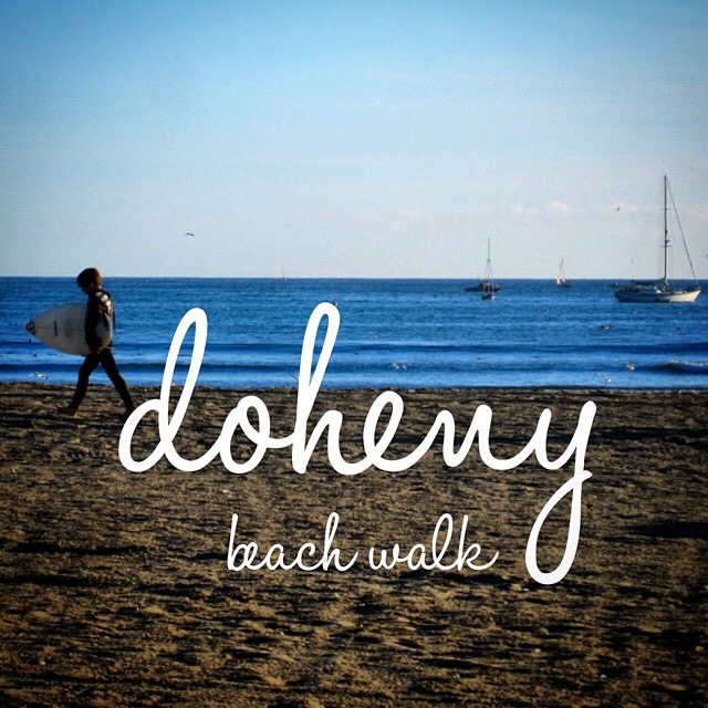
  2. Trestles Beach Walk takes you down a paved path to the world-renown Trestles surf beach.
  3. The Cristianitos Fault Loop is a little more rigorous, and includes a geology lesson, to boot!

Camping at San Onofre State Beach

There are two camping areas at San Onofre. The San Mateo Campground is about 1.5 miles inland. Nestled beside the seasonal San Mateo Creek among native trees, the campground is quiet and still close enough to the beach to walk.

The San Onofre Bluffs Campground puts you closer to the beach (about 1/4 mile) and even closer to Interstate 5! There are a few spaces where there is a berm separating you from the noise from the freeway, but don’t come here expecting quiet.

Parking at San Onofre

There are four areas for day use parking:

  1. There is a parking lot at the intersection of Cristianitos Road and El Camino Real at the south end of San Clemente. This area is where most of the surfers visiting Trestles park. TIP: If you can find a spot on the street, parking is free.
  2. The San Mateo Campground has day use parking.
  3. The Bluffs Campground has day use parking. You may park in any of the unnumbered spaces.
  4. The most interesting place, however, is the beach known as “Old Man’s”. This is the only place in the park — and possibly the only place south of Pismo Beach — where you can drive your car right onto the sand and park. It’s a throwback to the “old days.”

Note that all of these parking areas require either a $15 Day Use parking pass or you can display an annual California State Park pass.

Essential San Onofre State Beach Resources

  • Official San Onofre State Beach website

Filed Under: State Parks Tagged With: beach, San Clemente, San Onofre, State Park

Like what you found here at SoCal Hiker? This site is a labor of love. Share your support for the site and help us development of new trail guides and expanded coverage -- make your next outdoor equipment purchase through our advertisers.

You can also subscribe to our weekly newsletter and follow us on Facebook or Twitter.

Jeff H

About Jeff H

I'm an avid hiker and backpacker. My wife Joan and I are on the trails every weekend. I started SoCal Hiker to share my passion for outdoor adventure.

Comments

  1. Chivo says

    January 29, 2011 at 1:53 am

    You said: ‘surf spots along here begin at the north end with Cottons, then moving southward come Uppers, Middles, Lowers and Church.’ However, if you’re going to be guiding people around the area, you should know that the north-south order of breaks is: Cottons, Uppers, Lowers, Middles and then Church. One of the anomalies of this spot is the fact that middles doesn’t sit in the ‘middle’ of uppers and lowers. Just fyi.

    Reply
    • Jeff Hester says

      January 31, 2011 at 12:55 am

      Thanks for straightening that out for me. Fortunately there is a sign on the trail down to Trestles that shows the proper order. Unfortunately, I didn’t read it very closely.

      Reply
  2. Tom says

    September 27, 2022 at 11:14 am

    Is there any sand left on the beach at the end of trail 4 to put a beach towel and umbrella on and still be away from the water or is it basically just cliffs, dirt and then the water?

    Reply

Leave a Reply Cancel reply

Your email address will not be published. Required fields are marked *

This site uses Akismet to reduce spam. Learn how your comment data is processed.

About SoCal Hiker

Jeff on Mount Rainier

I created SoCal Hiker while preparing to thru-hike the John Muir Trail. My goal? Create guides for the best hiking and backpacking trails with enough detail to make it an enjoyable experience for you. And while I started with trails in Southern California, I’ve expanded across the west. We hike each trail to create these guides, sharing practical advice on gear and outdoor skills. Read more…

Connect with SoCal Hiker

  • 22,752 Fans
  • 11,946 Followers
  • Followers
  • 1,717 Followers
  • 5,281 Subscribers
  • 342 Subscribers
SoCalHiker was selected one of USA TODAY's 10 Best Hiking and Outdoor Blogs
Get our day-by-day guide to thru-hiking the John Muir Trail
Get up-to-day wildfire status throughout California

Products

  • San Gorgonio Benchmark San Gorgonio Benchmark $39.95
  • 2015 Six-Pack of Peaks patch 2015 Six-Pack of Peaks Patch $5.00
  • Mount Baldy T-Shirt $23.00 – $27.00
  • Come to the woods, for here is rest. - John Muir Come to the Woods Poster $13.00 – $16.00

Sponsors

Sponsor SoCalHiker and see your banner here

Featured Posts

Hiking Belknap Crater in the Mountain Washington Wilderness

Hiking this out-and-back route up Belknap Crater you'll traverse an other-worldly … [Read More...]

Hiking to the Simpson Reef Overlook on the Oregon Coast Trail

The Oregon Coast is rugged, beautiful and often uncrowded. This bluff-top … [Read More...]

Join Team SoCalHiker at the Climb for Heroes

Team SoCalHiker is climbing Mount Baldy again as part of the annual Climb for Heroes … [Read More...]

Lastest Comments

  • Amy Courtney on Ridgeline Trail
  • Jay Eleanor on Hiking to the Simpson Reef Overlook on the Oregon Coast Trail
  • Charles Krim on Hiking to the Simpson Reef Overlook on the Oregon Coast Trail
  • 11 Best California Bikepacking Routes | Wild Lumens on Inside Crystal Cove State Park
  • Ted Thed on Burbank Peak, Cahuenga Peak, Mt. Lee and the Hollywood Sign
Get your SoCalHiker stickers now

Get your SoCalHiker stickers!

Latest Posts

  • Hiking Belknap Crater in the Mountain Washington Wilderness October 20, 2022
  • Hiking to the Simpson Reef Overlook on the Oregon Coast Trail August 25, 2022
  • Join Team SoCalHiker at the Climb for Heroes August 23, 2022
  • Hiking the Welch-Dickey Loop in the White Mountain National Forest August 18, 2022
  • Hiking Turtlehead Peak from Red Rock Canyon National Conservation Area July 15, 2022

Recent Forum Topics

  • How to deal with accidents while hiking in the winter?
  • Warm Tips for your hiking in winter
  • Some tips for hiking.
  • Keep your body warm in the winter hiking
  • The benefits of hiking, more than you can imagine!

The Six-Pack of Peaks Challenge Series

Six-Pack of Peaks Challenge SeriesThe Six-Pack of Peaks Challenge Series gives you an opportunity to explore your world while supporting a great cause. There are eleven challenges around the country. Hike or run them at your own schedule.

Flex your adventure muscles!

Learn more here.


Search

Tags

3-6 miles 6-8 miles 8-10 miles 11+ miles Arizona Backpacking coastal dog-friendly easy family-friendly High Sierra Trail hiking Hiking The John Muir Trail hipster inspiration JMT John Muir John Muir Trail Kings Canyon National Park LA County moderate Mount Rainier National Park Muir Monday National Park Orange County Oregon out of bounds Pacific Crest Trail peak peakbagging quote scenic Sequoia National Park Sierra Nevada Six-Pack of Peaks State Park strenuous Thru-hiking Utah vista Washington waterfall wilderness Wonderland Trail Yosemite

Copyright © 2023 SoCalHiker.net · Metro Theme on Genesis Framework with WPEngine Hosting · Contact SoCal Hiker · Sitemap · Privacy Policy


Loading Comments...