


Runyon Canyon Park gets a bad rap. The park lies just beyond Hollywood Boulevard, and attracts a steady stream of dog walkers, hikers and trail runners. It’s not unusual to overhear a conversation about script development or a new pilot. It’s not a wilderness trail. You won’t find solitude here. But if you live in the area, Runyon Canyon is a great place for a mid-week hike, with a lung-busting climb, good views over LA and convenience. There are several trails through Runyon Canyon, but this moderately challenging 3.2 mile loop will appeal most to hikers.

Time: 90 min.
Difficulty: Moderate
Elevation gain: 1,030 ft
Dogs: Yes
When to go: Year-round
Getting to Runyon Canyon
Without mincing words, parking in LA is a bitch, and this is no exception. There is no public parking lot for Runyon Canyon Park, and the street parking is limited. Read the signs carefully. As of the time of writing, you can park for two hours during weekdays until 7pm, and then it’s permit parking only evenings and weekends. Factor in a short street walk just to get to the park. We lucked out and found a curbside spot on Vista, near the intersection with Franklin.
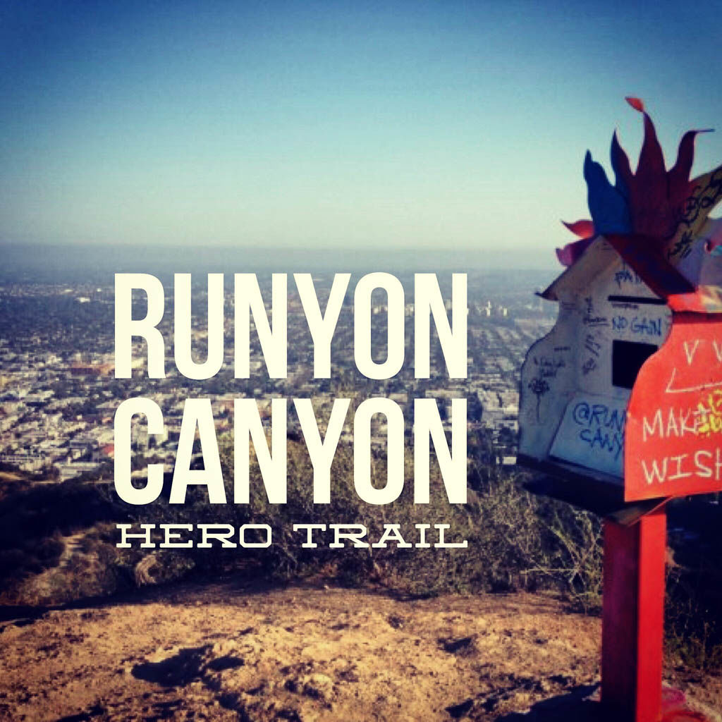
Walk uphill on Vista Street, following the street as it bends to the right and through the gate at the entrance to Runyon Canyon. From here, you might be tempted to follow the paved road right up the canyon. Don’t do it. Instead, look for the dirt trail that splits to the left and sharply uphill. This is the strenuous Hero Trail — much more fun, and you’ll lose a lot of the riff-raff in the process.

The trail uphill is quite steep in sections — almost to the point where your hands become helpful. But you’re rewarded with lighter crowds, a great workout, and an awesome view over the rest of the park. At the summit, you’ll find the Prayer Box.

Look around and you’ll also find the USGS benchmark.


Follow the trail around the mansions near the top of the hills until you reach the paved Runyon Canyon Road. Turn right and head downhill. At about the 1.5 mile mark, you’ll see a broad dirt trail bearing left and splitting away from the paved road. Take it. This is the Star Trail, and leads down the eastern ridge above Runyon Canyon.
There are several vistas with a benches where you can soak in the view. Some of the steeper sections of the trail have been improved with steps to make the going easier.

At the 2.25 mile point, take a sharp right and follow the paved road back into the canyon. You’ll pass the tennis courts, eventually reaching a bend as the road turns to head back down the canyon toward the trailhead, but don’t go there just yet. Pick your way through a little-travelled single track trail back up the canyon. About 300 yards back — hidden from view — is the Peace Spiral.

From here, turn around and follow the trail back to the paved road, and then down the canyon toward the Fuller Avenue entrance. You’ll see a trail to your right that climbs up and over a short hill and back to the Vista Street entrance.
Runyon Canyon Trail Map
Photo Gallery
Click on any photo to view a larger version. You can also leave comments on any photo.


Runyon Canyon Tips
- Runyon Canyon Park is maintained as an urban wilderness. There are lots of people, but also snakes, coyotes and deer.
- Dogs are allowed off-leash in much of this park. Read the signs for details.
- Best time to go is week nights, Monday through Thursday. Even so, don’t expect solitude.
Runyon Canyon Weather Forecast
[forecast width=”100%” location=”90068″]