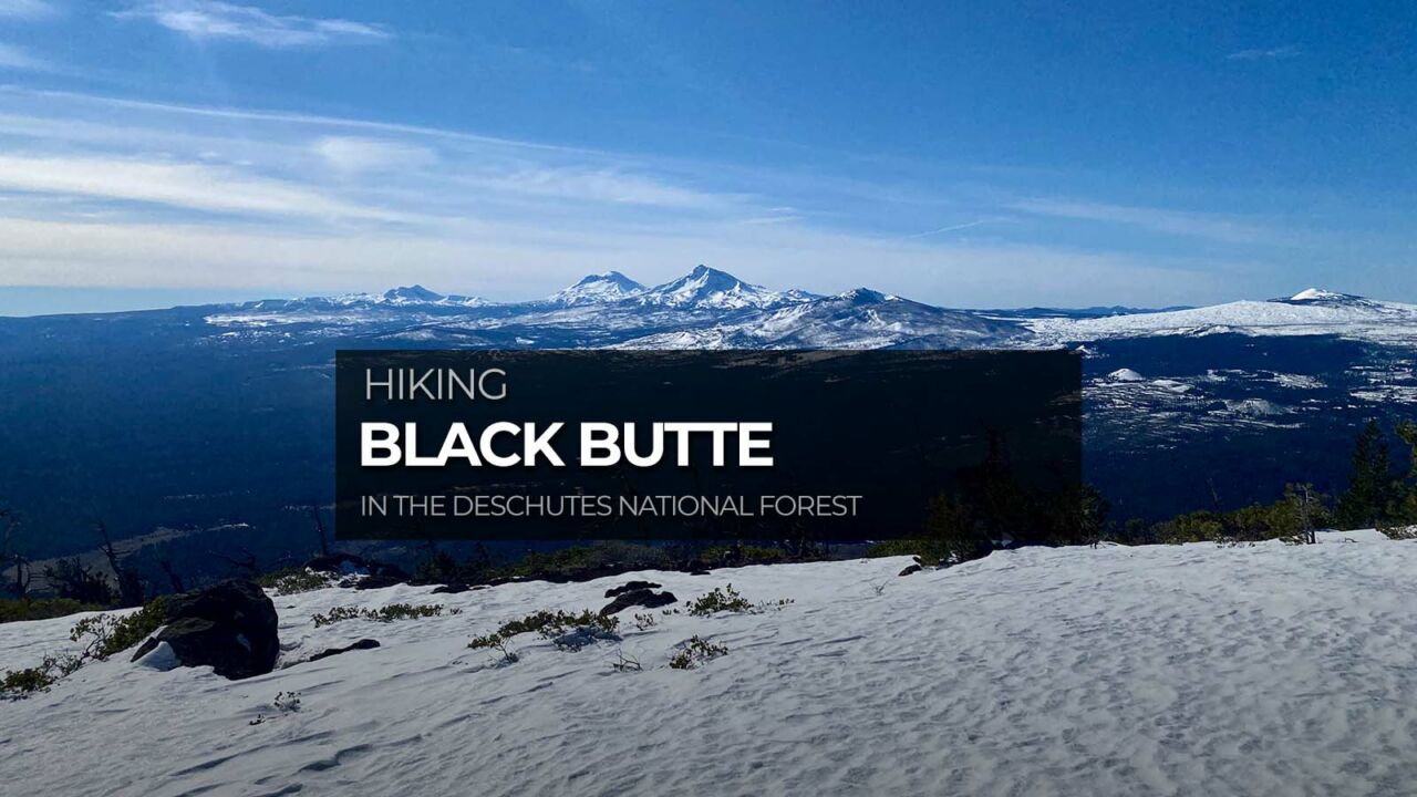
Hiking Black Butte

Black Butte is an extinct stratovolcano that sits east of the Cascades, rising 3,076′ above the surrounding plain. This symmetrical cone-shaped butte is home to an active fire lookout tower, as well as a historic cupola that you can easily imagine must have been the coolest summer digs ever, with spectacular views of Mt Washington, The Sisters and beyond.
Distance: 4.4 miles
Time: 2-3 hours
Difficulty: Moderate
Elevation gain: 1,443 ft
Dogs: Yes, on leash
When to go: Mid-June to early October
Download GPX
Getting to the Trailhead
There are two options for hiking Black Butte. The Upper Trailhead starts roughly half-way up the butte. It requires several miles of driving on a bumpy gravel road that narrows to one lane in sections, and results in the shorter hike described here. The road does not require high clearance or 4WD in dry conditions. The trailhead has plenty of parking and pit toilets. There is no water available. The Lower Trailhead begins just off Highway 20, and doubles the length and vertical gain. The route you choose is up to you.
You can get driving directions to the Upper Black Butte Trailhead via Google Maps here.


Hiking to the Summit of Black Butte
The trail is well-engineered, beginning with a gentle, persistent climb through shady forest.

Many of the trees are covered in moss, giving the forest a moody feeling that’s a perfect start for our morning hike.

About a mile up the trail, the forest clears and the wildflowers abound. This area on the south side of the butte is shady if you hit it early enough, but fully exposed as the sun rises higher in the sky.


At the 2 mile mark, the trail wraps around the east end of the butte, traveling through the remnants of a wildfire as you make the final ascent to the summit.

The top of Black Butte is broad, with an active fire lookout tower on the east end, and a historic cupola on the west end. There used to be a cabin just west and directly below the cupola, but it was removed. You can still see the foundation.
On a clear day, you can see up and down the Cascade Range, and east over much of Central Oregon.


[vr url=https://socalhiker.net//wp-content/uploads/2017/09/AEON6497.jpg view=360]


Retrace your steps to return to the trailhead.
Black Butte Trail Map & Elevation Profile
Black Butte Tips & Resources
- At the top, please stay on the marked trails to avoid damaging the fragile ecosystem.
- At the time of writing, no permits were required, but a Northwest Forest Pass is required to park at the trailhead May 1 to September 30. You can purchase a pass at the trailhead with $5 cash. If you have a hang tag with an annual National Parks pass, that will also work.
- Bring plenty of water, sun protection, and the other ten essentials.
- Check out William Sullivan’s 100 Hikes / Travel Guide Central Oregon Cascades (affiliate link) for more on the history and flora on Black Butte.
- Want more of a challenge? Start at Camp Sherman for double the mileage and the vertical climb!
Sisters Weather Forecast
[forecast width=”100%” location=”97730″]
 The Central Oregon Six-Pack of Peaks Challenge
Black Butte is part of the Central Oregon Six-Pack of Peaks Challenge, a self-paced hiking challenge that takes you up six, iconic peaks–each one a bit higher and tougher.
It’s a challenge in itself, or great training for still bigger adventures. Learn more and sign-up here.
Originally hiked with Joan and Dan on July 14, 2017.