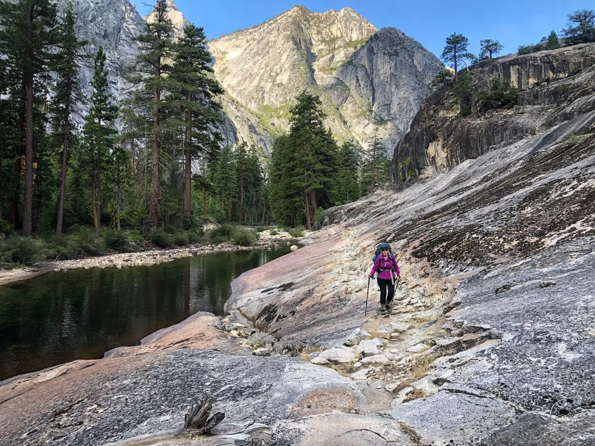
Yosemite National P ark, and in particular Yosemite Valley, is home to some of the most famous wilderness landmarks in America. But north of the Valley, and north of Highway 120 and Tuolumne Meadows, resides an area of the park known as the Yosemite Wilderness. And in the same way that the mighty Merced River cuts its way through the 3,000+ foot deep Yosemite Valley, so too does the powerful Tuolumne River cut its way through a similarly spectacular canyon in the Yosemite Wilderness know simply as The Grand Canyon of Tuolumne. This huge river runs West and Southwest from Tuolumne Meadows, through Glen Aulin and then almost 20 miles to the massive Hetch Hetchy Reservoir – all the while cutting its way through the deep and massive Grand Canyon of Tuolumne. The Grand Canyon features a series of famous waterfalls at it’s upper/Eastern end, including Waterwheel Falls, LeConte Falls, California Falls and Tuolumne Falls.
The Grand Canyon of Tuolumne can be backpacked as a multi-day out-and-back from either its West side or East Side, or it can be backpacked as a loop – starting from either Tuolumne Meadows or from White Wolf. We decided to backpack it as a loop starting and ending at White Wolf in a fantastic 5-day, 50-mile backcountry adventure.
Why start/end at White Wolf? Several reasons:
- During 2022, the Tuolumne Meadows backpacker’s camp was CLOSED for restoration and repairs. This eliminated the opportunity to sleep there the night before our start for acclimation and gear shakedowns. The White Wolf campground was open and available.
- The White Wolf campground is much closer to the entrance to the GC of Tuolumne, eliminating the out-and-back miles that would have to be repeated from Tuolumne Meadows to Glen Aulin and back.
- The White Wolf campground day one start would be almost all downhill into the GC of Tuolumne – a good way to start day one.
Planning the Trip
We booked our backcountry permit online through the Yosemite backcountry permit system exactly 168 days prior to our entry date. The map we used to plan our route was the Tom Harrison Yosemite High Country Map. This one map shows the entire route. We chose the following schedule for our trip – hoping that this would keep our average miles around 10 miles per day and also put us near water each night:
- Travel Day One: Drive to Yosemite National Park via Highway 395 and Highway 120 – enter YNP at the Highway 120 Eastern Gate. Acquire our backcountry permit at the Tuolumne Meadows ranger station. Then drive to White Wolf, sign in and pay the money at the drop box, and pitch camp in the White Wolf backpackers camp.
- Day One: Hike from White Wolf North to Harden Lake, then East/Northeast and down into the GC of Tuolumne to Pate Valley.
- Day Two: Hike East up the GC of Tuolumne to Waterwheel Falls.
- Day Three: Hike East up and out of the GC of Tuolumne to Glen Aulin, then South to the May Lake / Ten Lakes trail junction with a side trip to Polly Dome Lakes.
- Day Four: Hike West around Tuolumne Peak to Ten Lakes.
- Day Five: Hike over Ten Lakes Pass and then South and West to White Wolf, load up the car and then head home via a night in Bishop.
Total (Tom Harrison Map) Miles (including the side trip to Polly Dome Lakes): 48.9 Miles.
Yosemite Grand Canyon of Tuolumne Tips and Notes
- Wilderness Permits are required to stay overnite in the Yosemite Backcountry. All trailheads are based on a quota system, and permits can be applied for 168 prior to departure. For all information on Yosemite Wilderness Permits, trail quotas and applications, go to https://www.nps.gov/yose/planyourvisit/wildpermits.htm.
- With the exception of the White Wolf Campground backpackers camp, all of the campsites we used on the trail were backcountry sites with NO bear boxes for storage. Therefore, APPROVED bear canisters are required for this loop to store all food and items with a scent. You will be required to go through a quick education process on this when you pick up your permit at the Tuolumne Meadows permit station.
- We tracked the trip via GaiaGPS for iPhone. Our GPX track can be downloaded above.
- Due to our late season start date, water was scarce in some spots. Lakes and major streams should be used – seasonal water on maps was almost entirely dry. Earlier in the season would yield water from all seasonal sources and would require many wet trail crossings.
- Normally in Yosemite, campfires are permitted above 6,000 fee and below 9,600 fee in elevation in improved rock fire rings. This year, NO FIRES were permitted in the park backcountry.
- We had a short burst of heavy rain on Day 3 and light rain on Day 4, so make sure you have proper rain gear, pack covers and shelter on this loop.
Why Take This Route
If you are as passionate about Yosemite National Park as we are (after all, we were married at Glacier Point), then a trip to the Northern half of the park and the Yosemite Wilderness should be on your bucket list. The Grand Canyon of Tuolumne and it’s majestic canyon and stunning waterfalls are a box that should be checked off.
Another benefit of this route is the small numbers of people in late season – it is a true backcountry experience after Labor Day.
This loop is perfect for beginner backpackers and experienced backpackers alike.
There’s no better way to see the Northern section of Yosemite National Park than the Grand Canyon of Tuolumne Loop.
Originally hiked September 3-8, 2022 by Greg Glass and Barbara Hale. All photos by the same.