Day Three is the “Waterfall Money Day” in the GC of Tuolumne. The first three or so miles up to the top of the canyon and Glen Aulin feature a series of gorgeous falls and granite features. Again we started early to beat the heat, so our views of the falls were shaded and lovely.
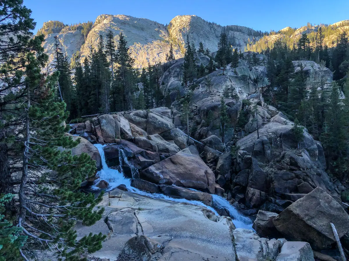
First, we arrive at LeConte Falls. Again, the late season flow is light, but it’s still an absolutely beautiful setting. Next, we climb up to California Falls – and hike in a bit off-trail to get a close up view. After California falls, the trail departs a bit North of the river and winds it way through the stunning Glen Aulin meadow. The walls of the canyon jut straight up from the side of the trail, and the lush green meadow creates an incredibly vibrant color pallet. As we approach the junction of the Pacific Crest Trail and the Glen Aulin High Sierra Camp, the final water feature is the White Cascade – with its water flow and red rock, the sunrise gives it an absolutely beautiful look.
We stop for a quick rest just after the bridge over the Tuolumne River to admire the magnificent Tuolumne Falls and check out the map for upcoming water sources. Again, the late season schedule as eliminated most if not all of the seasonal water sources – so we need to make sure we’ll have water on this next leg of the trip. After a map review, we decide that we’d better carry and extra load of water – so I fill up our dirty bag at the falls with 4 extra liters of water and strap it to the outside of my pack. Not the most pleasant additional weight, but better safe the sorry. With the water strapped in, we turn away from the PCT (that heads back to Tuolumne Meadows) and head south and UP on the May Lake trail.
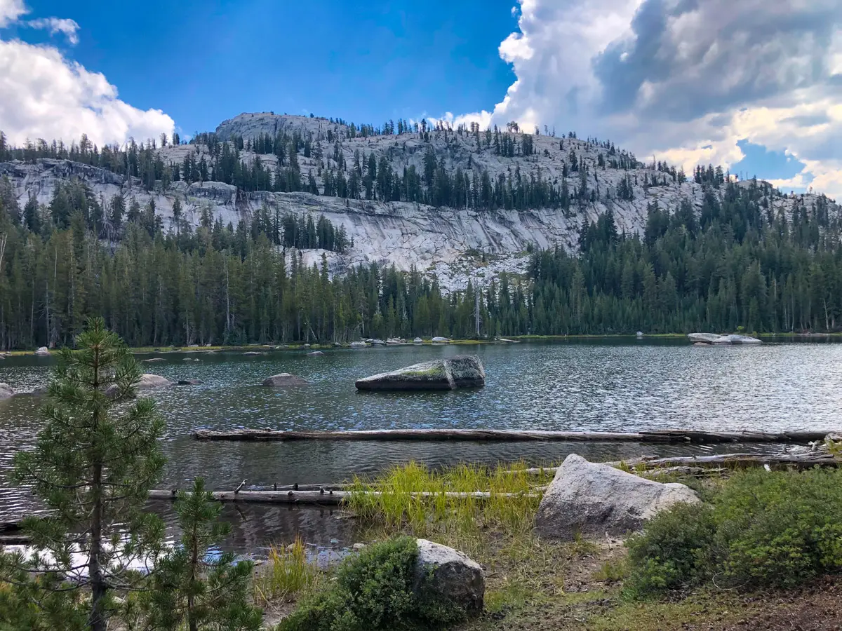
As we pass McGee Lake – a potential water source – we confirm that the lake is low and dirty, so we’re happy we have extra water. We encounter a solo hiker doing the same loop but counter clockwise and he confirms there’s not much water around. We then encounter two rangers on horseback that have ridden up from May Lake and Tuolumne Meadows on patrol. In a “small world” story, we find out that the ranger is from Southern California and works with Montrose SAR! We talk about the Angeles NF a bit, confirm the lack of water, and discuss a water side trip to Polly Dome Lakes. The ranger tells us how to find the trail and we say goodbye and carry on.
We find the turnoff to Polly Dome Lakes and I convince my wife that the extra 1.8 miles will be worth it to have a full water source. It’s a small up and down trail but it leads us to a beautiful and stunning setting on the lake with tons of camping areas. My wife is bushed from the lack of good sleep the night before, so I lay out a towel and get her comfortable for an afternoon nap. While she naps, I dump out all the water and do a complete fresh re-fill of all our water containers. Now we are good to go for the night and next morning. The combination of the water source, naptime and the beauty of this pristine lake make the 1.8 mile side trip totally worth it! After my wife wakes up – fully refreshed – the clouds start to roll in and it looks like a thunderstorm is on its way. So, we saddle up fast and head back to the main trail and south to the May Lake / Ten Lakes trail junction hoping to beat the storm.
We arrive at the trail junction and scope out a flat piece of ground to pitch camp. As it starts to sprinkle, we quickly get the tent up and get everything secured in the vestibule. No sooner are we done than the thunder, lightning and rain hit full force. We jump in the tent and hunker down, riding out 30 minutes of storm. When it passes, we climb back out – inspect everything – and cook dinner. We are good to go for the night with enough water to get us to the next viable source on the way up to Ten Lakes the next day.
You must be logged in to post a comment.