• COVID-19 Park and Trail Closures
  • Learn about the Six-Pack of Peaks Challenge
  • Shop
  •  

SoCal Hiker

  • Find a Hiking Trail
    • All Areas
    • Arizona
    • Colorado
    • Los Angeles
    • Orange County
    • Oregon
    • San Francisco Bay
    • Washington
  • Trail Guides
  • Six-Pack of Peaks
    • Colorado Six-Pack of Peaks
      • Bergen Peak
      • Rocky Mountain
      • Birthday Peak
      • Horseshoe Mountain
      • Grays Peak
    • New England Six-Pack of Peaks
    • NorCal Six-Pack of Peaks
      • Mount Umunhum
      • Mount Saint Helena
      • Mount Tamalpais
      • Mount Diablo
      • Mount Sizer
      • Rose Peak
    • Oregon Six-Pack of Peaks
      • Tumalo Mountain
      • Black Butte
      • Black Crater
      • Maiden Peak
      • Mount Bachelor
      • South Sister
    • SoCal Six-Pack of Peaks
      • Mt. Wilson
      • Cucamonga Peak
      • Mt. San Antonio (Mt Baldy)
      • San Bernardino Peak
      • San Jacinto Peak
      • San Gorgonio
  • Backpacking
    • High Sierra Trail
    • John Muir Trail
      • Overview of the John Muir Trail
      • Training
      • Day-by-Day Itinerary
      • Resupply Addresses
      • JMT Discussion Forum
    • Lost Coast Trail
    • North/South Lake Loop
    • Rae Lakes Loop
    • Red Peak Pass Loop
    • Theodore Solomons Trail
    • Trans-Catalina Trail
    • Wonderland Trail
  • Gear
  • Forums
    • Latest Topics
    • Ask a Question
    • Campfire
    • Trails
    • Trail Reports
    • Gear Wisdom
    • Classifieds
  • Login

Mishe Mokwa Trail to Sandstone Peak

September 20, 2013 By Jeff Hester 15 Comments

Sandstone Peak from Circle X Ranch

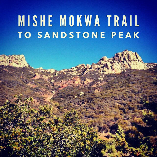
Sandstone Peak and the Mishe Mokwa Trail in particular are revered by many as one of the “must-hike” trails in Southern California. Casey over at Modern Hiker describes it as “the Hike That Got Me Hiking.” It was Kolby “Condor” Kirk’s 6th hike in his 100 hikes goal, back when he really getting into hiking. This trail is located in the Santa Monica Mountains near the border of Los Angeles and Ventura County, and with views of the valley, the Pacific Ocean, and the mountains to the east, not to mention Balancing Rock, Split Rock and other interesting it is a pretty special area.

Trail Details
Distance: 6.1 miles
Time: 3-4 hours
Difficulty: Moderate
Elevation gain: 1,686 ft
Dogs: No
When to go: Year-round
I had wanted to hike the Mishe Mokwa trail to Sandstone Peak for a while. I had originally planned to hike Sandstone Peak with some hiking friends a few months back, but the Camarillo Springs Fire broke out a few days before our planned hike, and we had to change our plans. This past weekend it finally happened.

The Sandstone Peak trailhead parking is about one mile past Circle X Ranch on Yerba Buena Road. The landmark on Pacific Coast Highway is the famous seafood roadhouse, Neptune’s Net — where we would stop for lunch after our hike. The road up to the trailhead is narrow and very crooked. We took our time and saw more bicycles than cars.

Sandstone Peak Trailhead

The gravel parking lot has plenty of parking. Near the entrance is a sign with details on the area and the requisite warnings about wildlife and safety. The trail begins at the gate, and proceeds promptly and steeply up hill.

Sandstone Peak Trailhead

After about 0.4 miles you reach the first of many junctions. To the left, the trail heads directly to Sandstone Peak — a little over a mile away. To the right is the Mishe Mokwa trail. This trail also takes you to Sandstone Peak. It is a longer route, but it turns the hike into a loop with some really interesting things to see and lots of options for add-on adventure. We headed to the right.

Backbone Trail Junction

The trail winds along the side of the mountain, with views extending across the valley and often much further. In another 0.2 miles we reached another junction. This is where the Backbone Trail joins the Mishe Mokwa Trail. We stayed to the left and followed the trail along the backside of the mountain.

Backbone Trail Junction

At about the 1.5 mile mark, look across the valley and you’ll see the remarkable Balancing Rock. This huge boulder looks like a gentle breeze could topple it, but it’s been there for ages. It’s remarkable.

Balancing Rock

The trail winds along the side of the valley, eventually reaching a shady low-point at Split Rock. Another great boulder, this one split into three pieces. One of the cracks is big enough to walk through. There is a picnic table, and it’s a great spot for a break.

Split Rock

Optional Side Trip #1 – Balancing Rock

Just beyond Split Rock you’ll see a sign for the trail to Balancing Rock. This is an out-and-back side trip that will take you up close to that giant, tottering boulder. We decided to take this another time. We continued on the Mishe Mokwa trail, climbing gradually higher and higher.

The Mishe Mokwa Trail

Optional Side Trip #2 – Tri-Peaks

At about the 3 mile mark you’ll come across a couple of junctions with signs to Tri-Peaks. This out-and-back option adds a fair climb and another mile to the trip. It was hot, and we decided to stick to our original plan: bag Sandstone Peak.

Tri-Peaks

Inspiration Point

At 3.5 miles, look for the sign to your right to Inspiration Point. This is a very short spur that really doesn’t add much to the length of the trek, and provides some truly inspirational views.

View from Inspiration Point

Continuing on, we climbed in full exposure. It was getting hotter than we expected. We were grateful when we reached the final spur that took us to the top of Sandstone Peak. We ascended these steps, then picked our way along the ridge line. The trail is sometimes difficult to find, but we aimed for the summit, and soon were there. The last bit we even used our hands here and there as it’s fairly steep.

Memorial atop Mt. Allen, AKA Sandstone Peak

Sandstone Peak

The views from Sandstone Peak are phenomenal.

View from Mt. Allen

The Summit Register

Most of the popular and prominent peaks in Southern California have  a small notebook stashed near the peak in a waterproof canister. It’s customary to sign the summit register to record your ascent of said peak. For many peaks the Sierra Club regularly  replaces these notebooks, which on popular trails can fill up quickly. The historical registers are sent to the Bancroft Library in Berkeley for archival, and are available for viewing.

The summit register atop Sandstone Peak looks like an old-fashioned brass-covered mail slot, built into the memorial to Herbert Allen, the namesake of Mount Allen, the real name of what everyone calls Sandstone Peak. Confused? It may be the heat.

Speaking of the heat, and summit registers, it’s always entertaining to see what other hikers scrawl in the trail register. It’s customary to leave a little message to mark the occasion, as well as the date and your name. On this particularly hot day, the entries were muy caliente!

It’s HOT! Hotter than the crevasses of Satan’s butt cheeks.”  – Summit register entry from earlier in the day

Sandstone Peak Summit Register

Video from Sandstone Peak and the Backbone Trail

This is my first attempt at recording video using my StickPic. I recorded a couple thoughts at the summit of Sandstone Peak, as well as on the hike down the Backbone Trail to the trailhead. It’s a little rough around the edges, so if you’ve used one of these and have some tips, let me know.

[responsive_youtube Fcw46cv7nXM norel]

Mishe Mokwa to Sandstone Peak Trail Map

© OpenStreetMap contributors
Download

Photo Gallery

Click on any photo to view a larger version. You can also leave comments on any photo.

Sandstone Peak from Circle X Ranch
Sandstone Peak Trailhead
Mishe Mokwa and the Backbone Trail
Junction
Junction
On the Mishe Mokwa Trail
Balancing Rock
Balancing Rock
Split Rock
Split Rock
IMG_1156
Tri-Peaks
View from Inspiration Point
IMG_1150
IMG_1152
IMG_1154
IMG_1157
IMG_1159
Memorial atop Mt. Allen, AKA Sandstone Peak
View from Mt. Allen
IMG_1160
Sandstone Peak Summit Register
IMG_1164
IMG_1166
Google Earth overview of Mishe Mokwa Trail to Sandstone Peak (Mt. Allen)

Sandstone Peak Tips

  • Bring the 10 essentials
  • Take time to thumb through the summit register
  • Be sure to stop at Inspiration Point
  • No permits are required
  • Trailhead parking is free
  • The road getting to the trailhead is very windy so take your time.

More Sandstone Peak Resources

  • Hike the entire trail (in reverse) in 15 minutes (video)
  • Hiking Mishe Mokwa Trail to Tri-Peaks and Sandstone Peak – ModernHiker
  • Hiking Mishe Mokwa Trail to Sandstone Peak: A Photo Guide – California Through My Lens
  • Trail Guides and Hiking Books for the Santa Monica Mountains
  • Santa Monica Mountains National Recreation Area

Sandstone Peak Weather Forecast

The location could not be found.

I found that this forecast underestimates the temperature for this location. I got better results from the NOAA website.

Related

Filed Under: Trail Guides Tagged With: 6-8 miles, coastal, moderate, peakbagging, Sandstone Peak, Santa Monica Mountains, Santa Monica Mountains National Recreation Area, Ventura County

Like what you found here at SoCal Hiker? This site is a labor of love. Share your support for the site and help us development of new trail guides and expanded coverage -- make your next outdoor equipment purchase through our advertisers.

You can also subscribe to our weekly newsletter and follow us on Facebook or Twitter.

Jeff H

About Jeff Hester

I'm an avid hiker and backpacker. My wife Joan and I are on the trails every weekend. I started SoCal Hiker to share my passion for outdoor adventure.

Comments

  1. Josh says

    September 23, 2013 at 12:55 pm

    Awesome post! I really like the recap and the video addition. My stickpic story is i put my Gopro on it and didnt not push it all the way down, I was walking down some switchbacks and next thing I know the gopro was in the dirt haha. So make sure it is on secure!

    Reply
  2. Jeff HJeff Hester says

    September 24, 2013 at 7:25 am

    I hope your Gopro was okay. I was using my trusty Canon SD780. It’s sturdy, but I don’t think it would like being dumped in the dirt. Actually, that makes me think– maybe there is a way to use the wrist band to tether it to the pole “just in case.”

    Reply
  3. Dhaval Rawal says

    September 29, 2013 at 8:43 pm

    Between your and http://californiathroughmylens.com/'s post, i had to do this post. Did the Sandstone peak then the Mishe Mowhawk trail. Got tiresome towards the end, but loved every bit of it.

    Thanks for sharing!

    Reply
    • Jeff HJeff Hester says

      October 3, 2013 at 5:16 am

      I’m glad you were inspired! I prefer to do the Mishe Mokwa Trail first, as it’s a more gradual incline to Sandstone, but to each his own. And sadly, that trail is now closed because it falls within the jurisdiction of the Santa Monica Mountains National Recreation Area (a National Park System area). Let’s hope that gets resolved quickly so this wonderful trail can be enjoyed again.

      UPDATE: I posted this comment when the parks were shut down temporarily during the government shut-down in 2013. It has long since been open.

      Reply
  4. Pam S. says

    January 12, 2015 at 7:16 pm

    Is the trail open yet? Just read your post and wanted to try this weekend.

    Reply
    • Jeff HJeff Hester says

      January 12, 2015 at 7:39 pm

      Hi Pam! As far as I know, this trail wasn’t closed. Are you referring to the PCH closure?

      Reply
      • Pam S. says

        January 12, 2015 at 8:25 pm

        In the last comment you wrote that trail is now closed because it falls within the jurisdiction of the Santa Monica Mountains National Recreation Area (a National Park System area). But I just realized it was written a few years ago – thanks for the response. Im going to try it as soon as pch opens up.

        Reply
  5. Jeff HJeff Hester says

    January 12, 2015 at 8:58 pm

    Whoops! That comment on October 3, 2013 was during the government shut-down, when all the National Parks were closed until Congress and the President worked out a budget. It’s been open for a long while since. I’ve added a note to that comment to clarify that point.

    Reply
  6. Daniel Arriola says

    February 28, 2015 at 8:09 pm

    Planning on going tomorrow. Good idea? Or bad?

    Reply
    • Jeff HJeff Hester says

      March 3, 2015 at 1:35 pm

      Daniel, I presume you meant in the rain that was forecast? Most of the trail is going to drain pretty well, so even in wet weather the trail should be manageable. There may be sections that would get either slippery or muddy though.

      Did you end up hiking it? If so, what was the weather like and how was the trail?

      Reply
  7. Dwight says

    March 29, 2015 at 9:30 am

    Did this yesterday, March 28 2015. Parked at the Mishe Mokwa parking lot and hit the MM trail at 10:30a. First hike using trekking poles and found them to be quite useful. Stayed on then trail and hit the Sandstone Peak in exactly two hours and 5 miles. Enjoyed the awesome view (ocean blocked by the marine layer) then took the “to the parking lot” trail. Pretty busy day on the trail. There were a lot Korean hikers out with a couple of the gentlemen singing acapella Korean songs that added a pleasant diversity to the hike. We took the return (almost all downhill) trail all the way into the parking lot then we realized it was the wrong parking lot. We walked along the road about a half mile up then found our parking lot. We ended up logging 7.45 miles for our hiking adventure. The MM trail offered so many different varieties of flora and terrain types making it even neater!

    Reply
  8. Allen says

    August 15, 2015 at 4:18 pm

    Is there water at the top of sandstone?

    Reply
    • Jeff HJeff Hester says

      August 17, 2015 at 5:17 pm

      No water anywhere on that loop, sadly. BYOW! 🙂

      Reply
  9. Nic says

    November 10, 2017 at 11:28 am

    Your trail description says no dogs but the picture of the trail sign says they are allowed on leash.

    Reply
  10. Andrew Pish says

    August 27, 2020 at 11:42 pm

    Just did this today! Great information here, I felt very prepared for the hike.

    Reply

Leave a Reply Cancel reply

Your email address will not be published. Required fields are marked *

This site uses Akismet to reduce spam. Learn how your comment data is processed.

About Jeff Hester

I created SoCal Hiker while preparing to thru-hike the John Muir Trail. My goal? Create guides for the best hiking trails throughout Southern California--and occasionally beyond. I personally hike each trail to create these guides, sharing practical advice on gear and outdoor skills. Read more...

Connect with SoCal Hiker

  • 22,237 Fans
  • 11,783 Followers
  • 21,640 Followers
  • 1,685 Followers
  • 5,467 Subscribers
  • 331 Subscribers

Get the SoCal Hiker Newsletter

Sign up to get your weekly trail recommendation and the latest updates from SoCal Hiker.

SoCalHiker was selected one of USA TODAY's 10 Best Hiking and Outdoor Blogs
Get our day-by-day guide to thru-hiking the John Muir Trail
Get up-to-day wildfire status throughout California

Products

  • Six-Pack of Peaks Patch for 2016 2016 Six-Pack of Peaks Patch $6.00
  • Let your #SixPackOfPeaks flag fly Six-Pack of Peaks Camper Cap $23.00
  • Señor Muir Taco Hut T-Shirt $19.00 – $27.50
  • Mount Wilson T-Shirt $23.00 – $27.00

Sponsors

Sponsor SoCalHiker and see your banner here

Featured Posts

Hiking Black Mountain in Rancho San Antonio County Park

At 2,812 feet, Black Mountain looms large, way up, and behind, the smaller hills to … [Read More...]

Hiking Camelback Mountain via the Echo Canyon Trail

Camelback Mountain is the most popular mountain to hike in the Phoenix area for good … [Read More...]

Hiking to High Point on Palomar Mountain in the Cleveland National Forest

Appropriately named High Point is the highest peak in the Palomar Ranger District of … [Read More...]

Lastest Comments

  • Oliver John on 10 Overnight Backpack Trips in Southern California
  • Gustavo on Social Distancing on Public Trails
  • katrien on Gear Review: BioLite Stove
  • Jacob on Vital Link Trail to Verdugo Peak
  • Greg on San Gabriel Peak, Mt Disappointment, Mt Deception, Mt Markham and Mt Lowe
Get your SoCalHiker stickers now

Get your SoCalHiker stickers!

Latest Posts

  • Hiking Black Mountain in Rancho San Antonio County Park January 31, 2021
  • Hiking Camelback Mountain via the Echo Canyon Trail December 9, 2020
  • Hiking to High Point on Palomar Mountain in the Cleveland National Forest December 4, 2020
  • Hiking Hot Springs Mountain on the Los Coyotes Reservation November 19, 2020
  • New Day Hiking Permit Requirements for Wilderness Areas in the San Bernardino National Forest August 31, 2020

Recent Forum Topics

  • 1st overnight backing trip
  • Recommendations for trips for me and my dog
  • log hikes
  • My Baldy
  • Cactus to Clouds v. Iron Mountain

The Six-Pack of Peaks Challenge Series

Six-Pack of Peaks Challenge SeriesThe Six-Pack of Peaks Challenge gives you an opportunity to explore your world while supporting a great cause.

Flex your adventure muscles!

Learn more here.


Search

Tags

3-6 miles 6-8 miles 8-10 miles 11+ miles Arizona Backpacking coastal dog-friendly easy family-friendly High Sierra Trail hiking Hiking The John Muir Trail hipster inspiration JMT John Muir John Muir Trail Kings Canyon National Park LA County moderate Mount Rainier National Park Muir Monday National Forest National Park Orange County Oregon out of bounds Pacific Crest Trail peak peakbagging quote scenic Sierra Nevada Six-Pack of Peaks State Park strenuous Thru-hiking Utah vista Washington waterfall wilderness Wonderland Trail Yosemite

Copyright © 2021 SoCalHiker.net · Metro Theme on Genesis Framework with WPEngine Hosting · Contact SoCal Hiker · Sitemap · Privacy Policy

Copyright © 2021 · Metro Pro Theme on Genesis Framework · WordPress · Log in