
Today was our fourth and final day on the Lost Coast Trail. The last day of any backpacking trip is always bittersweet. We looked forward to sleeping in a bed and eating a meal that wasn’t rehydrated. Yet we want to linger and savor the sense of peace and connectedness we’ve enjoyed on the trail.
Time: 5 hours
Difficulty: Strenuous
Elevation gain: 75 ft
Dogs: Yes
When to go: Year-round
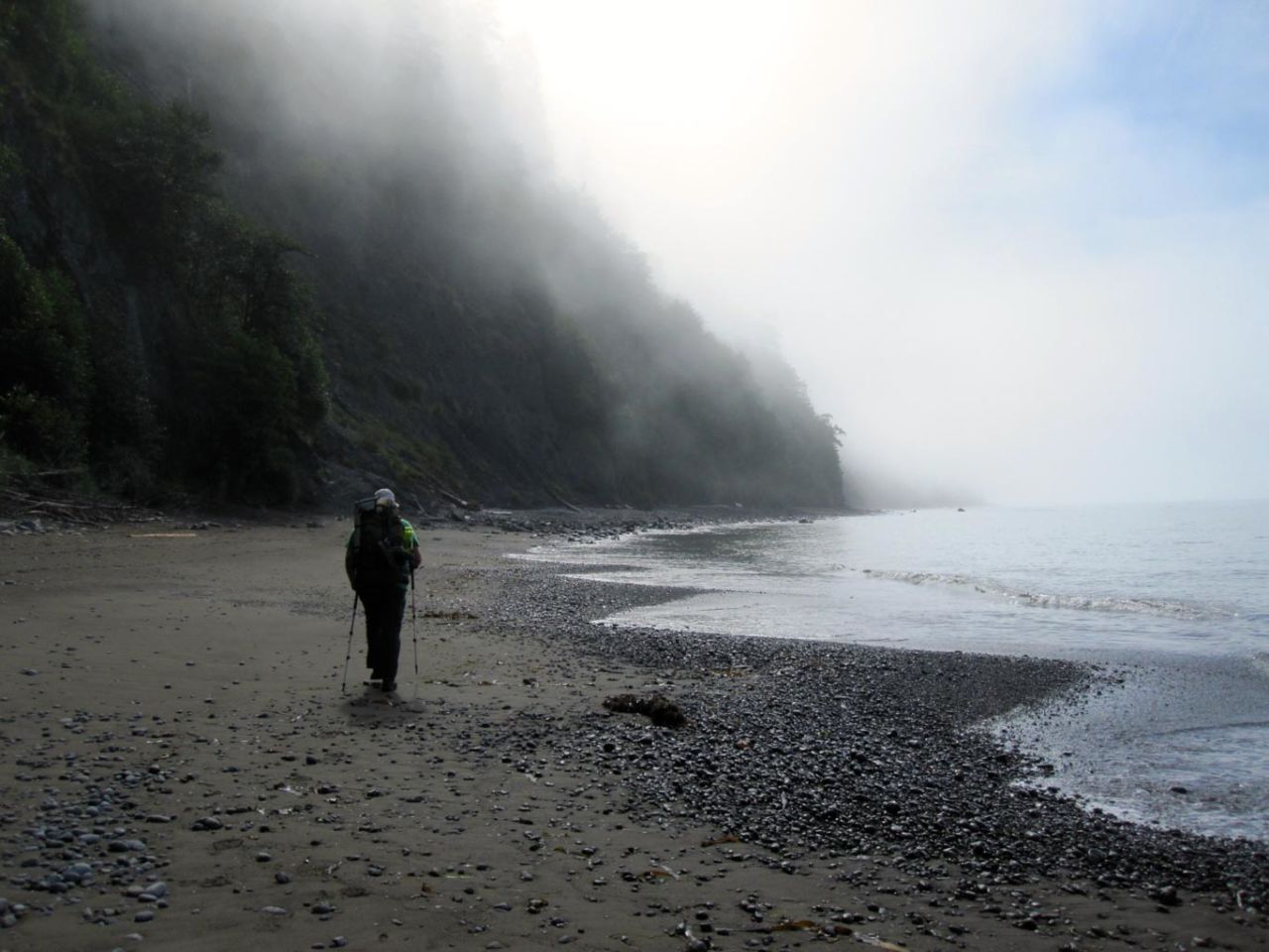
Our tide chart told us that high tide peaked at 7:45am. We broke camp in the morning mist and headed south down Miller Flat. One mile south of Big Flat Creek, the terrace ends and the trail heads down to the beach. We arrived a bit early, and the surf still lapped the rock outcrops. We dropped our packs and enjoyed the smell of the salt air and the sound of the waves crashing. The cobbled beach stones chattered as the surf pushed and pulled them down the beach.

Soon we were joined by two other groups of backpackers. The first — an older group of four brothers and their father; the second a group of three twenty-somethings — one hiking barefoot. One by one each group started back down the Lost Coast as the tide began to recede. We unconsciously created space between each party, so we still had the sense of having the trail mostly to ourselves.

The entire Lost Coast Trail is beautiful and surprisingly diverse. But this 4.5 mile section from the south end of Miller Flat to Gitchell Creek may have been my favorite section of the trail. You walk on the beach. The mountains and the forest drop precipitously down to the beach itself. At high tide, the surf meets the forest.
The close proximity of thick forested hills provides hiding spots for the deer, bear and other creatures whose prints you will often see in the sand. It’s odd to think of a bear or a deer on the beach, but here its quite normal. And who can blame them!? The scenery is absolutely breathtaking.


Along this section are two popular camp areas at Shipman Creek and Buck Creek. These often fill up, which was one reason we stayed at Miller Flat.
The next mile beyond Gitchell Creek shows signs of signifcant erosion — a reminder that the sea is continually reshaping the coastline.

At mile 8.2 there are two significant boulders on the beach. When you reach these, you’re in the home stretch. Beyond these rocks the beach widens, and on a clear day you can pick out a few homes on the bluffs of Shelter Cove two miles away.

The Black Sands Beach trailhead parking is on a bluff between Telegraph and Humboldt Creeks. Continue past Telegraph Creek, then head up the north side of Humboldt Creek and you’ll see the walkway.
Lost Coast Trail: Day Four Trail Map
Day Four on the Lost Coast: Photo Gallery
Click on any photo to view a larger version. You can also leave comments on any photo.


 is Near")


After the Hike
We stowed our gear and I put on a fresh shirt that I left in the car, then headed for lunch in Shelter Cove. From there, we drove the long, windy road back to the 101 and turned south. Our destination? A civilized finish to the trip with a stay at the Glendeven Inn in Mendocino. Highly recommended.
Shelter Cove Weather Forecast
[forecast width=”100%” location=”95589″]
 Overview of the Lost Coast Trail
- Day 1: Mattole Beach to Sea Lion Gulch
- Day 2: Sea Lion Gulch to Spanish Flat
- Day 3: Spanish Flat to Miller Flat
- Day 4: Big Flat to Shelter Cove – You are here

You must be logged in to post a comment.