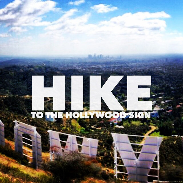
Mt. Lee, the Hollywood Sign and Bronson Caves
Trail Details
Distance: 7.5 miles
Time: ~2-3 hours
Difficulty: Moderate
Elevation gain: 1,003 ft
Dogs: Yes, on leash
When to go: Year-round
Time: ~2-3 hours
Difficulty: Moderate
Elevation gain: 1,003 ft
Dogs: Yes, on leash
When to go: Year-round
I moved up to LA from south Orange County in 2012, and when look down my street, I can see the Hollywood Sign on the hills a few miles away. It’s a very popular hike (you’ll see lots of other people on the trail), but in spite of that, it was on my “must-hike” list, especially now that I’m living so close.
A Brief History of the Hollywood Sign
 The original sign was build in 1923 by Los Angeles Times publisher Harry Chandler as an advertisement for his upscale “Hollywoodland” residential development. The development went bust — a casualty of the Great Depression — and the sign fell into disrepair. The “H” fell over, and the sign now read “OLLYWOODLAND.” It finally became city property in 1944.
After the war, the Hollywood Chamber of Commerce spruced up the sign, removing the “LAND” and repairing the toppled “H.” And again, it slowly fell into dispair. By the mid-70s, it was in bad shape, and in 1978, Hugh Hefner organized a fundraiser to restore the sign. A wacky range of celebrities stepped up to sponsor a letter, ranging from Alice Cooper to Gene Autry and Andy Williams.
The Trail
There are several routes to the sign, but this one is great because it also takes you on a short side trip to the Bronson Caves — famous for use as the Batcave in the 1960s Batman television series. Yes, this is the cave that you saw the Batmobile speed out of on it’s way to fight the villans of Gotham, and you can hike right through them!
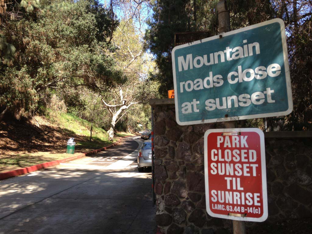
Getting to the Trailhead
Park at the end of Canyon Drive. There is parking inside the boundaries of Griffith Park, but when it’s full, you can also park on the street along Canyon Drive. Observe the signs, and be sure not to block any driveways.
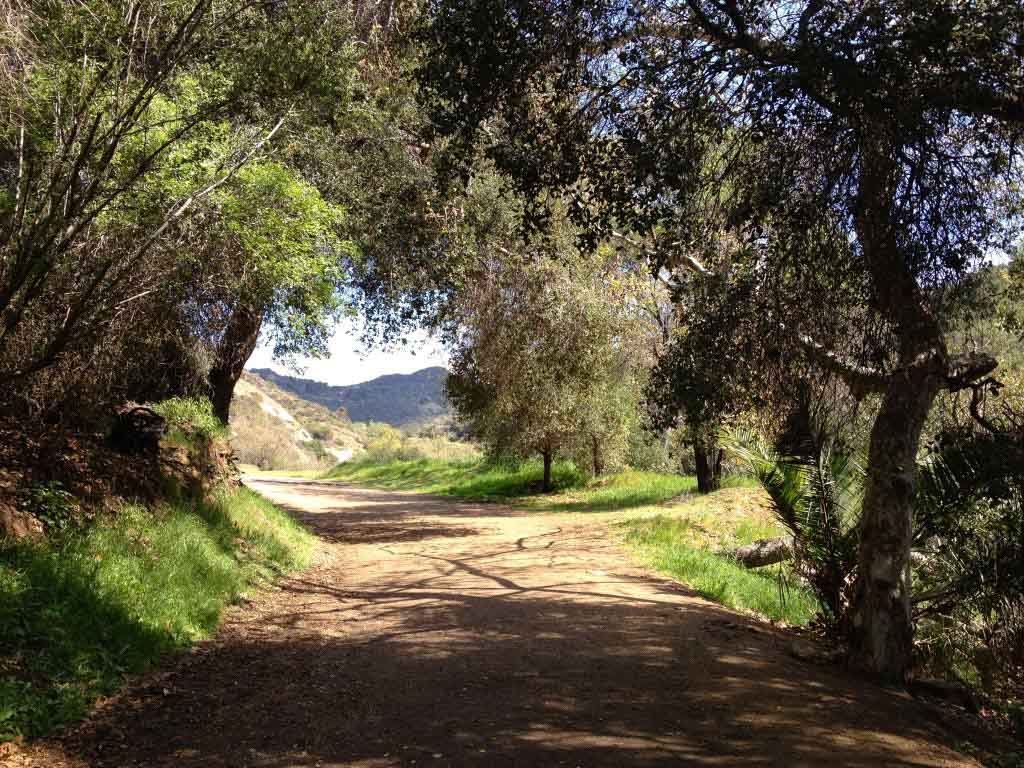
The trail begins in a busy park area popular with families for the playground, the trees and the picnic areas.
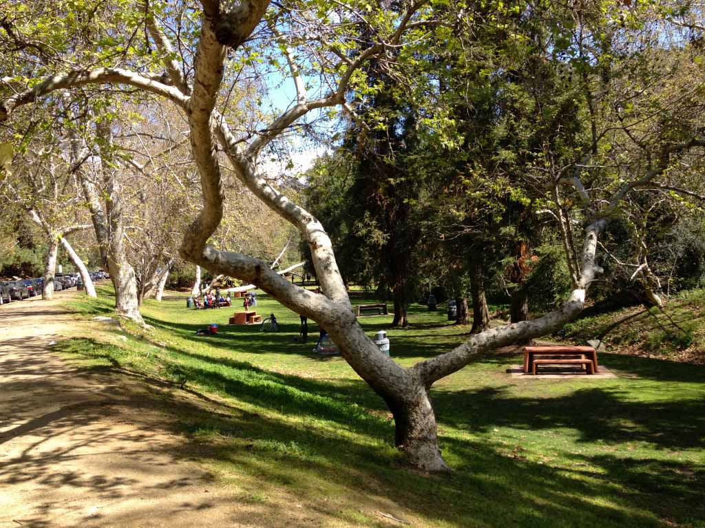
It’s very pleasant, and makes a great place for an aprés-hike picnic.
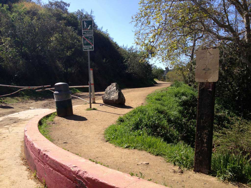
Before heading up to the Hollywood Sign, look for a turnoff towards your right (east). This is the short out-and-back spur to the Bronson Caves.
Follow this dirt road about 1/4 mile and you’ll see the caves off to the left.
The term “cave” is a misnomer. They are actually man-made tunnels leftover from a quarry operation in the early 1900s. The tunnels served as the setting for the Batmobile’s speedy departure from the Batcave in the ’60s, and has also been used for various photo, TV and movie shoots over the years. A fitting side-trip for our hike to the Hollywood Sign, and a great place for dramatic tunnel photos.
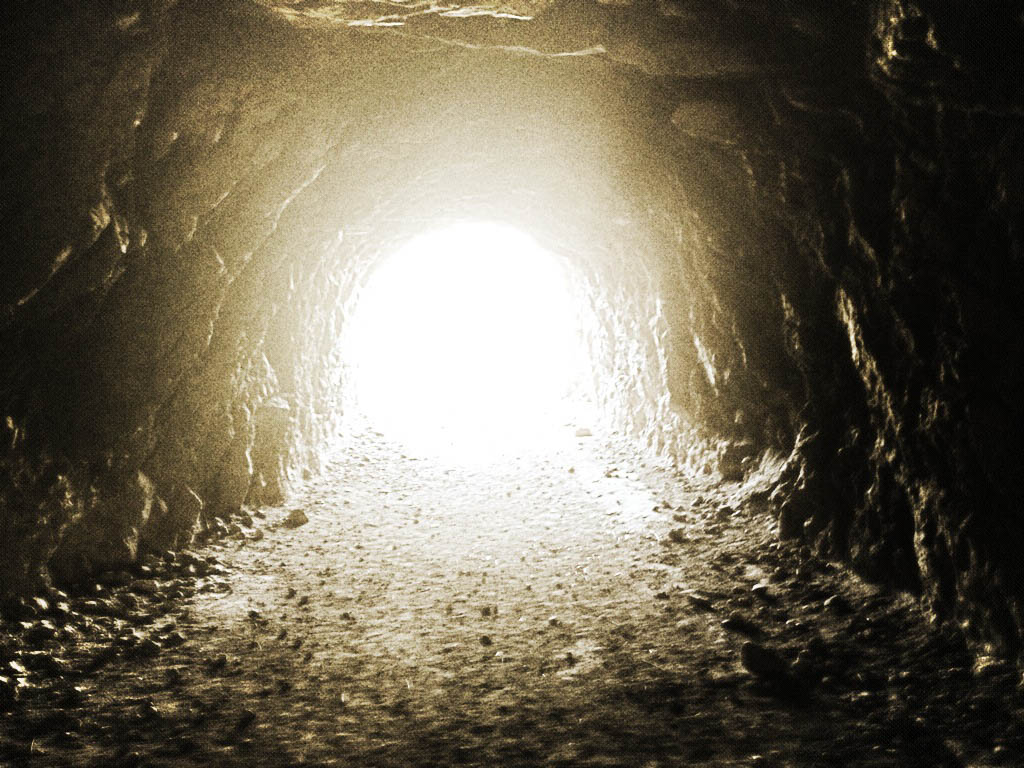
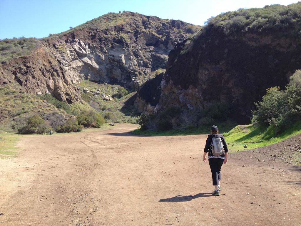
Exploring the tunnels doesn’t take long, since it’s pretty short, but it’s fun and worth the short side trip. Retrace your steps to Canyon Drive, then continue your trip up the canyon. Keep heading north along the road and you’ll reach a point where it becomes a fire road chained off to cars.
Continue on and you’ll begin climbing up and above the treelined canyon. Most of this hike is exposed to the sun, so bring a hat and sunscreen (you can thank me later).

The first junction will be at the top of the canyon, where you will turn left (west) on the Mulholland Trail. This is a relatively level trail — a nice break after a good climb out of the canyon. Follow this westward and it takes you to the Hollywood Sign.
IMPORTANT NOTE: There are two additional trail junctions you will pass along the way: the Beechwood and Mt Lee trails. Bear right at each of these junctions. This will seem counterintuitive — at the second junction, you’ll feel like you’re moving away from the sign (which is true, for a moment). The trail to the top actually goes around the north side of Mt. Lee in a spiral, so stick with it.
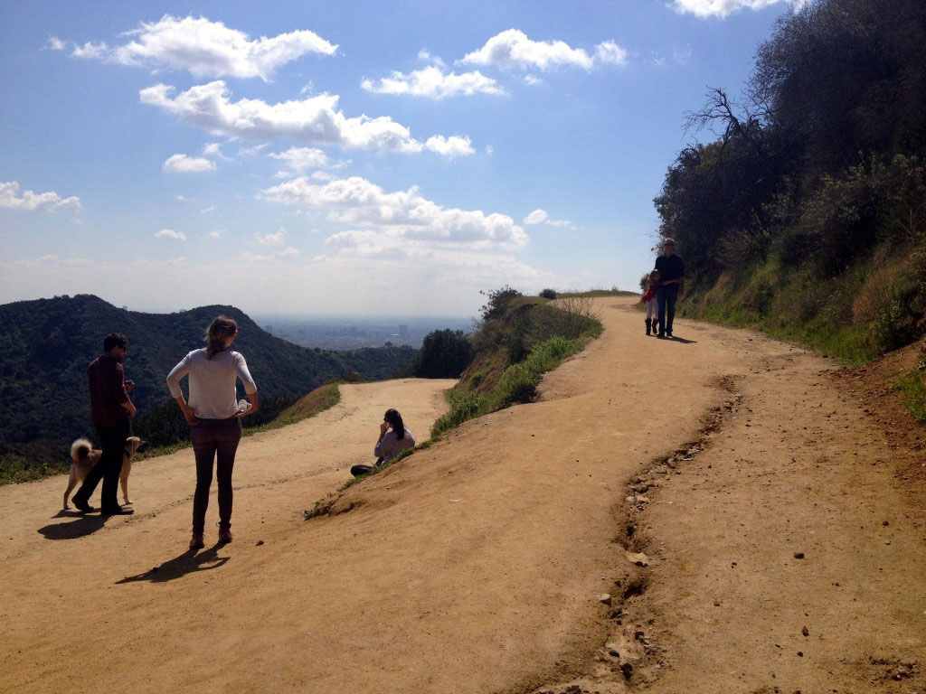
Along the way you’re rewarded with great views of Los Angeles and the valley, from the Pacific Ocean to the San Gabriel Mountains and beyond.
When you reach the Hollywood Sign, you’re actually behind and slightly above. The sign itself is surrounded by a security fence (with cameras). Don’t bother trying to climb over for a closer look. No, you cannot sit in the letter “O” and dangle your feet like you’ve seen in the movies.
But don’t stop there. Follow the spiral road to a short trail to the summit of Mt. Lee. This is where you’ll have the best shot of the famous sign, and the city beyond.
Soak it in, and when you’re ready, retrace your steps to Canyon Drive. You’ve just tasted a bit of LA history!
This is a fun trail to take visiting friends and family on. Not a wilderness trek, but rich with history, great views of the city and fun to talk about afterwards. Cap off your hike with a picnic near the trailhead, or do like we did — and head to Go Burger on Sunset and Vine.
Trail Map
Photo Gallery
Click on any photo to view a larger version. You can also leave comments on any photo.


More Hollywood Sign Trail Resources
- Get to the trailhead parking on Google Maps.
- GPS user? Download the GPX file
- The Hollywood Sign Trust – Great resource for more details on the history of the sign.
- Live webcams of the Hollywood Sign
- Other Perspectives
- Hiking Griffith Park – Mt. Lee to the Hollywood Sign – ModernHiker
- Hollywood Sign and the Batcave in Griffith Park – Greene Adventures
- Hollywood Sign & the Batcave – California Through My Lens
- Three Ways to the Hollywood Sign – An overview of alternate trails, via LAist
- Hiking to the Hollywood Sign – Gadling
You must be logged in to post a comment.