
Hiking to Devils Postpile and Rainbow Falls
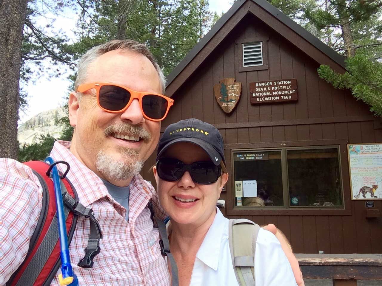
Devil's Postpile Ranger Station trailhead
Moderate
4.5 mi
Out-and-back
4.5 mi
7.2 km
Distance
690 ft
210 m
Gain
7,674 ft
2,339 m
Summit
2-3 hours
Est. time
I’ve been to the unique geologic formation known as Devils Postpile several times, including on my thru-hikes of the John Muir Trail. Last time, we didn’t take the trip up to the top, nor did we visit the impressive Rainbow Falls, so when we were up in Mammoth Lakes, both were on our to-hike list.
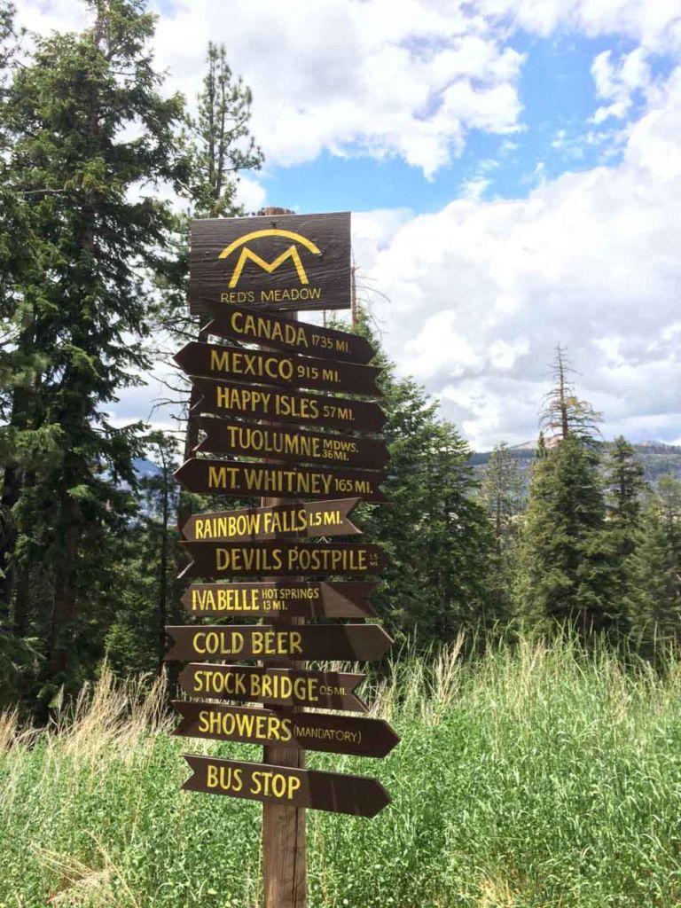
Hiking to Devils Postpile and Rainbow Falls is fairly easy, but there is some vertical gain and you’ll want to take your time to learn about the geology and soak in the views. This route gives you a 4.5 mile tour of the postpile before winding down the San Joaquin River to Rainbow Falls, and finally climbing back up to Red’s Meadow — a place well known to every JMT and PCT hiker.
Getting to Devils Postpile National Monument
During the summer months, you can’t drive down to Devils Postpile National Monument. Instead, park near the Mammoth Adventure Center, when you’ll buy tickets for the shuttle down to the valley. The shuttle runs pretty frequently, and while you’re down in the valley, you can hop-on and off as often as you like.
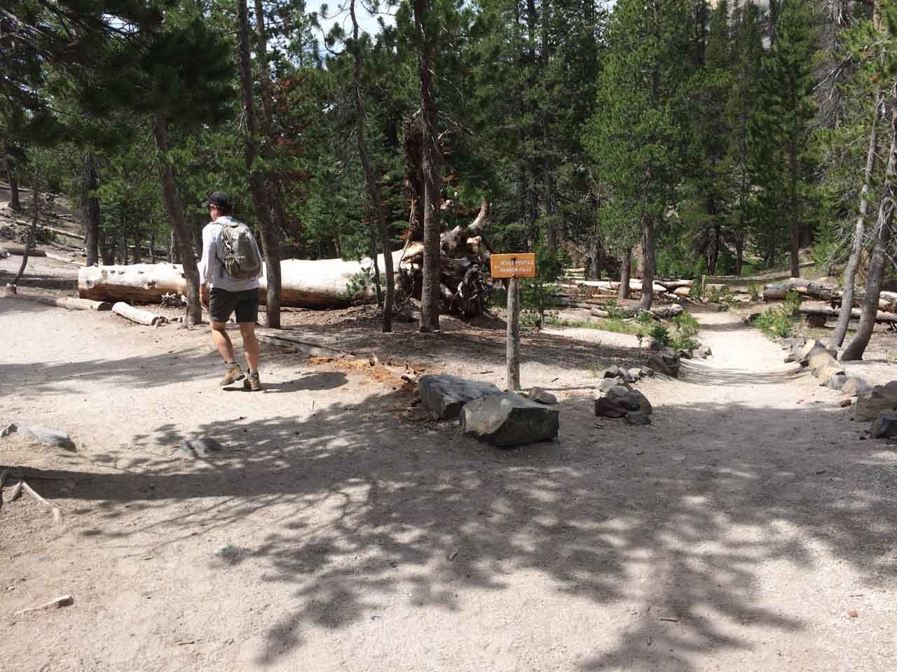
There are a number of stops in the valley, so ask the driver to tell you which stop to get off for the Devils Postpile. This will get you started right in front of the Devils Postpile ranger station, where you can also pickup a free trail map and information about the area.
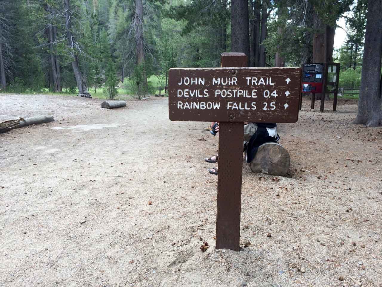
Hiking to Devils Postpile
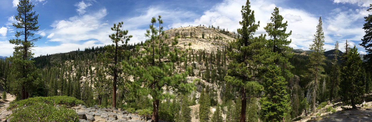
There are a myriad of trails criss-crossing this area, but it’s well-signed. Follow the signs leading to the Devil’s Postpile.

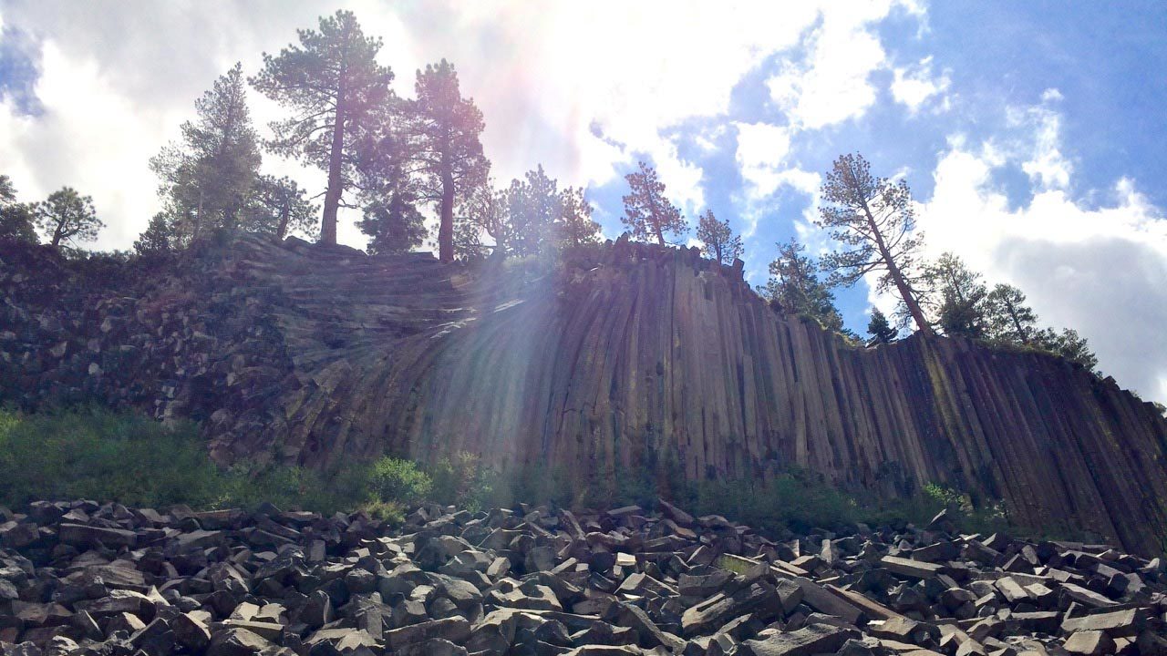
As you near the Postpile, you’ll see a signed junction to the Upper Postpile Loop. Make a mental note of that trail, because you’ll come back to it after seeing the Postpile from below. Another 20 yards takes you to the perfect viewing area.

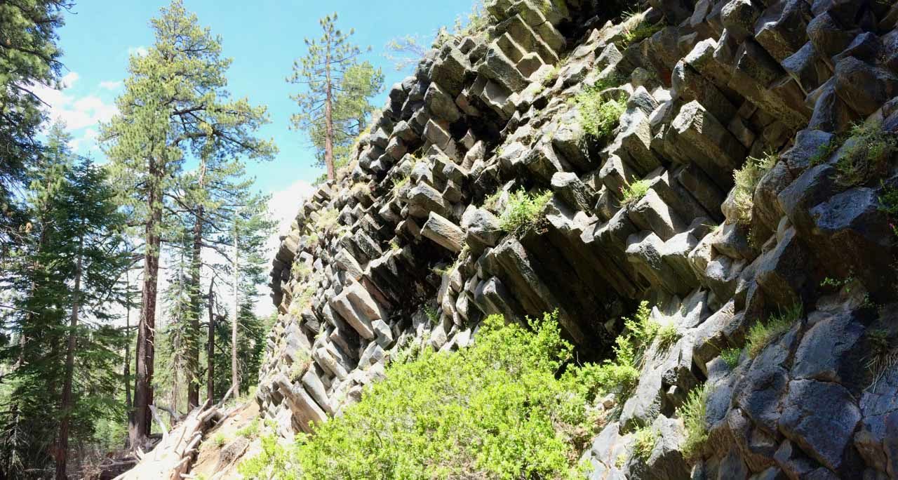
The “posts” are a fascinating, naturally occurring geologic formation. From the bottom of the pile you can see huge chunks that have broken off over time, as well as a great angle on the columns themselves. It’s tough to soak it all in, and the panorama mode on my iPhone came in handy here.
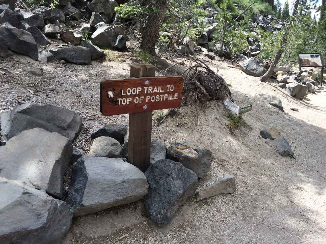
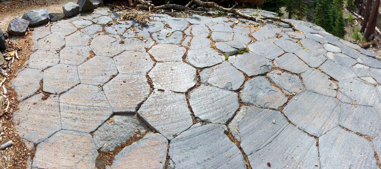
Backtrack to the junction we passed earlier and take the loop trail to the top of the Postpile. It’s a fairly short climb, and at the top you will see how the columns fit together. I think they look a bit like giant, hexagonal bathroom tiles.

Continue on the loop trail back down the other end of the Postpile and you’re rewarded with yet another interesting view of the columns.

Back at the bottom, you rejoin the trail toward Rainbow Falls. At 1.4 miles you’ll cross Red’s Creek. The water level was pretty low, but there are a couple heavy timbers you can walk over to avoid stepping in the creek.
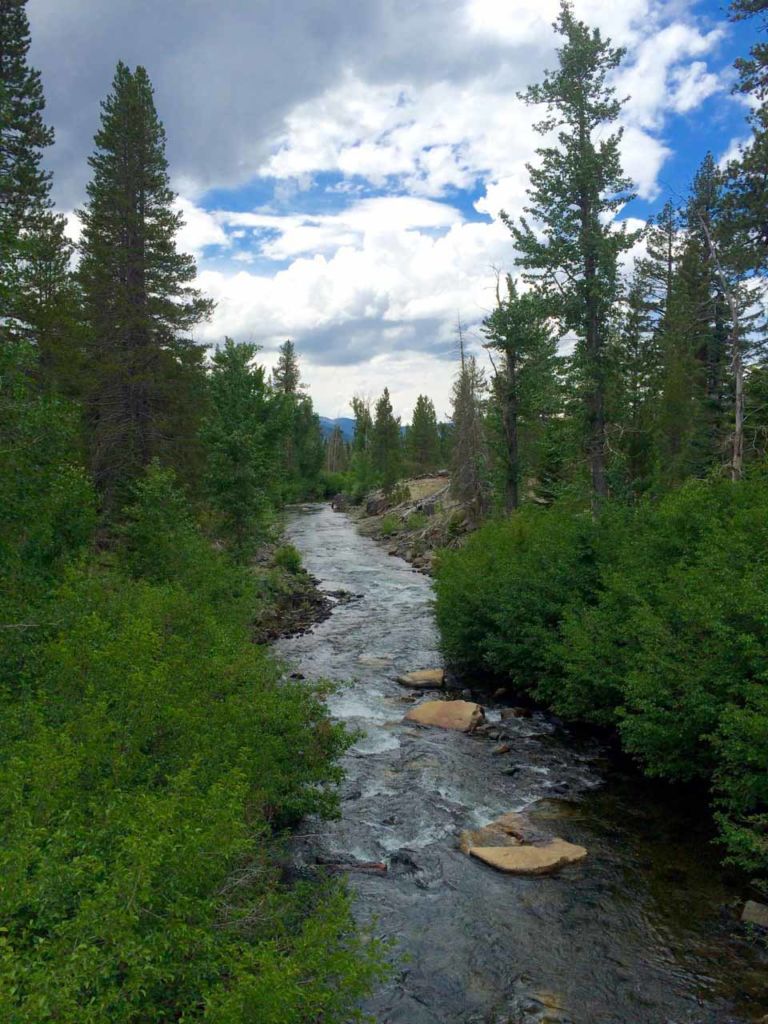
At 1.7 miles, the trail crosses the John Muir Trail. Take a short detour to the right and you’ll enjoy great views up and down the San Joaquin River from a sturdy wood-and-steel bridge.
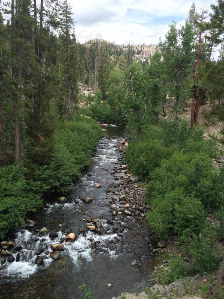
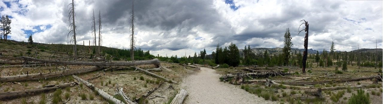
Return to the Rainbow Falls trail and continue south. Here you enter an area with open skies, burn-scarred trunks standing like skeletons over brush and new growth. This area was burned in the 1992 Rainbow Fire, and is still decades away from recovering.

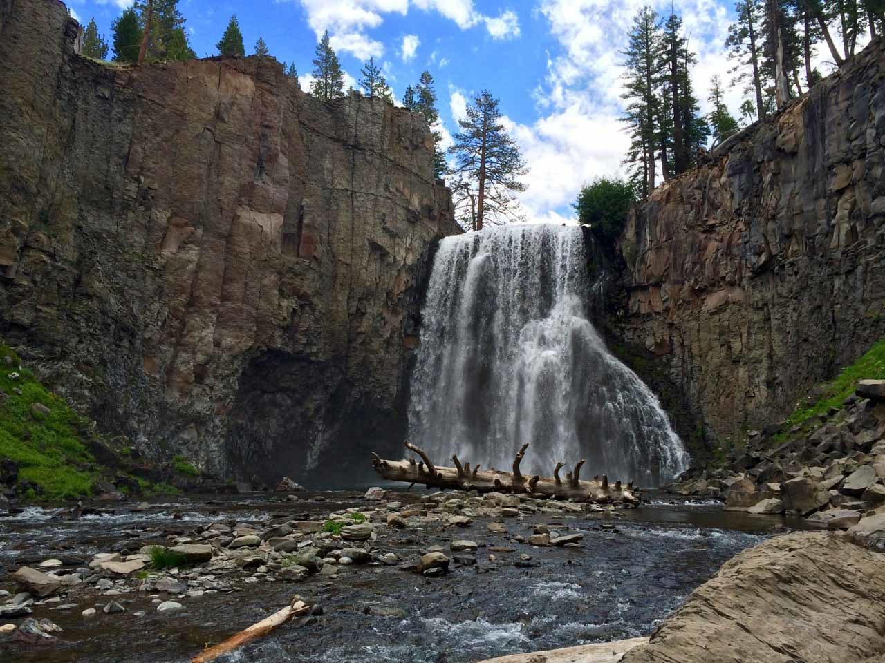
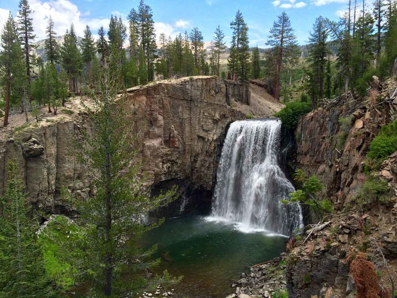
At ~3.4 miles you get your first glimpse of Rainbow Falls from above the bluff. Be sure to stop at both of the overlooks; each view is unique.
Finally, descend the steep steps to the base of the falls. This is where the scope and magnitude of Rainbow Falls really hits home.

Soak in the sounds and the energy of the falls. Take a break. This is a place that’s worth spending some time in. When you’ve topped off the tank, climb back up the steps and begin retracing your steps. This time, however, you’re going to watch for the fork to Reds Meadows Resort.
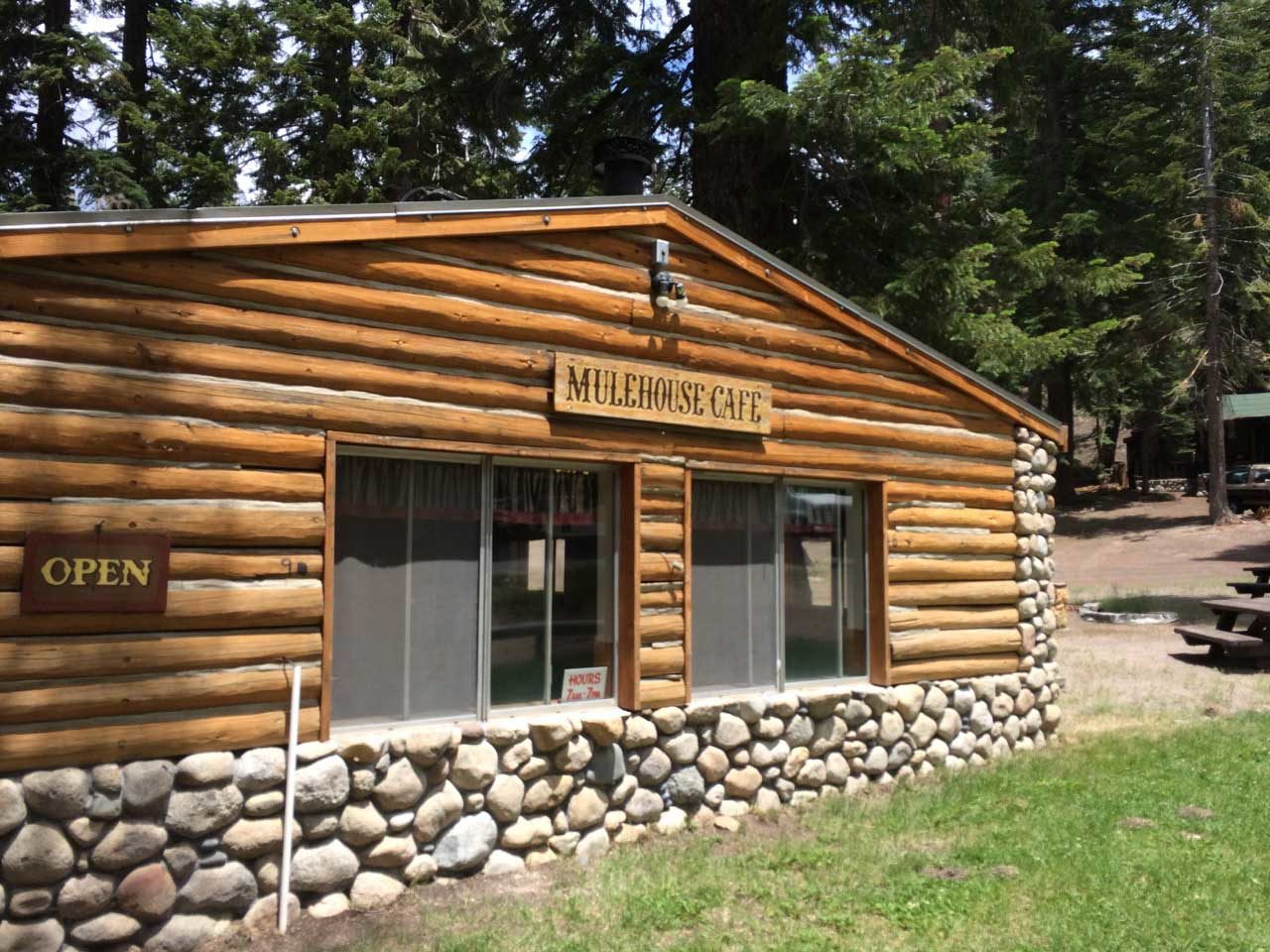
Reds Meadows Resort is primarily a pack station, a cafe and a general store. There are a few cabins that are available for rent, but that’s not why you’re here. You want a well-earned lunch and a milkshake from the Mulehouse Cafe. This place was here when I first thru-hiked the John Muir Trail back in 1980. It was still here when I thru-hiked the JMT 30 years later in 2010. It’s still here now, and it will probably be here for years to come. It’s a fixture for thru-hikers on the JMT and PCT, in part because Reds Meadow is one of the common resupply points. But it’s also one of the few places where you come so close to civilization.
On any given afternoon you’re just as likely to dine with tourists visiting Mammoth from Europe as you are dirty, smelly, sweaty thru-hikers stopping in for a cheeseburger and fries. It’s a great experience.
One word of advice — the degree of deliciousness is directly proportional to the number of miles you’ve hiked.
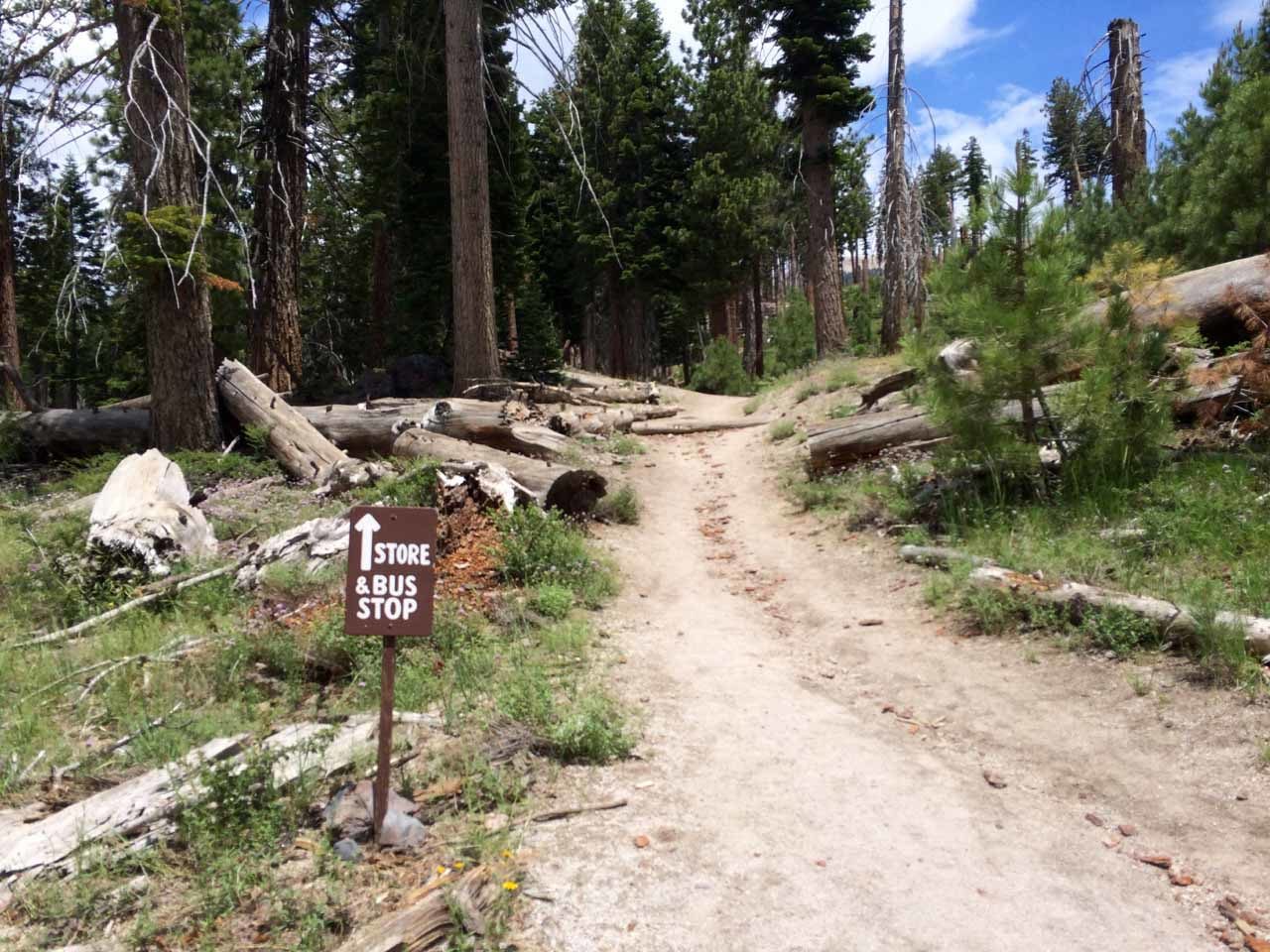
From Reds Meadow, you simply wait for the shuttle to reappear and whisk you back to the Mammoth Adventure Center.
This is a great little hike with two exceptional destinations. I will always hike here whenever I’m in Mammoth Lakes.
Devils Postpile to Rainbow Falls Trail Map
Photo Gallery
Click on any photo to view a larger version. You can also leave comments on any photo.
Devils Postpile Tips
- Bring a liter of water per person. Even though it’s an easy hike, it can be hot in the sun.
- Bring a hat and sunscreen. Most of this hike is shaded, but the sections that are not demand sun protection.
- Bring mosquito repellant. Especially in August.
- After your hike, stop for lunch at the Mulehouse Cafe and order a milkshake.
- Take at least a few steps on the John Muir Trail and Pacific Crest Trail.
Congratulations. You are now a section hiker.
More Devils Postpile Resources
- During the summer, cars are not allowed to drive into Devils Postpile. Instead, you must take the shuttle from the Mammoth Adventure Center. At the time of writing, tickets were $7 per adult.
- Dogs on leash are allowed, and you can take a dog on the shuttle but they must wear a muzzle. The Adventure Center will sell you a muzzle if you need it.
- Reds Meadow website
- Download the GPX file for use with your GPS device or app
You must be logged in to post a comment.