• COVID-19 Park and Trail Closures
  • Learn about the Six-Pack of Peaks Challenge
  • Shop
  •  

SoCal Hiker

  • Find a Hiking Trail
    • All Areas
    • Arizona
    • Colorado
    • Los Angeles
    • Orange County
    • Oregon
    • San Francisco Bay
    • Washington
  • Trail Guides
  • Six-Pack of Peaks
    • Colorado Six-Pack of Peaks
      • Bergen Peak
      • Rocky Mountain
      • Birthday Peak
      • Horseshoe Mountain
      • Grays Peak
    • New England Six-Pack of Peaks
    • NorCal Six-Pack of Peaks
      • Mount Umunhum
      • Mount Saint Helena
      • Mount Tamalpais
      • Mount Diablo
      • Mount Sizer
      • Rose Peak
    • Oregon Six-Pack of Peaks
      • Tumalo Mountain
      • Black Butte
      • Black Crater
      • Maiden Peak
      • Mount Bachelor
      • South Sister
    • SoCal Six-Pack of Peaks
      • Mt. Wilson
      • Cucamonga Peak
      • Mt. San Antonio (Mt Baldy)
      • San Bernardino Peak
      • San Jacinto Peak
      • San Gorgonio
  • Backpacking
    • High Sierra Trail
    • John Muir Trail
      • Overview of the John Muir Trail
      • Training
      • Day-by-Day Itinerary
      • Resupply Addresses
      • JMT Discussion Forum
    • Lost Coast Trail
    • North/South Lake Loop
    • Rae Lakes Loop
    • Red Peak Pass Loop
    • Theodore Solomons Trail
    • Trans-Catalina Trail
    • Wonderland Trail
  • Gear
  • Forums
    • Latest Topics
    • Ask a Question
    • Campfire
    • Trails
    • Trail Reports
    • Gear Wisdom
    • Classifieds
  • Login

Roller Coaster Ridge Trail

April 13, 2010 By Jeff Hester 29 Comments

Pacific vista

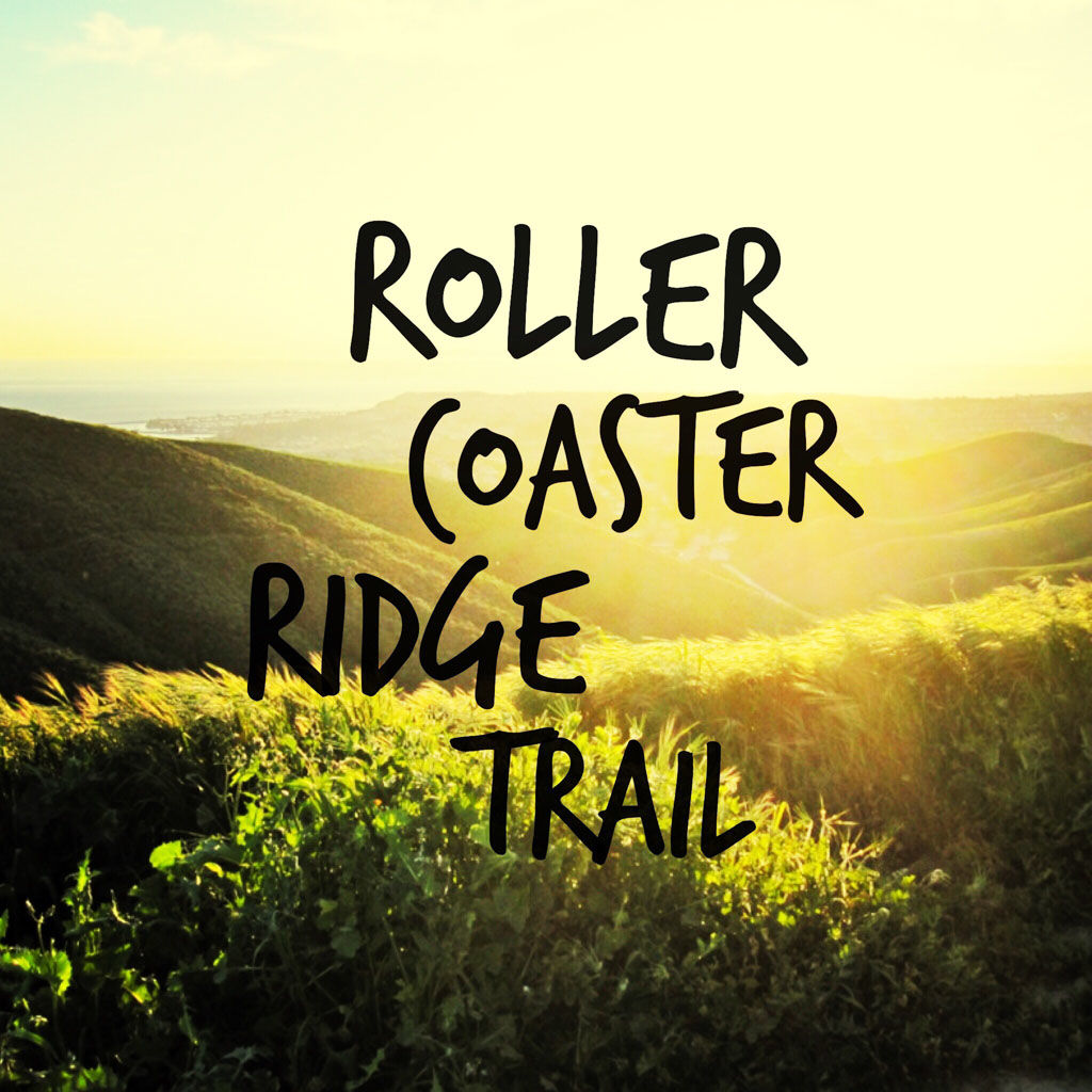
Technically speaking, there is no trail or ridge officially named The Roller Coaster, but if there was, this would be it. This is a great double-track trail with hills that will get your heart pumping. I like to hike this after work most Wednesdays, and enjoy the ocean breezes, the sweeping coastal and mountain views and the sunset over Catalina Island. It’s a little slice of heaven right in the heart of south Orange County.

The Trailhead

Trail Details
Distance: 4.6 miles
Time: ~1.5 hours
Difficulty: Moderate
Elevation gain: 1,150 ft
Dogs: OK
When to go: Year round
Although most of the trail lies in the boundaries of San Juan Capistrano, the trail begins at a gate at the end of Camino de los Mares in San Clemente. Note that there is no parking allowed on Camino de los Mares. Instead, park on the side street about 50 yards from the end.

At the gate you have two options. For the gung-ho, take an immediate left and head up the steep hill. When you reach the first junction, turn right to meetup with the main trail on the ridge. The second option is a little kinder on the lungs. Head straight up the main trail to the ridge. It’s a long, gradual ascent.

As you travel the ridge you’ll climb over two hills, then follow the trail as it gradually climbs of the left side of the ridge. At the saddle, take a sharp right up the steep hill. The trail is marked as the Patriot Trail. You’ll follow this ridge all the way to the terminus — a flag pole. You can sign the logbook in the mailbox (or just see who else has been there). Turn around and head back, but at the first junction, veer left and follow the trail along the side of the ridge and retrace your steps to the trailhead.

Bobcat

roller-coaster-ridge

Trail Map and Elevation Profile

© OpenStreetMap contributors
Download

Photo Gallery

Click an image for a larger version.

Bobcat
Roller Coaster Ridge map
roller-coaster-ridge
Pacific vista
Easter Fence Post
Pacific Ocean Vista
The Flag
Walking Towards the Light
Views to Catalina Island
Sunset at the Flag Pole
At the turnaround point
Hiking up Patriot Trail
I was training for a backpacking trip
On the ridgeline
At the flag pole
Pacific vista

Tips

  • Bring a liter of water (my recommendation).
  • There is no shade, so wear sun protection. I prefer to hike this early or late in the day, especially during warmer months.
  • The trail is shared with bikers and horses. Keep your eyes and ears open.
  • I have seen one rattlesnake on this trail, and heard others say they’ve seen them. Nothing to be fearful of, but keep your eyes open so you don’t step into one.
  • My favorite après-hike dinner is the Number 1 combo (grilled fish taco, black beans, brown rice and extra salsa) at the Wahoo’s on Camino de los Mares. Highly recommended, and healthy, too.


Resources

  • Trailhead on Google Maps

Have fun, be safe, and see you on the trail!

Related

Filed Under: Trail Guides Tagged With: 3-6 miles, dog-friendly, hills, loop, moderate, San Clemente, San Juan Capistrano, vista

Like what you found here at SoCal Hiker? This site is a labor of love. Share your support for the site and help us development of new trail guides and expanded coverage -- make your next outdoor equipment purchase through our advertisers.

You can also subscribe to our weekly newsletter and follow us on Facebook or Twitter.

Jeff H

About Jeff Hester

I'm an avid hiker and backpacker. My wife Joan and I are on the trails every weekend. I started SoCal Hiker to share my passion for outdoor adventure.

Comments

  1. Derek (100 Peaks) says

    April 13, 2010 at 2:58 pm

    It looks like a great hike. It’s nice to be able to get an ocean breeze while hiking.

    Looks pretty green out there. Will be brown soon!

    Reply
  2. SoCal Hiker says

    April 13, 2010 at 5:08 pm

    Derek, yes, it’s very green right now. The wildflowers are blooming! It’ll be interesting to see how long before it all turns brown.

    And it’s hard to beat an ocean breeze, or the view, to keep you going on the trail.

    Reply
  3. Cari Galperin says

    April 24, 2011 at 3:26 am

    I did this hike today and it was excellent. I was with another member of the OC Miniature Pinscher Meetup group. In January, we did a hike of similar difficulty called Weir Canyon Loop. Our Meetup does hikes ranging from easy to difficult so I always have my eyes out for new hikes. This website is really well done. Thanks.

    Reply
  4. Jeff Turner says

    May 10, 2012 at 5:21 pm

    This looks like a fabulous hike, Jeff. Thanks for sharing it.

    Reply
    • Jeff Hester says

      May 11, 2012 at 5:45 am

      Thanks for visiting, Jeff T. I love the Roller Coaster Ridge–it’s a perfect length and workout, and the views are terrific. Doing it mid-week at sunset is just about perfection.

      Reply
  5. Janet says

    February 9, 2014 at 6:16 pm

    Great hike, but…. your directions say to take a right when you come to the first junction (if you take that immediate left up the hill when you start out) and it’s really a left! We wound up way out east – got back to start point after hour and a half and then went up the hill and found the flagpole – although it all looked quite a bit different than the pics here… very big flagpole! Anyway, we had a great adventure! wouldn’t have found it without this website, so thanks… and the getting lost was half the fun (and the workout!)

    Reply
    • Jeff HJeff Hester says

      February 9, 2014 at 6:40 pm

      Thanks for the comment, Janet. I’m glad you enjoyed the hike in spite of that wrong turn.

      I checked my instructions and think they’re still correct. It reads “At the gate you have two options. For the gung-ho, take an immediate left and head up the steep hill. When you reach the first junction, turn right to meetup with the main trail on the ridge. The second option is a little kinder on the lungs. Head straight up the main trail to the ridge. It’s a long, gradual ascent.”

      So IF you take the first left inside the gate (straight up the steep hill), then you would turn right at the first junction. If you go straight (which it sounds like you did) you turn left at the ridge.

      I agree that it can be confusing, but now that you know the trail, I hope you’ll explore it further in the future.

      Reply
      • Janet says

        February 10, 2014 at 5:48 am

        We definitely will and others that you have on your site. It’s a great site… thank you for sharing your discoveries!

        Reply
  6. Roxane says

    March 22, 2014 at 5:15 pm

    Hiked the Ridge this morning. It was perfect weather! It took us a little longer than 1.5 hours but we were geocaching along the way. 🙂 One side note….I noticed this morning that there actually is a small amount of parking on the very last block of Camino De Los Mares. As you are pulling up to the trailhead you will see 2 “No Parking” signs but if you look a little closer…right underneath them it says “from dusk to dawn”. As long as you park in between those two signs you are great! 🙂 I was going to take a pic of the signs for you but I forgot on our way out. Really happy I came across your site! You give great trail info! 🙂 See you on the trails! 🙂

    Reply
    • Jeff HJeff Hester says

      March 24, 2014 at 10:24 am

      Thanks, Roxane. That’s right — you CAN park on Camino de los Mares between those signs. I’ve actually parked there on after-work hikes, getting back a little bit after sunset with no issues.

      Thanks for the kind words!

      Reply
  7. L says

    June 6, 2015 at 1:36 pm

    LOVE this trail! Thanks for this wonderful website.

    Reply
  8. Hannah says

    July 11, 2015 at 6:52 pm

    Just wanted to let you know that this is one of my favorite hikes! It’s official name is the Patriot trail or flag pole hike 🙂

    Reply
    • Jeff HJeff Hester says

      July 13, 2015 at 1:00 pm

      Thanks, Hannah! Yes… Roller Coast is my nickname for the trail. Each of the trails up there has a name, but the Patriot Trail makes sense, especially with the flag.

      Reply

Leave a Reply Cancel reply

Your email address will not be published. Required fields are marked *

This site uses Akismet to reduce spam. Learn how your comment data is processed.

About Jeff Hester

I created SoCal Hiker while preparing to thru-hike the John Muir Trail. My goal? Create guides for the best hiking trails throughout Southern California--and occasionally beyond. I personally hike each trail to create these guides, sharing practical advice on gear and outdoor skills. Read more...

Connect with SoCal Hiker

  • 22,109 Fans
  • 11,612 Followers
  • 21,640 Followers
  • 1,674 Followers
  • 5,420 Subscribers
  • 328 Subscribers

Get the SoCal Hiker Newsletter

Sign up to get your weekly trail recommendation and the latest updates from SoCal Hiker.

SoCalHiker was selected one of USA TODAY's 10 Best Hiking and Outdoor Blogs
Get our day-by-day guide to thru-hiking the John Muir Trail
Get up-to-day wildfire status throughout California

Products

  • San Bernardino benchmark San Bernardino Peak Benchmark $39.95
  • 2017 Women's Six-Pack of Peaks Racerback Tank $27.00
  • South Sister Benchmark South Sister Benchmark $39.95
  • 2017 Six-Pack of Peaks mug 2017 Six-Pack of Peaks Mug $15.95

Sponsors

Sponsor SoCalHiker and see your banner here

Featured Posts

Hiking Camelback Mountain via the Echo Canyon Trail

Camelback Mountain is the most popular mountain to hike in the Phoenix area for good … [Read More...]

Hiking to High Point on Palomar Mountain in the Cleveland National Forest

Appropriately named High Point is the highest peak in the Palomar Ranger District of … [Read More...]

Hiking Hot Springs Mountain on the Los Coyotes Reservation

Hot Springs Mountain in the Los Coyotes Reservation is the highest peak in San Diego … [Read More...]

Lastest Comments

  • Ramesh on Haskell Canyon Open Space
  • Jeff H on Hiking the Tumalo Falls Loop
  • GGreco on Hiking the Tumalo Falls Loop
  • Allan Hoskins on Kintla Lake Hike in Glacier National Park
  • Elizabeth Dawson on Rae Lakes Loop via Kearsarge Pass
Get your SoCalHiker stickers now

Get your SoCalHiker stickers!

Latest Posts

  • Hiking Camelback Mountain via the Echo Canyon Trail December 9, 2020
  • Hiking to High Point on Palomar Mountain in the Cleveland National Forest December 4, 2020
  • Hiking Hot Springs Mountain on the Los Coyotes Reservation November 19, 2020
  • New Day Hiking Permit Requirements for Wilderness Areas in the San Bernardino National Forest August 31, 2020
  • Interview: John Soares, author of ‘Camp for Free: Dispersed Camping & Boondocking on America’s Public Lands’ July 30, 2020

Recent Forum Topics

  • 1st overnight backing trip
  • Recommendations for trips for me and my dog
  • log hikes
  • My Baldy
  • Cactus to Clouds v. Iron Mountain

The Six-Pack of Peaks Challenge Series

Six-Pack of Peaks Challenge SeriesThe Six-Pack of Peaks Challenge gives you an opportunity to explore your world while supporting a great cause.

Flex your adventure muscles!

Learn more here.


Search

Tags

3-6 miles 6-8 miles 8-10 miles 11+ miles Arizona Backpacking coastal dog-friendly easy family-friendly High Sierra Trail hiking Hiking The John Muir Trail hipster inspiration JMT John Muir John Muir Trail Kings Canyon National Park LA County moderate Mount Rainier National Park Muir Monday National Forest National Park Orange County Oregon out of bounds Pacific Crest Trail peak peakbagging quote scenic Sierra Nevada Six-Pack of Peaks State Park strenuous Thru-hiking Utah vista Washington waterfall wilderness Wonderland Trail Yosemite

Copyright © 2021 SoCalHiker.net · Metro Theme on Genesis Framework with WPEngine Hosting · Contact SoCal Hiker · Sitemap · Privacy Policy

Copyright © 2021 · Metro Pro Theme on Genesis Framework · WordPress · Log in