• COVID-19 Park and Trail Closures
  • Learn about the Six-Pack of Peaks Challenge
  • Shop
  •  

SoCal Hiker

  • Find a Hiking Trail
    • All Areas
    • Arizona
    • Colorado
    • Los Angeles
    • Orange County
    • Oregon
    • San Francisco Bay
    • Washington
  • Trail Guides
  • Six-Pack of Peaks
    • Colorado Six-Pack of Peaks
      • Bergen Peak
      • Rocky Mountain
      • Birthday Peak
      • Horseshoe Mountain
      • Grays Peak
    • New England Six-Pack of Peaks
    • NorCal Six-Pack of Peaks
      • Mount Umunhum
      • Mount Saint Helena
      • Mount Tamalpais
      • Mount Diablo
      • Mount Sizer
      • Rose Peak
    • Oregon Six-Pack of Peaks
      • Tumalo Mountain
      • Black Butte
      • Black Crater
      • Maiden Peak
      • Mount Bachelor
      • South Sister
    • SoCal Six-Pack of Peaks
      • Mt. Wilson
      • Cucamonga Peak
      • Mt. San Antonio (Mt Baldy)
      • San Bernardino Peak
      • San Jacinto Peak
      • San Gorgonio
  • Backpacking
    • High Sierra Trail
    • John Muir Trail
      • Overview of the John Muir Trail
      • Training
      • Day-by-Day Itinerary
      • Resupply Addresses
      • JMT Discussion Forum
    • Lost Coast Trail
    • North/South Lake Loop
    • Rae Lakes Loop
    • Red Peak Pass Loop
    • Theodore Solomons Trail
    • Trans-Catalina Trail
    • Wonderland Trail
  • Gear
  • Forums
    • Latest Topics
    • Ask a Question
    • Campfire
    • Trails
    • Trail Reports
    • Gear Wisdom
    • Classifieds
  • Login

Skull Rock and Temescal Loop

June 23, 2015 By Jeff H 1 Comment

Hike to Skull Rock on the Temescal Loop Trail

The Temescal Loop trail is one of my favorite hikes on days when the sun dips low. This variation includes a side trip further up the ridge to Skull Rock. And yes, it really does look like a skull (with a little imagination).

img
Trail Details
Distance: 5.1 miles
Time: 2 hours
Difficulty: Moderate
Elevation gain: 1,103 ft
Dogs: No
When to go: Year-round
With the addition of a small side trip to Skull Rock, this hike is 5.1 miles and has a respectable elevation gain of over 1,100 feet. It also passes by the mythical Temescal Canyon waterfall. It’s  only been a trickle whenever I’ve been by it, even the day after rain, but I’m told if you time your hike just right, it can be a pretty little waterfall. Need proof? Read on.

Getting There

This hiking trail begins and ends in Temescal Gateway Park, located at 15601 Sunset Blvd., Pacific Palisades (at the intersection of Temescal Canyon Road and Sunset Boulevard). You can either find free parking on Temescal Canyon Road or pay for parking in the park (at the time of writing, $7 which you put in an envelope and slip in a locked box). As you head into the canyon, you’ll reach a series of buildings that are part of a conference center. There are restrooms here with actual plumbing, as well as an information kisok with details on the history of the canyon and a map.

NOTE: The maps on the kiosk show only the trails in the Temescal Gateway Park, and not the adjacent Topanga State Park. The route described here is not fully shown on the kiosk maps, as this loop enters Topanga State Park.

The Trail

Being a loop hike, you can hike this in either direction. I hiked counter-clockwise, heading up the canyon first, then to Skull Rock, and finally down the ridge trail. This gives you more shade on the uphill section and would be my recommendation. If you insist on going clockwise, I’ve got you covered.

Starting in the back of Temescal Gateway Park, continue back up the canyon on the Temescal Canyon Trail, passing the rustic buildings that are still used for conferences, meetings and presentations. As you wind further back up the shady canyon, the trail becomes more quiet as you leave the “picnic crowd” behind.

Temescal Canyon Trails

The canyon trail is mostly shady and snakes along the typically dry Temescal Creek. You’ll pass a number of building for the conference center — but just keep heading back into the canyon and pretty soon the trail becomes very clear and easy to follow.

Temescal Canyon Trail

At about the 1.2 mile mark (starting at Sunset Blvd.) the trail starts to climb more seriously. It maintains a steady climb all the way to Skull Rock, but first you’ll see the (mythical?) waterfall.

You’ll know you have reached the waterfall when you get to the bridge. If you didn’t know there was a waterfall here, you might walk right by it, because every time I’ve hiked here, even the day after rain, it’s been nothing more than a trickle.

The waterfall in Temescal Canyon typically looks like a trickle

They mythical quality of this waterfall?  Explained by this photo from the information kiosk.

Photo: James Kenney

The next half mile the trail climbs out of the canyon to the ridgeline. Much of this portion of the trail is shaded, making it a good choice for staying cool(er) on the climb. When you see a break in the brush, stop and soak in the view back down the canyon.

Temescal Canyon

When you reach the junction with the ridgeline trail, you have a choice. Turn left and return to the trailhead via the ridgeline trail, or turn right to continue up hill to Skull Rock. This out-and-back spur adds one mile to the hike, but is worth a visit.

Skull Rock

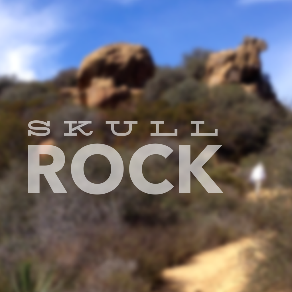
The trail runs near Skull Rock, but continues up the ridge deep into Topanga State Park. To reach Skull Rock, look for one of several use trails on the left leading to the rock outcrop.

From atop the rock, it doesn’t really look like much of a skull, but the view is pretty awesome. Looking south the sweeping arc of the coastline stretches out before you, reaching to distinctive Palos Verdes. On a clear day, you can see Catalina Island.

In the photo below you can see the Temescal Ridge Trail that you’ll take to return to the trailhead.

Above Skull Rock

You’ve climbed uphill to this point. The remainder of this hike will be downhill.

Scramble back to the trail, then retrace your steps to the junction with the canyon trail. This time, you’ll head straight ahead and take the Temescal Ridge Trail back down to the trailhead.

Note that as you descend you will pass two junctions that lead down to residential communities nowhere near your car. Stay on the ridge trail and follow it down. Eventually you’ll reach a series of switchbacks that descend the canyon and return you to your starting point.

Skull Rock and Temescal Loop Trail Map

© OpenStreetMap contributors
Download file: skull-rock-and-temescal-loop.gpx

Photo Gallery

Click on any photo to view a larger version. You can also leave comments on any photo.

Temescal Canyon Trail
No Dogs in Topanga State Park
Waterfall... this way
The waterfall in Temescal Canyon typically looks like a trickle
Beneath the bridge
Temescal Canyon
Trail junction
Trail to Skull Rock
Panoramic view of Palisades coast from Temescal Ridge
Skull Rock
Skull Rock
Trail to Skull Rock
Skull Rock
Santa Monica Bay
Above Skull Rock
Yoda approved hike
Sandstone ridge resembles a dragons back
Downtown LA and snow-capped Mt. Baldy
Photo: James Kenney


Skull Rock Tips

  • The best time to hike this is late in the day as the sun dips low in the sky.
  • Watch out for the stop light cameras in Temescal Canyon!
  • You can pay for parking in the park, or park on the street for free (pay heed to the signs).

More Temescal Canyon Resources

  • Top Trails: Los Angeles by Jerry Schad
  • Temescal Gateway Park – official website
  • Temescal Canyon Trail Map – printable PDF
  • Only like hiking loops in a clockwise direction? No problem.

Temescal Canyon Weather Forecast

The location could not be found.

Filed Under: State Parks, Trail Guides Tagged With: 3-6 miles, coastal, easy, LA County, Pacific Palisades, Skull Rock, Temescal Canyon, Topping State Park, vista, waterfall

Like what you found here at SoCal Hiker? This site is a labor of love. Share your support for the site and help us development of new trail guides and expanded coverage -- make your next outdoor equipment purchase through our advertisers.

You can also subscribe to our weekly newsletter and follow us on Facebook or Twitter.

Jeff H

About Jeff H

I'm an avid hiker and backpacker. My wife Joan and I are on the trails every weekend. I started SoCal Hiker to share my passion for outdoor adventure.

Comments

  1. KovasP says

    June 24, 2015 at 1:54 pm

    Good sounding loop. Pretty cool the conference center caters to hikers.

    Reply

Leave a Reply Cancel reply

Your email address will not be published. Required fields are marked *

This site uses Akismet to reduce spam. Learn how your comment data is processed.

About SoCal Hiker

Jeff on Mount Rainier

I created SoCal Hiker while preparing to thru-hike the John Muir Trail. My goal? Create guides for the best hiking and backpacking trails with enough detail to make it an enjoyable experience for you. And while I started with trails in Southern California, I’ve expanded across the west. We hike each trail to create these guides, sharing practical advice on gear and outdoor skills. Read more…

Connect with SoCal Hiker

  • 22,757 Fans
  • 11,901 Followers
  • 21,640 Followers
  • 1,718 Followers
  • 5,281 Subscribers
  • 340 Subscribers
SoCalHiker was selected one of USA TODAY's 10 Best Hiking and Outdoor Blogs
Get our day-by-day guide to thru-hiking the John Muir Trail
Get up-to-day wildfire status throughout California

Products

  • Mount Wilson Benchmark Mount Wilson Benchmark $39.95
  • 2017 Six-Pack of Peaks Sticker 2017 Six-Pack of Peaks Sticker $3.00
  • Mount San Jacinto T-Shirt $23.00 – $25.00
  • 2017 Women's Six-Pack of Peaks Racerback Tank $27.00

Sponsors

Sponsor SoCalHiker and see your banner here

Featured Posts

Backpacking the Grand Canyon of Tuolumne Loop in Yosemite National Park

Yosemite National P ark, and in particular Yosemite Valley, is home to some of the … [Read More...]

Hiking Belknap Crater in the Mountain Washington Wilderness

Hiking this out-and-back route up Belknap Crater you'll traverse an other-worldly … [Read More...]

Hiking to the Simpson Reef Overlook on the Oregon Coast Trail

The Oregon Coast is rugged, beautiful and often uncrowded. This bluff-top … [Read More...]

Lastest Comments

  • JEFF MALONEY on Backpacking on the Santa Cruz Trail in the Santa Barbara Backcountry
  • Sai Chandavarkar on Hiking Mt Baden-Powell
  • Amy Courtney on Ridgeline Trail
  • 11 Best California Bikepacking Routes | Wild Lumens on Inside Crystal Cove State Park
  • Ted Thed on Burbank Peak, Cahuenga Peak, Mt. Lee and the Hollywood Sign
Get your SoCalHiker stickers now

Get your SoCalHiker stickers!

Latest Posts

  • Backpacking the Grand Canyon of Tuolumne Loop in Yosemite National Park March 24, 2023
  • Hiking Belknap Crater in the Mountain Washington Wilderness October 20, 2022
  • Hiking to the Simpson Reef Overlook on the Oregon Coast Trail August 25, 2022
  • Join Team SoCalHiker at the Climb for Heroes August 23, 2022
  • Hiking the Welch-Dickey Loop in the White Mountain National Forest August 18, 2022

Recent Forum Topics

  • Understanding the Physiology and Psychology of Hiking in the Cold
  • Scaling Peaks in Cold and Snowy Conditions
  • Strategies for Making Cold-Weather Hiking Fun and Safe with Kids
  • The Benefits of Winter Hiking: Exploring the Beauty and Solitude of Snowy Trai
  • Lost Coast Trail

The Six-Pack of Peaks Challenge Series

Six-Pack of Peaks Challenge SeriesThe Six-Pack of Peaks Challenge Series gives you an opportunity to explore your world while supporting a great cause. There are eleven challenges around the country. Hike or run them at your own schedule.

Flex your adventure muscles!

Learn more here.


Search

Tags

3-6 miles 6-8 miles 8-10 miles 11+ miles Arizona Backpacking coastal dog-friendly easy family-friendly High Sierra Trail hiking Hiking The John Muir Trail hipster inspiration JMT John Muir John Muir Trail Kings Canyon National Park LA County moderate Mount Rainier National Park Muir Monday National Park Orange County Oregon out of bounds Pacific Crest Trail peak peakbagging quote scenic Sequoia National Park Sierra Nevada Six-Pack of Peaks State Park strenuous Thru-hiking Utah vista Washington waterfall wilderness Wonderland Trail Yosemite

Copyright © 2023 SoCalHiker.net · Metro Theme on Genesis Framework with WPEngine Hosting · Contact SoCal Hiker · Sitemap · Privacy Policy


Loading Comments...