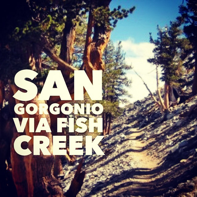
San Gorgonio Mountain. Old Grayback. At 11,503 feet it’s the highest mountain in Southern California. Getting to the top is no easy feat. It’s a strenuous hike, and you’ll work hard no matter which route you choose. Â It’s a popular destination as part of a training regimen for Mt. Whitney or the John Muir Trail. For others, summiting San Gorgonio is a goal in itself.

Time: ~10 hours
Difficulty: Strenuous
Elevation gain: 3,390 ft
Dogs: Yes
When to go: June-October
Getting to the trailhead is part of the adventure. Heading east on Highway 38 (the “back” way to Big Bear), drive one mile past Heart Bar Park Road, and turn right onto a spur road signed for Heart Bar Campground and Fish Creek.
What begins as a paved road quickly changes to a gravely dirt road. NOTE: A high-clearance vehicle is recommended. I drove this in my 2WD Xterra and the ride was bumpy but fine. A sedan might be a different story.
You’ll follow this road for about 7.5 miles. Watch for the signs toward Fish Creek on your right. The parking area is small, but since you started early, you’ll have no problem finding a space. As part of the San Bernardino National Forest, you will need to display your Adventure Pass.
The trail itself starts out gently. Just before the one mile mark, you cross Fish Creek and you begin to experience more elevation gain. At your right will be Fish Creek Meadow. At about Mile 2 you’ll cross another seasonal creek and begin climbing up the steep southeast slope of Grinnell Mountain.
At 4.5 miles, you reach the Fish Creek Saddle. There are campsites here, and a wiser person might actually backpack to this point. Then day hike to the summit, splitting this trip into something more manageable. Maybe next time.
In any case, Fish Creek Saddle is a good spot to gather, rest and check your map and your bearings.
Continuing southwest on Fish Creek Trail, you get a little break from the climbing as you traverse the northwest face of Lake Peak. To your right you’ll have views of Dry Lake. You’ll pass the North Fork Trail and reach a three-way junction. The Fish Creek Trail ends, the Dry Lake Trail goes to your right, and the Sky High Trail goes to your left and up to San Gorgonio (which you are now on the northern slope of).
You’ll notice that the foot traffic picks up here, as you’ll get hikers from Dry Lake coming up this route. Plus people tend to start slowing down due to the altitude.
As you hike along the Sky High Trail, keep your eyes open for signs of the airplane wreckage. There are numerous planes that have crashed into San Gorgonio, but the trail goes right by one of them, and there is a memorial plaque marking the spot. In 1953, a military C-47 crashed into the side of the mountain during a snowstorm. All 13 men aboard perished.
The day I hiked this trail, I felt awesome. I was cruising up the trail, breezing past other hikers. Even up the series of steep switchbacks at mile 6.5 unfazed me. And then — at about mile 8 — it hit me. I had to stop and catch my breath. My pace slowed considerably. The summit was so close, but I had to take it slow and easy. The altitude told me, and I had no choice but to obey.
I made it to the summit, downed my lunch, took some photos, and started back down. The route back was easy, but as is often the case on long hikes, my feet started feeling sore. The last two miles seemed much longer than I remembered. Be sure to take care on the route back that you note any trail junctions, check your map or GPS and make sure you’re headed in the right direction. On a hike this long, you don’t want to take any wrong turns.
Modifications
One brilliant modification I would recommend is breaking this up into a two or three day trip. You can backpack to Fish Creek Saddle, setup camp, then hike up to the summit (or explore other areas) from your base. The only hitch is that there are no reliable water sources up at the saddle, so plan to bring your own.
Another great modification would be to snow shoe in the winter, though this will require map and compass skills for navigation (depending on snow levels).
San Gorgonio Mountain via Fish Creek Trail Map
Photo Gallery
Click on any photo to view a larger version. You can also leave comments on any photo.
Tips for Hiking San Gorgonio Mountain
- You’ll need a permit. You need to allow at least five days for processing. Plan ahead so you’re not disappointed.
- You’ll need an Adventure Pass for parking at the trailhead.
- Bring plenty of water. I’d suggest at least 4 liters per person per day. Don’t underestimate the water and electrolytes you’ll need.
- Wear sunscreen and bring a hat. Much of the higher elevations are exposed to the sun.
- Start hiking early. The trailhead parking officially opens at 6am. We got there about 5:35 and there were only a few spots left in the upper lot. It’s a long day, and by starting early you’ll avoid the worst of the heat.
- Be prepared. Yeah, it’s the old Boy Scout motto, but on an all-day mega hike like this, preparation really counts. Carry the 10 essentials. It’s a long trail.
More San Gorgonio Resources
- GPS user? Download the GPX file (right-click and “save as”)
- View the trail in Google Earth
- Get driving directions to the trailhead. Click the blue pin and “directions” for turn-by-turn driving directions to the trailhead. A National Forest Adventure Pass is required for parking.
- Download a printable topo map of the trail.
- And check out our guide to San Gorgonio via the Vivian Creek trail.
San Gorgonio Weather Forecast
[forecast width=”100%” location=”92339″]
Well done my friend! I have never single dayed this only backpacked it. It is an epic adventure for sure!
Thanks, Josh. Next time I’d like split this up over two days and backpack this. I was pretty weary when I got back to the car. Let me know when you’re up for a repeat trip!
Awesome post! I did it yesterday 10-22-2013. Took me 13 hours with 20 pounds of photo gear. BTW, Due to the law changes, adventure passes NOT required at Fish Creek or Aspen Grove. A day hike like this deserves the longest day of the year. The switchbacks approaching the peak had some early snow which made them quite treacherous. I was beat and it was past 2pm so I turned around about 1 mile before the peak. However, I quickly came upon a couple behind that talked me into continuing. Against my better judgement I continued to the peak. I was so tired on the way back I was almost delirious. Half the trip back was in complete darkness with temps below 30 degrees. I fell once but was not hurt. Even with headlamps etc, I got disoriented and had to check the GPS app “Map My Hikes” to verify my ascent path. On the last mile back to the trailhead a huge tree had fallen and had blocked the path!! What are the odds? Again, a check of the GPS helped verify this and plotted a path around the felled tree. I tried to nap in truck for 20 minutes before driving back to Anaheim, but the drive home was perilous as well!
Great post – thanks! I’ll be doing it in two days (Saddle as camp spot) this weekend. Thanks for sharing.
Just got back from the trek last night. It is now at the top of my list for strenuous hikes, along with Mount San Jacinto. We left from Carlsbad at 4pm on a Friday, got to the Fish Creek trail head around 8pm (traffic). The 5 mile hike to Fish Creek Saddle campground was done in darkness – arriving a little after midnight (with full packs). In tents/bags by 1am. The night was very cool – but not too bad. Got up the next morning at 5:30-ish to start hiking to the summit with lighter day packs by 6:15am. Saw nobody else the entire time, crossed several ice fields and arrived at the summit at 9:30am. One of our Scouts hiked the entire route in slip-on Vans shoes (crazy). Still saw nobody else. Spent some time up there recharging, eating, taking photos, and checking out the view. Some strong winds up there but the weather was great otherwise – no smoke from the fires. We got back to the Saddle around 1pm, then packed our tents and gear (though we all wanted to just crash). The last 5 miles back to Fish Creek trail head with full packs were very tough as temperatures rose to around 85-90F. Got back to the vehicles around 5pm and back to Carlsbad at 8pm. It was a grueling trip – but very satisfying. Other than a few blisters and sore muscles, there were no problems.
So as far as the 10 hour estimate, I’d say that is applicable to very fit people travelling with light day packs – moving rapidly and not stopping too much. We had 8 fit people, took many breaks and we spent more like 12 hours on the trail split over the first night and next day. Of course, we had full packs for half of the trek so that slowed us down. The ice fields also slowed us down a bit… strongly recommend trekking poles!
Have fun – this is a great hike.
What a great recap, Jeff! Thanks for sharing. Sounds like you had a great time. I’m glad the smoke from the wildfires in SoCal didn’t seem to be an issue.
How was the campground at the saddle? I’ve breezed right by there but never really checked it out.
Jeff,
I’m headed up to Fish Creek tonight from Encinitas. I’m basically doing the same exact hike you did on the 18th. How was the night hike to Fish Creek Saddle? Any issues keeping on the trail?
Also, I can’t get the GPX file to upload? Can you please double check the link? I’m looking forward to hearing back from you!1
Great recap on the hike as well! Much appreciated!!!
Ciao
I didn’t hike up the trail at night (someone in the comments did). I started in early morning (not dark). The trail is pretty easy to follow up to the saddle. I recommend having a map in addition to GPS. As for the GPX file, try right-clicking and save as to copy locally, then upload to your GPS device. What device are you using? I might be able to offer more specific advice with that info.
Have a great hike!
Mr. Hester,
Thanks for the reply! I wanted to ask Jeff Schaffer, my apologies. I tried right clicking….I’m using a Suunto Ambit. I do have maps of this specific hike. I wanted to track it on my GPS so I could share it with others wanting to do the same hike. I love this website! You guys rock! Any info helps!
Cheers Amigo
Hi Jeff Schaffer – We are group of 6 that are planning on doing a day hike to this peak on 6/21. I wouldn’t call ourselves experienced hikers but this group has trekked Mt. Baldy (7 hr) last year and does 12 miles/2K altitudes hikes every weekend so we are hoping that we might be able to complete the trek in one day – start at 5:30 and be back by 8/9? Any thoughts? Do you think we are over ambitious and come prepared?
Also, do you recommend we carry a GPS device? We will be carrying 4 lt water, some food, hiking sticks, flashlight, etc…
Thanks for your response.
Hi,
I wanted to weigh in on your post SP. 2 weeks ago I ascended San Gorgonio Via Fish Creek for the first time. We started at 6am from the Fish Creek trail head and set up camp at Fish Creek Saddle(3 hours). The saddle is about 5 miles from the trail head. If you planned on pushing through and not camping you could make it to the summit by noon. The decent will take around 5/6 hours depending on the groups pace. We ran out of water (3 liters each) on the decent around Fish Creek Saddle. We pumped from a little mud puddle about 1 mile from Fish Creek Saddle. This hike can be done in one day. I would camp at the trail head if you plan on leaving at 5:30 am. It’s quit the adventure to get to the trail-head! All in, I think you’ll invest 13+ hours into this hike.
I would recommend:
Trekking poles
Water filter
60+ grams of protein each
Electrolytes
Download the GPX or FML file just in case you get lost
Headlamps
Mole skin
Sun screen
I just got back from Whitney yesterday. I did San Gorgonio in preparation for Whitney. I’d say that San Gorgonio comparable to the physical stress, but not elevation. Don’t under estimate water consumption. Use electrolytes to your benefit. Good luck on the trek! I hope I helped!
Hi Joshua – Thank you for the feedback. We were planning to take most of the items you listed except the GPS, need to look into it asap. Thanks for the heads up on the water and electrolyte.
Our plan is to see how far we get by 1:00 p.m. and if the peak is more than couple miles then we will start our decent back so that we can get back to the car and home in decent time. While it would be disappointing to return back without trekking to the peak, it should give us a good sense for the second attempt
I don’t think our group is prepared to do overnight camping…
Hello Jeff. Thanks for all the great info. On the topo map, it shows a locked gate just past Heart Bar where it seems to turn into a dirt road. Do you know if it is truly locked or can you get around it?
Thanks!
Mark, it can be locked, and may be during the winter. It’s always been open when I’ve been there, but I haven’t gone when there’s snow on the road.
Thanks for your response Jeff. The gate was indeed open.
Is it possible to get a backpacking permit the morning of? My buddy and want to overnight it this weekend.
Fax It soon. They usually fax me back in a day or less
p.smiley, as John said, you can fax in the application. I would add that you should give them a phone call to make sure there are permits available. They do reserve a certain number for walk-ins, too.
Cool web site.I live in big bear and been almost everywhere.this month Im planning on fish creek trail to San G,But am going to split off trail around mine shaft saddle (10,000) then climb ridge to the west that curves south to San G. also in one day…..See you on the trail Pete
anyone doing the hike this weekend? I’m heading up on Saturday morning. Possibly doing the two day.
Great site Jeff! I appreciate the photos and accurate directions. I’m training for whitney and want to do Gorgonio (I did San Bernardino Peak today). I know there is a route that avoids the rocky trail that passes the crash site (I did it four years ago as a loop). Unfortunately, I don’t have a GPS and haven’t a map either. Are you familiar with the route I’m referring to…an up and back? (I know…buy a map)
Jeff, thank you for your website. My dream has been the top of Mt. Whitney. At 61 and a wife with two new hips maybe we’ll try this one. Maybe I need to get in shape and stop procrastinating. Again, thanks for the great information. This really helps.
Did this as a backpacking trip in July 15. Stayed at the summit, and came down through South Forks Trail. Yes, we had someone pick ups up. It was so dry, we packed up all of our ater, but it is a great trek. Staying at the summit should be on everyone’s list.