• COVID-19 Park and Trail Closures
  • Learn about the Six-Pack of Peaks Challenge
  • Shop
  •  

SoCal Hiker

  • Find a Hiking Trail
    • All Areas
    • Arizona
    • Colorado
    • Los Angeles
    • Orange County
    • Oregon
    • San Francisco Bay
    • Washington
  • Trail Guides
  • Six-Pack of Peaks
    • Colorado Six-Pack of Peaks
      • Bergen Peak
      • Rocky Mountain
      • Birthday Peak
      • Horseshoe Mountain
      • Grays Peak
    • New England Six-Pack of Peaks
    • NorCal Six-Pack of Peaks
      • Mount Umunhum
      • Mount Saint Helena
      • Mount Tamalpais
      • Mount Diablo
      • Mount Sizer
      • Rose Peak
    • Oregon Six-Pack of Peaks
      • Tumalo Mountain
      • Black Butte
      • Black Crater
      • Maiden Peak
      • Mount Bachelor
      • South Sister
    • SoCal Six-Pack of Peaks
      • Mt. Wilson
      • Cucamonga Peak
      • Mt. San Antonio (Mt Baldy)
      • San Bernardino Peak
      • San Jacinto Peak
      • San Gorgonio
  • Backpacking
    • High Sierra Trail
    • John Muir Trail
      • Overview of the John Muir Trail
      • Training
      • Day-by-Day Itinerary
      • Resupply Addresses
      • JMT Discussion Forum
    • Lost Coast Trail
    • North/South Lake Loop
    • Rae Lakes Loop
    • Red Peak Pass Loop
    • Theodore Solomons Trail
    • Trans-Catalina Trail
    • Wonderland Trail
  • Gear
  • Forums
    • Latest Topics
    • Ask a Question
    • Campfire
    • Trails
    • Trail Reports
    • Gear Wisdom
    • Classifieds
  • Login

Haskell Canyon Open Space

December 3, 2013 By Jeff Turner 9 Comments

Sunrise view of Haskell Canyon Open Space Trails

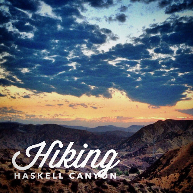
If I said I’ve hiked Haskell Canyon Open Space more than 100 times, it would not be an exaggeration. The main trailhead is about a mile walk from my front door, so this little treat of a hike is my mainstay. It is typically my Thanksgiving sunrise hike. Even after 100 times, it still entices me.

HaskellCanyoneMaps2

There are four main entries to the trail that wraps in a “U” shape around the canyon (marked in blue on the map). The main entry  (1) has a small parking lot right off of Copper Hill Road and is marked by a large sign.The trail splits in two directions from this point, one marked clearly to the left, and a small trail off to the right up a very steep incline. The trail to the left  will take you into the heart of the canyon over a relatively flat 1.2 mile journey to the crest. Only the last quarter mile is very steep. If you’re looking for a very casual walk in what will feel like a world away from the pace of life, simply turn around when it gets too steep.

Steep Hill at Haskell Canyon Open Space

There are two more entrances right off of Copper Hill Road, the second (2) is just a quarter of a mile down the road from the parking lot. This entrance is also marked by a sign, but begins to immediately lead up a challenging hill to the crest, as seen above. The hill itself is less than a half mile climb, but if you’re not in shape, it will be daunting.

Very steep hill at Haskell Canyon Open Space

The third entrance (3) directly off of Copper Hill is a service road that runs along the Haskell Canyon Wash. You can park your car right at the entrance and hike 3/4 of a mile to the beginning of a 1/2 mile severe incline. The hill is pictured above. The first time I hiked this portion, my lungs and legs burned the entire last 1/2 mile to the top. You won’t find many inclines as severe as this one, if you’re going down it, it’s difficult to control your speed. So, if you’re looking for a challenge, this is the route to take.

Fire Road access to Haskell Canyon Open Space

If, however, you want to hike along the crest and want the easiest route to the top, I suggest route number four (4). Drive up Deer Creek Run off of Copper Hill Rd until you reach the end of the cul de sac. You’ll see a fire road entrance with a gate. There is a path to the left of the gate that will get you to the fire road (shown above) that will lead you 1/4 mile up the hill via switch backs to the crest. While this is the easiest route, it will still be a workout.

Sunrise at Haskell Canyon Open Space

The crest trail itself has several steep inclines in either direction, so you won’t get bored on the hike. And because the crest is one of the highest points in this area of Santa Clarita, it is a perfect sunrise or sunset hike location.

Haskell Canyon Weather Forecast

The location could not be found.

Related

Filed Under: Trail Guides Tagged With: dog-friendly, Haskell Canyon, LA County, Santa Clarita, vista

Like what you found here at SoCal Hiker? This site is a labor of love. Share your support for the site and help us development of new trail guides and expanded coverage -- make your next outdoor equipment purchase through our advertisers.

You can also subscribe to our weekly newsletter and follow us on Facebook or Twitter.

Jeff T

About Jeff Turner

Avid hiker. 6 Kids. 1 Wife. 0 worries. Made in West Virginia.

Comments

  1. Hitch-Hikers Handbook says

    January 10, 2014 at 2:52 am

    Lovely photos, Jeff!
    If you like photography, we’d like to invite you to participate in the next edition of our Travel Photography Competition. Every week we publish 3 wining photos with links to the photographers’ websites. Here are the details: http://hitchhikershandbook.com/your-contributions/travel-photography/
    Happy hiking!

    Reply
  2. ajoannaproject says

    June 3, 2016 at 12:32 pm

    How long does it take you to do haskell canyon #4 the shortest one?

    Reply
  3. Jeff Turner says

    June 3, 2016 at 1:16 pm

    ajonannaproject, route 4 can be done in a couple of ways. If you want to hike only around the horseshoe, it is 4 miles from the place you can park, where the 4 marker is to the place where the blue line meets with the red and green lines. That is the peak of the hill on that side of the horseshoe. you could, alternatively, hike one complete loop that is just over 3 miles, but the last 3/4 of a mile would be on the streets leading back to your car.

    Reply
  4. Tracey K says

    September 22, 2016 at 10:44 am

    Hi There,
    Do you know how many miles route 1 is?

    Thanks

    Reply
  5. Jeff Turner says

    September 22, 2016 at 12:35 pm

    Tracey, Route 1 in a loop should be just over 2.5 miles.

    Reply
  6. Stuart Neumann says

    April 4, 2018 at 12:23 pm

    Hi Jeff:

    I’m a Location Manager working on a film for Netflix entitled “RIM OF THE WORLD”. I happened to see you cool photo of Los Angeles, which was taken from a mountain vantage point. I’m guessing that you probably shot the photo from one of the scenic overlooks, on the east side of the Angeles Crest Highway, as you’re going up the hill. Is this correct? Do you happen to remember whichscenic overlook it might have been? Were you using a telephoto lens or did the view actually look like the photo?

    We are trying to find this spot for a scene, for a dialog scene with our actors. I’ve attached your photo below for your reference. Thanks so much.

    Jeff, please don’t hesitate to contact me if you have any questions, or if you require any further information. Thank you for your continued support, cooperation and assistance.

    Best wishes –

    – Stuart

    Stuart Neumann
    Location Manager
    “RIM OF THE WORLD”
    Rim of the World Productions, Inc.
    stuartneumann@sbcglobal.net
    (323) 698-6899 (cell)

    Reply
  7. Ramesh says

    January 18, 2021 at 9:17 pm

    Hi Jeff,

    I just moved to Santa Clarita about 3 years ago and I love this trail. I live on Seco Canyon and did this hike 3 times this past weekend. I did your 6 pack of peaks as well and had no idea it was you would made that list until I saw this post. Wish you all the best in 2021 and hope to see you out on the trail!

    Reply

Leave a Reply Cancel reply

Your email address will not be published. Required fields are marked *

This site uses Akismet to reduce spam. Learn how your comment data is processed.

About SoCal Hiker

Jeff on Mount Rainier

I created SoCal Hiker while preparing to thru-hike the John Muir Trail. My goal? Create guides for the best hiking and backpacking trails with enough detail to make it an enjoyable experience for you. And while I started with trails in Southern California, I’ve expanded across the west. We hike each trail to create these guides, sharing practical advice on gear and outdoor skills. Read more…

Connect with SoCal Hiker

  • 22,158 Fans
  • 12,067 Followers
  • 21,640 Followers
  • 1,714 Followers
  • 5,308 Subscribers
  • 338 Subscribers
SoCalHiker was selected one of USA TODAY's 10 Best Hiking and Outdoor Blogs
Get our day-by-day guide to thru-hiking the John Muir Trail
Get up-to-day wildfire status throughout California

Products

  • All the Paths T-Shirt $26.50 – $28.00
  • 2017 Six-Pack of Peaks Patch 2017 Six-Pack of Peaks Patch
    Rated 5.00 out of 5
    $6.00
  • 2017 Six-Pack of Peaks mug 2017 Six-Pack of Peaks Mug $15.95
  • Mt Baden-Powell Replica Benchmark Mt Baden-Powell Benchmark $39.95

Sponsors

Sponsor SoCalHiker and see your banner here

Featured Posts

Hiking Black Butte from the Lower Trailhead

Black Butte is an iconic mountain that stands alone, prominent and proud. The 6,436' … [Read More...]

Hiking Monserate Mountain

A popular hike in north-inland San Diego County, Monserate Mountain provides a good … [Read More...]

Hiking Sutton Mountain

Sutton Mountain gives you a sense of just how big Oregon is. Nestled between the … [Read More...]

Lastest Comments

  • jen on Hiking Quartz Peak in the Sierra Estrella Wilderness
  • Marlene on Ridgeline Loop to Barbara’s Lake
  • Jen Davies on Hiking Mitchell Canyon to Mount Diablo
  • Brandon on Muir Monday: One Touch of Nature Makes the Whole World Kin
  • Shannon on Hiking to Mount Saint Helena
Get your SoCalHiker stickers now

Get your SoCalHiker stickers!

Latest Posts

  • Hiking Black Butte from the Lower Trailhead May 24, 2022
  • Hiking Monserate Mountain May 6, 2022
  • Hiking Sutton Mountain April 25, 2022
  • Hiking Telescope Peak in Death Valley National Park December 21, 2021
  • Hiking Corte Madera in the Pine Creek Wilderness December 17, 2021

Recent Forum Topics

  • All about permits for newcomers
  • 1st overnight backpack trip with my son
  • JMT NOBO from Red Cones to Happy isles – how many days?
  • Early Spring SoCal Backpacking
  • Logistics for Kearsarge TH to Crescent Meadow TH

The Six-Pack of Peaks Challenge Series

Six-Pack of Peaks Challenge SeriesThe Six-Pack of Peaks Challenge Series gives you an opportunity to explore your world while supporting a great cause. There are eleven challenges around the country. Hike or run them at your own schedule.

Flex your adventure muscles!

Learn more here.


Search

Tags

3-6 miles 6-8 miles 8-10 miles 11+ miles Arizona Backpacking coastal dog-friendly easy family-friendly High Sierra Trail hiking Hiking The John Muir Trail hipster inspiration JMT John Muir John Muir Trail Kings Canyon National Park LA County moderate Mount Rainier National Park Muir Monday National Park Orange County Oregon out of bounds Pacific Crest Trail peak peakbagging quote scenic Sequoia National Park Sierra Nevada Six-Pack of Peaks State Park strenuous Thru-hiking Utah vista Washington waterfall wilderness Wonderland Trail Yosemite

Copyright © 2022 SoCalHiker.net · Metro Theme on Genesis Framework with WPEngine Hosting · Contact SoCal Hiker · Sitemap · Privacy Policy


Loading Comments...