• COVID-19 Park and Trail Closures
  • Learn about the Six-Pack of Peaks Challenge
  • Shop
  •  

SoCal Hiker

  • Find a Hiking Trail
    • All Areas
    • Arizona
    • Colorado
    • Los Angeles
    • Orange County
    • Oregon
    • San Francisco Bay
    • Washington
  • Trail Guides
  • Six-Pack of Peaks
    • Colorado Six-Pack of Peaks
      • Bergen Peak
      • Rocky Mountain
      • Birthday Peak
      • Horseshoe Mountain
      • Grays Peak
    • New England Six-Pack of Peaks
    • NorCal Six-Pack of Peaks
      • Mount Umunhum
      • Mount Saint Helena
      • Mount Tamalpais
      • Mount Diablo
      • Mount Sizer
      • Rose Peak
    • Oregon Six-Pack of Peaks
      • Tumalo Mountain
      • Black Butte
      • Black Crater
      • Maiden Peak
      • Mount Bachelor
      • South Sister
    • SoCal Six-Pack of Peaks
      • Mt. Wilson
      • Cucamonga Peak
      • Mt. San Antonio (Mt Baldy)
      • San Bernardino Peak
      • San Jacinto Peak
      • San Gorgonio
  • Backpacking
    • High Sierra Trail
    • John Muir Trail
      • Overview of the John Muir Trail
      • Training
      • Day-by-Day Itinerary
      • Resupply Addresses
      • JMT Discussion Forum
    • Lost Coast Trail
    • North/South Lake Loop
    • Rae Lakes Loop
    • Red Peak Pass Loop
    • Theodore Solomons Trail
    • Trans-Catalina Trail
    • Wonderland Trail
  • Gear
  • Forums
    • Latest Topics
    • Ask a Question
    • Campfire
    • Trails
    • Trail Reports
    • Gear Wisdom
    • Classifieds
  • Login

Hiking Moro Canyon, Moro Ridge and the BFI in Crystal Cove State Park

January 3, 2011 By Jeff Hester 11 Comments

Rabbit

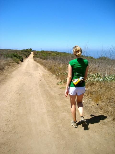
This loop is one of my favorite hiking trails in Crystal Cove State Park. At 5.5 miles and over 800′ of net vertical gain, this hike makes for a great workout. The length is about right to make it worth the trip, but won’t take all day. And the scenery is fantastic. The hike down Moro Ridge gives you some of the best coastal views in the park.

Trail Details
Distance: 5.5 miles
Time: 2 hours
Difficulty: Moderate
Elevation gain: 820 ft
When to go: Year round
The trail begins and ends at the El Moro Visitor Center. Parking requires either a day use parking pass (pay with your smartphone using the Passport Parking app) or an annual State Park day use pass.

The trail begins at the bottom of the parking lot. Take a left and follow the dirt trail that parallels the fence-line.

As the dusty trail winds down to the bottom of the hill, and you’ll turn left and cross the bridge. This is the El Moro Canyon trail.

At this point you have to chose which way to hike the loop. You can take the first right and hike up the trail known affectionately as “BFI“. Polite hikers will insist that this stands for Big “Fat” Incline, although I’ve heard more colorful options, and tend to agree with the latter.

I prefer to take this loop clockwise, continuing up El Moro Canyon and “I Think I Can“, then descending via El Moro Ridge and BFI. The choice is yours.

Continue up El Morro Canyon until you reach the second trail to the right. This is called East Cutoff Trail, or “I Think I Can.” It’s a long, uphill slog. Don’t be surprised if you encounter a few mountain bikers climbing slow-and-steady up this hill.

When you reach the top of the hill, bear right to head down El Moro Ridge back towards the coastline. During the spring, the hills are dotted with wildflowers. In the summer, keep your eyes peeled for rattlesnakes! I’ve also seen rabbits and deer (yes, there are deer back here!).

El Moro Ridge meanders toward the coast, eventually descending back down. You’ll get great views up and down the coastline from Laguna Beach to Newport Coast. As you see Pacific Coast Highway, watch for the trail marker on your right. This trail becomes BFI and leads you back down to El Moro Canyon just east of the bridge you crossed earlier.

From here, retrace your steps back to the visitor center.

Trail Map and Elevation Profile

© OpenStreetMap contributors
Download

Photo Gallery

Coastline
Rabbit
El Moro Ridge

Essential Crystal Cove State Park Resources

  • 3D view of route in Google Earth
  • GPS user? Download the GPX file
  • Crystal Cove Interpretive Association
  • I’ve seen rabbits, rattlesnakes and deer here. There are supposedly coyotes and bobcats, but I haven’t seen them. If you’re interested in learning more about the wildlife at Crystal Cove, stop by the visitor center. They have some great displays and free brochures to the plants, birds and wildlife of the park.
  • You can pay your Crystal Cove day-use fees using the Passport Parking app after you safely park your vehicle. Complementary ParksWiFi is available to assist with processing your payment.
  • SoCalHiker’s Inside Crystal Cove State Park

Related

Filed Under: Trail Guides Tagged With: 3-6 miles, coastal, Crystal Cove, moderate, Orange County

Like what you found here at SoCal Hiker? This site is a labor of love. Share your support for the site and help us development of new trail guides and expanded coverage -- make your next outdoor equipment purchase through our advertisers.

You can also subscribe to our weekly newsletter and follow us on Facebook or Twitter.

Jeff H

About Jeff Hester

I'm an avid hiker and backpacker. My wife Joan and I are on the trails every weekend. I started SoCal Hiker to share my passion for outdoor adventure.

Comments

  1. Oscar says

    July 27, 2011 at 2:35 pm

    That’s great, I’ve done some of the trails on Crystal Cove, but not sure if I’ve done this one. I didn’t realize you were into hiking this much. Your site is really slick and prtty neat that you’ve tracked all your miles and elevation and stuff.

    I’m going to show my wife your site because she’s been doing a lot of hiking lately and wants to find new spots. Also, that map/wordpress plugin seems pretty slick. Gonna have to try it soon.

    Reply
    • Jeff Hester says

      July 28, 2011 at 10:51 am

      Thanks, Oscar! Crystal Cove is a great place to hike. The only thing to watch for is the lack of sun protection. You’re pretty much exposed throughout the park, especially at mid-day. Hat plus sunscreen is a must this time of year.

      If you have any tips on other hiking trails you’d like to me add, let me know and I’ll put them on my “to-hike” list.

      Reply
  2. Ponchos says

    September 10, 2012 at 9:58 am

    Great route this! Thanks.

    Reply
  3. Catherine says

    June 2, 2014 at 8:20 pm

    So, just FYI. My friend and I went here after 6pm and got a $72 parking ticket. DO NOT go there after 6pm thinking you can park for free. False advertising, I promise you. I have the ticket to prove it. $15 is cheaper!

    Reply
  4. Jim Doe says

    October 19, 2016 at 8:05 pm

    DO NOT PAY THIS PARK ANYTHING. PARK IN THE STORES ACROSS THE STREET, THEY WILL NOT TOW, TEACH THESE PARK RANGERS A LESSON ABOUT ISSUING PARKING TICKETS WHILE THERE IS STILL ORANGE IN THE SKY. DO NOT GIVE THIS PARK A DIME, WALK IN THERE AND ENJOY IT.

    I HAVE BEEN AN ANNUAL PASS HOLDER FOR MORE THAN A DECADE AND ONE PARK RANGER, OFFICER BARBA, ISSUES $96 TICKETS WHILE MANY ARE STILL ENJOYING THE ORANGE IN THE SKY. ABUSE OF POWER AND HORRIBLE PUBLIC RELATIONS.

    THE GREED OF THIS PART OF GOVERNMENT AND OFFICE BARBA, HIS SUPERVISORS, IS PATHETIC AND NEEDS TO CEASE. WRITE NEWPORT CITY COUNCIL, SANTA ANA, AND SACRAMENTO ABOUT THIS GAUGING OF THE PUBLIC.

    JUST DO NOT BUY PASSES HERE ALTHOUGH IT IS BEAUTIFUL PLACE. GO TO OTHER PARKS, THESE RANGERS HERE ARE OUT OF CONTROL.

    Reply
    • Get Real says

      September 30, 2019 at 9:06 pm

      When tax payers universally say they don’t want more taxes and the political climate in DC keeps defunding park systems, how else do you think these parks stay open for you to enjoy and moan about?

      Reply
  5. R WR W says

    October 2, 2017 at 9:10 pm

    I have hiked here regularly and have heard but never seen rattlesnakes – people who have seen them have had it be on hot afternoons. I did see a super cool king snake last summer – it just did its thing, and it was an open area where we could skirt around it.

    I have also seen:
    – a pair of turkey vultures who ride the thermals each morning – mesmerizing!
    – roadrunners!
    – bunnies!
    – did see a coyote on the trail near the bottom of BFI last summer – it just did its thing and did not bother us. I have seen scat (coyote poop) on the main trails regularly.
    – lizards

    No sign where I have been of bobcats or cougars/pumas/mtn lions though technically they can roam here. Never seen deer here though seen tracks.

    The trails can get hot and there is very little shade. Be sure to bring plenty of water and plan your hike within your limits.

    Reply

Leave a Reply Cancel reply

Your email address will not be published. Required fields are marked *

This site uses Akismet to reduce spam. Learn how your comment data is processed.

About Jeff Hester

I created SoCal Hiker while preparing to thru-hike the John Muir Trail. My goal? Create guides for the best hiking trails throughout Southern California--and occasionally beyond. I personally hike each trail to create these guides, sharing practical advice on gear and outdoor skills. Read more...

Connect with SoCal Hiker

  • 22,238 Fans
  • 11,781 Followers
  • 21,640 Followers
  • 1,685 Followers
  • 5,467 Subscribers
  • 331 Subscribers

Get the SoCal Hiker Newsletter

Sign up to get your weekly trail recommendation and the latest updates from SoCal Hiker.

SoCalHiker was selected one of USA TODAY's 10 Best Hiking and Outdoor Blogs
Get our day-by-day guide to thru-hiking the John Muir Trail
Get up-to-day wildfire status throughout California

Products

  • Cucamonga Peak Benchmark Cucamonga Peak Benchmark $39.95
  • Come to the woods, for here is rest. - John Muir Come to the Woods Poster $13.00 – $16.00
  • Let your SoCalHiker flag fly! SoCalHiker Red, White & Blue Summit Flag
    Rated 5.00 out of 5
    $25.00
  • Quality, weather resistant and dishwasher safe SoCalHiker stickers. SoCal Hiker Stickers (2-pack) $3.50

Sponsors

Sponsor SoCalHiker and see your banner here

Featured Posts

Hiking Black Mountain in Rancho San Antonio County Park

At 2,812 feet, Black Mountain looms large, way up, and behind, the smaller hills to … [Read More...]

Hiking Camelback Mountain via the Echo Canyon Trail

Camelback Mountain is the most popular mountain to hike in the Phoenix area for good … [Read More...]

Hiking to High Point on Palomar Mountain in the Cleveland National Forest

Appropriately named High Point is the highest peak in the Palomar Ranger District of … [Read More...]

Lastest Comments

  • Oliver John on 10 Overnight Backpack Trips in Southern California
  • Gustavo on Social Distancing on Public Trails
  • katrien on Gear Review: BioLite Stove
  • Jacob on Vital Link Trail to Verdugo Peak
  • Greg on San Gabriel Peak, Mt Disappointment, Mt Deception, Mt Markham and Mt Lowe
Get your SoCalHiker stickers now

Get your SoCalHiker stickers!

Latest Posts

  • Hiking Black Mountain in Rancho San Antonio County Park January 31, 2021
  • Hiking Camelback Mountain via the Echo Canyon Trail December 9, 2020
  • Hiking to High Point on Palomar Mountain in the Cleveland National Forest December 4, 2020
  • Hiking Hot Springs Mountain on the Los Coyotes Reservation November 19, 2020
  • New Day Hiking Permit Requirements for Wilderness Areas in the San Bernardino National Forest August 31, 2020

Recent Forum Topics

  • 1st overnight backing trip
  • Recommendations for trips for me and my dog
  • log hikes
  • My Baldy
  • Cactus to Clouds v. Iron Mountain

The Six-Pack of Peaks Challenge Series

Six-Pack of Peaks Challenge SeriesThe Six-Pack of Peaks Challenge gives you an opportunity to explore your world while supporting a great cause.

Flex your adventure muscles!

Learn more here.


Search

Tags

3-6 miles 6-8 miles 8-10 miles 11+ miles Arizona Backpacking coastal dog-friendly easy family-friendly High Sierra Trail hiking Hiking The John Muir Trail hipster inspiration JMT John Muir John Muir Trail Kings Canyon National Park LA County moderate Mount Rainier National Park Muir Monday National Forest National Park Orange County Oregon out of bounds Pacific Crest Trail peak peakbagging quote scenic Sierra Nevada Six-Pack of Peaks State Park strenuous Thru-hiking Utah vista Washington waterfall wilderness Wonderland Trail Yosemite

Copyright © 2021 SoCalHiker.net · Metro Theme on Genesis Framework with WPEngine Hosting · Contact SoCal Hiker · Sitemap · Privacy Policy

Copyright © 2021 · Metro Pro Theme on Genesis Framework · WordPress · Log in