Hiking the Theodore Solomons Trail: Glacier Point to Illilouette Creek

The Theodore Solomons Trail is an epic alternative to the immensely popular John Muir Trail. It’s roughly 270 miles in length, and runs largely parallel to–and west of–the JMT. The TST was conceived back in 1974 to help alleviate the crowding on the JMT (yes, even back then). Unlike the JMT, the TST is not an official trail, but a route stitched together from existing trails. Some of those trails are no longer maintained, and many of them are rarely travelled. My goal is to hike the entire trail in sections and assess the viability of the route as an alternate to the JMT.
Trail Details
Distance: 4.5 miles
Time: 2 hours
Difficulty: Moderate
Elevation gain (loss): 652 ft (1,448 ft)
Dogs: No
When to go: June-October
Time: 2 hours
Difficulty: Moderate
Elevation gain (loss): 652 ft (1,448 ft)
Dogs: No
When to go: June-October
This hike was a short, sweet start to the first section of the Theodore Solomons Trail. We had swapped cars with friends who were starting at Clover Meadows and hiking north. Our permit was for a Saturday start, but we arrived at the Wawona Ranger Station around 3:30 PM Friday and were lucky enough to get a walk-in permit for Friday. Permit in hand, we drove to Glacier Point, took the requisite photos of Half Dome, Nevada and Vernal Falls, and at exactly 5:06pm we started hiking down the Panorama Trail.

The Panorama Trail is a beautiful route that leads down to the top of Nevada Falls. We followed it down to the junction towards Illilouette Falls, and then stayed right to follow Illilouette Creek upstream.

Our trail descended nearly 1,000 feet over the first 2.5 miles, stopping only when we reached the granite channel which Illilouette rushes through. Here we followed the gentle ascent along the creek, with beautiful views and the sounds of cascade.

At 3.8 miles we crossed a tributary feeding Illilouette from the north, and promptly began our first decent climb. We ascended over section of forest scarred by a past wildfire, with new growth sprouting everywhere among the charred and branch-less trunks standing watch over the mountainside.

Up until this point, we had only passed a few day hikers heading up toward Glacier Point. We didn’t encounter any other backpackers on the trail. Finally, at 4.2 miles, we reached a junction with a trail from Mono Meadows in the north, and saw several small groups of backpackers camped near the creek. This was the general area where we planned to camp on this short day — having started late.

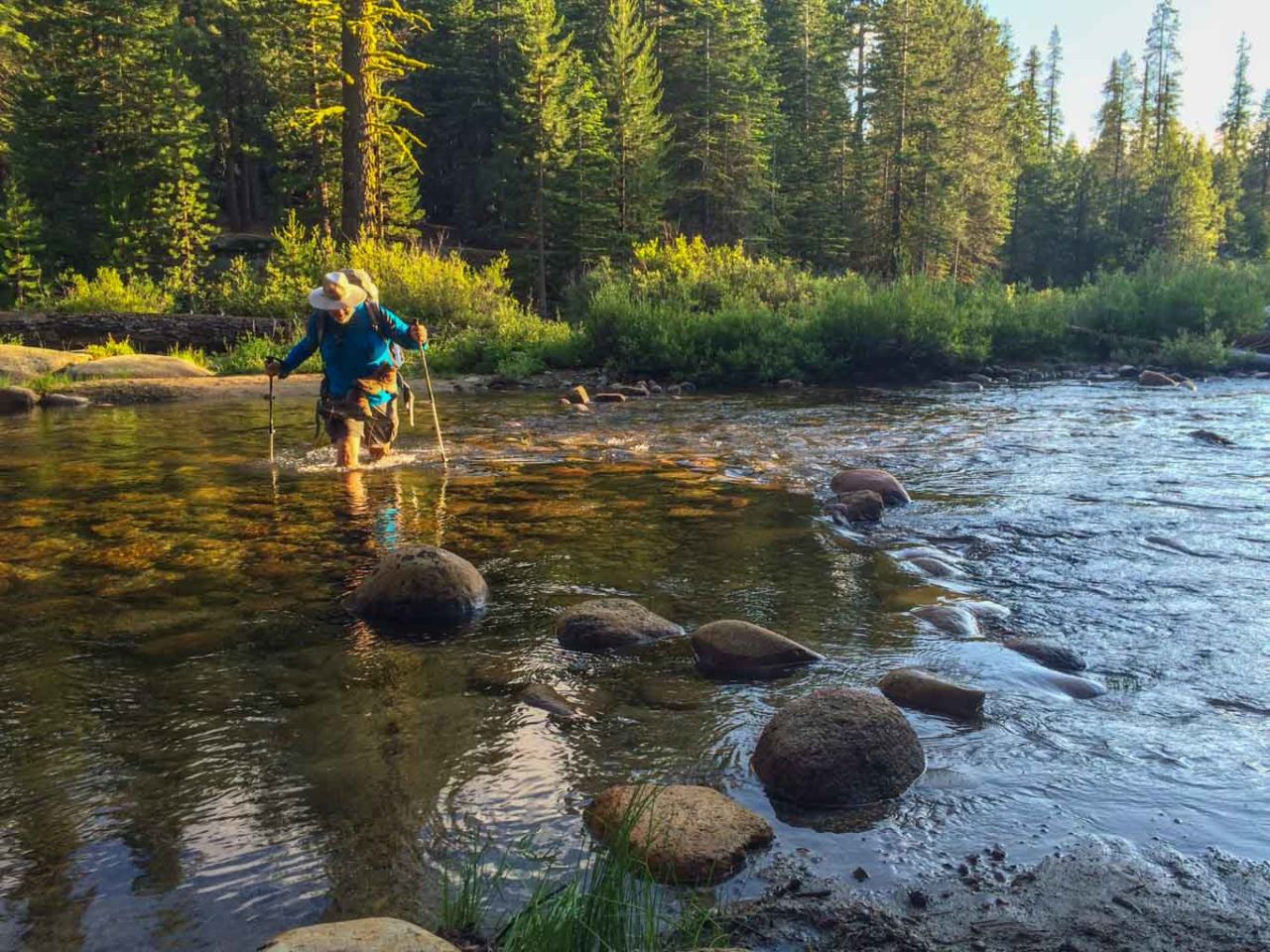
We took our boots off to wade across Illilouette Creek — the first of many such “boots off” crossings — and hunted for a suitable campsite. Up the bluff on the south side of Illilouette was another junction, and not far upstream an established campsite that we would call home for the night.

A few notes — the area of these two junctions (one on either side of the creek) is the first place where you can camp when backpacking. It’s also the last place on this trip that we saw other backpackers camped. The remainder of the 25.5 miles did not see a single occupied camp, and we saw a few people. It felt “busy” here at our first night’s camp (even though our campsite was far away from the others), but the remainder of the route felt very “wild” and highly travelled.
Also, the National Park trail signs claimed it was 3.5 miles, but my GPS clocked it at 4.5 (even after cleaning up the noise on the route). As with most things in life, the truth probably lies somewhere between.
There was plenty of water in Illilouette Creek, though the ranger warned us not to rely on small tributaries. We didn’t see any problem there, either, but there had been thunderstorms for two days prior to our trip.
We built a campfire and unwound. Today’s mileage was a bonus. Miles in the bank, so to speak. We effectively had a 4.5 mile head start on tomorrow’s hike towards Fernandez Pass.
Glacier Point to Illilouette Creek Trail Map
Photo Gallery
Click on any photo to view a larger version. You can also leave comments on any photo.


Obligatory Half Dome Selfie with Will


Additional Tips
- If you hike this as a shuttle, note it is a LONG drive from Clover Meadows to Glacier Point including many miles on a bumpy gravel road. Allow sufficient time and fuel.
- When parking at the trailhead, do not leave anything with any scent in your car (including air fresheners, toothpaste, deodorant, etc.). This is bear country, and they have ways of “opening” your car that you might not appreciate.
- Trail conditions where great throughout this section, which was not surprising given the number of occupied camps seen that night near the creek.
More Resources
- Wilderness permits are available up to 168 days in advance on a first-come, first-serve basis. Glacier Point is a popular alternate starting point for the John Muir Trail and for folks doing short overnight trips to Half Dome, so plan ahead as much as possible.
- As of this writing, the entry fee to Yosemite National Park is $30 per car.
- Get driving directions to Glacier Point via Google Maps
- Download the GPX file or view my raw tracking data from GaiaGPS.
Yosemite National Park Weather Forecast
[forecast width=”100%” location=”95389″]
You must be logged in to post a comment.