Hiking Sutton Mountain
Sutton Mountain trailhead
Strenuous
7 mi
Out-and-back
7 mi
11.3 km
Distance
1,612 ft
491 m
Gain
4,692 ft
1,430 m
Summit
3-4 hours
Est. time
Sutton Mountain gives you a sense of just how big Oregon is. Nestled between the Painted Hills unit of the John Day Fossil Beds National Monument and the tiny old town of Mitchell (population 142), this hike starts with a well-hidden trailhead, then follows an old jeep trail most of the way before requiring a short off-trail climb to the high point.
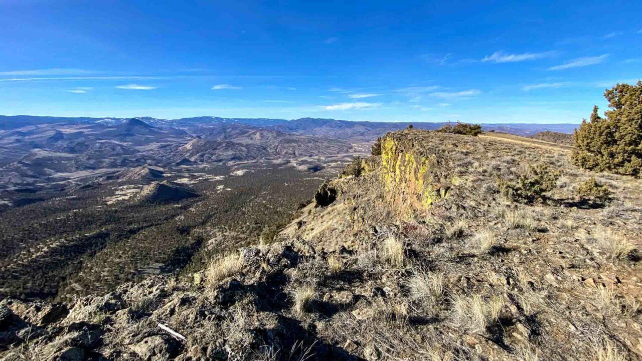
The views from the top are sublime. If you feel you’re in the middle of nowhere, you wouldn’t be wrong. There is a lot of open space in every direction, punctuated by the occasional ranch or historical artifact.
The Sutton Mountain Wilderness Study Area gets hot in the summer, so this trail is best hiked in the fall through spring. May and June are great months, when the wildflowers are blooming.
Getting to the Sutton Mountain Trailhead
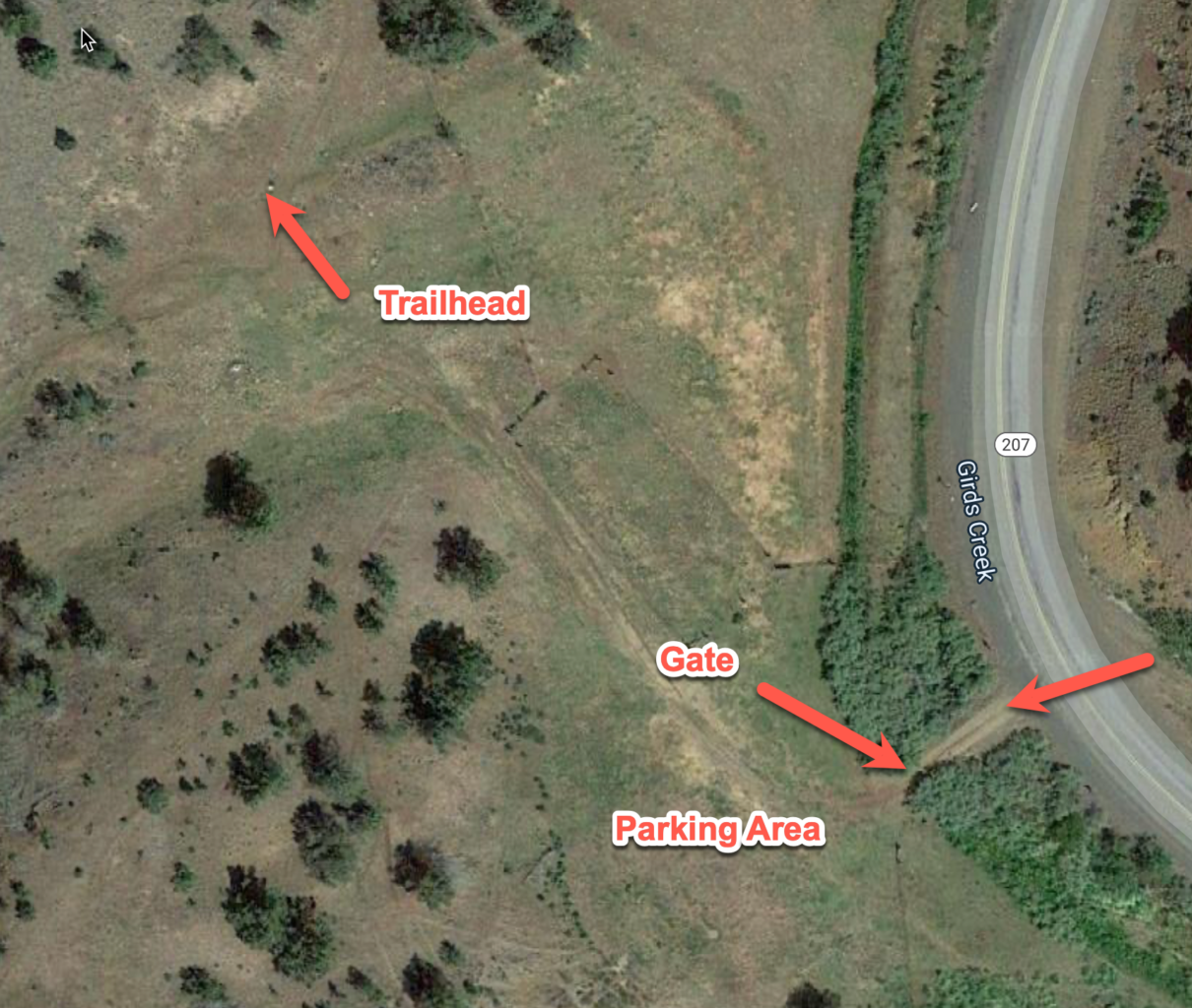
From Bend, Oregon it’s about 92 miles to the Sutton Mountain Trailhead. From Prineville, follow US 26 East for 29 miles. Turn left on OR-207 N (just before you reach Mitchell, but after the turn to the Painted Hills). Follow OR-207 N for 9.3 miles and the trailhead is on your left. There is no sign for the trailhead, and the gravel drive to the parking is easy to miss due to the brush. Get driving directions with Google Maps or use the trailhead coordinates 44°39’50.3″N 120°07’26.8″W with the navigation software of your choice.
When you turn on the driveway, there is a wire fence that you’ll need to open (and close behind) you. The parking area is a flat area with dirt and grass that can accommodate at least a dozen vehicles. It can get muddy, so bring a pair of shoes to change into after your hike.

Hiking Sutton Mountain
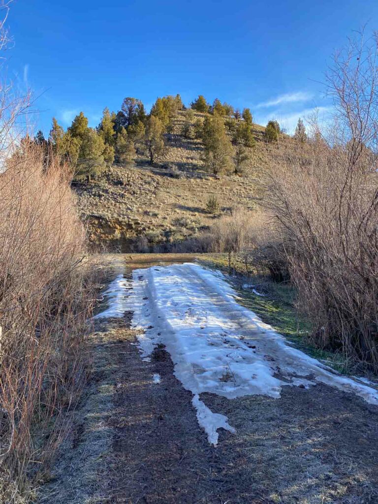
Once you’ve found the parking area, head to the northwest following a faint jeep trail. You’ll see a sign marking the Wilderness Study Area. Follow this track up and around the hill.

When we hiked this in February, there was still snow on the ground. The ground itself was frozen on our way up, but thawed to mud on the way down.

Most of the trail is bare dirt and rock; the vegetation scraped away over years of use.

At the 2.1 mile mark you pass through and opening in a a fence (seen below) and turn 90-degrees left. Imagine the cattle roaming the plain.

Follow the old jeep track uphill another 1.2 miles. The ridge that comprises Sutton Mountain looms to your left.

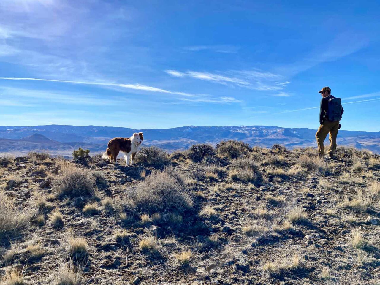
From here, you leave the old road and choose your own adventure, zig-zagging up the brushy incline to the ridge.

Once at the ridge, soak in the views!


Make your away along the ridge to the highpoint. There is a survey mark and a post. When we hiked, we were accompanied by a curious dog from a ranch near the trailhead. He followed us all the way up and back, escorting us to make sure we found our way.
After taking in the views, retrace your steps to return to the trailhead.
Sutton Mountain Trail Map & Elevation Profile
Sutton Mountain Tips
- There is no water nor facilities at the trailhead nor anywhere on the trail. Plan accordingly.
- Carry the 10 Essentials. We had no cell service for most of the trail, with spotty service at the summit.
- After the hike, stop in Tiger Town Brewing in nearby Mitchell. They have great sandwiches, wings and a namesake Sutton Mountain IPA.
- After lunch in Mitchell, visit the nearby Painted Hills unit of the John Day Fossil Bed National Monument.
- Check out the latest Sutton Mountain trip reports to see current trail conditions
- Find this hike and others in William Sullivan’s 100 Hikes: Eastern Oregon guidebook (Amazon)
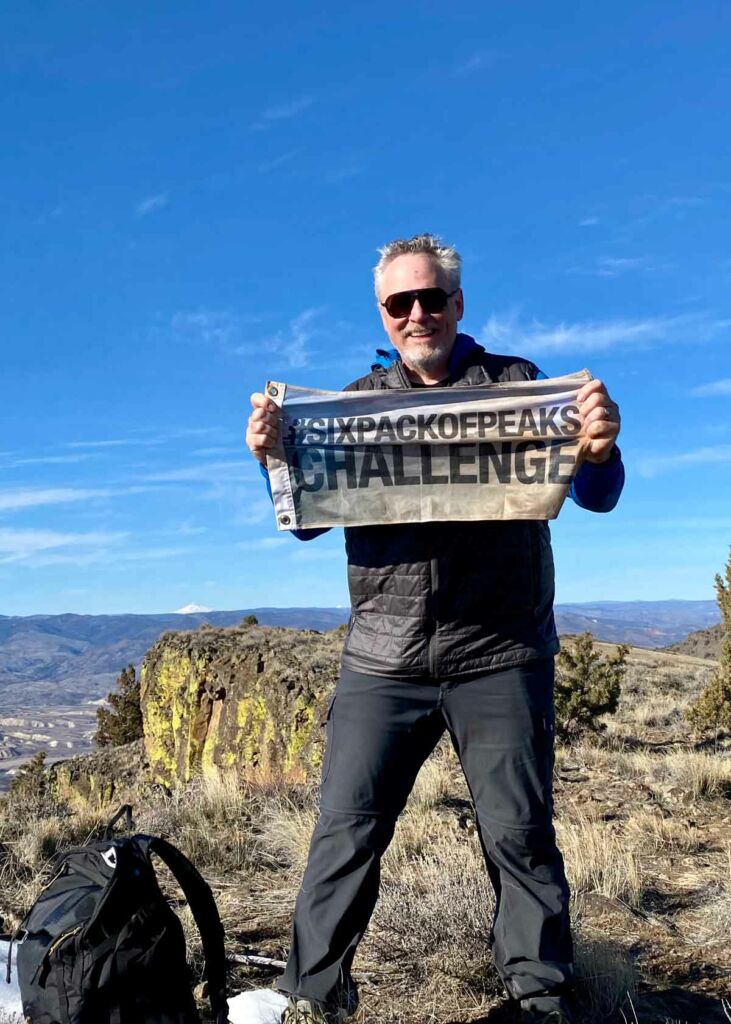
Central Oregon Six-Pack of Peaks Challenge
Sutton Mountain is part of the Central Oregon Six-Pack of Peaks Challenge. This self-paced hiking challenge includes six hikes in Central Oregon. They are a great way to explore the area, train for bigger adventures, and you’ll be doing good, with a portion of the net proceeds going to support Big City Mountaineers.

Jeff has hiked and explored trails for over 50 years, covering everything from casual canyon walks to rugged multi-day Sierra routes. He started SoCalHiker.net in 2010 to document the trails he loves — and to make it easier for others to discover them.
Originally hiked on February 6, 2022 with David and Rebecca.
You must be logged in to post a comment.