
Backpacking San Bernardino and San Gorgonio Peaks
One of the best way to enjoy the mountains of Southern California is on an overnight backpacking trip. I have hiked both San Bernardino Peak and San Gorgonio Peak both as day hikes and as overnight trips, but since many of the trailheads closed by the Lake Fire were reopened in 2017, I wanted to explore other options. These two peaks were the last two I needed to finish out my SoCal Six-Pack of Peaks Challenge, and with only two days on my schedule to hike, I knew it would be a challenge.
Trail Details
Distance: 30.2 miles
Time: 2 days
Difficulty: Strenuous
Elevation gain: 5,770 ft
Dogs: Yes
When to go: June to November
Time: 2 days
Difficulty: Strenuous
Elevation gain: 5,770 ft
Dogs: Yes
When to go: June to November
In a nutshell, the plan was to follow the John’s Meadow Trail up to the junction with the main San Bernardino Trail that begins at Angelus Oaks, follow that to the summit of San Bernardino, then continue on the San Bernardino Divide Trail to camp. Early the next day, continue on to the summit of San Gorgonio, then descend via the South Fork Trail.
Getting to the Trailheads
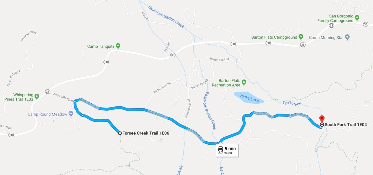
You’ll need to either have a friend drop you off or, more ideally, have two vehicles. In our case, there were three of us, each coming from different places and arriving at different times, so we ended up with three vehicles. We parked the nicer two cars at South Fork, and the rental car at Forsee Creek. Why? South Park has nice, paved parking. Forsee requires about a 1/2 mile drive up a very bumpy, rutted dirt and gravel road. I was able to drive my sedan back there without incident, but if you have a Mini Cooper or a BMW sedan, you might not want to risk it. 😉
Both trailheads are located off Jenks Lake Road, which is a partial loop that connects to Highway 38 on both ends. Driving up the mountain from Redlands, you’ll continue past Angelus Oaks, reaching Jenks Lake Road West on your right. The east end of this windy, paved road reconnects with Highway 38 miles away.
The closest trailhead is Forsee Creek Trail. There is a sign for the turn-off to the right (south) from Jenks Lake Road onto Forsee Creek Road. Note that this unpaved road is gated and may be closed during snow season. The dirt section is only about a 1/2 mile, so it could be walked. Get turn-by-turn directions via Google Maps.
The South Fork trailhead is on Jenks Lake Road East. There is a paved parking lot on the north side of the road, with the trail itself beginning on the south side. Get turn-by-turn directions via Google Maps.
The distance between the two trailheads is less than three miles, so if you only have one car, you could hike between the two.
Day 1: Forsee Creek Trailhead to San Bernardino Peak
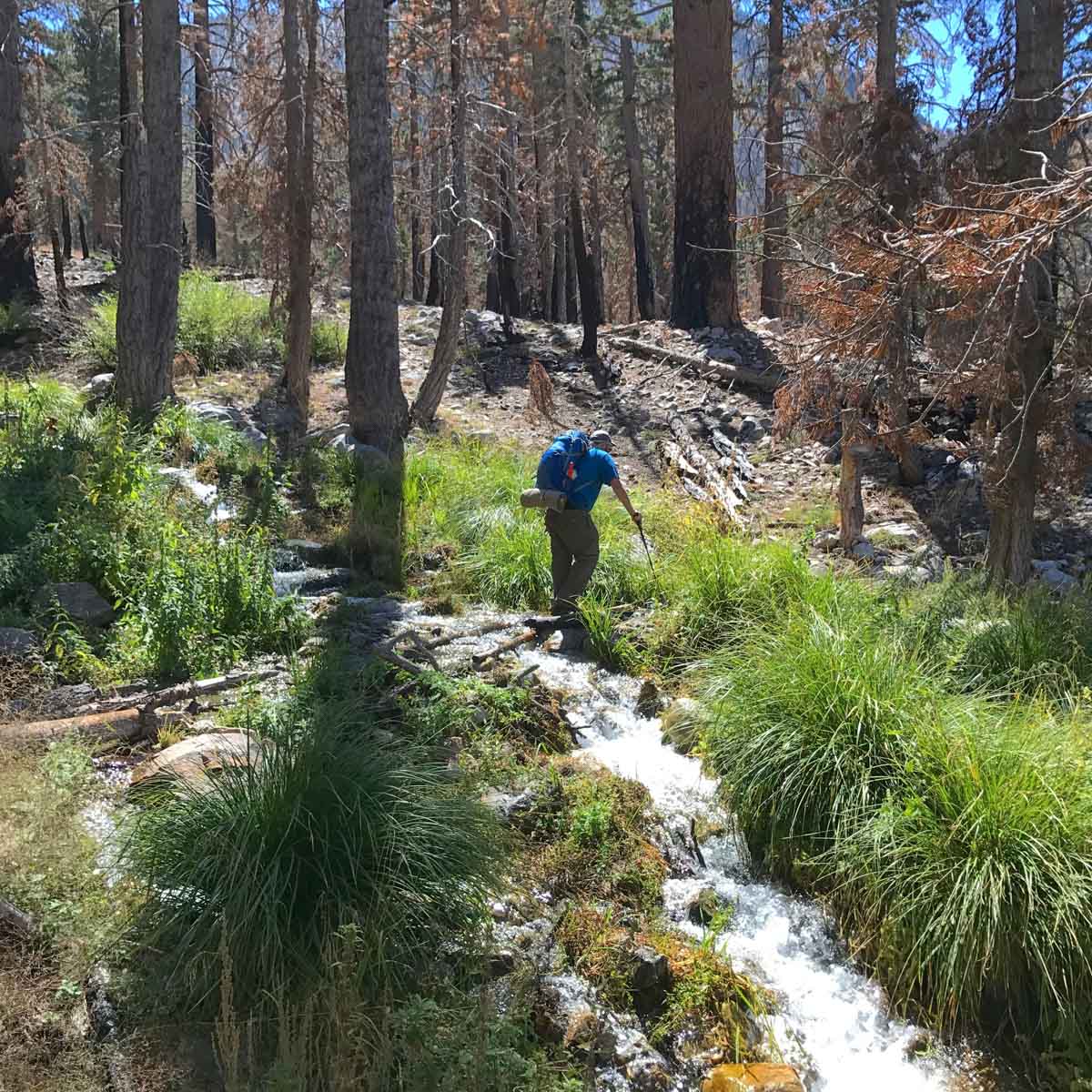
At the Forsee Creek Trailhead, there’s a sign with a somber reminder that portions of this hike travels through area scarred by the Lake Fire in 2015. Dead trees still standing represent a hazard, as does hillsides with little vegetation to hold them together in a rain storm. Be aware of the weather and your surroundings, and be prepared to change your plans if conditions do not allow safe passage.


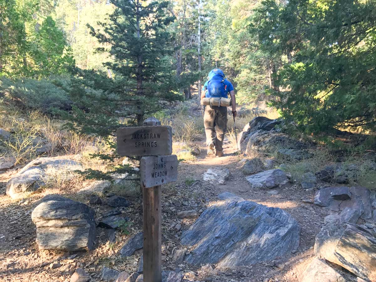
The trail climbs gradually for the first 0.5 miles, reaching the junction with the Johns Meadow Trail. Turn right (west) here. You’ll follow this trail for the next 5.7 miles with no other junctions.
The trail climbs gently for the first four miles of this hike, following the contours of the mountain while gradually climbing.


There are several small creeks near Johns Meadow Camp, so this would be a good camp option to do this route as a 2-night trip. Hike the easy 4 miles to Johns Meadow late on day one, and you’re well positioned for an early start on day two.
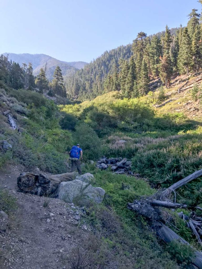
Once you pass Johns Meadow Camp the trail begins climbing quite steeply. The incline felt even steeper since we were carrying gear for overnight.
There are many places where the trail would be slippery with loose rock–easier to climb with trekking poles and much easier than going down. We all agreed that even though it was a steep climb, we were glad were weren’t coming back down this route.
At the 6.2 mile mark, you reach the junction with the main trail up San Bernardino, just a few yards from the rusted wheelbarrow that those who have hiked that route are no doubt familiar with.
From here, we followed a trail we had hiked before up to Limber Pines Spring, where we refilled all our water bottles and bladders. The water would need to last us up to San Bernardino, for cooking dinner and breakfast, getting us up to San Gorgonio in the morning and down to the next water at South Fork.


Note
There are a couple of springs downhill from the San Bernardino Divide Trail, but we didn’t relish the thought of going down to climb back up if we didn’t have to, and we had enough water storage to get us through.
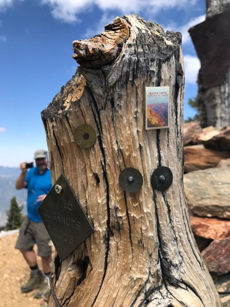
As we neared the summit of our first peak, we took the short detour to checkout Washington Monument. We’ve been there before, but this historic point was used by surveyors in laying out many of the streets of Southern California back in the 1800s. To this day, it’s covered with benchmarks datum points, and an assortment of odd pins added by hikers.
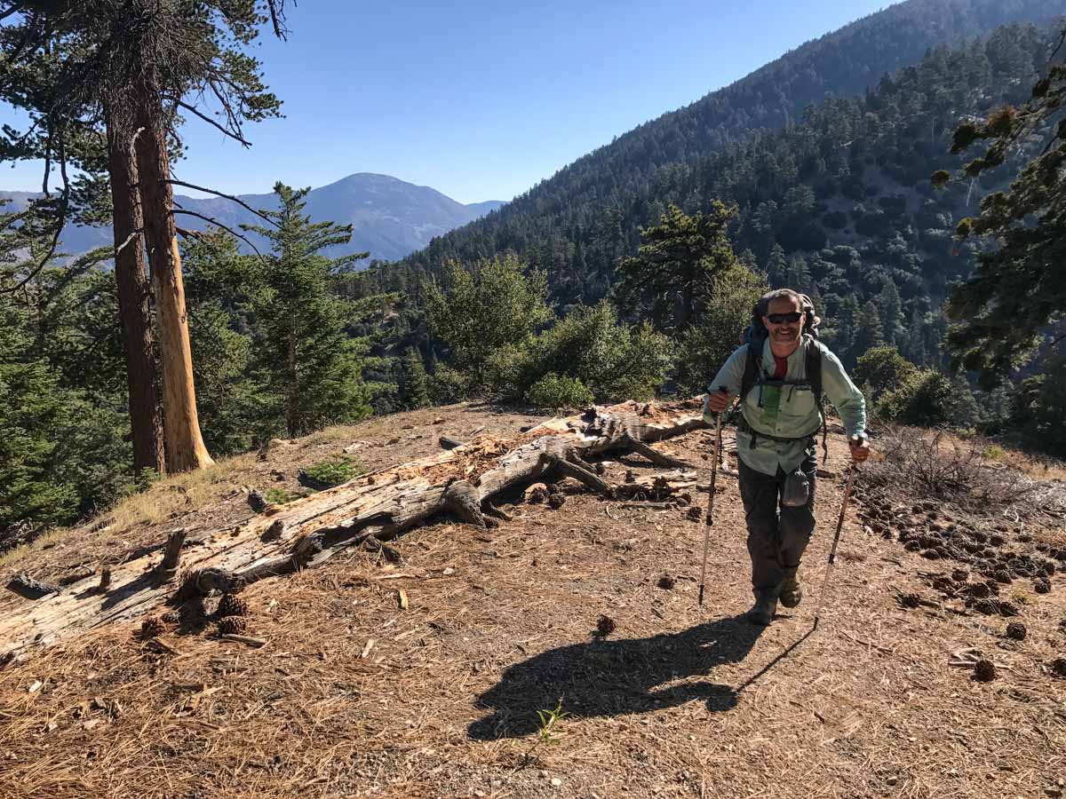
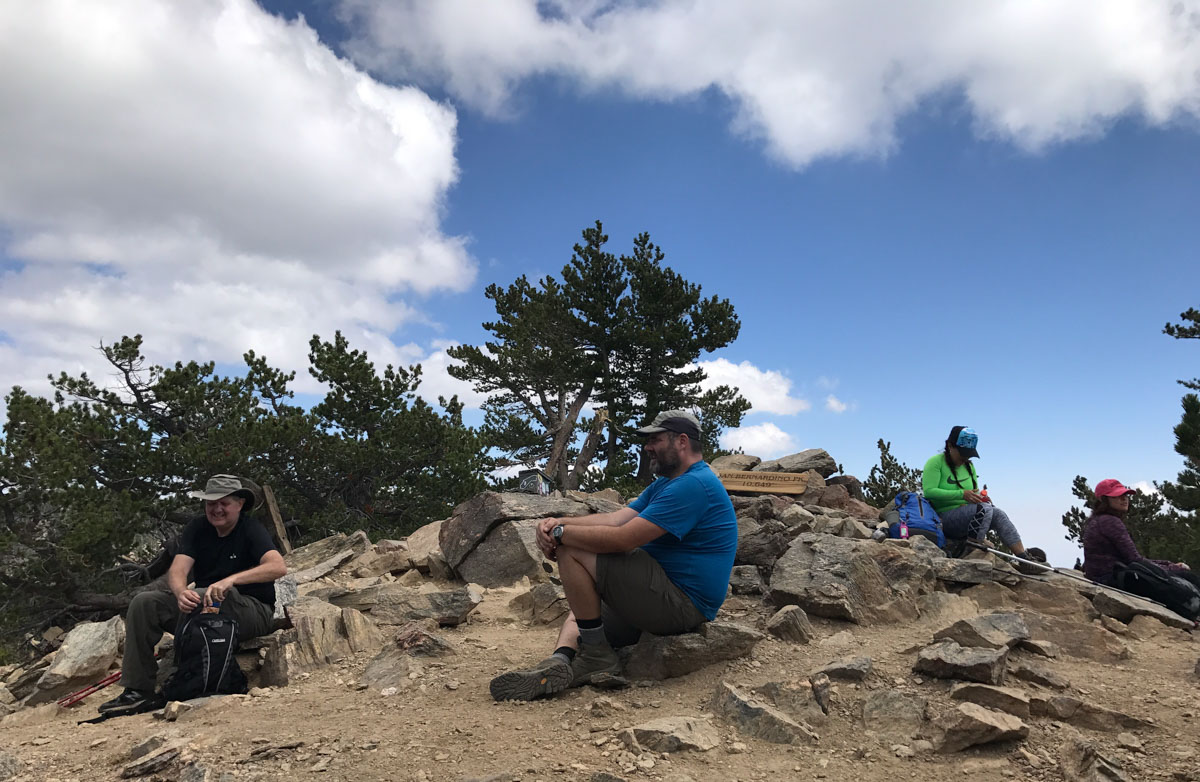
After roughly 11 miles of hiking, we reached San Bernardino Peak. This was the perfect spot for a lunch break and socializing with other hikers, many of whom were hiking the Six-Pack of Peaks Challenge.
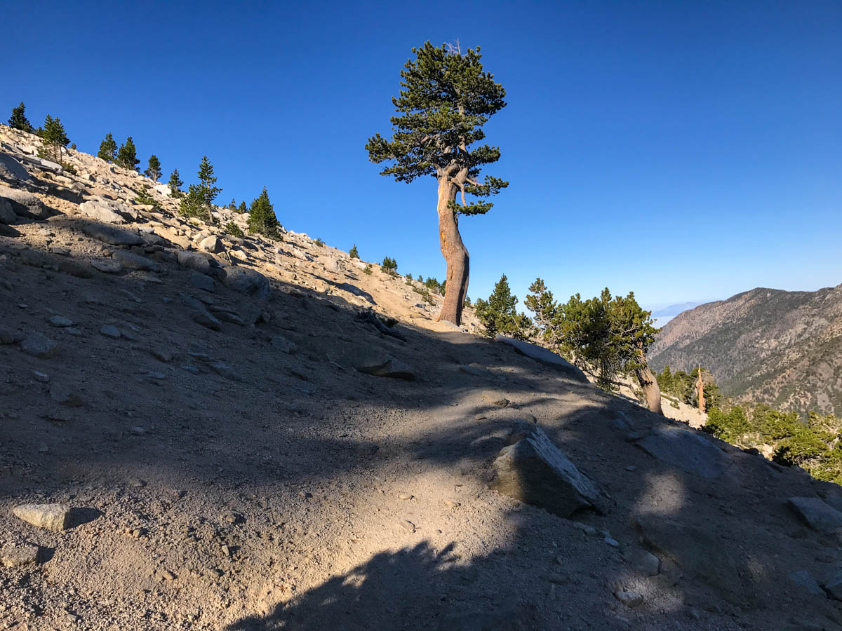
From here, we followed the San Bernardino Divide Trail as it makes it’s way east along the ridge. The trail dips and climbs, but stays above 10,000 feet. There are several trail junctions along the way, all well signed.
The landscape is fairly desolate, but we still saw patches of wildflowers even late in September.


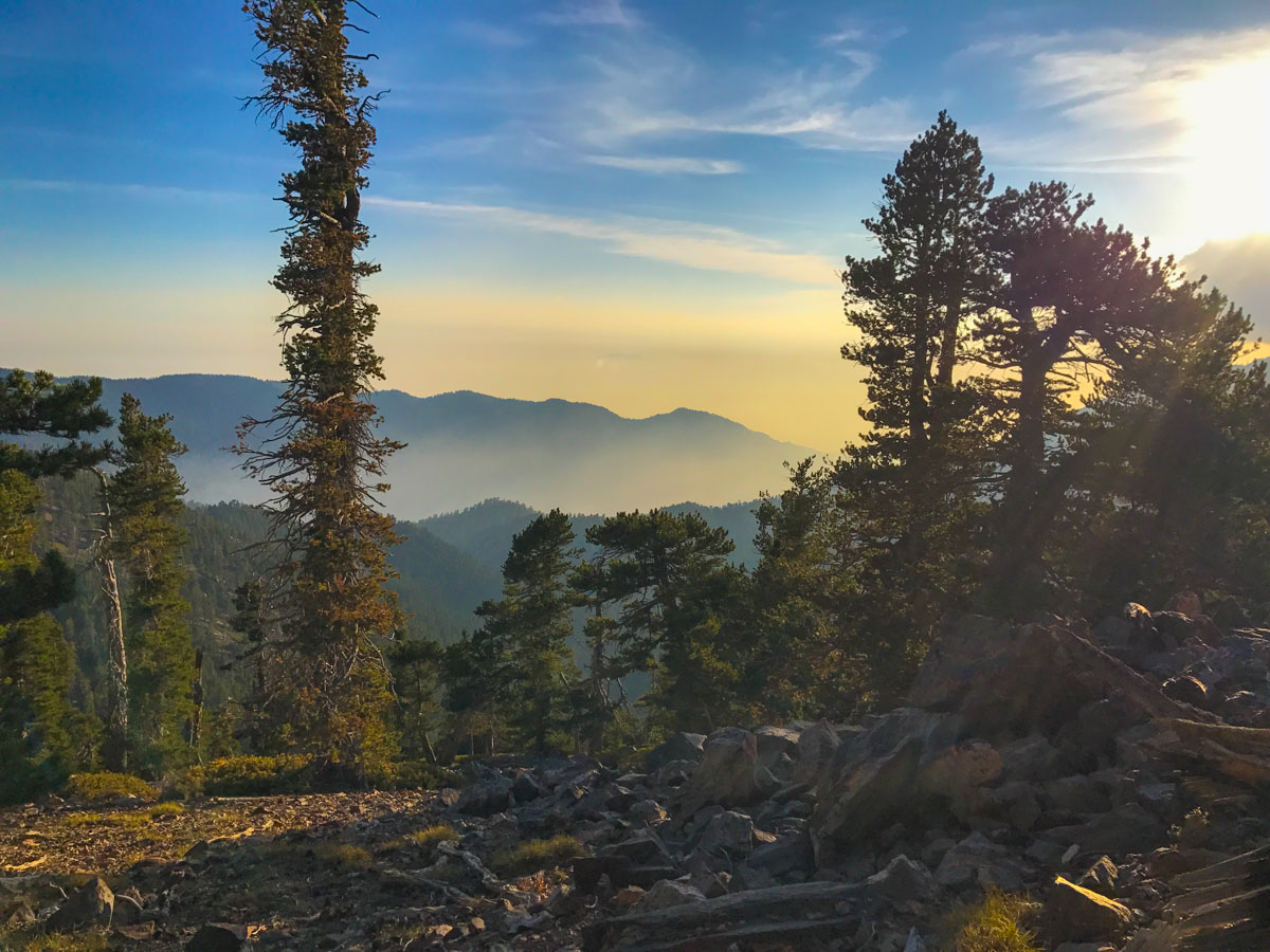
We considered hiking all the way to the San Gorgonio Summit Camp (our original plan), and we could have, but the spring in our step was gone and that goal didn’t sound so appealing any longer. We opted to camp at Red Rock Flat Camp, an ugly area at the edge of the fire-scarred forest, but with a beautiful view of the sunset to the west.
Day 1: Forsee Creek Trailhead to San Bernardino Peak Trail Map & Elevation Profile
Day 2: San Bernardino Divide to San Gorgonio and Down South Fork
On the second day, we hit the trail just as the first rays of sunlight hit our campsite. From Red Rock Flat Camp, the San Bernardino Divide Trail descends to Dollar Lake Saddle at 10,000 feet.
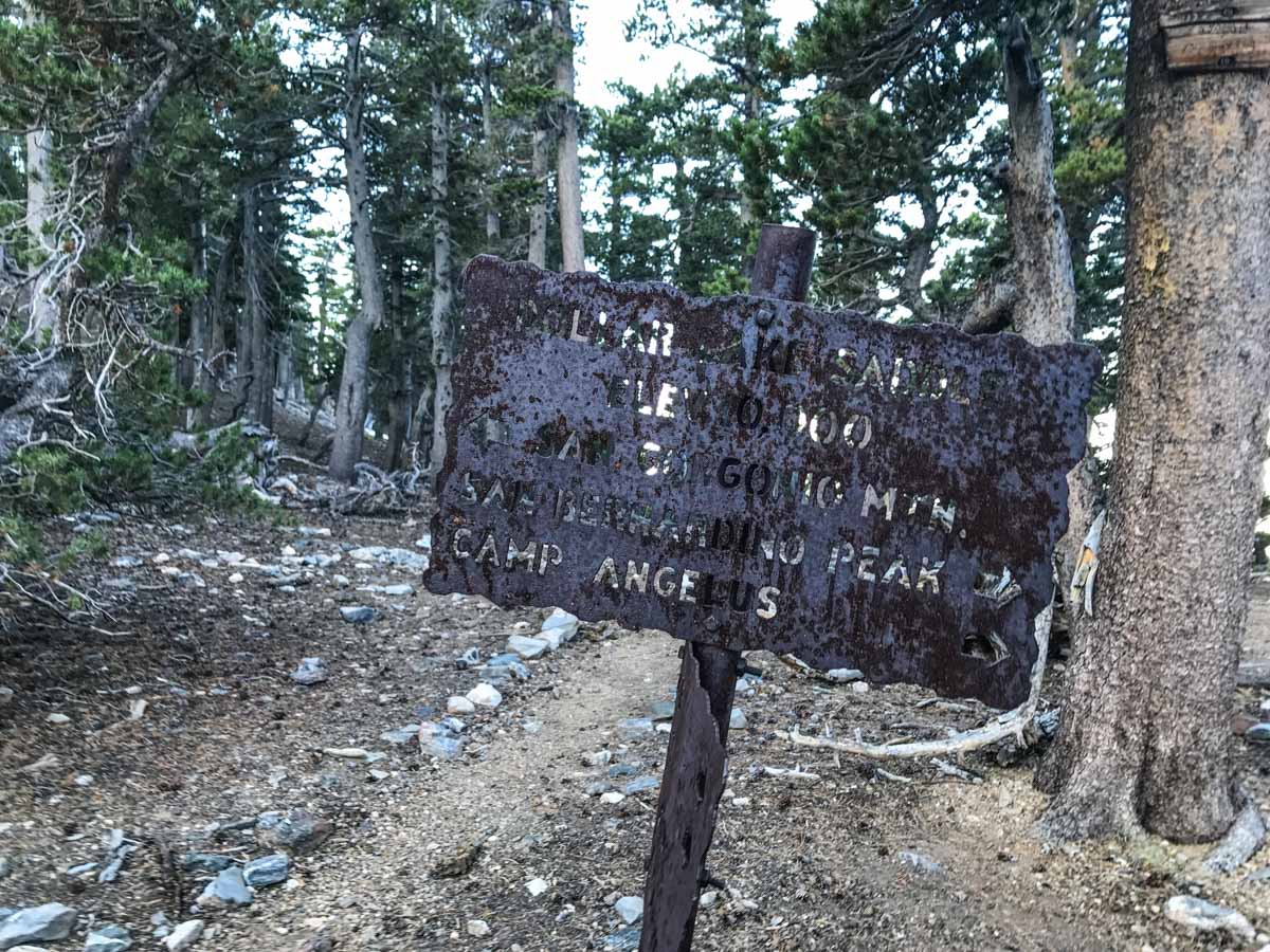
Several trails converge at this saddle, so be sure to follow the sign for San Gorgonio Mountain. The trail climbs the west-facing slope of the ridge with spectacular views.
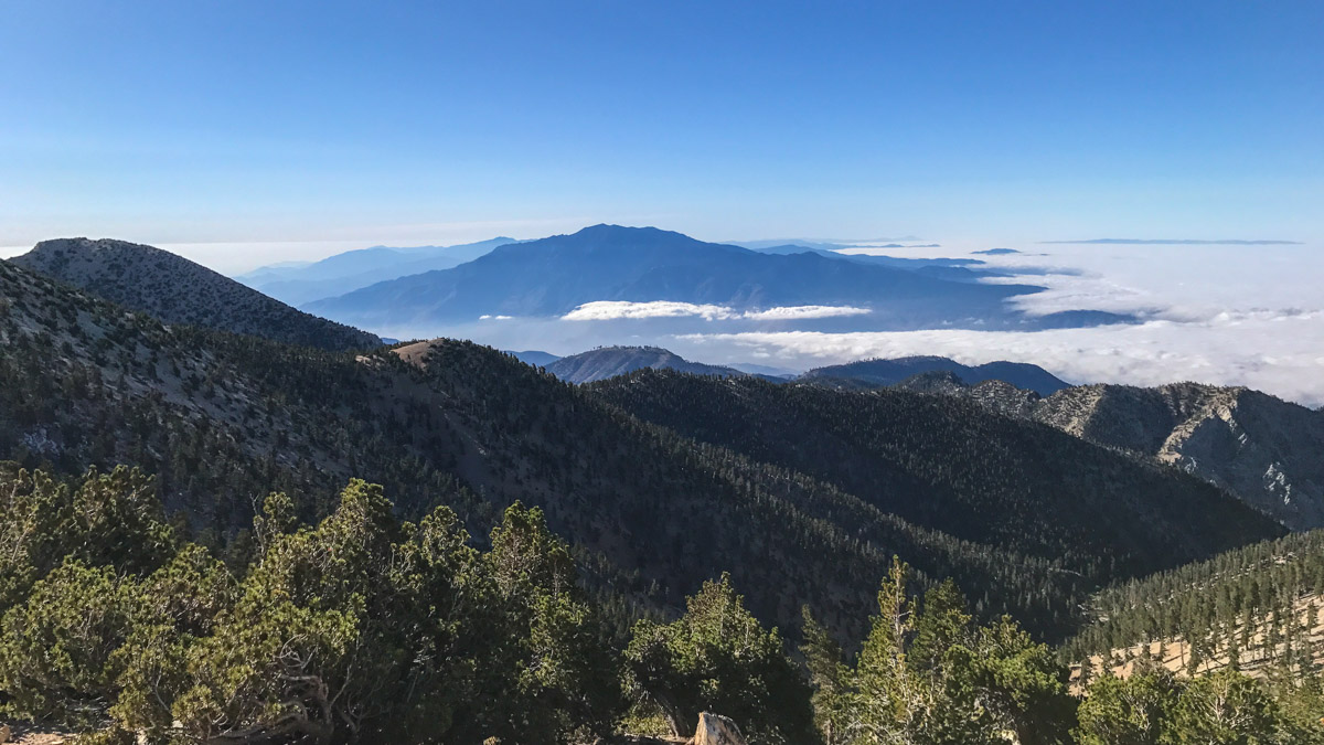
Rounding the corner, Mount San Jacinto comes into view across the valley to the south. I was standing at the top of that just two days earlier.
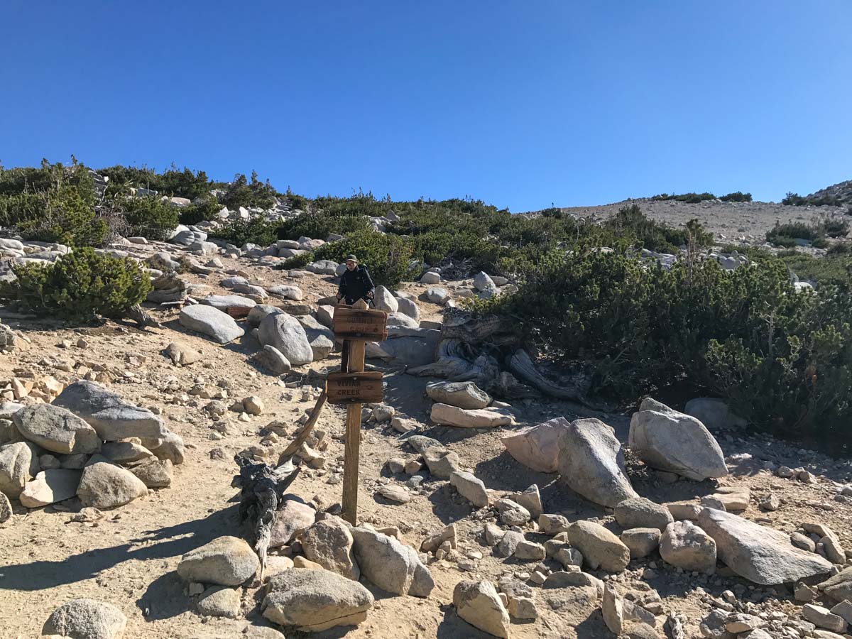
Soon we reached the trail coming up from High Creek. This is one of the more popular routes, heading up Vivian Creek to High Creek, then up to the ridge and across to the summit. It was still early, so we didn’t run into any day hikers, but we did see several who had camped at High Creek Camp and were making their way to the summit.
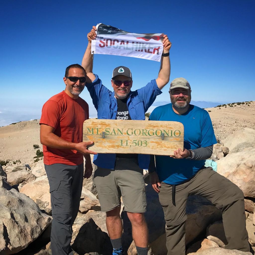
It’s a great feeling to reach the ridgeline to the summit, and this route made it feel really easy. The skies were cloudless and we enjoyed a rare, windless day atop San Gorgonio Mountain.
On the way back down, we took the Sky High Trail towards Mine Shaft Saddle. This wraps around the east side of San Gorgonio and is used for both the Fish Creek Trailhead (still closed at the time of this writing) and to our destination – the South Fork Trailhead.


The trail skirts the aptly named Dry Lake, then begins a steep descent toward South Fork.
This area had the most burn damage for the 2015 Lake Fire. While there were still some trees that survived, the area won’t look the same in my lifetime.
Thankfully, there was still plenty of water running at South Fork, even in late September. We filtered water and refilled our bottles and continued the descent.
We descended over 4,400 feet on day two, logging 15.5 miles.


Day 2: San Bernardino Divide to San Gorgonio Peak Trail Map & Elevation Profile
Tips & Tricks for Overnight Trips in the San Gorgonio Wilderness
- Wilderness permits are required for both day hikes and overnight trips in the San Gorgonio Wilderness. At the time of writing, there are no quotas for day hike permits, and you can even fill out your own at the Mill Creek Ranger Station. For all overnight trips, there are quotas based on the camp site(s) and days you choose. For details, visit the San Gorgonio Wilderness Association.
- Water can be tricky. the camps at higher elevations typically do not have a nearby water source, so plan to either carry enough to get you through the night and next day until you reach South Fork, or taking a detour downhill to a spring (adding one or more miles and additional vertical gain).
- Cell coverage is unreliable on this route. There may be places where you can pick up a weak signal, but don’t rely on this.
- Carry the Ten Essentials, and practice the Seven Leave No Trace Principles.
- The San Bernardino Divide Trail is also the route for the Nine Peak Challenge. Instead of taking the trail alongside the various peaks, you scramble up to the top of nine peaks.
Alternate Routes
You can hike in and exit from any number of trailheads. The most popular alternate route would be the San Bernardino Peak Trailhead in Angelus Oaks, exiting either via South Fork or the Vivian Creek Trailhead.
You can also stretch this out into a 3- or 4-day trip to cut down the daily mileage and enjoy the journey a bit longer.
For example, camp at Johns Meadow, then Limber Pine, then San Gorgonio Summit for a four day trip that includes summit sunset and sunrise atop Old Greyback.
Be prepared for extreme fluctuations in weather. Mountain weather can be very different than what you experience in the valley. Check Mountain Forecast for a summit forecast on San Gorgonio.
Originally hiked on September 16 & 17, 2017 with Jason Fitzpatrick and Ric Serena of The Muir Project.
You must be logged in to post a comment.